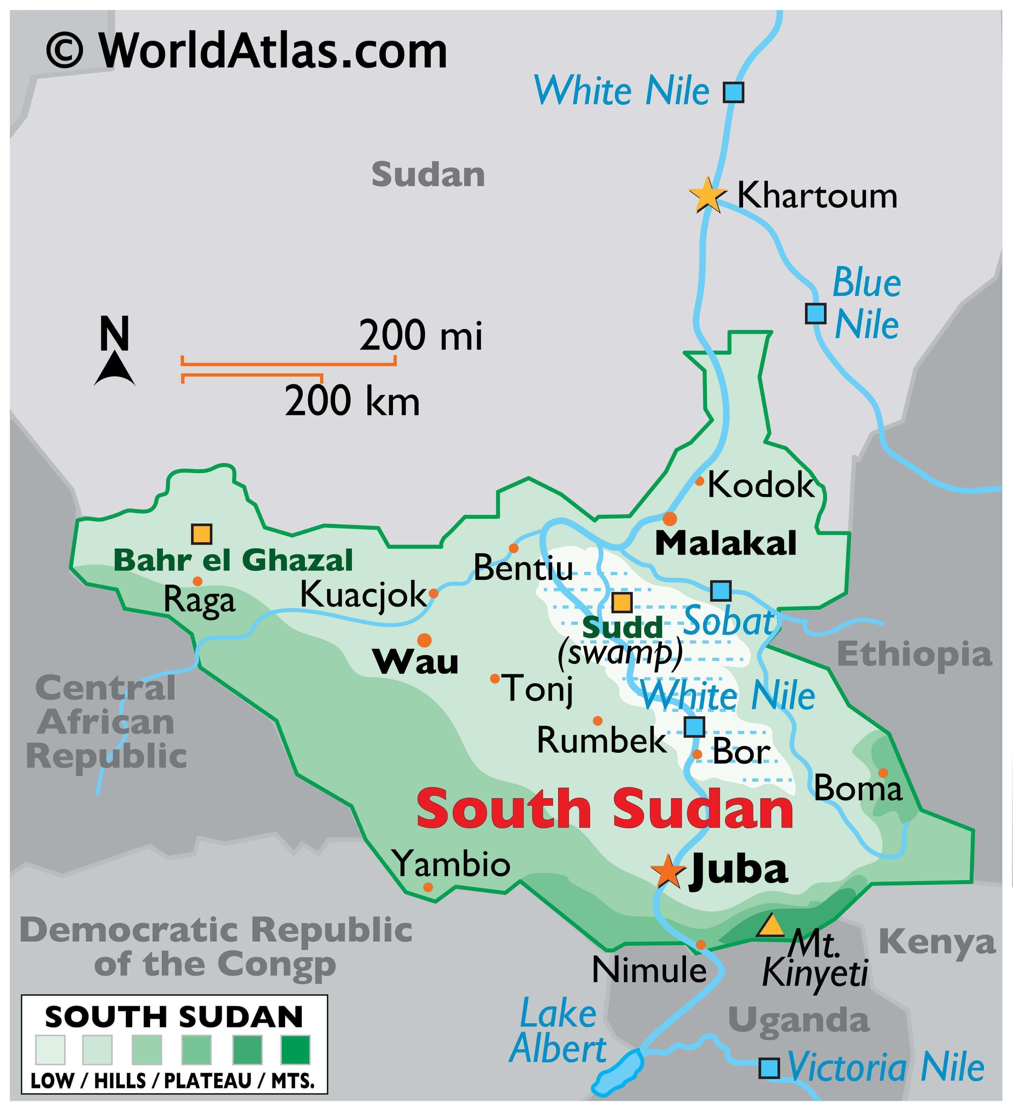
The East-Central African country of South Sudan covers an area of around 619,745 sq. km. The Nile River system is the country’s dominant physical feature. Most of the rivers of the country drain into the Nile River which leaves the country to enter Sudan and flow further north.
The terrain of South Sudan features massive plains and plateaus. One of the most interesting landforms here is the Al Sudd region which is a large swampy land located at the central region of a clay plain occupying the heart of South Sudan.
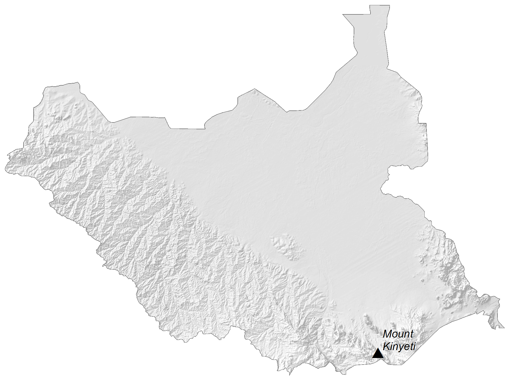
Two distinct highland areas exist in the country. Tall mountains with peaks exceeding 3,000 m called the Imatong Mountain range occur along South Sudan’s border with Uganda. Marked on the physical map above, the 3,187 m tall Mount Kinyeti, the country’s highest point, is located in this region.
Between the clay plain and the Nile-Congo watershed to the west and south of South Sudan is another elevated part of the country, the Ironstone Plateau. This region features relatively flat elevated land with abruptly rising isolated hills called inselbergs.
| Flag: |  |
|---|---|
| Legal Name: | Republic of South Sudan |
| Capital Value: | Juba |
| Largest City: |
Juba (403,215) |
| Official languages: | English |
| Demonym(s): | South Sudanese |
| Government: | Federal provisional unity government |
| Legislature: | Transitional National Legislature |
| Total Area: | 644,329 km² |
| Land Area: | 0 km² |
| Population: | 11,062,113 |
| Density: | 13.33/km (34.5/sq mi) (214th) |
| GDP: | $12.00 Billion |
| GDP Per Capita: | $1,119.65 |
| Currency Value: | South Sudanese pounds (SSP) |
| Driving side: | right |
| Calling code: | +211 |
| Internet TLD: | .ss |
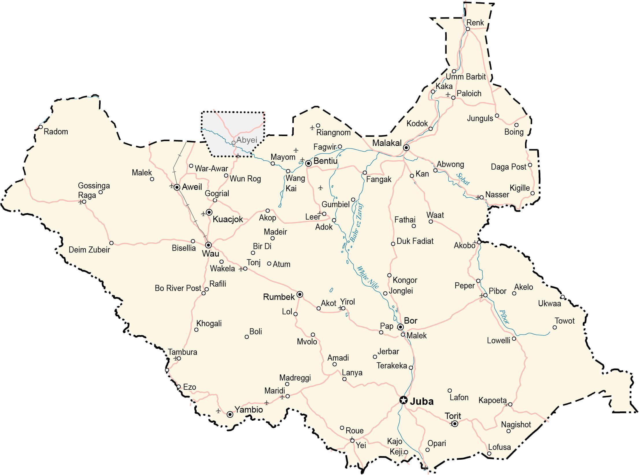
Explore the Republic of South Sudan with this detailed map. Discover its cities, towns, highways, roads, and airports. This South Sudan map collection features a reference map, satellite imagery, and an elevation map. Discover the beauty of this African nation with this comprehensive collection of maps.
Online Interactive Political Map
Click on ![]() to view map in "full screen" mode.
to view map in "full screen" mode.
A relatively new country that got its freedom from Sudan in 2011, South Sudan’s political divisions underwent a series of changes since independence.
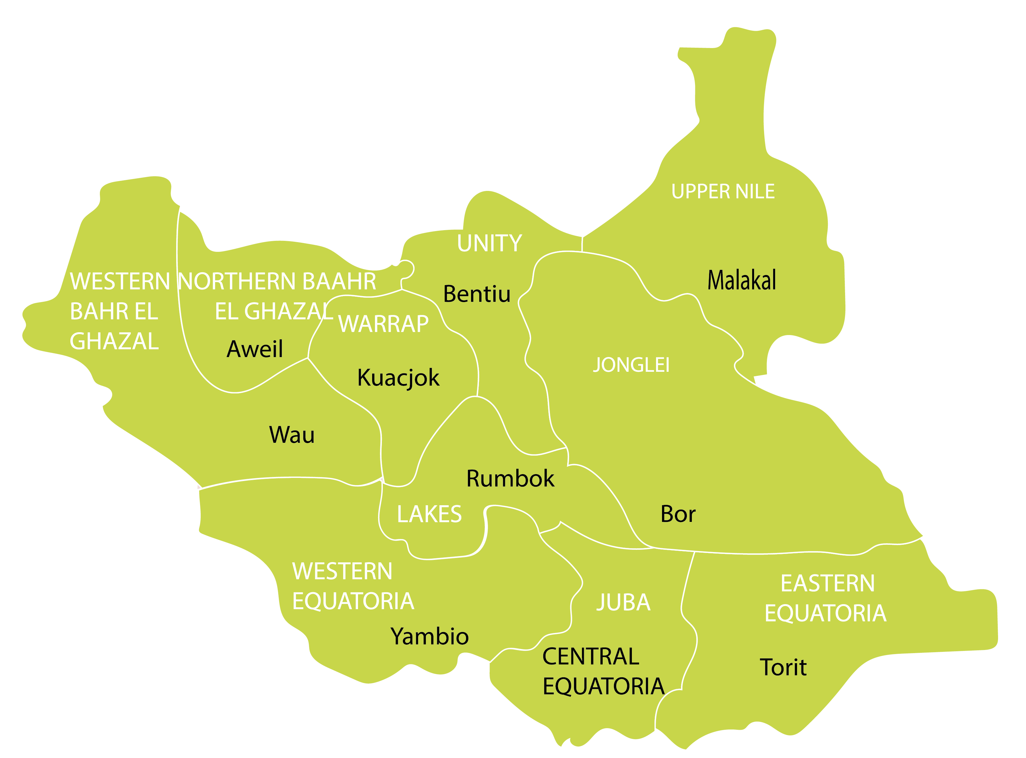
Originally composed of 10 states following its birth in 2011, the country was divided into 28 states in 2015 and 32 states in 2017 based on ethnic lines. However, the end of the South Sudanese Civil War and the signing of a peace agreement, the country returned to original 10 states on February 2020.
The states have been represented on the political map of the country above. In alphabetical order, they are as follows: Central Equatoria, Eastern Equatoria, Jonglei, Lakes, Northern Bahr el Ghazal, Unity, Upper Nile, Warrap, Western Bahr el Ghazal, Western Equatoria.
In addition to these states, South Sudan also has two administrative areas of Ruweng and Pibor and a special administrative area of Abyei that is part of both Sudan and South Sudan as per the Comprehensive Peace Agreement of 2005.
The capital of South Sudan, Juba, is also the regional capital of the Central Equatoria state.
Location Maps
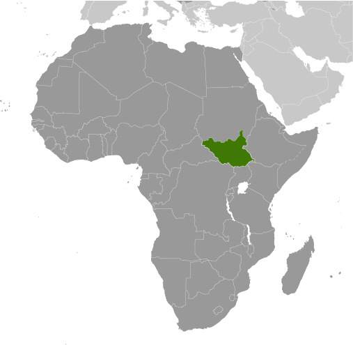
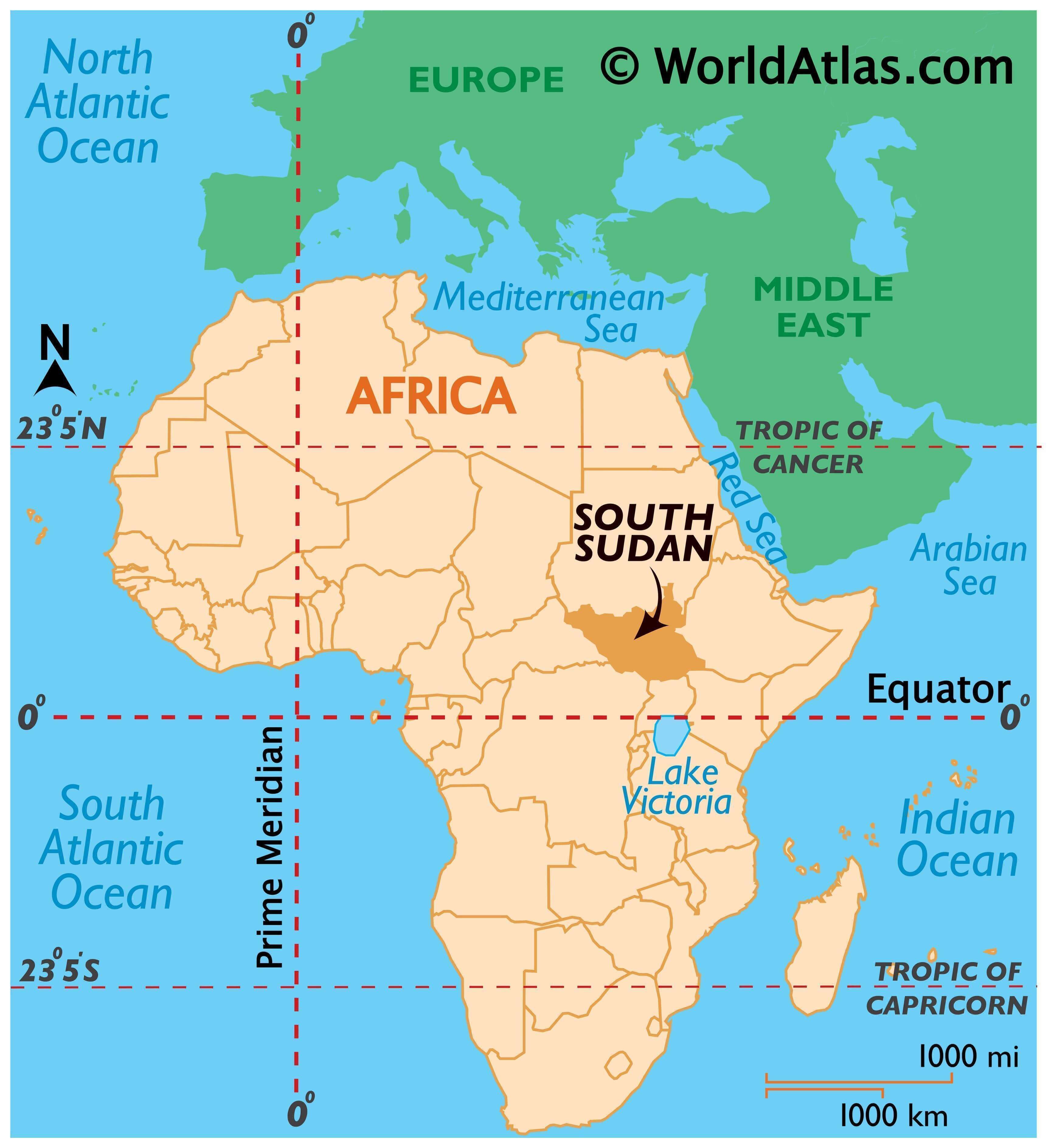
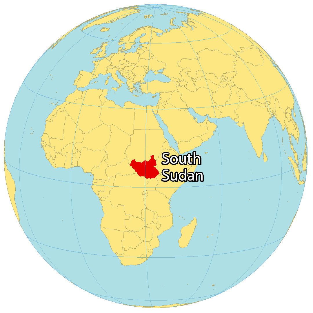
Where is South Sudan?
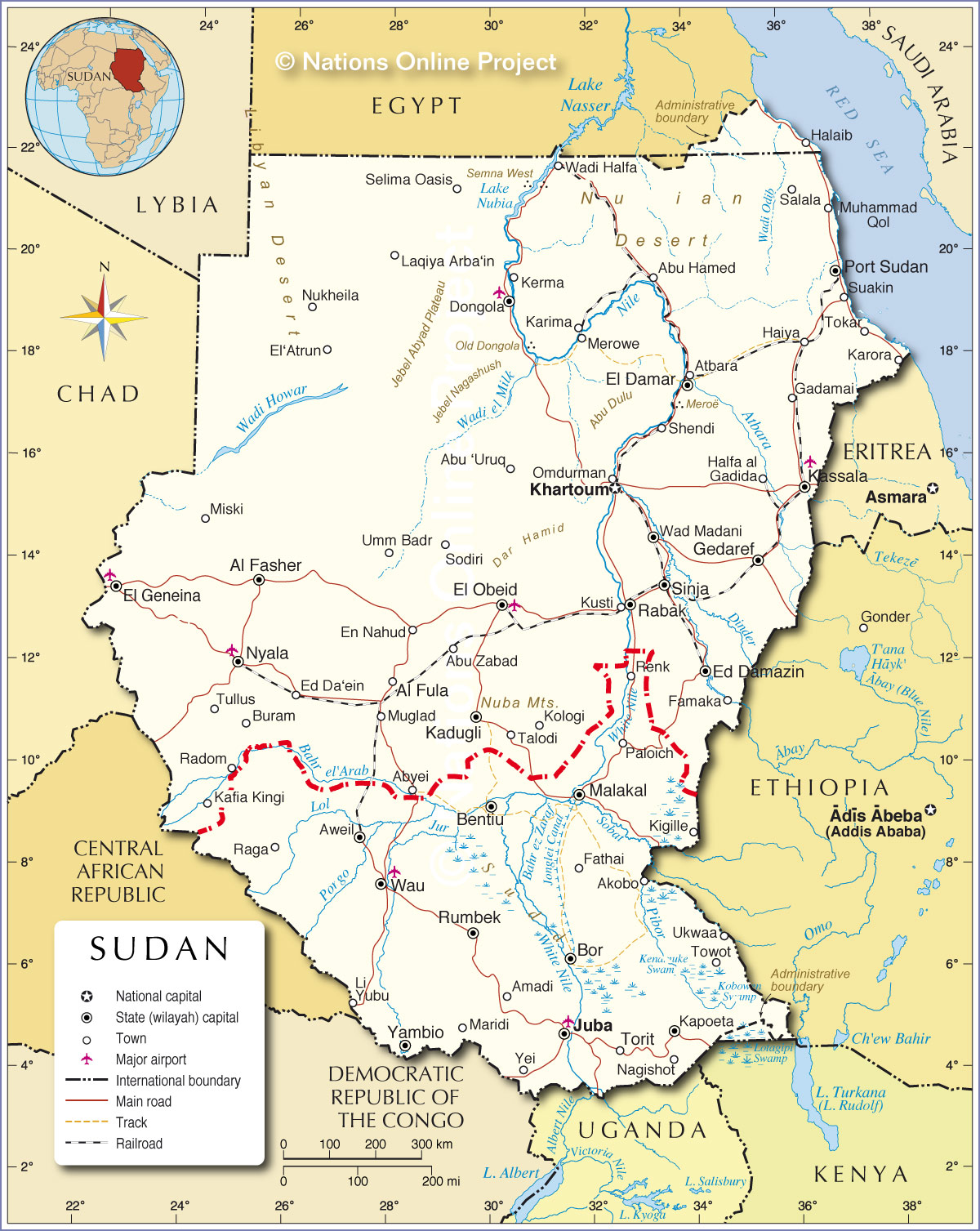
South Sudan is a landlocked country in east-central Africa. It is bordered by Ethiopia to the east, Sudan to the north, the Central African Republic to the west, the Democratic Republic of Congo to the southwest, Uganda to the south, and Kenya to the southeast. In 2011, South Sudan gained independence from the Republic of Sudan, making it one of the most recent sovereign states. The capital and largest city of South Sudan is Juba, while other major cities include Malakal, Yei, and Wau.
High Definition Political Map of South Sudan
History
The Nilotic people of South Sudan—the Dinka, Anyuak, Bari, Acholi, Nuer, Shilluk, Kaligi (Arabic Feroghe), and others—first entered South Sudan sometime before the tenth century, coinciding with the fall of medieval Nubia. From the 15th to the 19th century, tribal migrations, largely from the area of Bahr el Ghazal, brought the Anyuak, Dinka, Nuer, and Shilluk to their modern locations in Bahr El Ghazal and the Upper Nile Region, while the Acholi and Bari settled in Equatoria. The Zande, Mundu, Avukaya and Baka, who entered South Sudan in the 16th century, established the region’s largest state of Equatoria Region.
The Dinka is the largest, the Nuer the second-largest, the Zande the third-largest, and the Bari the fourth-largest of South Sudan’s ethnic groups. They are found in the Maridi, Yambio, and Tombura districts in the tropical rainforest belt of Western Equatoria, the Adio of Azande client in Yei, Central Equatoria, and Western Bahr el Ghazal. In the 18th century, the Avungara sib rose to power over the rest of Azande society, a domination that continued into the 20th century. British policies favoring Christian missionaries, such as the Closed District Ordinance of 1922 (see History of Anglo-Egyptian Sudan), and geographical barriers such as the swamplands along the White Nile curtailed the spread of Islam to the south, thus allowing the southern tribes to retain much of their social and cultural heritage, as well as their political and religious institutions.
British colonial policy in Sudan had a long history of emphasizing the development of the Arab north, and largely ignoring the Black African south, which lacked schools, hospitals, roads, bridges, and other basic infrastructure. After Sudan’s first independent elections in 1958, the continued neglect of the southern region by the Khartoum government led to uprisings, revolts, and the longest civil war on the continent. People affected by the violence included the Dinka, Nuer, Shilluk, Anyuak, Murle, Bari, Mundari, Baka, Balanda Bviri, Boya, Didinga, Jiye, Kaligi, Kuku, Lotuka, Nilotic, Toposa, and Zande.
The Azande have had good relations with their neighbours, namely the Moru, Mundu, Pöjulu, Avukaya, Baka, and the small groups in Bahr el Ghazal, due to the expansionist policy of their king Gbudwe, in the 18th century. In the 19th century, the Azande fought the French, the Belgians and the Mahdists to maintain their independence. Ottoman Egypt, under the rule of Khedive Ismail Pasha, first attempted to control the region in the 1870s, establishing the province of Equatoria in the southern portion. Egypt’s first appointed governor was Samuel Baker, commissioned in 1869, followed by Charles George Gordon in 1874, and by Emin Pasha in 1878.
The Mahdist Revolt of the 1880s destabilized the nascent province, and Equatoria ceased to exist as an Egyptian outpost in 1889. Important settlements in Equatoria included Lado, Gondokoro, Dufile, and Wadelai. European colonial maneuverings in the region came to a head in 1898, when the Fashoda Incident occurred at present-day Kodok; Britain and France almost went to war over the region. In 1947, British hopes of joining South Sudan with Uganda while leaving Western Equatoria as part of the Belgian Congo were dashed by the Rajaf Conference to unify North and South Sudan.
South Sudan has an estimated population of 8 million, but, given the lack of a census in several decades, this estimate may be severely distorted. The economy is predominantly rural and relies chiefly on subsistence farming. Around 2005, the economy began a transition from this rural dominance, and urban areas within South Sudan have seen extensive development.
The region has been negatively affected by two civil wars since Sudanese independence: from 1955 to 1972, the Sudanese government fought the Anyanya rebel army (Anya-Nya is a term in the Madi language which means “snake venom”) during the First Sudanese Civil War, followed by the Sudan People’s Liberation Army/Movement (SPLA/M) in the Second Sudanese Civil War for over twenty years, from 1983 to 2005. As a result, the country suffered serious neglect, a lack of infrastructure development, and major destruction and displacement. More than 2.5 million people have been killed, and millions more have become refugees both within and outside the country.
Independence (2011)
Between 9 and 15 January 2011, as a consequence of the Comprehensive Peace Agreement, a referendum was held to determine whether South Sudan should become an independent country and separate from Sudan, and 98.83% of those who took part voted for independence. On 23 January 2011, members of a steering committee on post-independence governing told reporters that upon independence the land would be named the Republic of South Sudan “out of familiarity and convenience”. Other names that had been considered were Azania, Nile Republic, Kush Republic and even Juwama, a portmanteau for Juba, Wau and Malakal, three major cities. South Sudan formally became independent from Sudan on 9 July, although certain disputes still remained, including the division of oil revenues, as 75% of all the former Sudan’s oil reserves are in South Sudan. The region of Abyei still remains disputed and a separate referendum will be held in Abyei on whether they want to join Sudan or South Sudan. The South Kordofan conflict broke out in June 2011 between the Army of Sudan and the SPLA over the Nuba Mountains.
On 9 July 2011, South Sudan became the 54th independent country in Africa (9 July is now celebrated as Independence Day, a national holiday) and since 14 July 2011, South Sudan is the 193rd member of the United Nations. On 27 July 2011, South Sudan became the 54th country to join the African Union. In September 2011, Google Maps recognized South Sudan as an independent country, after a massive crowdsourcing mapping initiative was launched.
In 2011 it was reported that South Sudan was at war with at least seven armed groups in 9 of its 10 states, with tens of thousands displaced. The fighters accuse the government of plotting to stay in power indefinitely, not fairly representing and supporting all tribal groups while neglecting development in rural areas. Joseph Kony’s Lord’s Resistance Army (LRA) also operates in a wide area that includes South Sudan.
Inter-ethnic warfare in some cases predates the war of independence and is widespread. In December 2011, tribal clashes intensified between the Nuer White Army of the Lou Nuer and the Murle. The White Army warned it would wipe out the Murle and would also fight South Sudanese and UN forces sent to the area around Pibor.
In March 2012, South Sudanese forces seized the Heglig oil fields in lands claimed by both Sudan and South Sudan in the province of South Kordofan after conflict with Sudanese forces in the South Sudanese state of Unity. South Sudan withdrew on 20 March, and the Sudanese Army entered Heglig two days later.
Joining East Africa
South Sudan and Democratic Republic of Congo are the newest members of the East African Community. South Sudan acceded to the Treaty of the East Africa Community on 15 April 2016 and become a full Member on 15 August 2016.
Civil war (2013–2020)
On the 5th of September 2013, an article written by analyst Duop Chak Wuol was published by the US-based South Sudan News Agency (SSNA). . The writer raised critical questions surrounding what he described as the rise of autocracy within the top leadership of the Sudan People’s Liberation Movement (SPLM) and warned of monumental repercussions unless the ruling elites restored the founding principles of the party. Duop also berated the ruling party, arguing that the party has replaced its founding principles with “forgotten promises and deceptions.” In December 2013, a political power struggle broke out between President Kiir and his former deputy Riek Machar, as the president accused Machar and ten others of attempting a coup d’état. Fighting broke out, igniting the South Sudanese Civil War. Ugandan troops were deployed to fight alongside South Sudanese government forces against the rebels. The United Nations has peacekeepers in the country as part of the United Nations Mission in South Sudan (UNMISS). Numerous ceasefires were mediated by the Intergovernmental Authority on Development (IGAD) between the Sudan People’s Liberation Movement (SPLM) and SPLM – in opposition and were subsequently broken. A peace agreement was signed in Ethiopia under threat of United Nations sanctions for both sides in August 2015. Machar returned to Juba in 2016 and was appointed vice president. Following a second breakout of violence in Juba, Machar was replaced as vice-president and he fled the country as the conflict erupted again. Rebel in-fighting has become a major part of the conflict. Rivalry among Dinka factions led by the President and Malong Awan has also led to fighting. In August 2018, another power-sharing agreement came into effect.
About 400,000 people are estimated to have been killed in the war, including notable atrocities such as the 2014 Bentiu massacre. Although both men have supporters from across South Sudan’s ethnic divides, subsequent fighting has been communal, with rebels targeting members of Kiir’s Dinka ethnic group and government soldiers attacking Nuers. More than 4 million people have been displaced, with about 1.8 million of those internally displaced, and about 2.5 million having fled to neighboring countries, especially Uganda and Sudan.
On 20 February 2020, Salva Kiir Mayardit and Riek Machar agreed to a peace deal, and on 22 February 2020 formed a national unity government as Machar was sworn in as the deputy leader of the country.
Despite the official cessation of the civil war, violence between armed militia groups at the community level has continued in the country; according to Yasmin Sooka, Chair of the Commission of Human Rights in Sudan, the level of violence “far exceeds the violence between 2013 and 2019”.
The first democratic elections in South Sudan since the start of the civil war were scheduled for 2023 by the peace agreement that ended the war officially, but the transitional government and opposition agreed in 2022 to move them to late 2024 instead.
Physical Map of South Sudan
Geography
South Sudan lies between latitudes 3° and 13°N, and longitudes 24° and 36°E. It is covered in tropical forest, swamps, and grassland. The White Nile passes through the country, passing by Juba.
South Sudan’s protected area of Bandingilo National Park hosts the second-largest wildlife migration in the world. Surveys have revealed that Boma National Park, west of the Ethiopian border, as well as the Sudd wetland and Southern National Park near the border with Congo, provided habitat for large populations of hartebeest, kob, topi, buffalo, elephants, giraffes, and lions.
South Sudan’s forest reserves also provided habitat for bongo, giant forest hogs, red river hogs, forest elephants, chimpanzees, and forest monkeys. Surveys begun in 2005 by WCS in partnership with the semi-autonomous government of Southern Sudan revealed that significant, though diminished wildlife populations still exist, and that, astonishingly, the huge migration of 1.3 million antelopes in the southeast is substantially intact.
Habitats in the country include grasslands, high-altitude plateaus and escarpments, wooded and grassy savannas, floodplains, and wetlands. Associated wildlife species include the endemic white-eared kob and Nile Lechwe, as well as elephants, giraffes, common eland, giant eland, oryx, lions, African wild dogs, cape buffalo, and topi (locally called tiang). Little is known about the white-eared kob and tiang, both types of antelope, whose magnificent migrations were legendary before the civil war. The Boma-Jonglei Landscape region encompasses Boma National Park, broad pasturelands and floodplains, Bandingilo National Park, and the Sudd, a vast area of swamp and seasonally flooded grasslands that includes the Zeraf Wildlife Reserve.
Little is known of the fungi of South Sudan. A list of fungi in Sudan was prepared by S. A. J. Tarr and published by the then Commonwealth Mycological Institute (Kew, Surrey, UK) in 1955. The list, of 383 species in 175 genera, included all fungi observed within the then boundaries of the country. Many of those records relate to what is now South Sudan. Most of the species recorded were associated with diseases of crops. The true number of species of fungi in South Sudan is probably much higher.
In 2006, President Kiir announced that his government would do everything possible to protect and propagate South Sudanese fauna and flora, and seek to reduce the effects of wildfires, waste dumping, and water pollution. The environment is threatened by the development of the economy and infrastructure. The country had a 2019 Forest Landscape Integrity Index mean score of 9.45/10, ranking it fourth globally out of 172 countries.
Several ecoregions extend across South Sudan: the East Sudanian savanna, Northern Congolian forest–savanna mosaic, Saharan flooded grasslands (Sudd), Sahelian Acacia savanna, East African montane forests, and the Northern Acacia–Commiphora bushlands and thickets.
Climate
South Sudan has a tropical climate, characterized by a rainy season of high humidity and large amounts of rainfall followed by a drier season. The temperature on average is always high with July being the coolest month with average temperatures falling between 20 and 30 °C (68 and 86 °F) and March being the warmest month with average temperatures ranging from 23 to 37 °C (73 to 98 °F).
The most rainfall is seen between May and October, but the rainy season can commence in April and extend until November. On average May is the wettest month. The season is “influenced by the annual shift of the Inter-Tropical Zone” and the shift to southerly and southwesterly winds leading to slightly lower temperatures, higher humidity, and more cloud coverage.
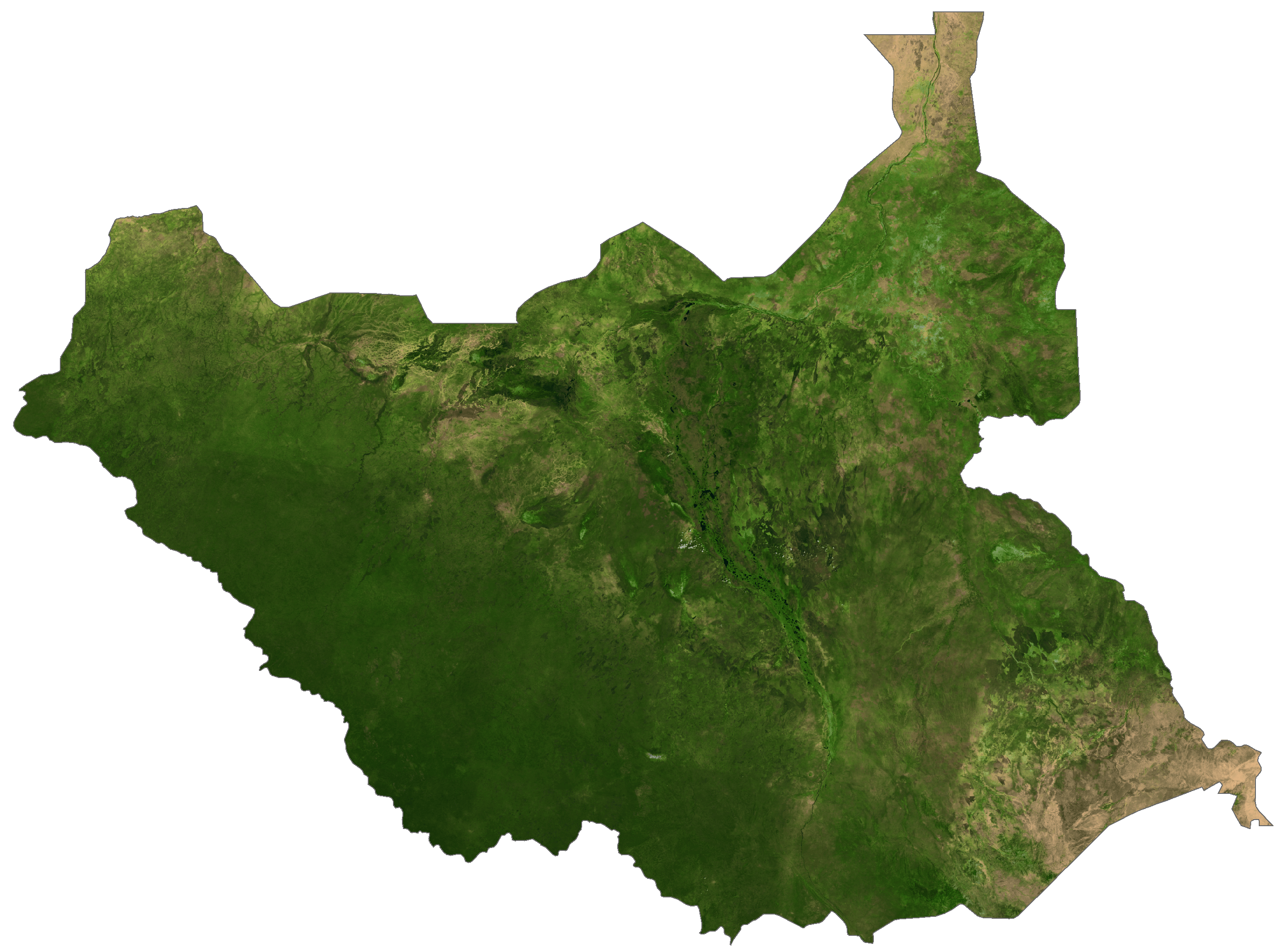
South Sudan Satellite Map
Elevation Map