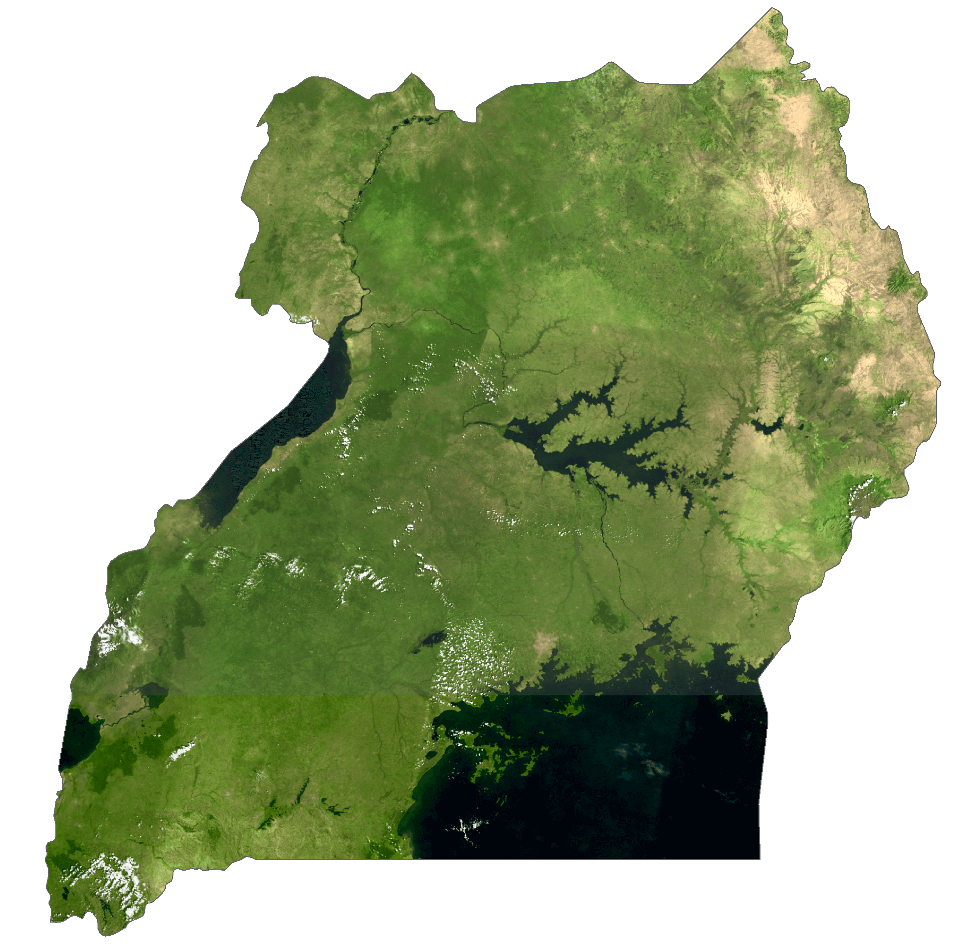
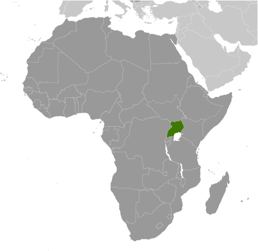
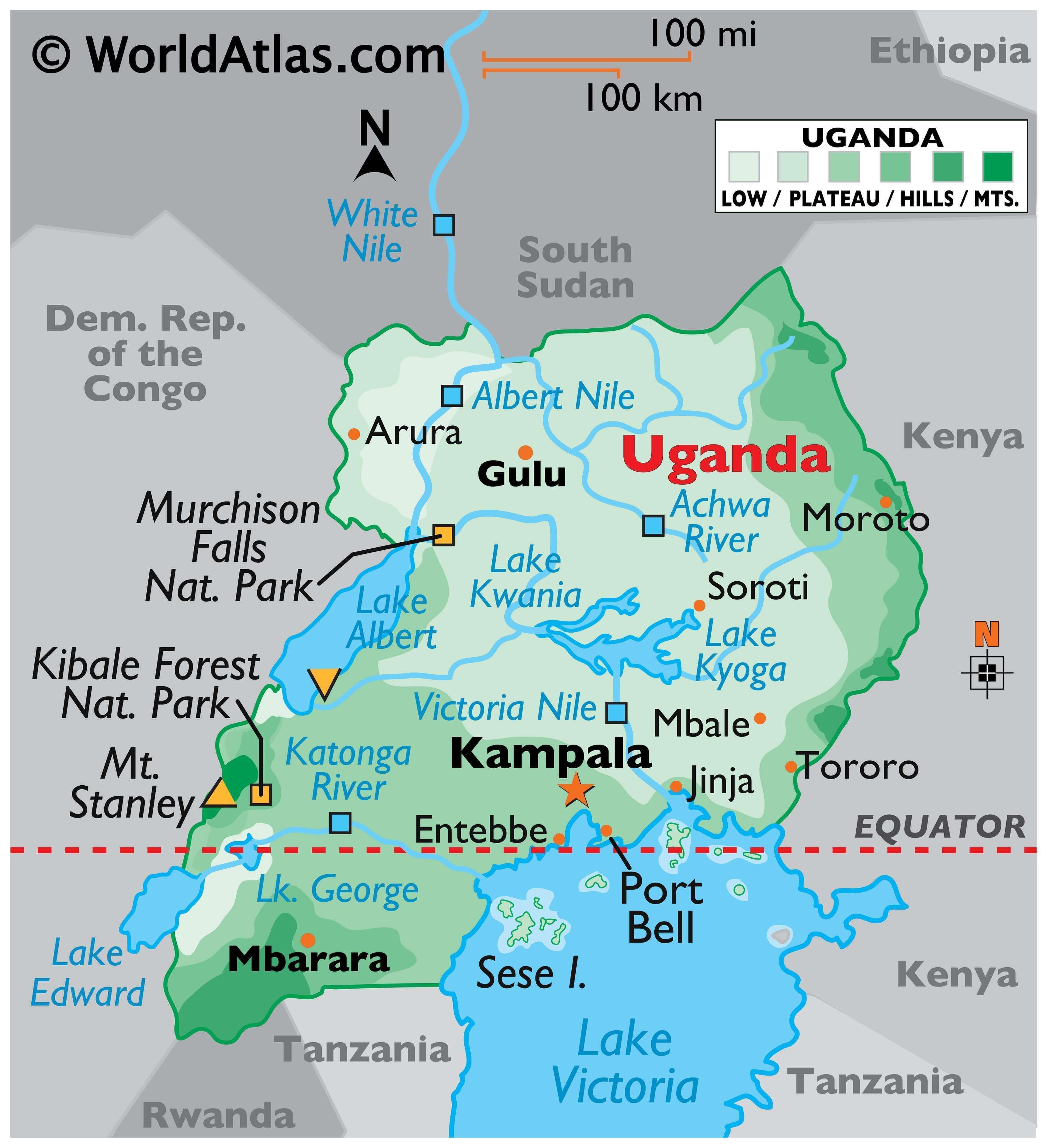
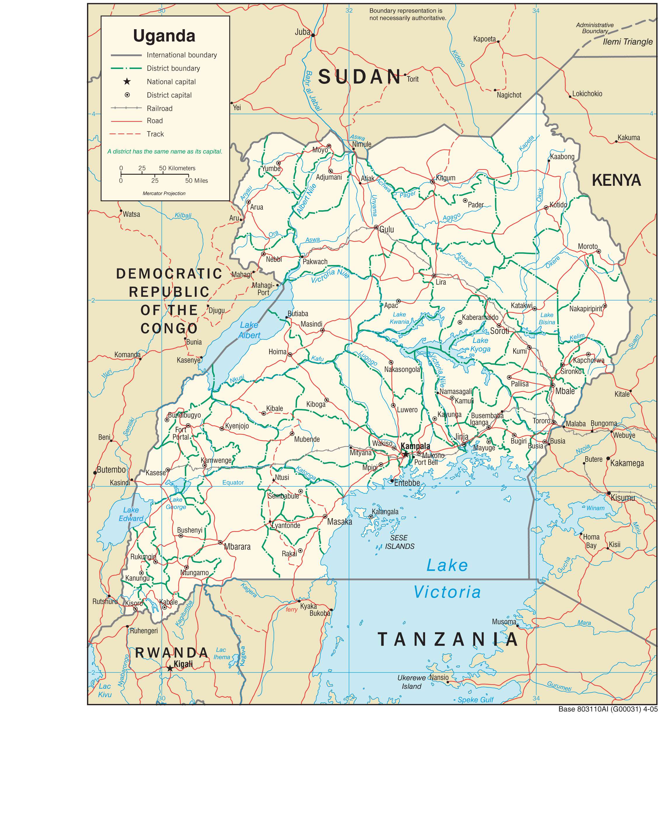
Located on the edge of the Equator, Uganda is positioned in south-central Africa, and bordered by the Democratic Republic of the Congo (DRC), Kenya, Rwanda, Sudan and Tanzania.
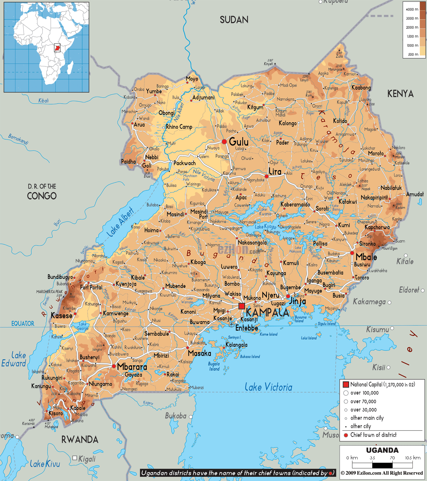
Uganda averages about 1,100 metres (3,609 ft) above sea level, and while much of its border is lakeshore, Uganda is landlocked with no access to the sea.
Most of Uganda is covered by a plateau that gradually drops in elevation northwards. The edges of this massive plateau are marked by mountain ranges and valleys.
The western boundaries of the country are formed by Virunga and Ruwenzori Mountains, and the Western Rift Valley. The country’s highest peak, the 5,109 m Margherita Peak is part of the Ruwenzori Range. Lakes George and Edward lie between the Virunga and Ruwenzori mountains. Lakes Albert is located in the Western Rift Valley and the Albert Nile River also starts its course in this region.
The Imatong Mountains mark the edge of the Ugandan plateau to the north at the country’s borders with South Sudan. The average elevation here is 1,800 m.
To the northeast, the plateau ends in a string of volcanic mountains with Mount Elgon being the highest at 4,321 m.
Lake Victoria forms the southern boundary of the country with Tanzania and Kenya.
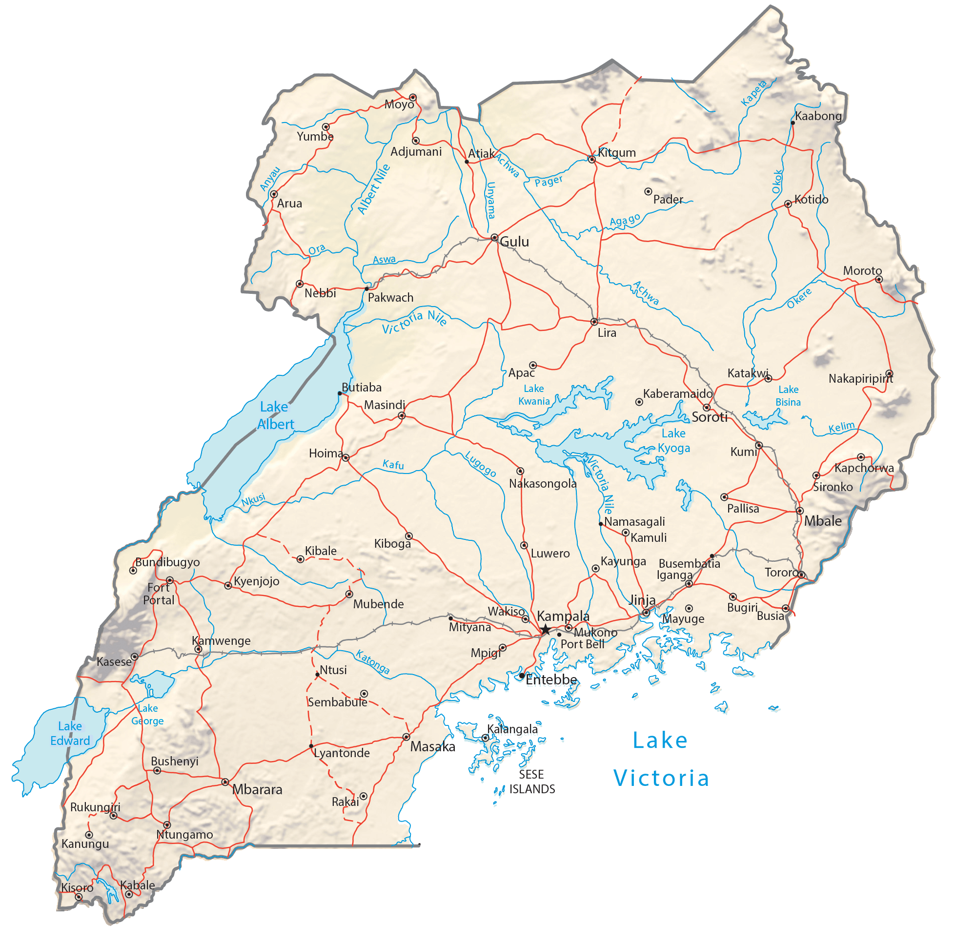
Uganda has eight major rivers, the Victoria Nile, Achwa, Okok, Pager, Albert Nile, Kafu, Mpongo, and Katonga.
The country’s southern rivers drain into Lake Victoria. Rivers rising to the north of this lake empty into Lake Kyoga. The southwestern rivers drain into lakes Edward and George while the Albert Nile drains Lake Albert.
At 621 m, Lake Albert has Uganda’s lowest point.
| Flag: |  |
|---|---|
| Legal Name: | Republic of Uganda |
| Capital Value: | Kampala |
| Largest City: |
Kampala (3,298,364) |
| Official languages: |
|
| Demonym(s): | Ugandan |
| Government: | Unitary dominant-party presidential republic |
| Legislature: | Parliament |
| Total Area: | 241,038 km² |
| Land Area: | 197,100 km² |
| Water Area: | 43,938 km² |
| Population: | 44,269,594 |
| Density: | 157.1/km (406.9/sq mi) (75th) |
| GDP: | $34.39 Billion |
| GDP Per Capita: | $776.77 |
| Currency Value: | Ugandan shillings (UGX) |
| Driving side: | left |
| Calling code: | +256 |
| Internet TLD: | .ug |
Explore the geography of Uganda with an interactive map that features stunning satellite imagery, elevation maps, and reference information. Discover cities, towns, lakes, rivers, highways, roads, and other features that make up the country of Uganda.
Online Interactive Political Map
Click on ![]() to view map in "full screen" mode.
to view map in "full screen" mode.
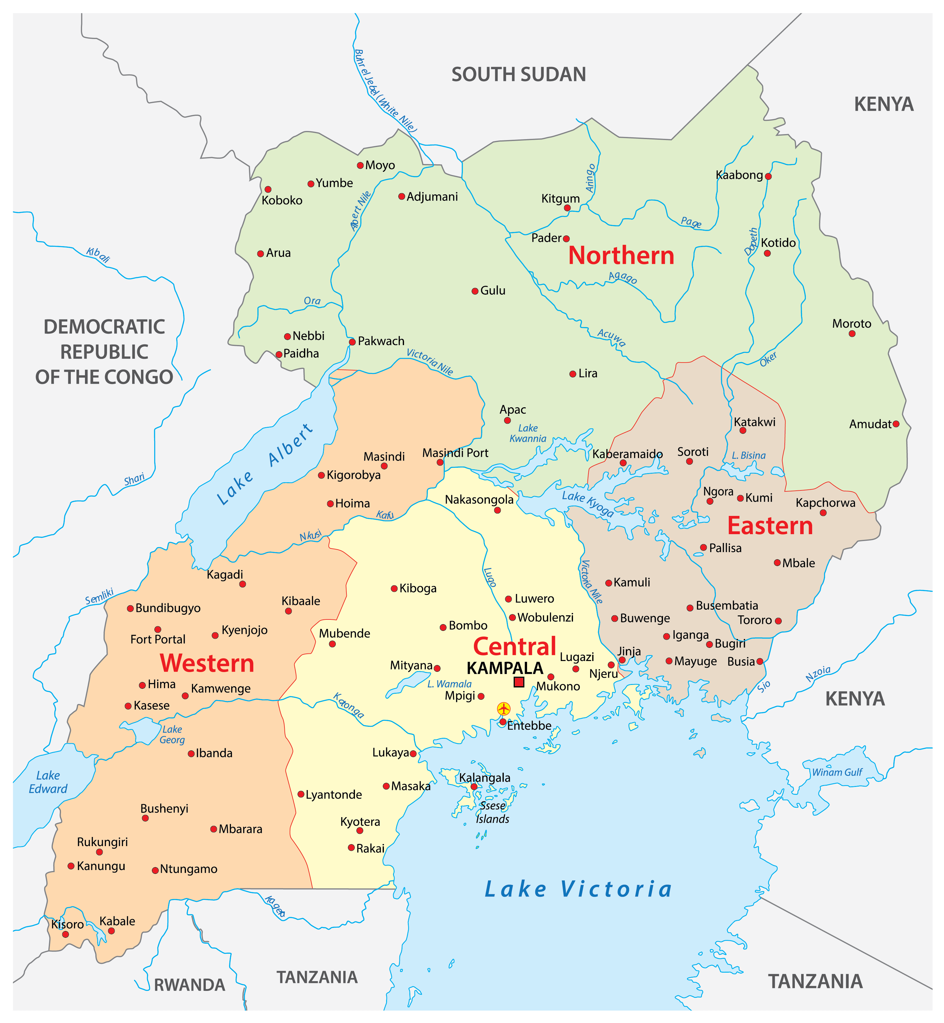
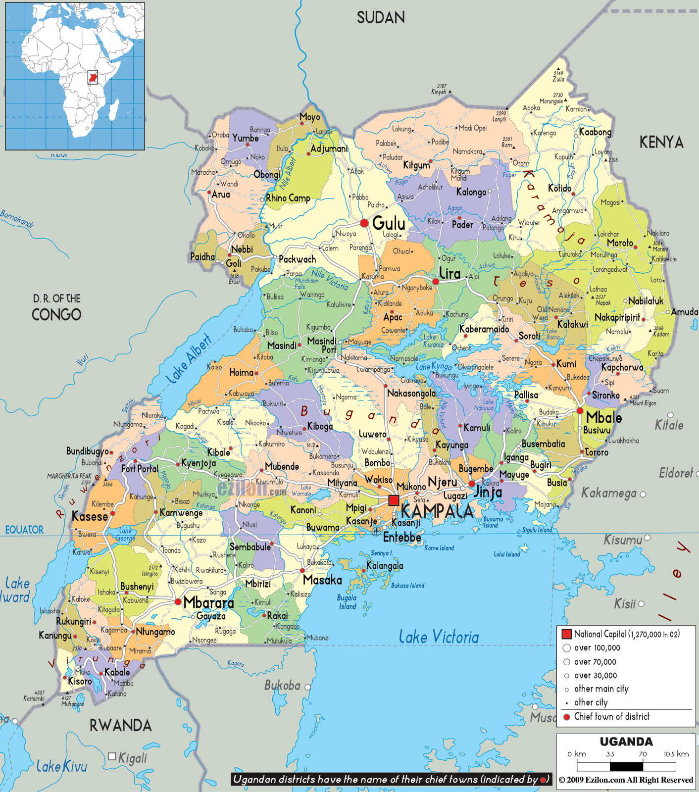
Uganda has four major administrative divisions called regions. These are Central, Western, Eastern, and Northern. These regions are further sub-divided into 15 sub-regions which are constituted by 121 districts. The districts are further broken down into smaller administrative units. These include 146 counties, 1 city council, and 13 municipalities.
With an area of 85,391.7 sq. km, the Northern Region of Uganda is the largest by area. In terms of population, the Central Region is the largest. Kampala, the regional capital of the Central Region, is also the national capital and largest city of Uganda.
Location Maps
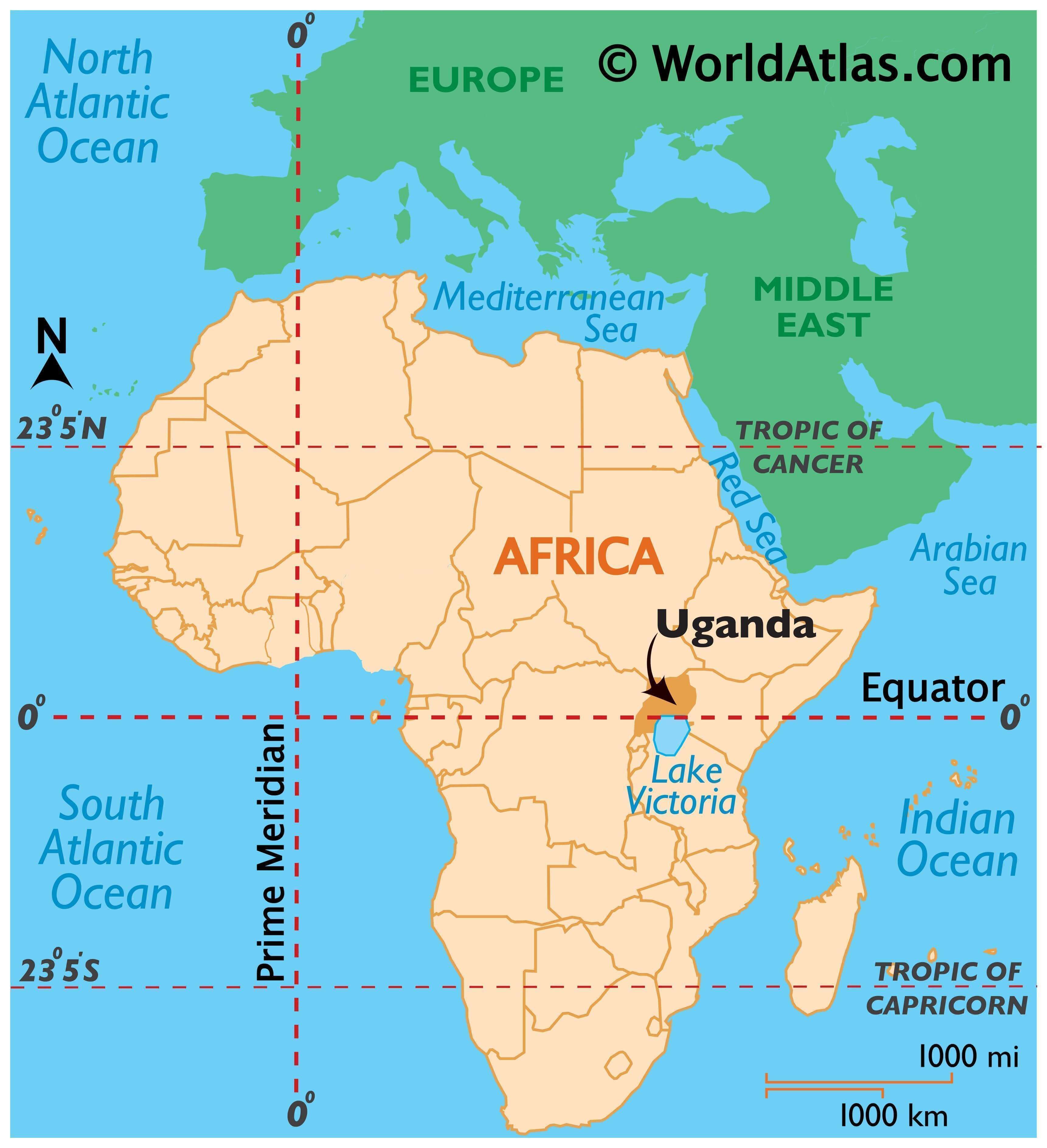
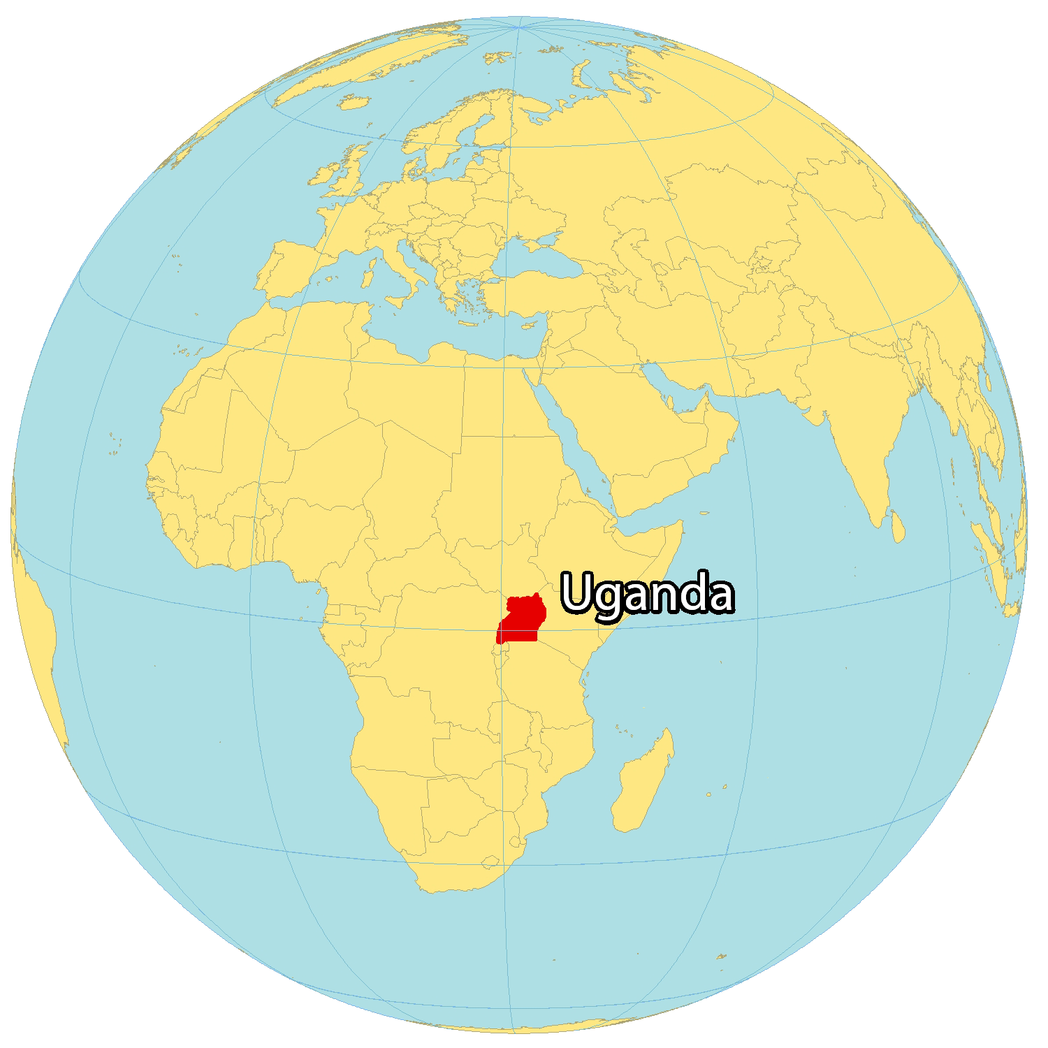
Where is Uganda?
Uganda is a landlocked country located in East Africa, renowned for its wealth of nature such as the Nile Basin, 60+ protected areas, and Africa’s largest lake, Lake Victoria. The country’s capital, Kampala, is situated close to this lake, with other major cities such as Gulu, Lira, and Mbarara scattered throughout the country.
Uganda is bordered by Kenya to the east and the Democratic Republic of the Congo to the west, with two separate mountain chains. Additionally, it’s beside South Sudan to the north, as well as Rwanda and Tanzania to the south.
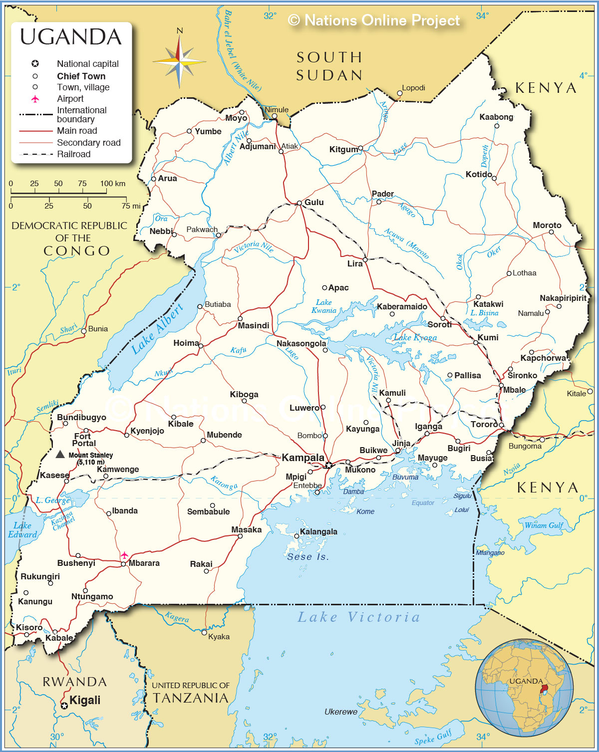
High Definition Political Map of Uganda
Physical Map of Uganda
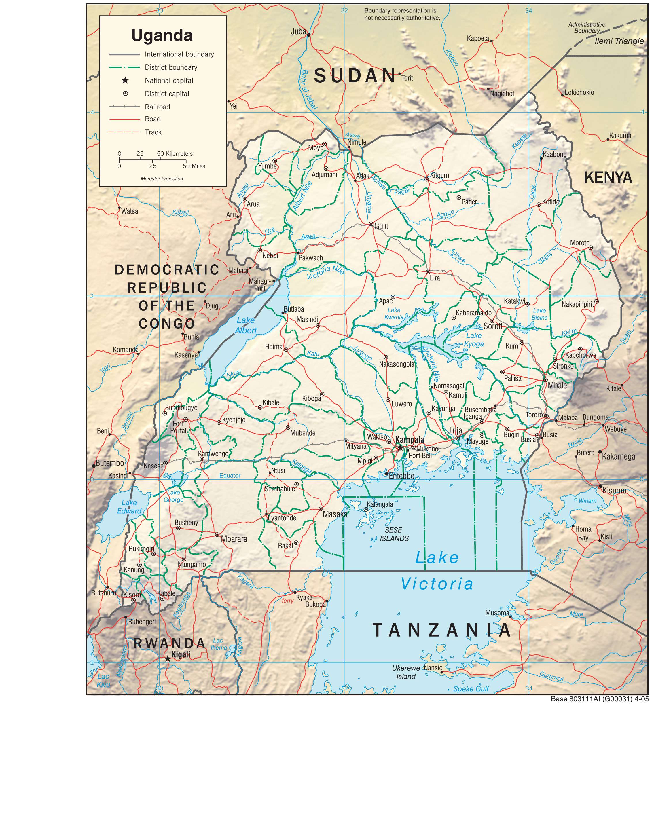
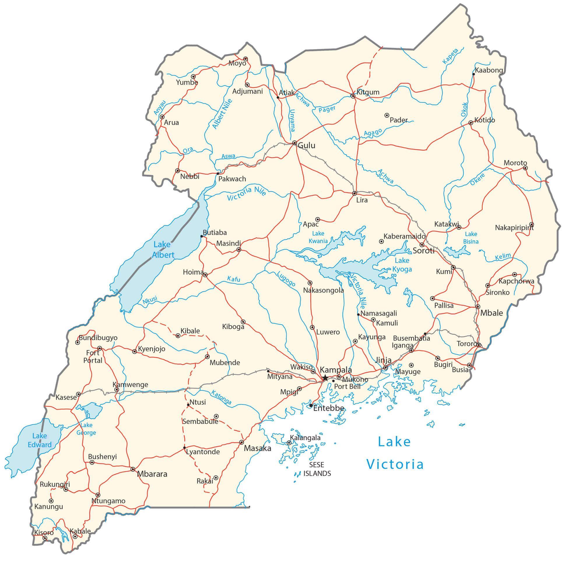
Transportation Map of Uganda
Uganda Satellite Map