Israel is a sovereign nation that covers an area of about 20,770 sq. km in West Asia.
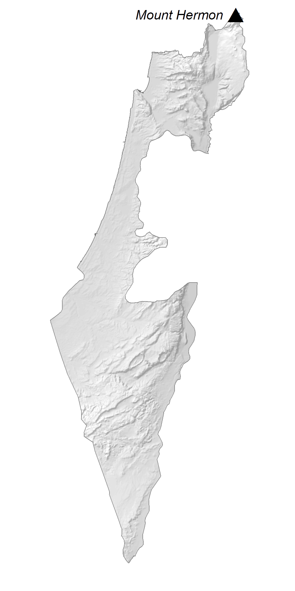
As observed on the physical map of Israel above, despite its small size, the country has a highly varied topography. It can be divided into four distinct physiographic regions.
The Mediterranean coastal plain: A fertile (and mostly flat) coastal plain fronts the Mediterranean Sea coastline of Israel. It is about 115 miles (185 km) long and is quite narrow. Several sandy beaches dot the coast.
Hills in central and northern Israel: Here, rolling hills dissect the country, including the central Samarian hills and the mountains and hills of Galilee in the north. Israel’s highest point, Mt. Meron, which peaks at 3,963 ft. (1,208m) is located in the northern mountain region. It has been marked on the map by a yellow triangle. These mountains of this region end in an escarpment that overlooks the Great Rift Valley.
The Great Rift Valley: The valley runs south to the Gulf of Aqaba along its southern border with Jordan.
Negev Desert (part of the Sinai Desert) dominates the southern landscape.
The Dead Sea is the lowest point (below sea level) on earth. The River Jordan is the most significant river, forming the natural border between Israel and Jordan.
Lake Tiberias and the Jordan River comprises the main drainage system in Israel. Several other rivers also flow through the country.
| Flag: |  |
|---|---|
| Legal Name: | State of Israel |
| Capital Value: | Jerusalem; note – the US recognized Jerusalem as Israel’s capital in December 2017 without taking a position on the specific boundaries of Israeli sovereignty |
| Official languages: | Hebrew |
| Demonym(s): | Israeli |
| Government: | Unitary parliamentary republic |
| Legislature: | Knesset |
| Total Area: | 21,937 km² |
| Land Area: | 21,497 km² |
| Water Area: | 440 km² |
| Population: | 9,053,300 |
| Density: | 439/km (1,137.0/sq mi) (29th) |
| GDP: | $395.10 Billion |
| GDP Per Capita: | $43,641.40 |
| Currency Value: | New Israeli shekels (ILS) |
| Driving side: | right |
| Calling code: | +972 |
| Internet TLD: | .il |
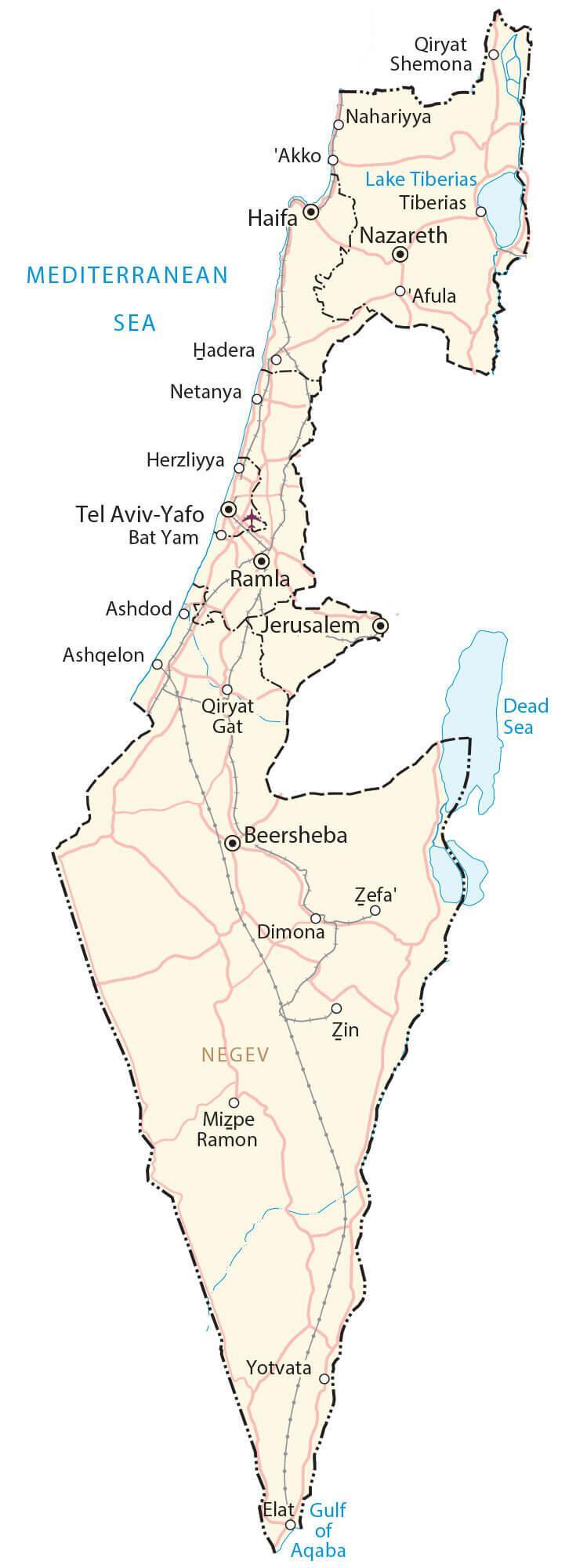
Explore the beauty of Israel with this interactive map. Discover the cities, towns, highways, lakes, and rivers that make up the State of Israel. Get a bird’s eye view of the country with the satellite imagery and elevation map, including the highest peak, Mount Hermon in the north.
Online Interactive Political Map
Click on ![]() to view map in "full screen" mode.
to view map in "full screen" mode.
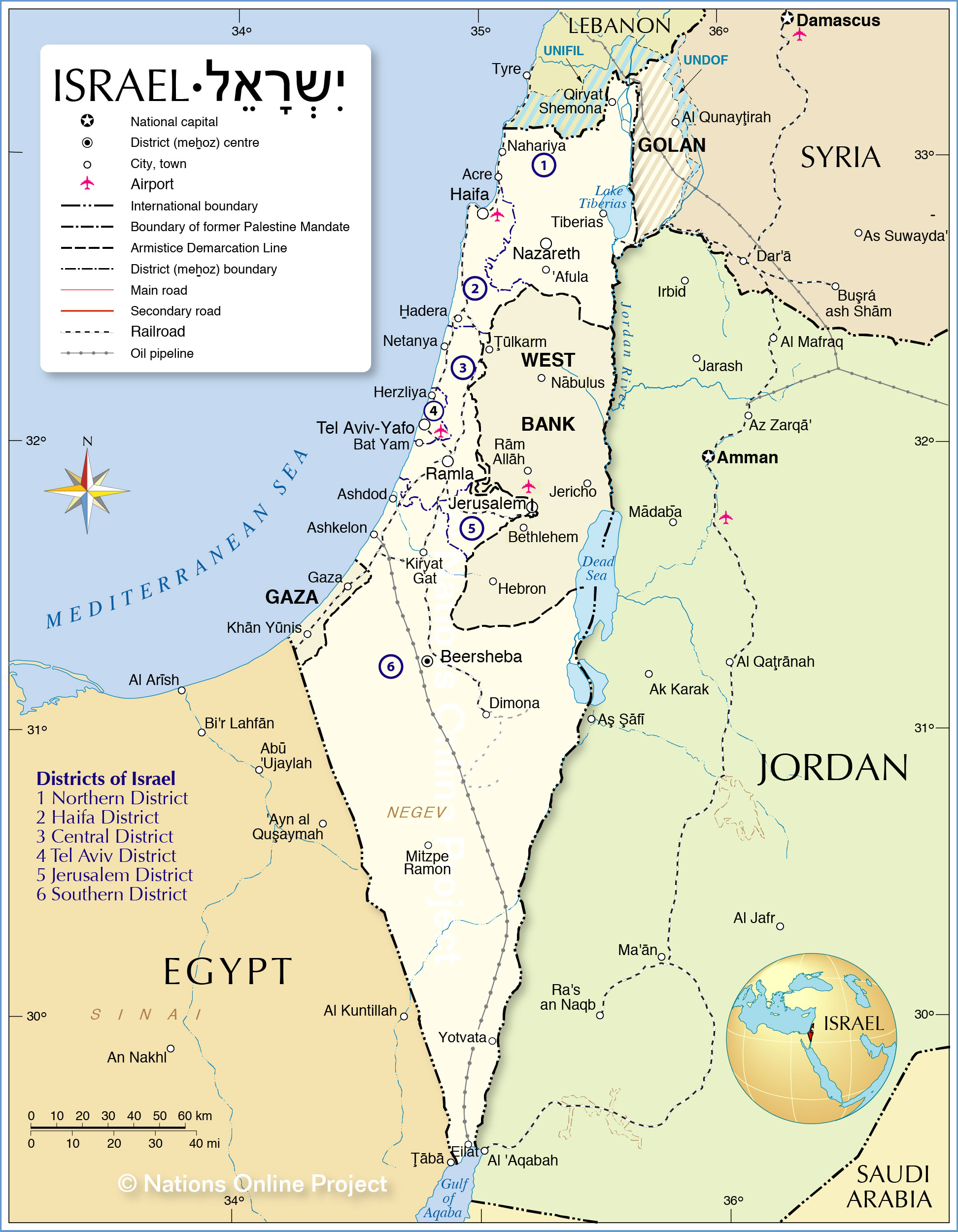
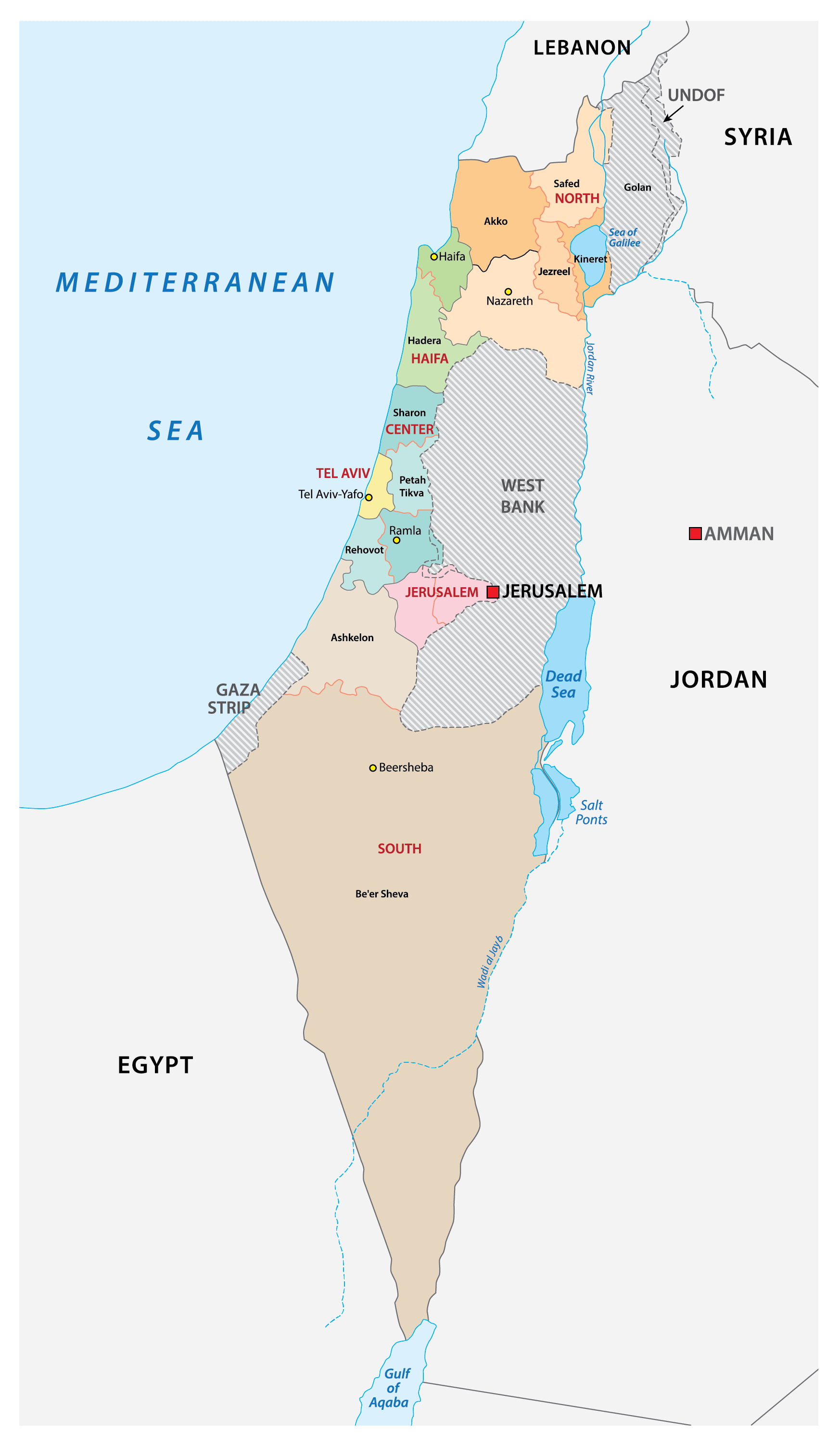
Israel (officially, State of Israel) is divided into 6 administrative districts (mehozot, sing. mehoz). In alphabetical order these districts are: Central, Haifa, Jerusalem, Northern, Southern and Tel Aviv. The districts are further divided into 15 subdistricts (nafot) and a number of smaller subdivisions.
Located on a plateau in the Judaen Mountains, between the Mediterranean Sea and the Dead Sea, is Jerusalem – the capital and largest city of Israel. Jerusalem is regarded as a sacred city by the Christians, Jews and Muslims. Tel Aviv, located in central Israel, is the country’s economic and technological center.
Location Maps
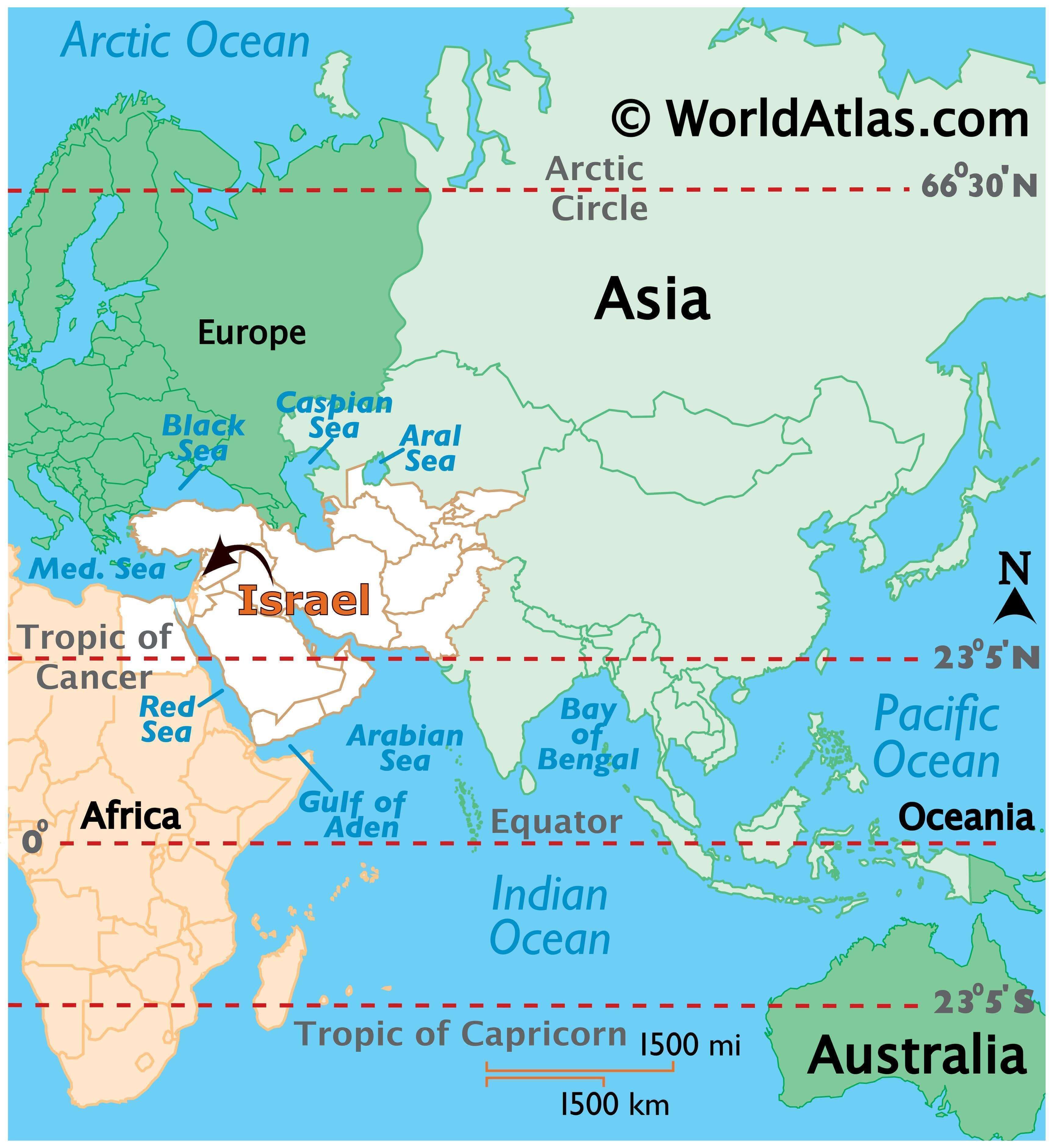
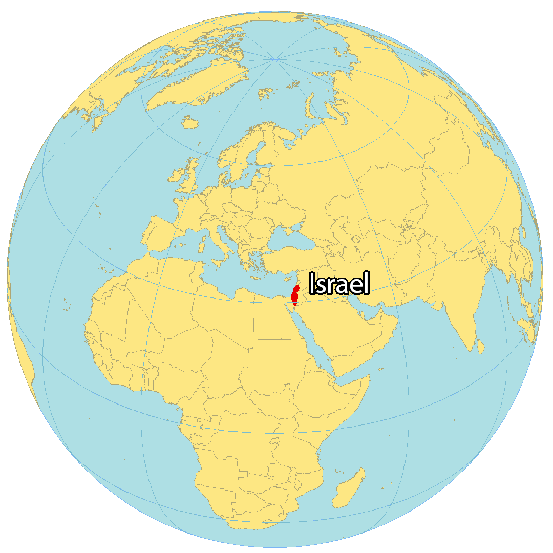
Where is Israel?
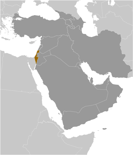
Israel is a country situated in the Middle East, along the Mediterranean Sea and the Red Sea. It is bordered by Lebanon to the north, Syria to the northeast, Jordan to the east, Palestine (West Bank and the Gaza Strip) to the east and west, and Egypt to the southwest. It is known for its Jewish country, its conflicts between Israel and Palestine, as well as the Dead Sea. Jerusalem is the capital and largest city of Israel, and the city of Tel Aviv is also an economic and technological center.
High Definition Political Map of Israel
Physical Map of Israel
Israel Satellite Map
Elevation Map