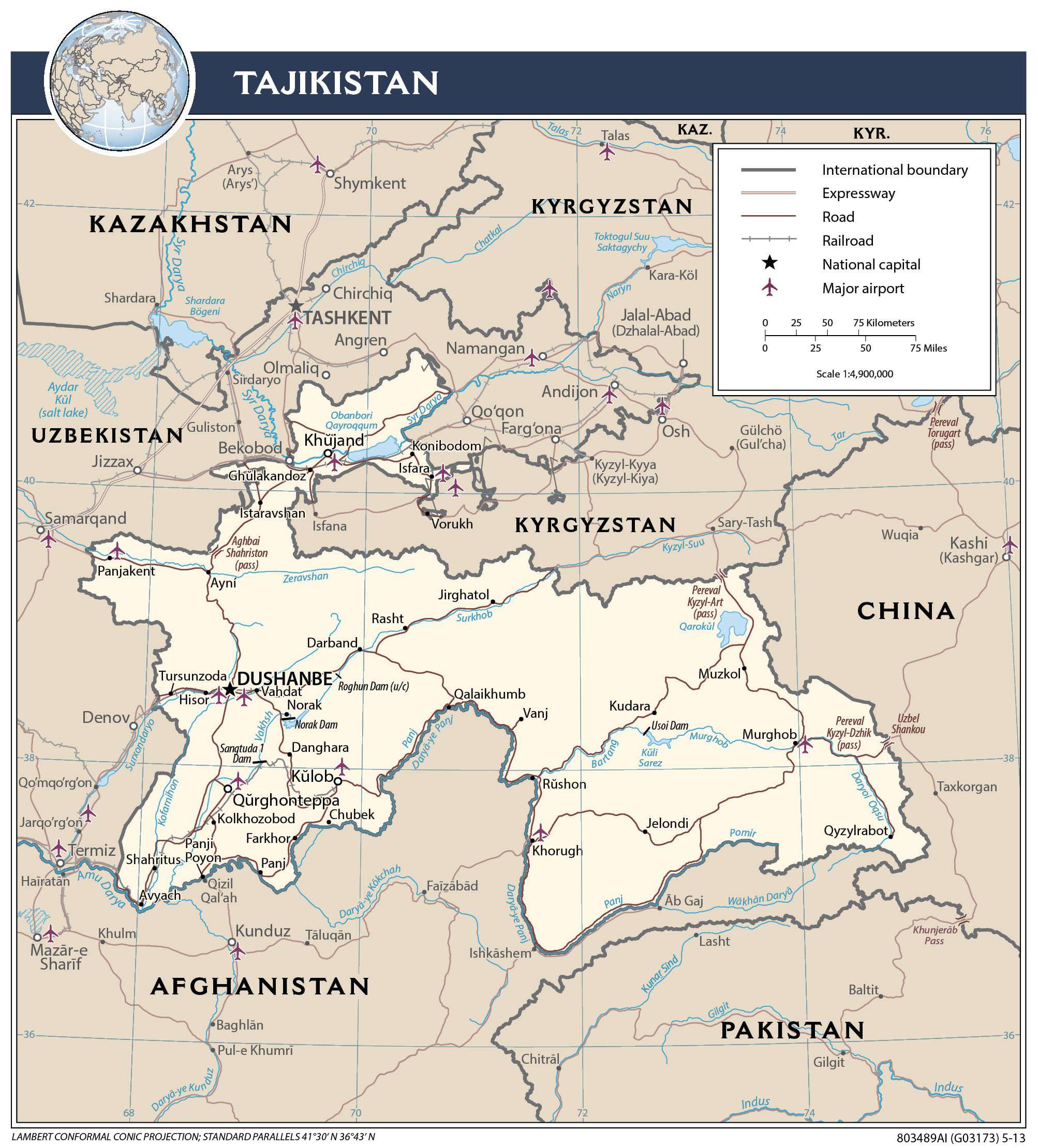
Tajikistan, a landlocked Central Asian country occupies an area of 143,100 sq. km. It is the region’s smallest nation.
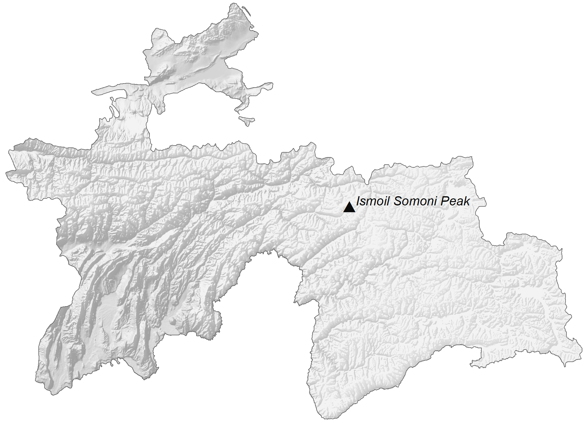
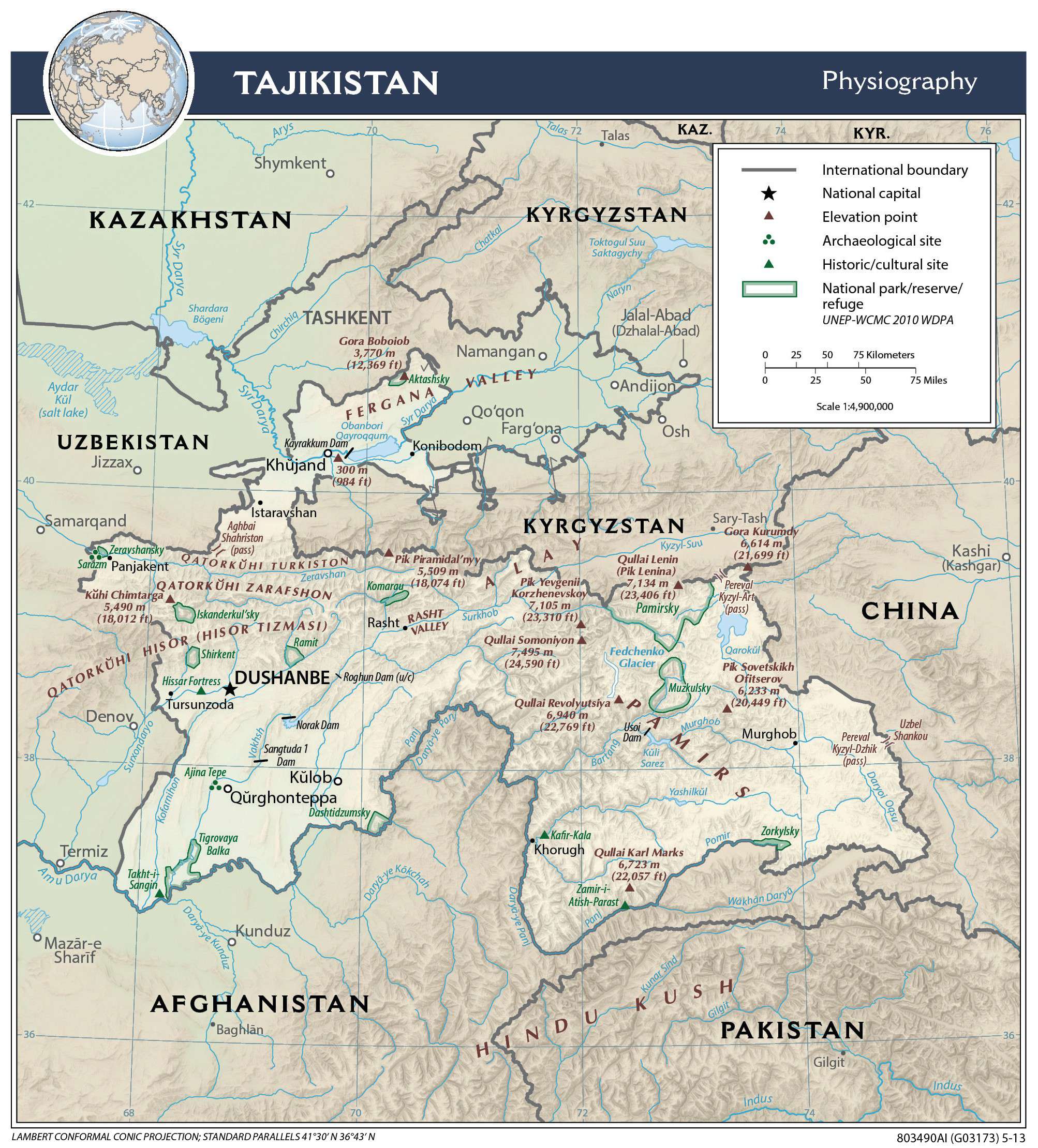
As observed on the physical map of Tajikistan above, almost the entire country (around 93%) is mountainous. In fact, more than half of the country is higher than 3,000 m, (9,842 ft.) in elevation.
The map also shows the two most dominant mountain ranges in the country, the Alay Range in the north and the Pamir Mountains to the southeast.
Tajikistan’s highest point is Qullai Ismoili Somoni, and peaks at 24,589 ft. (7,495 m).
The numerous mountain chains are etched with deep valleys formed by a dense maze of cold-water rivers. The eastern mountains contain many glaciers and lakes. The Fedchenko Glacier (surrounding the country’s highest peaks and marked on the map) covers 700 sq. km, and is the largest non-polar glacier in the world
The lowest elevations are in the northwest, southwest, and in the Fergana Valley, which dominates Tajikistan’s far northern section.
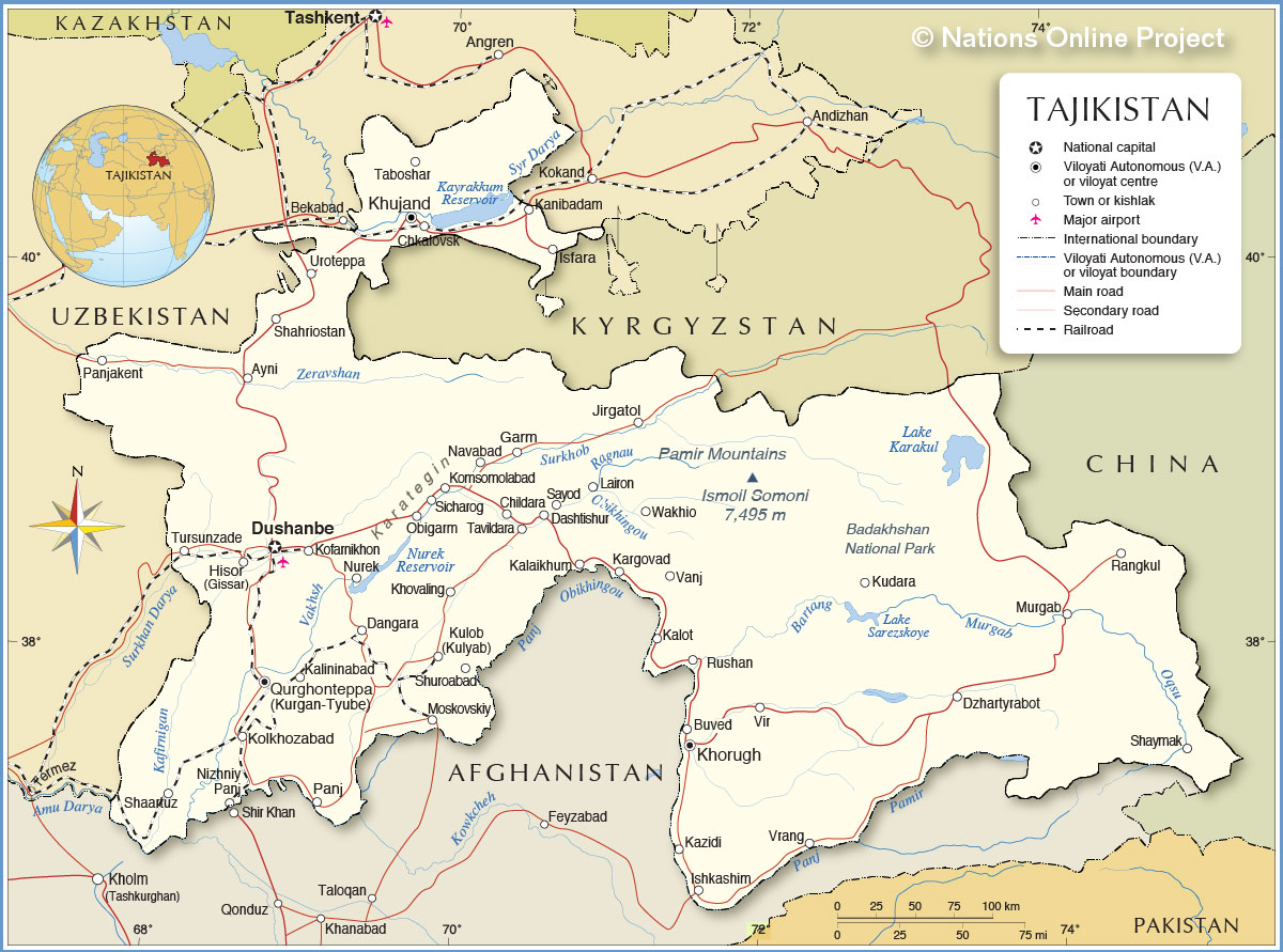
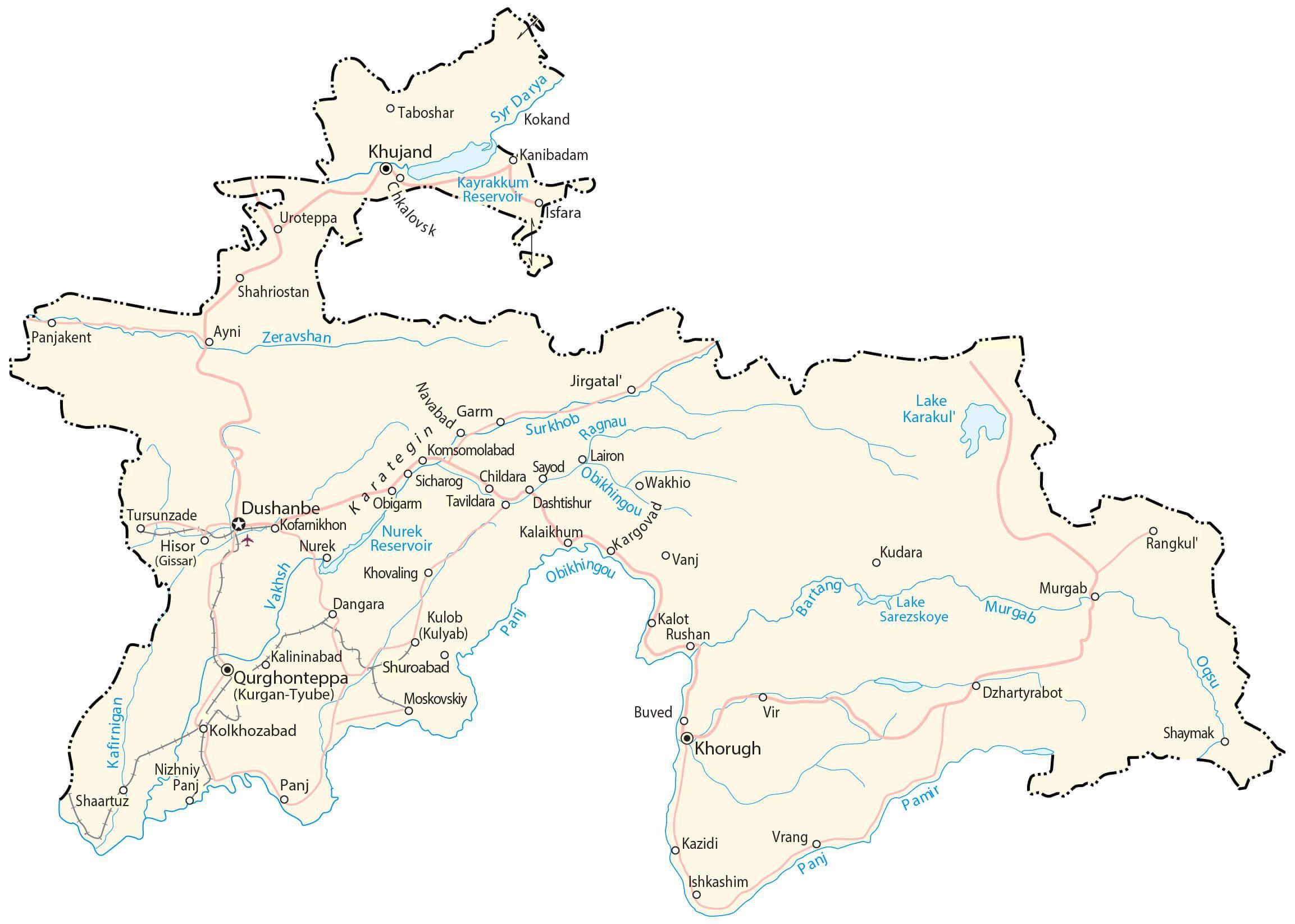
The country’s extensive mountain system spawns many rivers, with the most significant being the Syr Darya, Amu Darya (called the Panj in central Tajikistan), Vakhsh (called the Surkhob in northern Tajikistan), Panj, Pamir, and Bartang.
| Flag: |  |
|---|---|
| Legal Name: | Republic of Tajikistan |
| Capital Value: | Dushanbe |
| Largest City: |
Dushanbe (915,712) |
| Official languages: |
|
| Demonym(s): |
|
| Government: | Unitary presidential republic under an authoritarian dictatorship |
| Legislature: | Supreme Assembly |
| Total Area: | 144,100 km² |
| Land Area: | 141,510 km² |
| Water Area: | 2,590 km² |
| Population: | 9,321,018 |
| Density: | 48.6/km (125.9/sq mi) (155th) |
| GDP: | $8.12 Billion |
| GDP Per Capita: | $870.79 |
| Currency Value: | Tajikistani somoni (TJS) |
| Driving side: | right |
| Calling code: | +992 |
| Internet TLD: | .tj |
Explore the beauty of Tajikistan with this map collection! It features a reference map, satellite imagery, and an elevation map that covers cities, towns, roads, highways, lakes, rivers, and the Alay and the Pamir Mountains.
Discover the vast, stunning landscape of Tajikistan with this comprehensive map collection! It includes a reference map, satellite imagery, and an elevation map that covers cities, towns, roads, highways, lakes, rivers, and the Alay and the Pamir Mountains.
Online Interactive Political Map
Click on ![]() to view map in "full screen" mode.
to view map in "full screen" mode.
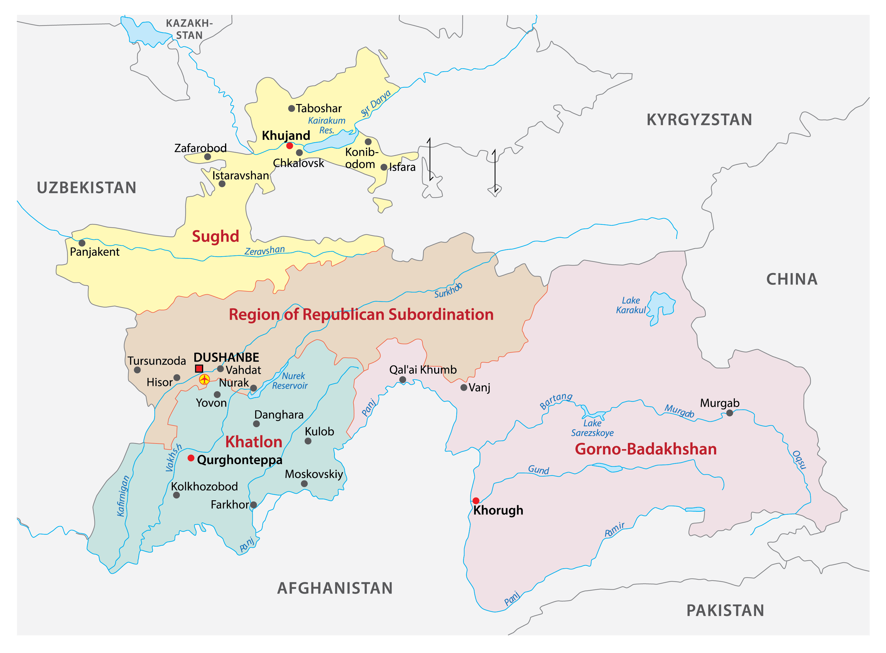
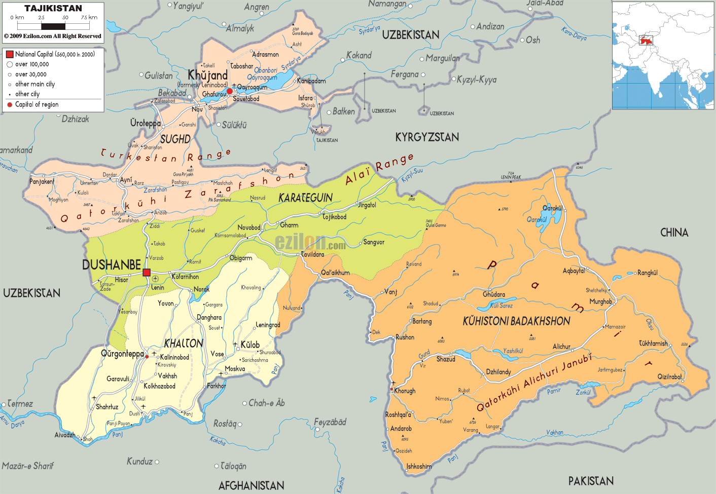
Tajikistan (officially, Republic of Tajikistan) is a sovereign country and is divided into 4 administrative regions or provinces. These regions are: the province of Sughd, the province of Khatlon, the Gorno-Badakhshan Autonomous province (GBAO) and the Region of Republican Subordination (formerly, Karotegin province). These provinces are divided into 58 districts which are further subdivided into 367 jamoats.
Dushanbe is the capital and the largest city of Tajikistan. It is located on the southern slopes above the Kofarnihon valley.
Location Maps
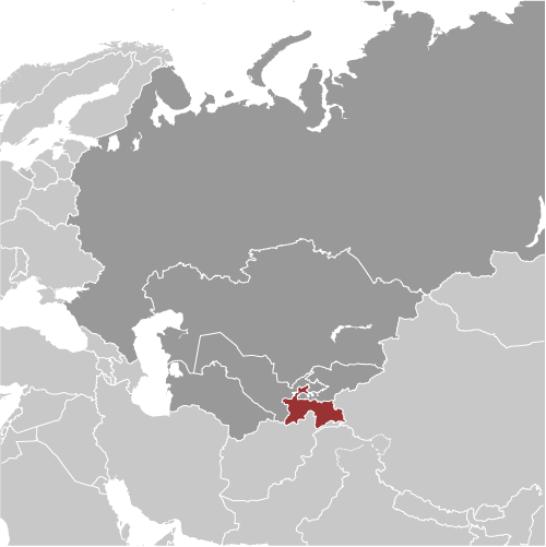
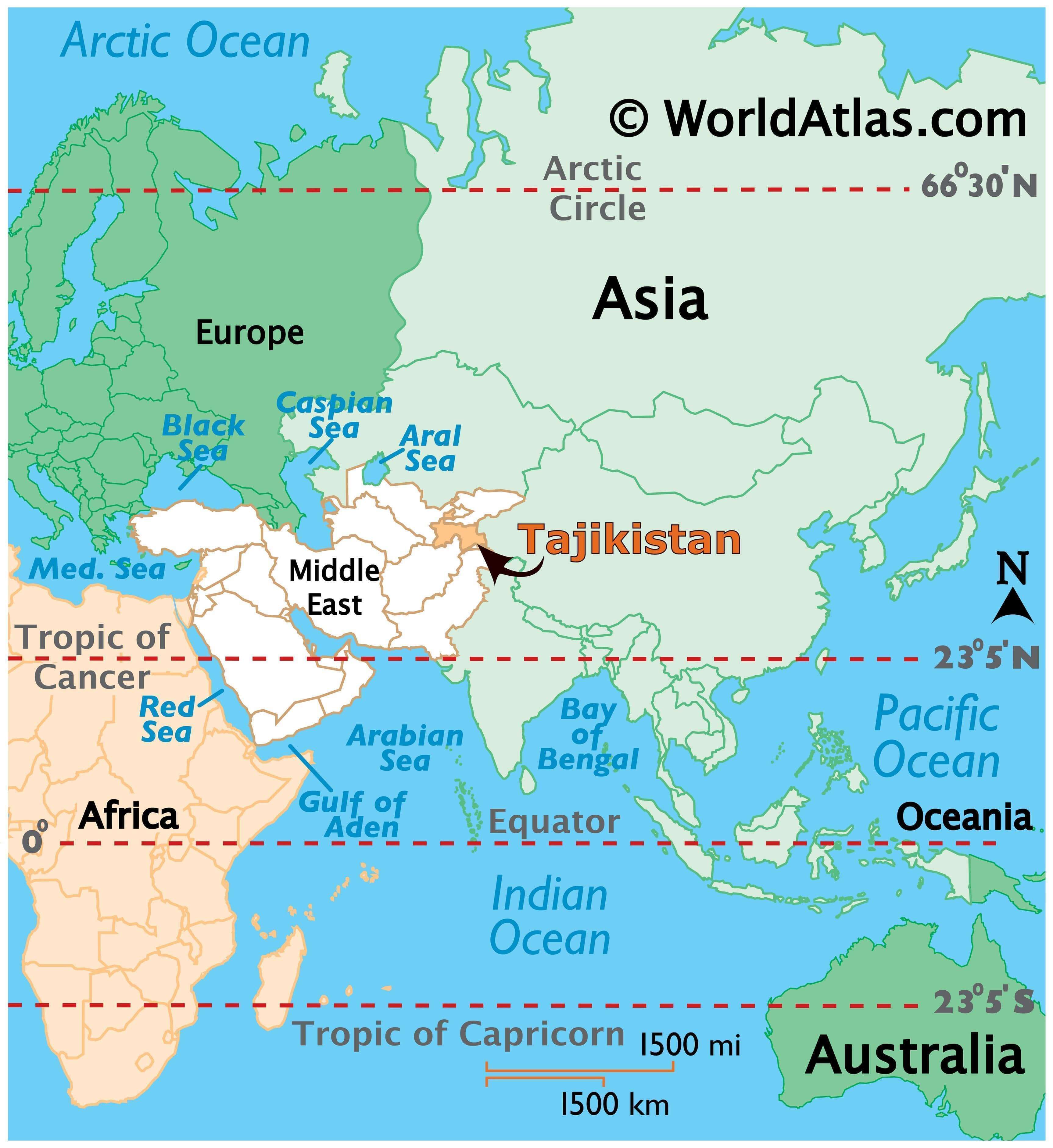
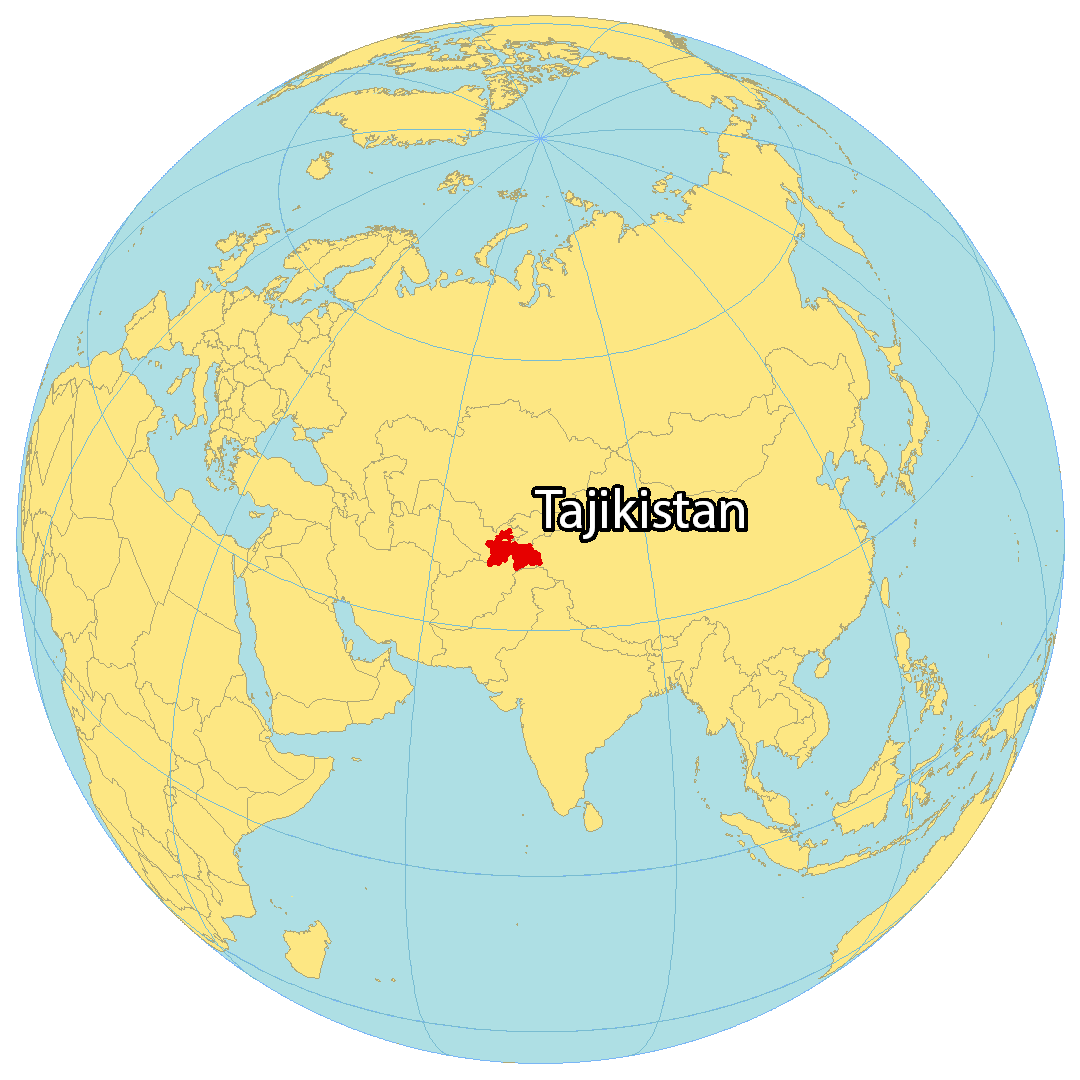
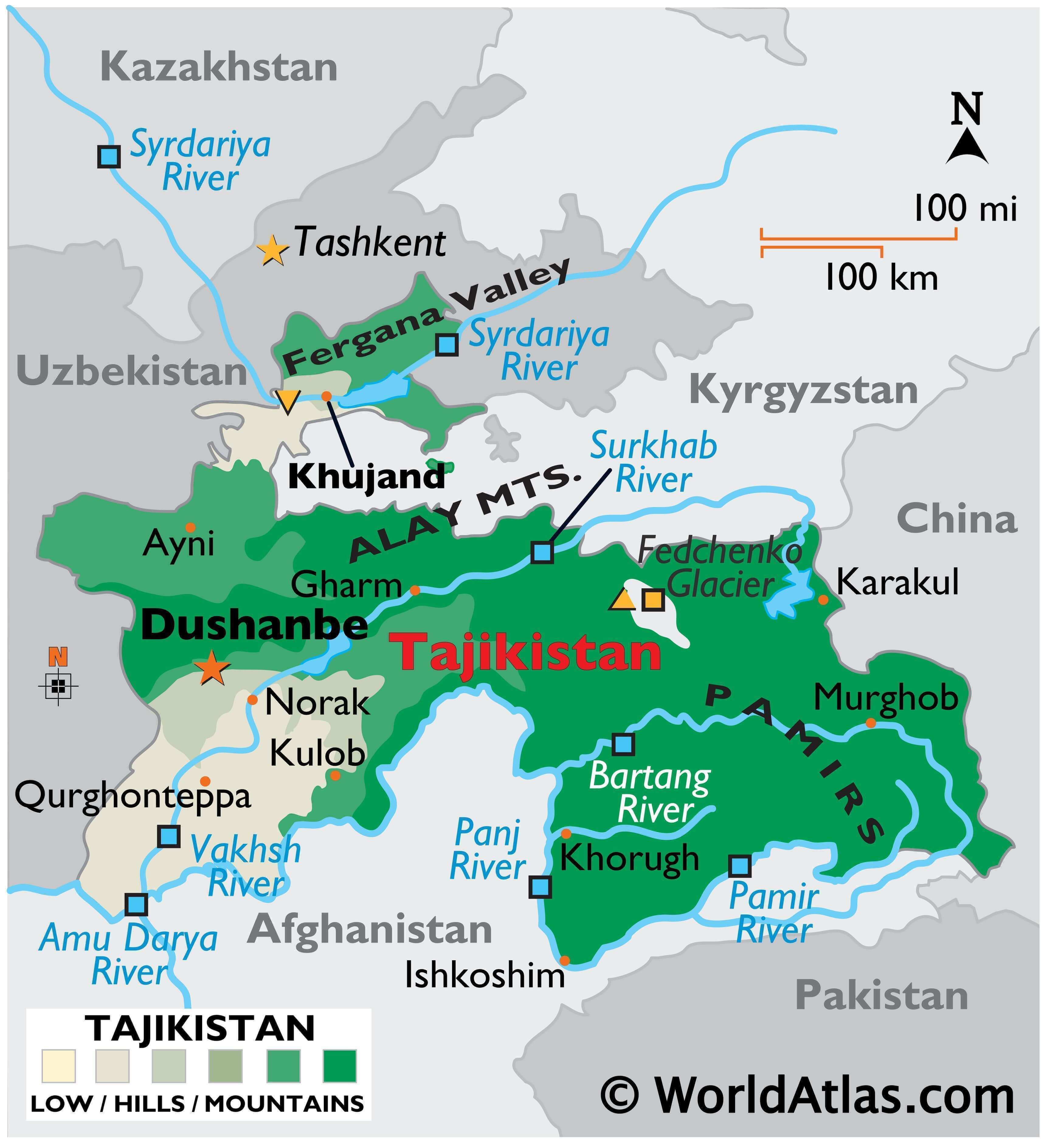
Where is Tajikistan?
Tajikistan is a landlocked country located in Central Asia surrounded by the Alay and Pamir Mountains. It has Uzbekistan to the west, Kyrgyzstan to the north, China to the east, and Afghanistan to the south. This beautiful country is known for its electrical power, ancient cultural roots, and high mountains, earning it the nickname “Roof of the World”. Dushanbe is the capital and largest city in Tajikistan, with other major cities including Khujand, Kulob, and Bokhtar.
High Definition Political Map of Tajikistan
Tajikistan Administrative Map

History
Early history
Cultures in the region have been dated back to at least the fourth millennium BC, including the Bronze Age Bactria–Margiana Archaeological Complex, the Andronovo cultures and the pro-urban site of Sarazm, a UNESCO World Heritage Site.
The earliest recorded history of the region dates back to about 500 BC when much, if not all, of modern Tajikistan, was part of the Achaemenid Empire. Some authors have also suggested that in the seventh and sixth centuries BC, parts of modern Tajikistan, including territories in the Zeravshan valley, formed part of the ancient Hindu Kambojas tribe before it became part of the Achaemenid Empire. After the region’s conquest by Alexander the Great it became part of the Greco-Bactrian Kingdom, a successor state of Alexander’s empire. Northern Tajikistan (the cities of Khujand and Panjakent) was part of Sogdia, a collection of city-states which was overrun by Scythians and Yuezhi nomadic tribes around 150 BC. The Silk Road passed through the region and following the expedition of Chinese explorer Zhang Qian during the reign of Wudi (141BC–87 BC) commercial relations between Han Empire and Sogdiana flourished. Sogdians played a major role in facilitating trade and also worked in other capacities, as farmers, carpetweavers, glassmakers, and woodcarvers.
The Kushan Empire, a collection of Yuezhi tribes, took control of the region in the first century AD and ruled until the fourth century AD during which time Buddhism, Nestorian Christianity, Zoroastrianism, and Manichaeism were all practised in the region. Later the Hephthalite Empire, a collection of nomadic tribes, moved into the region and Arabs brought Islam in the early eighth century. Central Asia continued in its role as a commercial crossroads, linking China, the steppes to the north, and the Islamic heartland.
It was briefly under the control of the Tibetan Empire and the Tang dynasty from 650 to 680 CE and then under the control of the Umayyads in 710 CE.
Samanid Empire
The Samanid Empire, 819 to 999, restored Persian control of the region and enlarged the cities of Samarkand and Bukhara (both cities are today part of Uzbekistan) which became the cultural centers of Iran and the region was known as Khorasan. The empire was centered in Khorasan and Transoxiana; at its greatest extent encompassing modern-day Afghanistan, large parts of Iran, Tajikistan, Turkmenistan, Uzbekistan, Kyrgyzstan, parts of Kazakhstan, and Pakistan. Four brothers Nuh, Ahmad, Yahya, and Ilyas founded the Samanid state. Each of them ruled territory under Abbasid suzerainty. In 892, Ismail Samani (892–907) united the Samanid state under one ruler, thus effectively putting an end to the feudal system used by the Samanids. It was also under him that the Samanids became independent of Abbasid authority. The Kara-Khanid Khanate conquered Transoxania (which corresponds approximately with modern-day Uzbekistan, Tajikistan, southern Kyrgyzstan, and southwest Kazakhstan) and ruled between 999 and 1211. Their arrival in Transoxania signalled a definitive shift from Iranian to Turkic predominance in Central Asia, but gradually the Kara-khanids became assimilated into the Perso-Arab Muslim culture of the region.
In the 13th century, the Mongol Empire swept through Central Asia, invaded Khwarezmian Empire and sacked the cities, looting and massacring people everywhere. Turco-Mongol conqueror Tamerlane founded the Timurid Empire in and around modern-day Tajikistan and Central Asia, becoming the first ruler of the Timurid dynasty.
Bukharan rule
Modern Tajikistan fell under the rule of the Khanate of Bukhara during the 16th century and with the empire’s collapse in the 18th century it came under the rule of both the Emirate of Bukhara and Khanate of Kokand. The Emirate of Bukhara remained intact until the 20th century but during the 19th century, for the second time in world history, a European power (the Russian Empire) began to conquer parts of the region.
Imperial Russia
Russian Imperialism led to the Russian Empire’s conquest of Central Asia during the late 19th century’s Imperial Era. Between 1864 and 1885, Russia gradually took control of the entire territory of Russian Turkestan, the Tajikistan portion of which had been controlled by the Emirate of Bukhara and Khanate of Kokand. Russia was interested in gaining access to a supply of cotton and in the 1870s attempted to switch cultivation in the region from grain to cotton (a strategy later copied and expanded by the Soviets). By 1885 Tajikistan’s territory was either ruled by the Russian Empire or its vassal state, the Emirate of Bukhara, nevertheless Tajiks felt little Russian influence.
During the late 19th century, the Jadidists established themselves as an Islamic social movement throughout the region. Although the Jadidists were pro-modernization and not necessarily anti-Russian, the Russians viewed the movement as a threat because the Russian Empire was predominantly Christian. Russian troops were required to restore order during uprisings against the Khanate of Kokand between 1910 and 1913. Further violence occurred in July 1916 when demonstrators attacked Russian soldiers in Khujand over the threat of forced conscription during World War I. Despite Russian troops quickly bringing Khujand back under control, clashes continued throughout the year in various locations in Tajikistan.
Soviet period
After the Russian Revolution of 1917 guerrillas throughout Central Asia, known as basmachi, waged a war against Bolshevik armies in an attempt to maintain independence. The Bolsheviks prevailed after a four-year war, in which mosques and villages were burned down and the population heavily suppressed. Soviet authorities started a campaign of secularisation. Practising Islam, Judaism, and Christianity was discouraged and repressed, and many mosques, churches, and synagogues were closed. As a consequence of the conflict and Soviet agriculture policies, Central Asia, Tajikistan included, suffered a famine that claimed many lives.
In 1924, the Tajik Autonomous Soviet Socialist Republic was created as a part of Uzbekistan, but in 1929 the Tajik Soviet Socialist Republic (Tajik SSR) was made a separate constituent republic; however, the predominantly ethnic Tajik cities of Samarkand and Bukhara remained in the Uzbek SSR. Between 1927 and 1934, collectivisation of agriculture and a rapid expansion of cotton production took place, especially in the southern region. Soviet collectivisation policy brought violence against peasants and forced resettlement occurred throughout Tajikistan. Consequently, some peasants fought collectivization and revived the Basmachi movement. Some small scale industrial development also occurred during this time along with the expansion of irrigation infrastructure.
Two rounds of Stalin’s purges (1927–1934 and 1937–1938) resulted in the expulsion of nearly 10,000 people, from all levels of the Communist Party of Tajikistan. Ethnic Russians were sent in to replace those expelled and subsequently Russians dominated party positions at all levels, including the top position of first secretary. Between 1926 and 1959 the proportion of Russians among Tajikistan’s population grew from less than 1% to 13%. Bobojon Ghafurov, First Secretary of the Communist Party of Tajikistan from 1946 to 1956, was the only Tajik politician of significance outside of the country during the Soviet Era. He was followed in office by Tursun Uljabayev (1956–61), Jabbor Rasulov (1961–1982), and Rahmon Nabiyev (1982–1985, 1991–1992).
Tajiks began to be conscripted into the Soviet Army in 1939 and during World War II around 260,000 Tajik citizens fought against Germany, Finland and Japan. Between 60,000 (4%) and 120,000 (8%) of Tajikistan’s 1,530,000 citizens were killed during World War II. Following the war and Stalin’s reign, attempts were made to further expand the agriculture and industry of Tajikistan. During 1957–58 Nikita Khrushchev’s Virgin Lands Campaign focused attention on Tajikistan, where living conditions, education and industry lagged behind the other Soviet Republics. In the 1980s, Tajikistan had the lowest household saving rate in the USSR, the lowest percentage of households in the two top per capita income groups, and the lowest rate of university graduates per 1000 people. By the late 1980s Tajik nationalists were calling for increased rights. Real disturbances did not occur within the republic until 1990. The following year, the Soviet Union collapsed, and Tajikistan declared its independence on 9 September 1991, a day which is now celebrated as the country’s Independence Day.
Independence
After the beginning of the Perestroika era, declared by Mikhail Gorbachev throughout the USSR, supporters of the independence of the republics began to speak openly and freely. In Tajikistan SSR, the independence movement had been active since 1987. Supporters of independence were the Islamic Renaissance Party of Tajikistan, the Democratic Party of Tajikistan and the national democratic Rastokhez (Revival) Movement. On the eve of the collapse of the USSR, the population of Tajikistan SSR was divided into two camps. The first wanted independence for Tajikistan, the restoration of Tajik culture and language, the restoration of political and cultural relations with Iran and Afghanistan and other countries, and the second part of the population opposed independence, considering it the best option to remain part of the USSR. During the 1991 Soviet Union Referendum (the first internationally observed referendum in the country’s history) on continuing the Soviet system and the Soviet Union itself, nearly 97% of voters in Tajikistan approved of Question 1: “Do you consider it necessary to preserve the USSR as a renewed federation of equal sovereign republics, which will be fully ensured of human rights and freedoms of any nationality?”, though by dissolution in December of the same year, a significant proportion of Tajikistan’s population supported what was by then the fait accompli of independence for the union-level republics of the Soviet Union.
In February 1990, riots and strikes in Dushanbe and other cities began due to the difficult socio-economic situation, lack of housing, and youth unemployment. The nationalist and democratic opposition and supporters of independence joined the strikes and began to demand the independence of the republic and democratic reforms. Islamists also began to hold strikes to demand respect for their rights and independence of the republic. The Soviet leadership introduced Internal Troops in Dushanbe to eliminate the unrest.
Post-independence
Almost immediately following independence, the nation fell into civil war among various factions; often distinguished by clan loyalties. More than 500,000 residents fled during this time because of persecution, increased poverty and better economic opportunities in the West or in other former Soviet republics. Emomali Rahmon came to power in 1992, defeating former prime minister Abdumalik Abdullajanov in a November presidential election with 58% of the vote. The elections took place shortly after the end of the war, and Tajikistan was in a state of complete devastation. The estimated dead numbered over 100,000. Around 1.2 million people were refugees inside and outside of the country. In 1997, a ceasefire was reached between Rahmon and opposition parties under the guidance of Gerd D. Merrem, Special Representative to the Secretary General, a result widely praised as a successful United Nations peacekeeping initiative. The ceasefire guaranteed 30% of ministerial positions would go to the opposition. Elections were held in 1999, though they were criticised by opposition parties and foreign observers as unfair and Rahmon was re-elected with 98% of the vote. Elections in 2006 were again won by Rahmon (with 79% of the vote) and he began his third term in office. Several opposition parties boycotted the 2006 election and the Organization for Security and Cooperation in Europe (OSCE) criticised it, although observers from the Commonwealth of Independent States claimed the elections were legal and transparent. Rahmon’s administration came under further criticism from the OSCE in October 2010 for its censorship and repression of the media. The OSCE claimed that the Tajik Government censored Tajik and foreign websites and instituted tax inspections on independent printing houses that led to the cessation of printing activities for a number of independent newspapers.
Russian border troops were stationed along the Tajik–Afghan border until summer 2005. Since the September 11, 2001 attacks, French troops have been stationed at Dushanbe Airport in support of air operations of NATO’s International Security Assistance Force in Afghanistan. United States Army and Marine Corps personnel periodically visit Tajikistan to conduct joint training missions of up to several weeks duration. The Government of India rebuilt the Ayni Air Base, a military airport located 15 km southwest of Dushanbe, at a cost of $70 million, completing the repairs in September 2010. It is now the main base of the Tajikistan air force. There have been talks with Russia concerning use of the Ayni facility, and Russia continues to maintain a large base on the outskirts of Dushanbe.
In 2010, there were concerns among Tajik officials that Islamic militarism in the east of the country was on the rise following the escape of 25 militants from a Tajik prison in August, an ambush that killed 28 Tajik soldiers in the Rasht Valley in September, and another ambush in the valley in October that killed 30 soldiers, followed by fighting outside Gharm that left 3 militants dead. To date the country’s Interior Ministry asserts that the central government maintains full control over the country’s east, and the military operation in the Rasht Valley was concluded in November 2010. However, fighting erupted again in July 2012. In 2015, Russia sent more troops to Tajikistan.
In May 2015, Tajikistan’s national security suffered a serious setback when Colonel Gulmurod Khalimov, commander of the special-purpose police unit (OMON) of the Interior Ministry, defected to the Islamic State.
In 2021, following the Fall of Kabul, Tajikistan allegedly got involved in the Panjshir conflict against the Taliban on the side of the National Resistance Front of Afghanistan.
In September 2022 armed clashes, including the use of artillery, erupted along much of the border between Kyrgyzstan and Tajikistan.
Physical Map of Tajikistan
Transportation Map of Tajikistan
Tajikistan Satellite Map
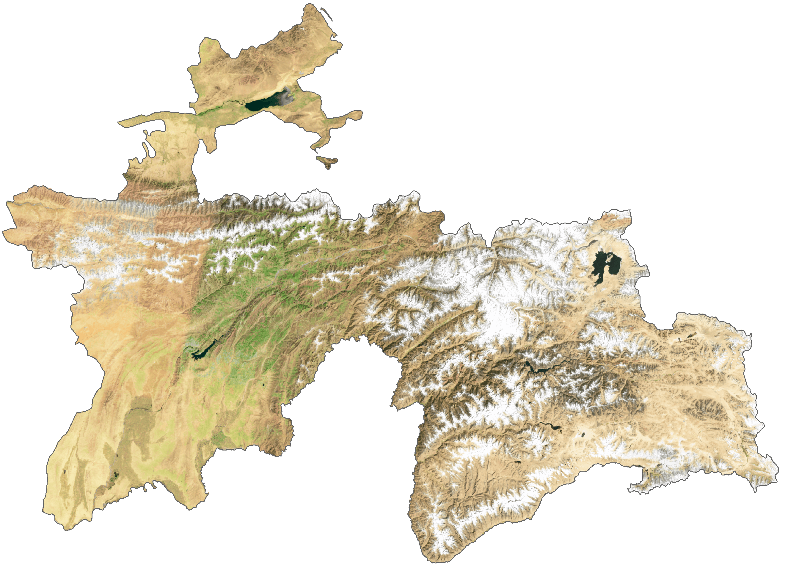
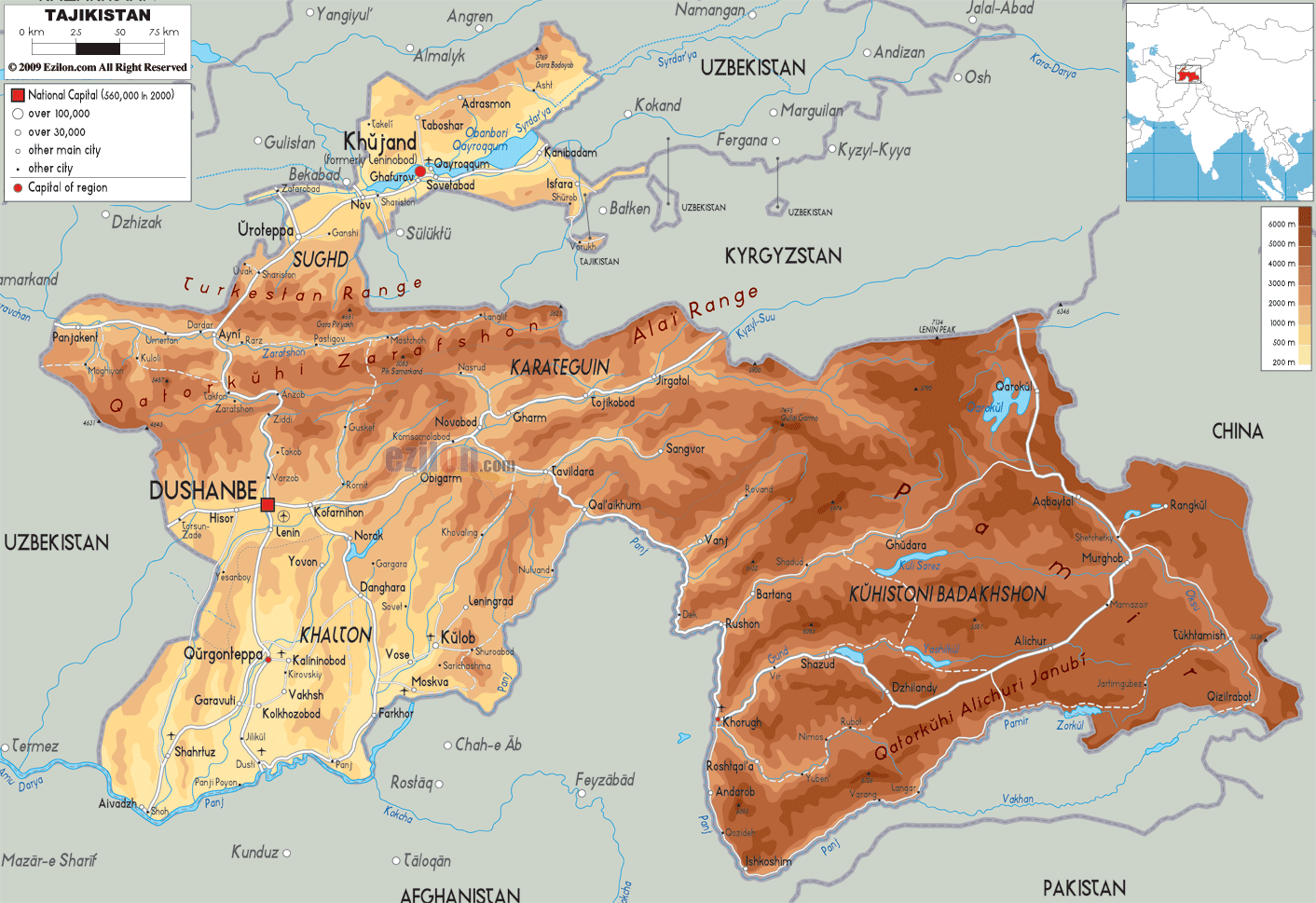
Elevation Map