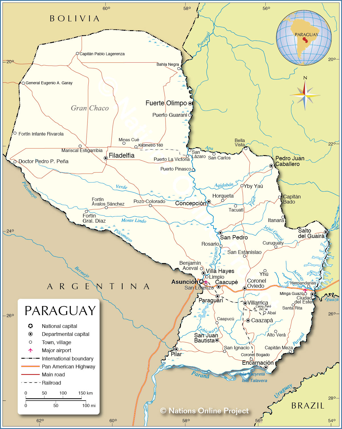
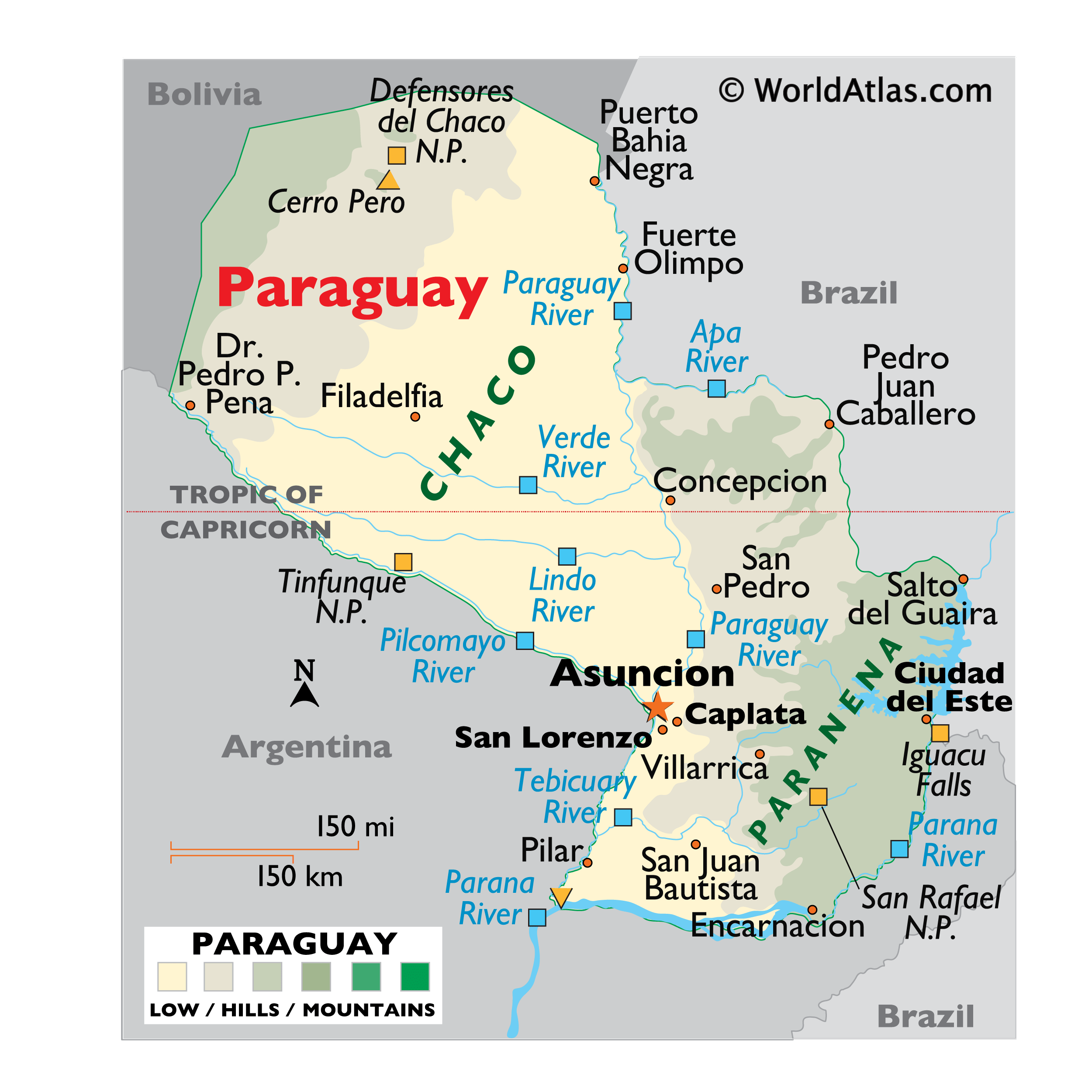
The landlocked nation of Paraguay covering an area of 406,752 sq.km (157,050 sq mi), is located in Central South America.
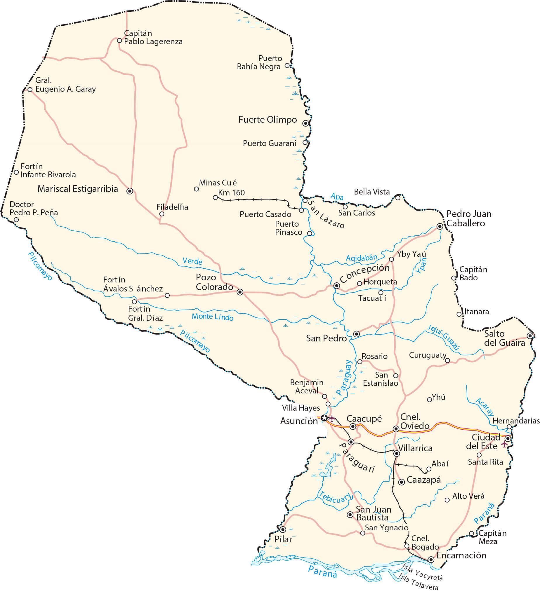
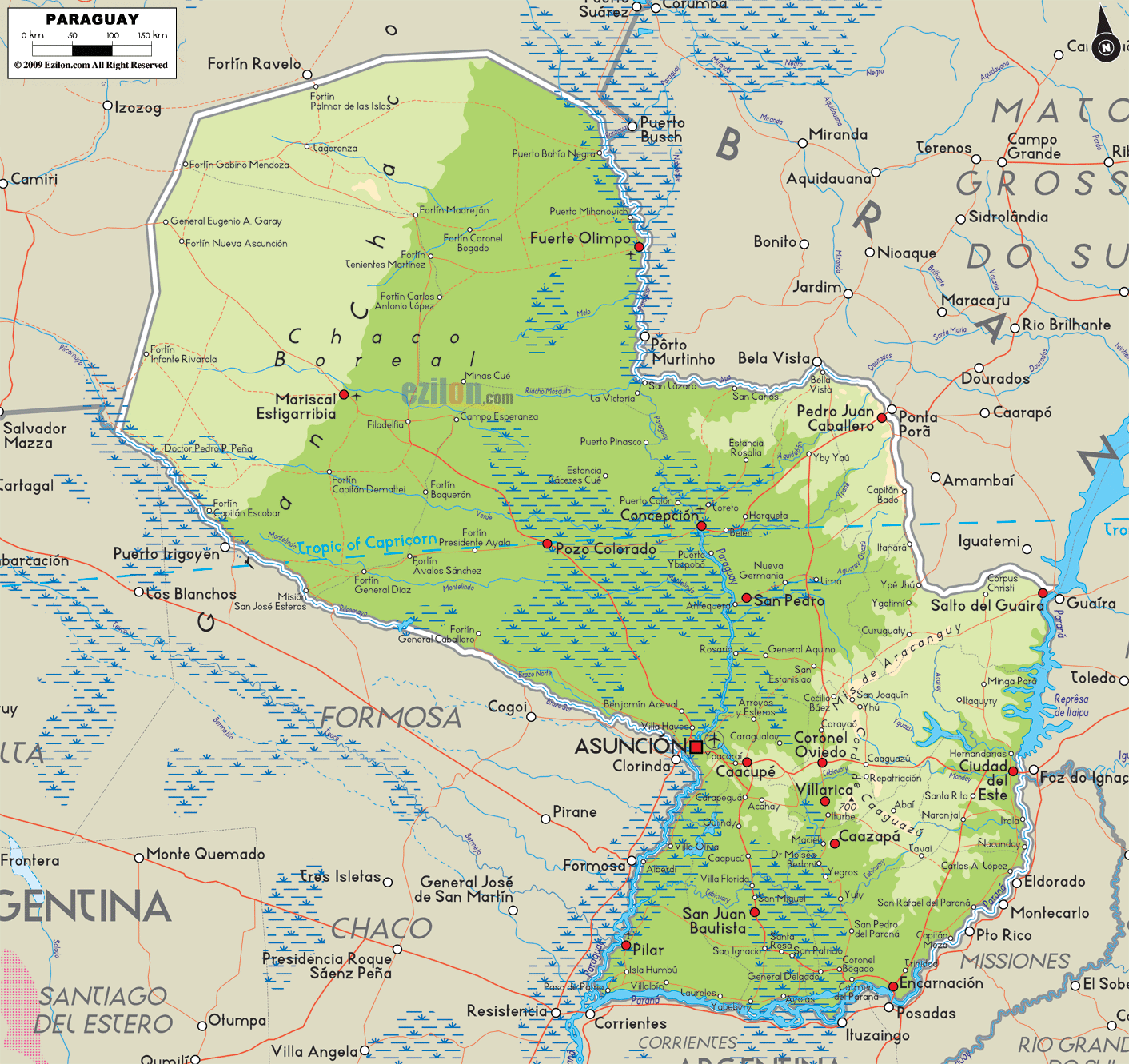
As observed on the physical map of the country, Paraguay is crisscrossed by many rivers. The three largest rivers – the Paraguay, Parana and Pilcomayo -forms over 75% of the country’s borders. The Parana River forms the country’s eastern and southern borders and joins the Paraguay River in the country’s southwestern region. As marked on the map by an upright yellow triangle is the country’s highest peak – Cerro Pero at 2,762 ft (842m).
The Paraguay River divides the country into two major regions: the Paranena (Eastern Region), east of the Paraguay River, is a fertile, cultivated landscape, with rolling hills, low mountains and subtropical forests.
To the west of the Paraguay River, in the Western Region, the hot scrublands and low plains of the Chaco cover about 60% of Paraguay’s total land area. The Chaco region is one of the most sparsely populated regions in South America.
The two major lakes of Paraguay are Lake Ypoa, which is the largest; and Lake Vera.
| Flag: |  |
|---|---|
| Legal Name: | Republic of Paraguay |
| Capital Value: | Asuncion |
| Official languages: |
|
| Demonym(s): | Paraguayan |
| Government: | Unitary presidential republic |
| Legislature: | Congress |
| Total Area: | 406,752 km² |
| Land Area: | 397,302 km² |
| Water Area: | 9,450 km² |
| Population: | 7,044,636 |
| Density: | 18/km (46.6/sq mi) (210th) |
| GDP: | $38.15 Billion |
| GDP Per Capita: | $5,414.80 |
| Currency Value: | Guarani (PYG) |
| Driving side: | right |
| Calling code: | +595 |
| Internet TLD: | .py |
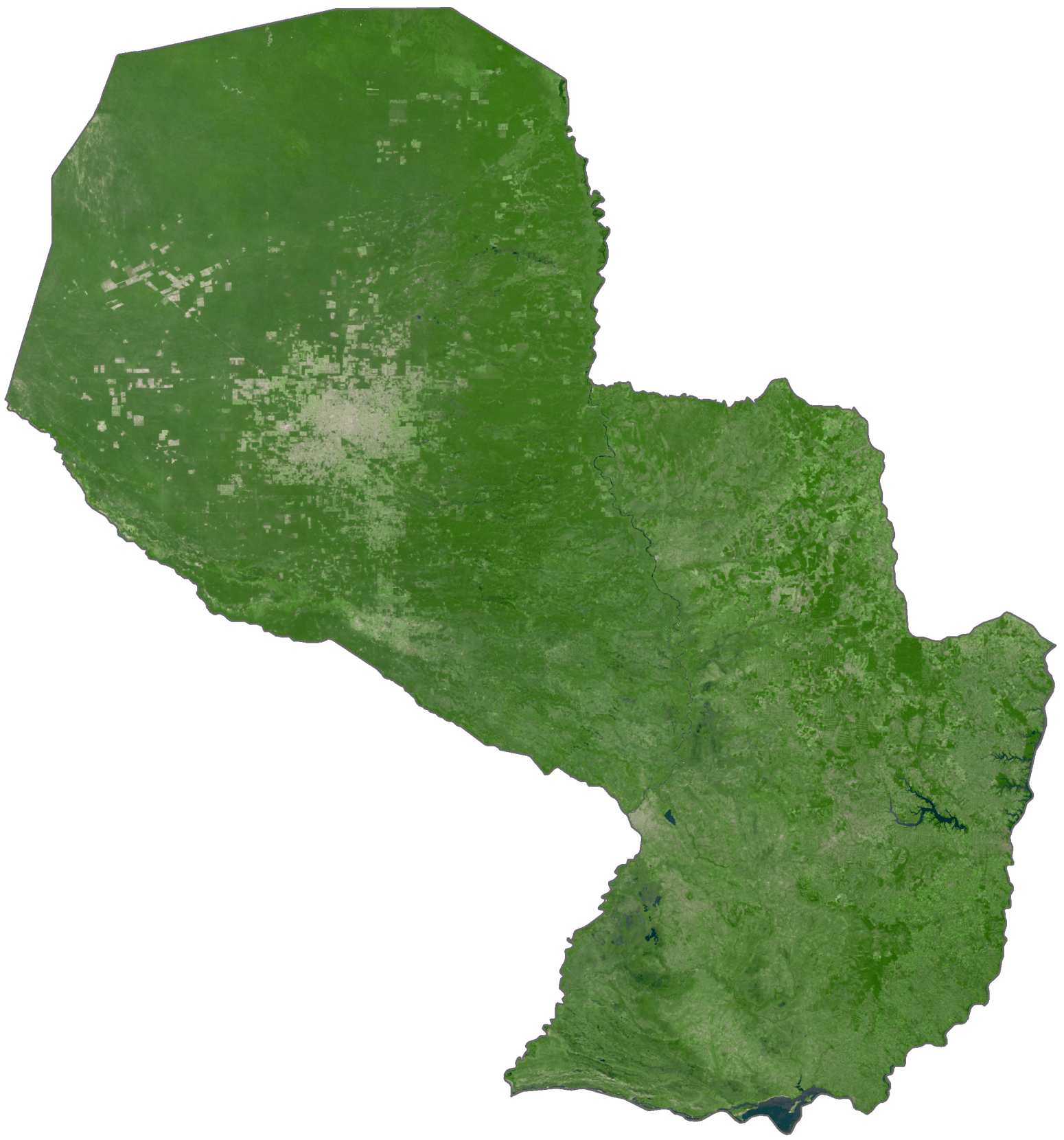
Paraguay is a country of diverse landscapes and rich cultural heritage. This map provides a great visual representation of its varied geography, with detailed images of its cities, towns, highways, roads, lakes, and rivers. Satellite imagery and an elevation map allows for an even deeper exploration of the country’s notable features, such as the Chaco, Paraneña, and the Paraguay River.
Online Interactive Political Map
Click on ![]() to view map in "full screen" mode.
to view map in "full screen" mode.
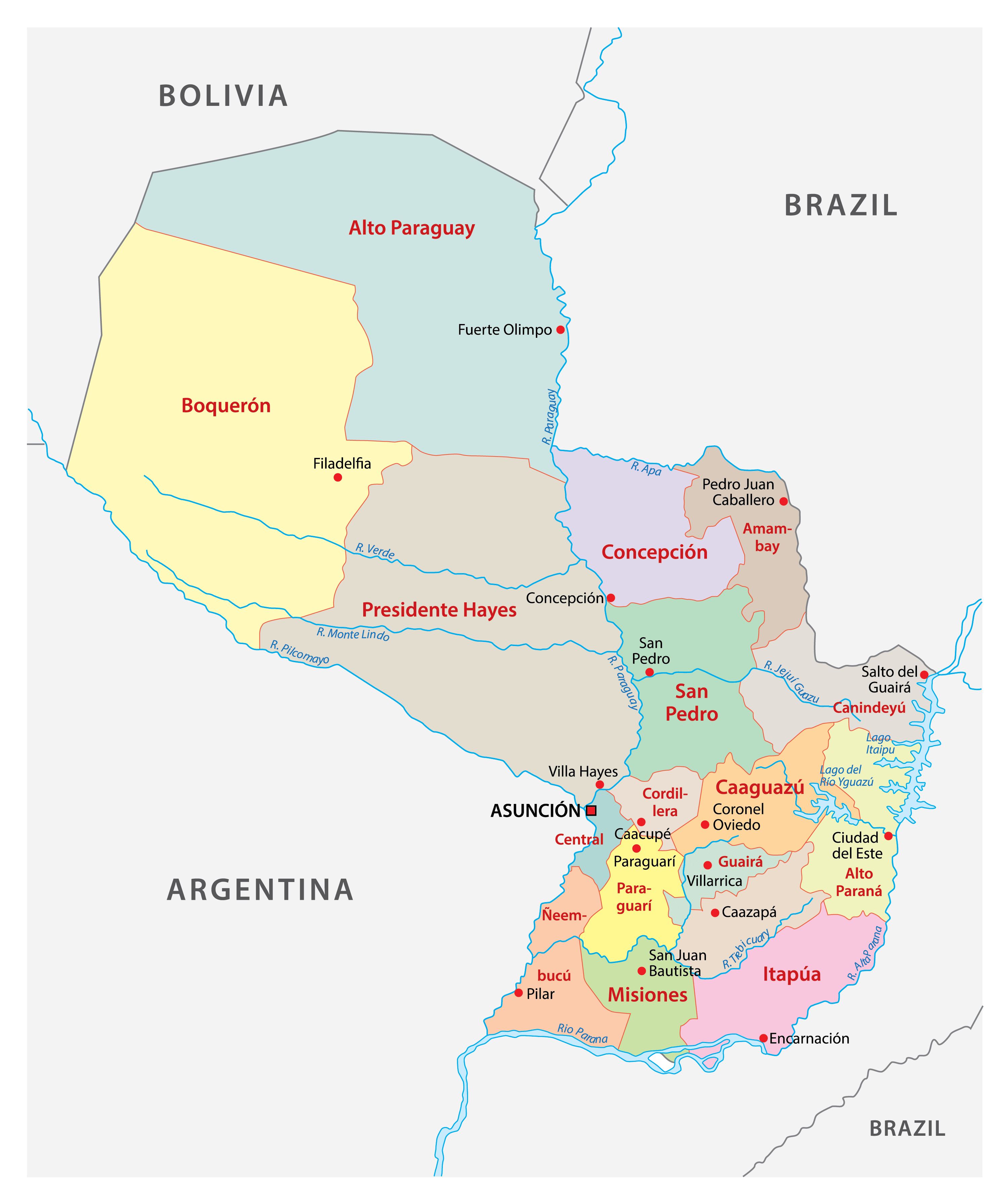
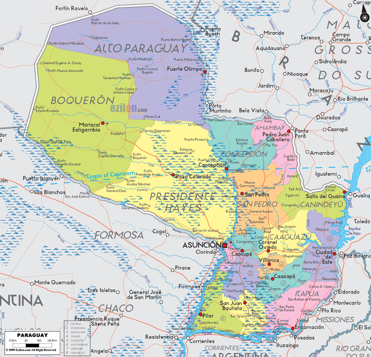
Paraguay (officially, the Republic of Paraguay) is divided into 17 departments (departamentos, singular – departamento) and 1 capital city (Distrito Capital). In alphabetical order, the departments are: Alto Paraguay, Alto Parana, Amambay, Boqueron, Caaguazu, Caazapa, Canindeyu, Central, Concepcion, Cordillera, Guaira, Itapua, Misiones, Neembucu, Paraguari, Presidente Hayes and San Pedro. Asunción is the Distrito Capital. These departments are further subdivided into districts (distritos). The districts are further divided into municipalities and rural districts.
The landlocked nation of Paraguay covers an area of 406,752 sq. km. Located on the east bank of Paraguay River is, Asunción – the national capital and the largest city of Paraguay. It is one of South America’s “oldest cities”, and is the administrative, cultural and industrial center of Paraguay. Asunción is also the principal port of the country.
Location Maps
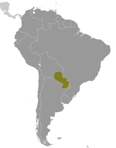
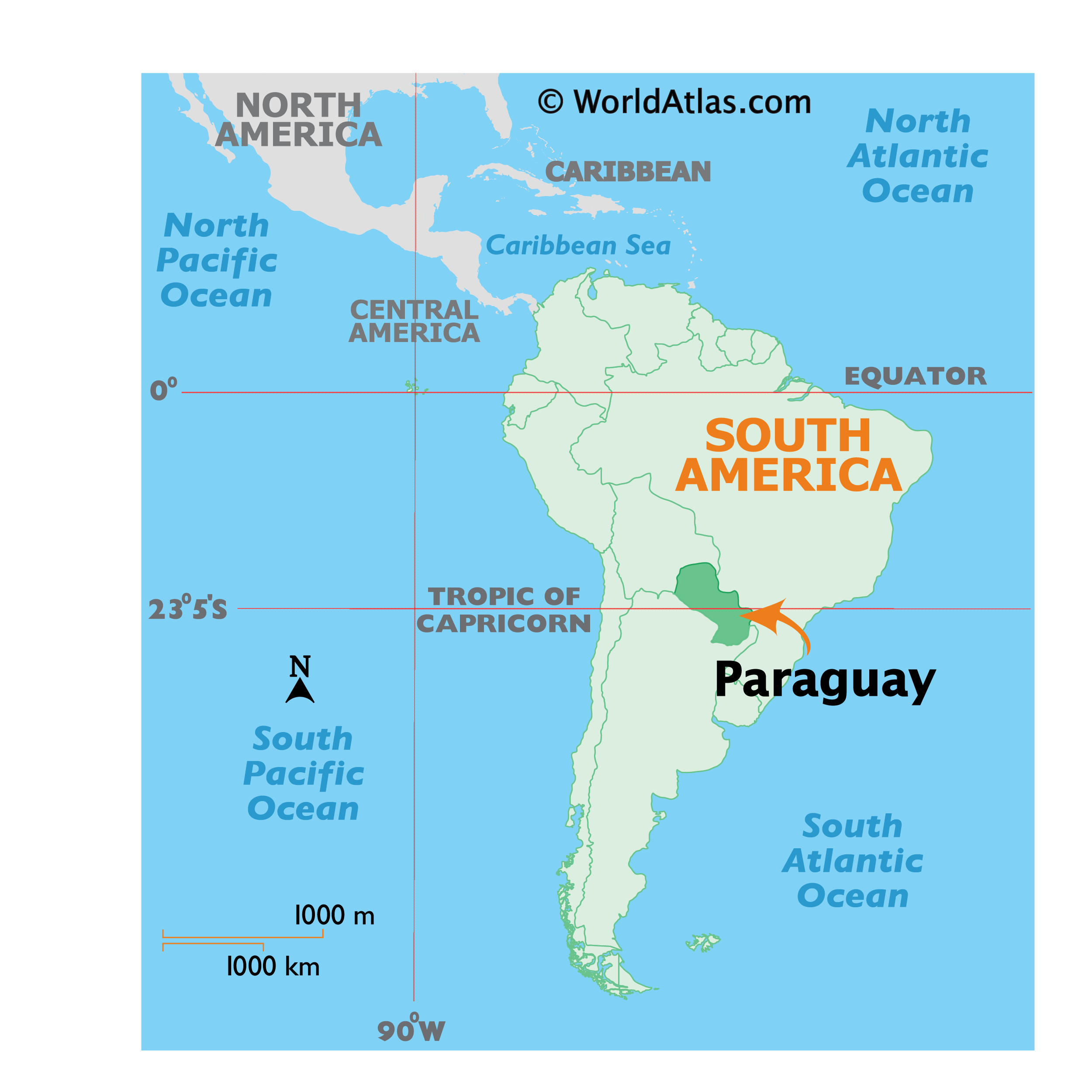
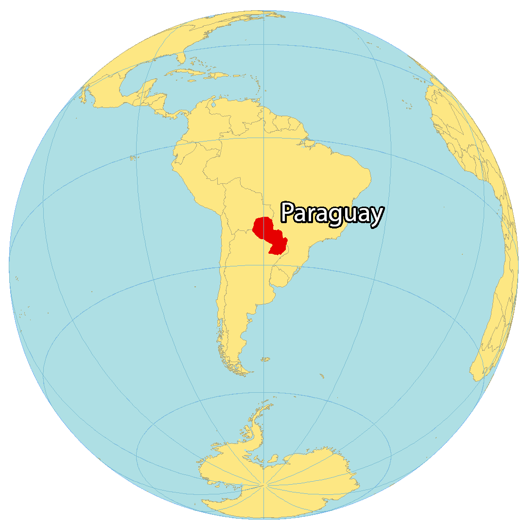
Where is Paraguay?
Paraguay is a landlocked country situated in South America. It is bordered by Bolivia to the northwest, Argentina to the south, and Brazil to the northeast. This advantageous location has earned Paraguay the nickname “the heart of South America”. Additionally, the country is often referred to as “the land of water”, which is due to the Paraguay River which divides the country into north and south and the Guarani Aquifer, the world’s largest water reserve, which extends into Brazil and Argentina. The capital and largest city of Paraguay is Asuncion.
High Definition Political Map of Paraguay
Physical Map of Paraguay
Paraguay Satellite Map
Elevation Map
