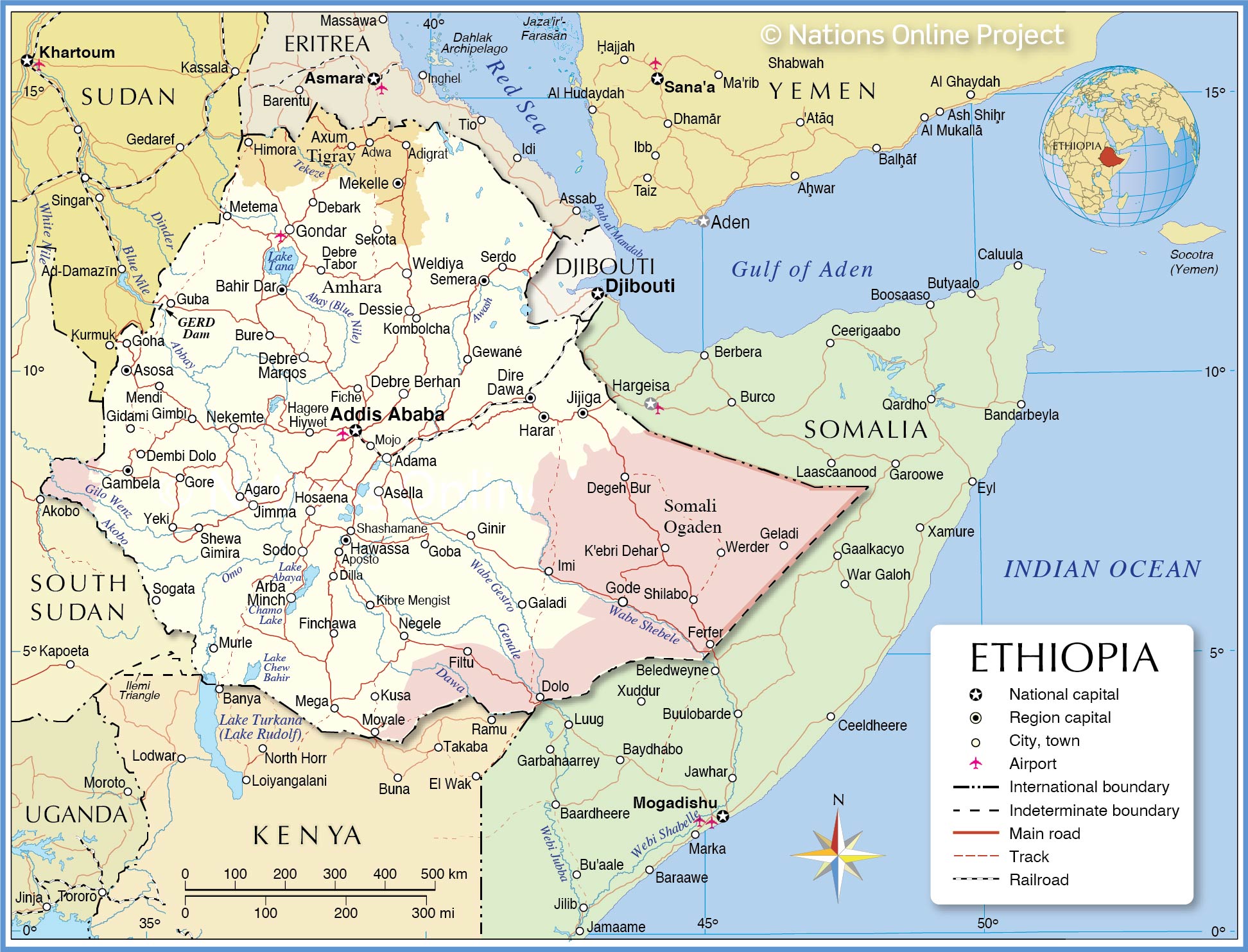
Ethiopia is a landlocked country in East Africa occupying an area of 1,104,300 sq. km.
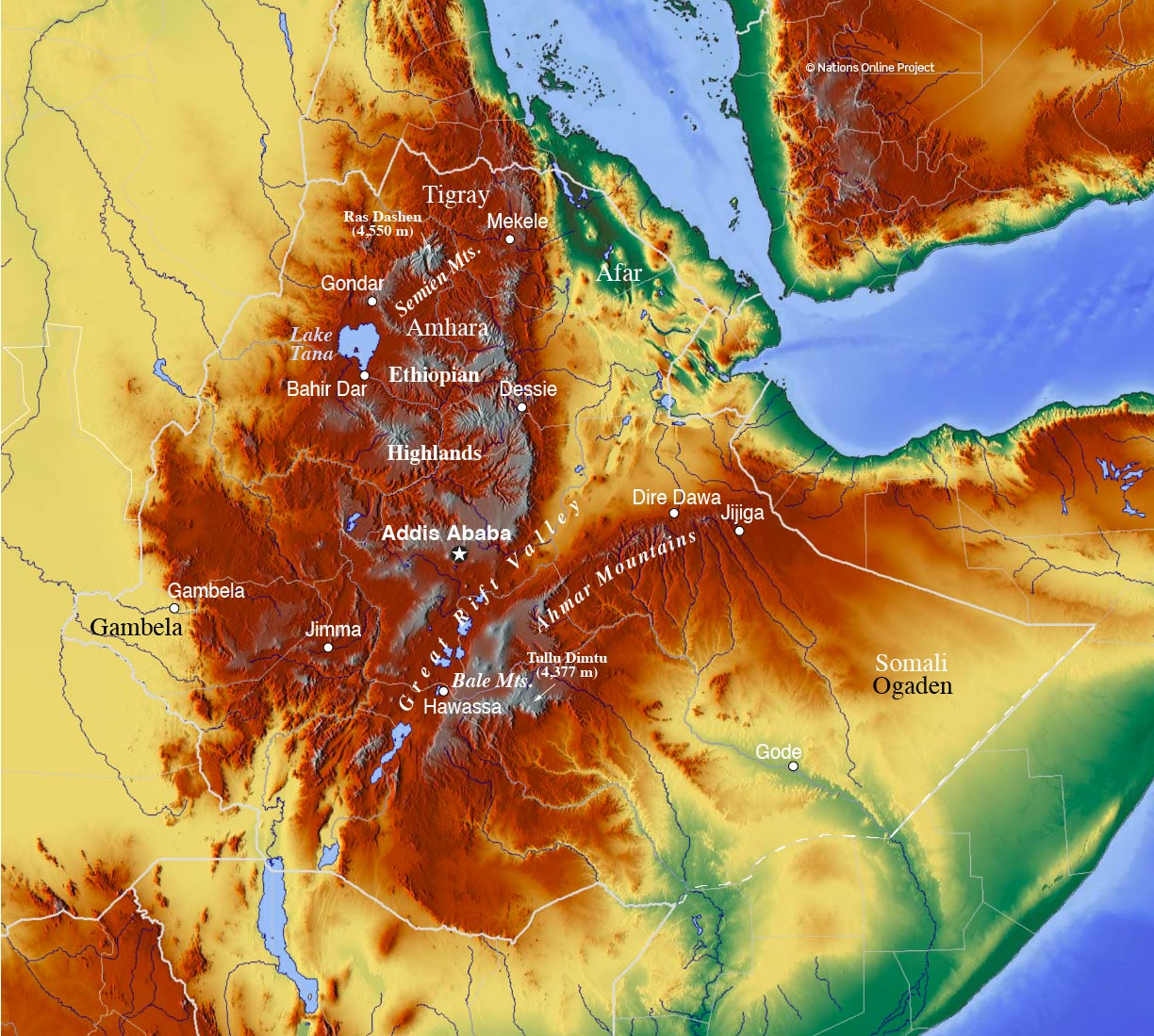
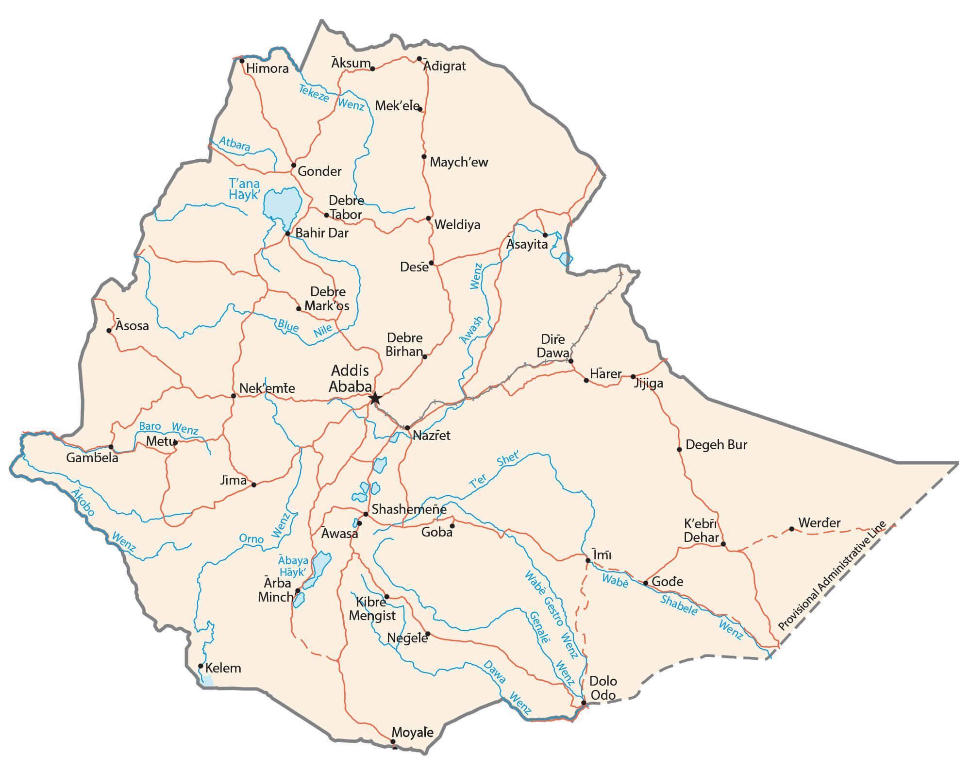
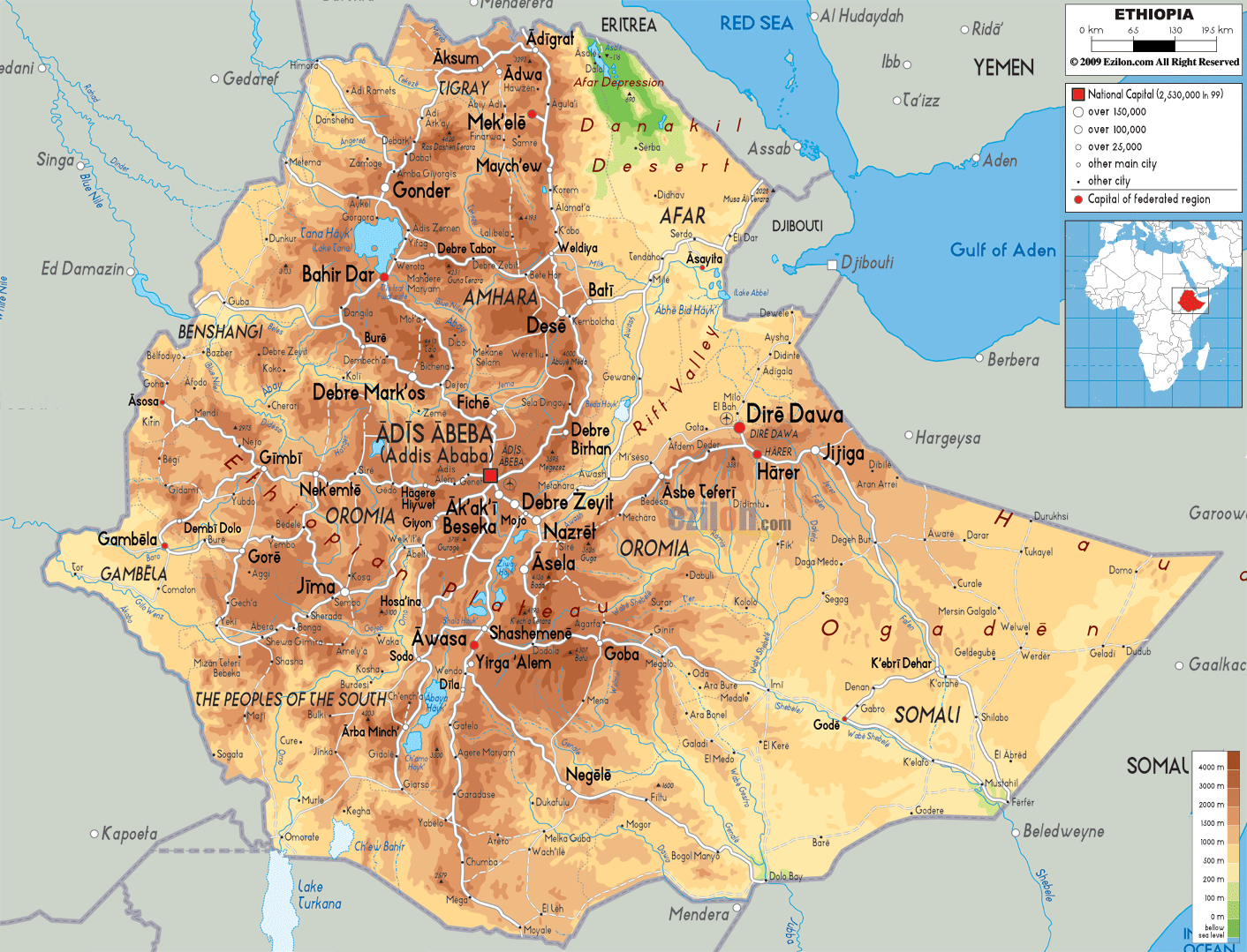
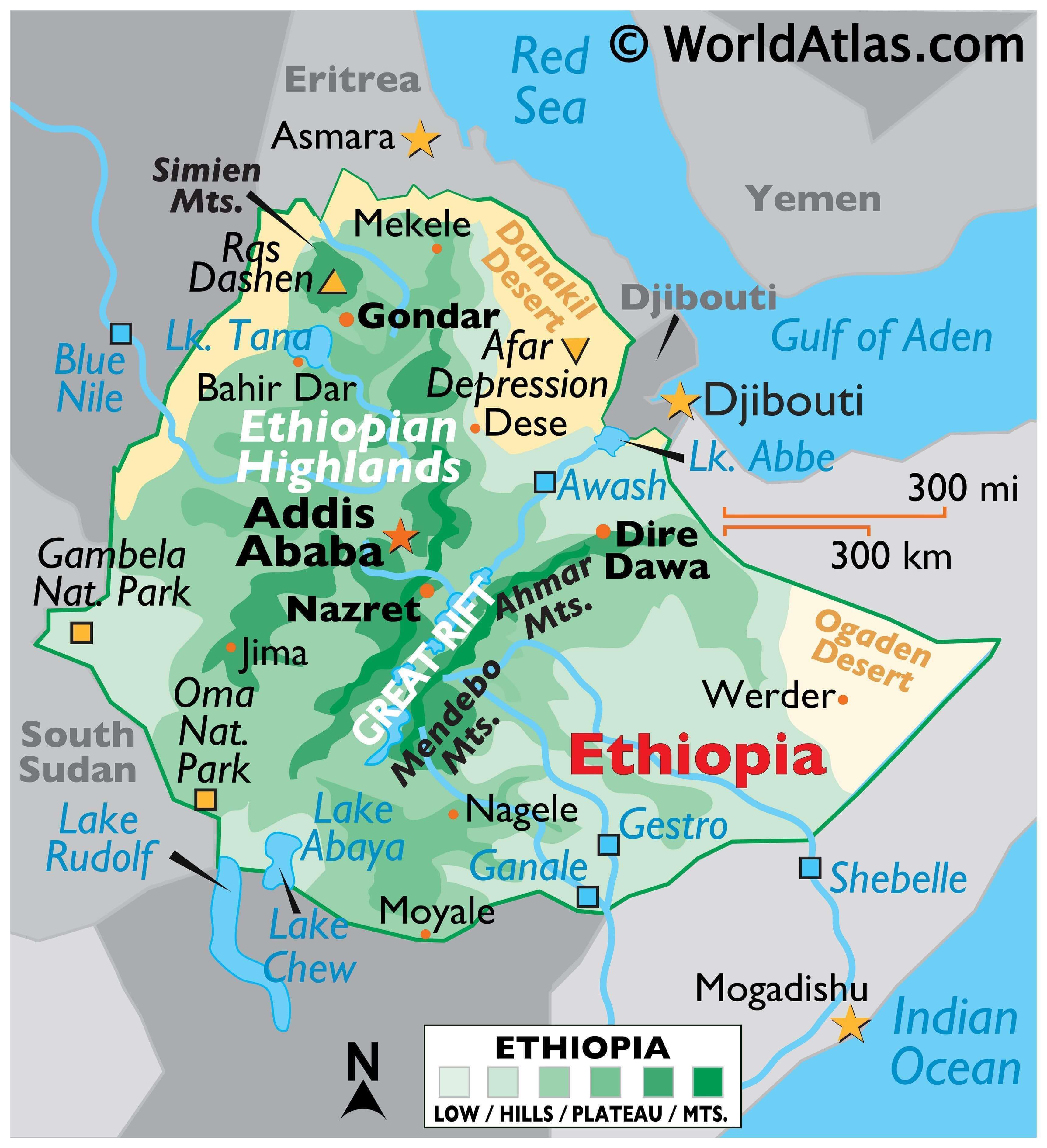
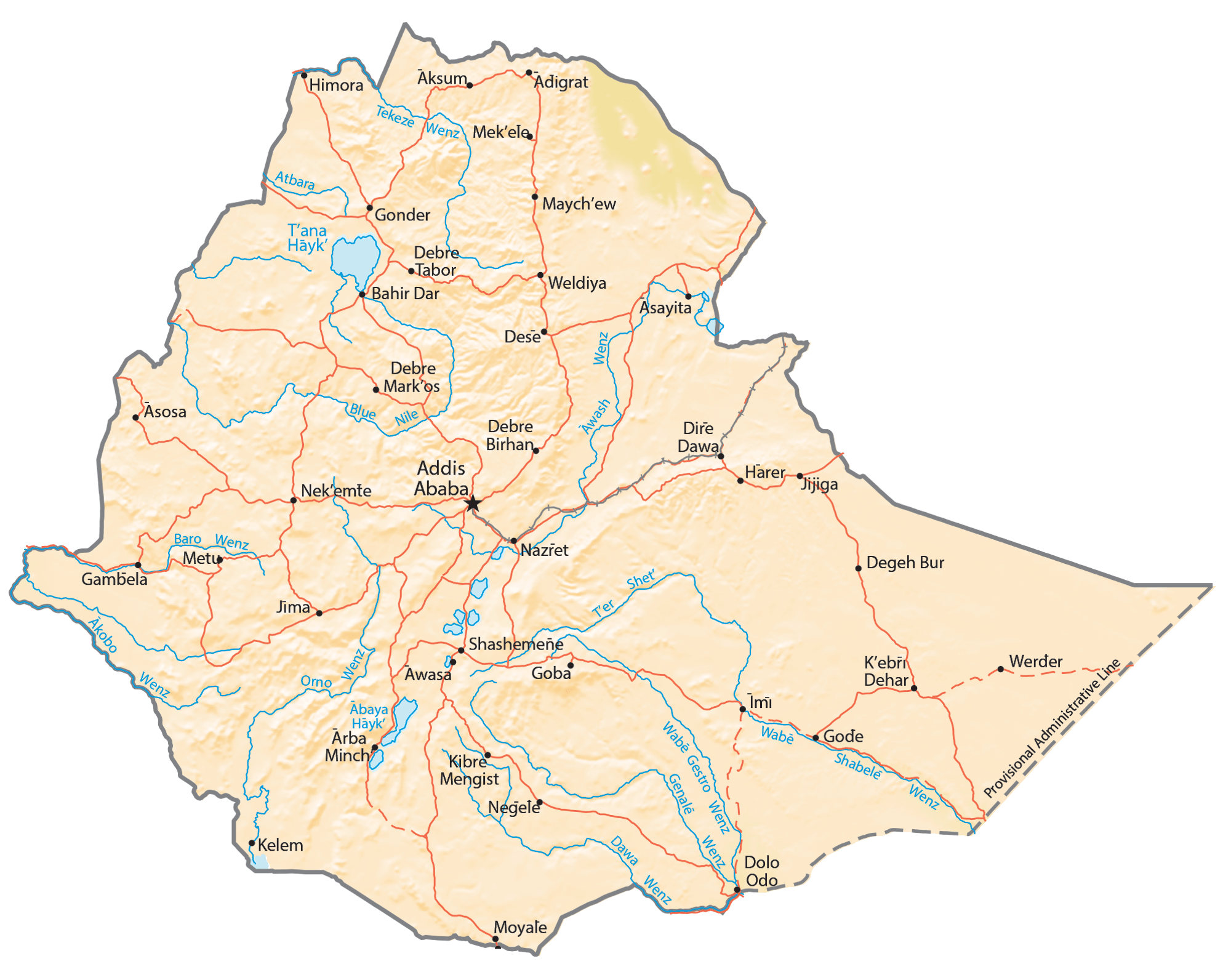
The country has one of the most rugged and complex topographies in the continent. The five major topographic features of the country are the Rift Valley, Western and Eastern Highlands, and Western and Eastern Lowlands.
The North Central massifs of the country host the highest point in the country marked by the yellow upright triangle. It is the 4,533 m high Mount Ras Dejen. Lake Tana (marked on the map), the biggest lake in the country is also located here at an altitude of around 1,800m.
Along the border with Sudan, the Western lowlands extend north to south and have elevations of around 1,000 m and host the lower valleys of rivers like Tekeze, Blue Nile, and Baro.
To the northeast is the Afar Depression or the Denakil Plain has the Kobar Sink with the lowest point in the country at -125 m. This area is part of the Rift Valley that extends into a narrower depression in the southwest. As observed on the map above, this contains the lake region of the country with numerous lakes like Abaya, Rudolf, Chew, etc., that form an internal drainage basin.
The Eastern Highlands have peaks higher than 4,000 m but are less extensive than their Western counterpart. The Eastern lowlands include the Ogaden Desert and Hawd.
Ethiopia has three main drainage systems. To the east, the Genale and Shebele Rivers rise in the Eastern Highlands and drain into the Indian Ocean. To the southwest, the lakes and Awash River form the Rift Valley internal drainage system. To the west is the system formed by the Baro, Tekeze, and the Blue Nile Rivers that flow into Sudan.
| Flag: |  |
|---|---|
| Legal Name: | Federal Democratic Republic of Ethiopia |
| Capital Value: | Addis Ababa |
| Official languages: | Afar Amharic Oromo Somali Tigrinya |
| Demonym(s): | Ethiopian |
| Government: | Federal parliamentary republic |
| Legislature: | Federal Parliamentary Assembly |
| Total Area: | 1,104,300 km² |
| Land Area: | 1,096,570 km² |
| Water Area: | 7,730 km² |
| Population: | 112,078,730 |
| Density: | 92.7/km (240.1/sq mi) (123rd) |
| GDP: | $96.11 Billion |
| GDP Per Capita: | $857.50 |
| Currency Value: | Birr (ETB) |
| Driving side: | right |
| Calling code: | +251 |
| Internet TLD: | .et |
Discover the beauty of Ethiopia with this detailed map. It features major cities, towns, highways, and a satellite and elevation view of the Great Rift Valley. Get an overview of the geography and culture of the country, and plan your next trip with ease!
Online Interactive Political Map
Click on ![]() to view map in "full screen" mode.
to view map in "full screen" mode.
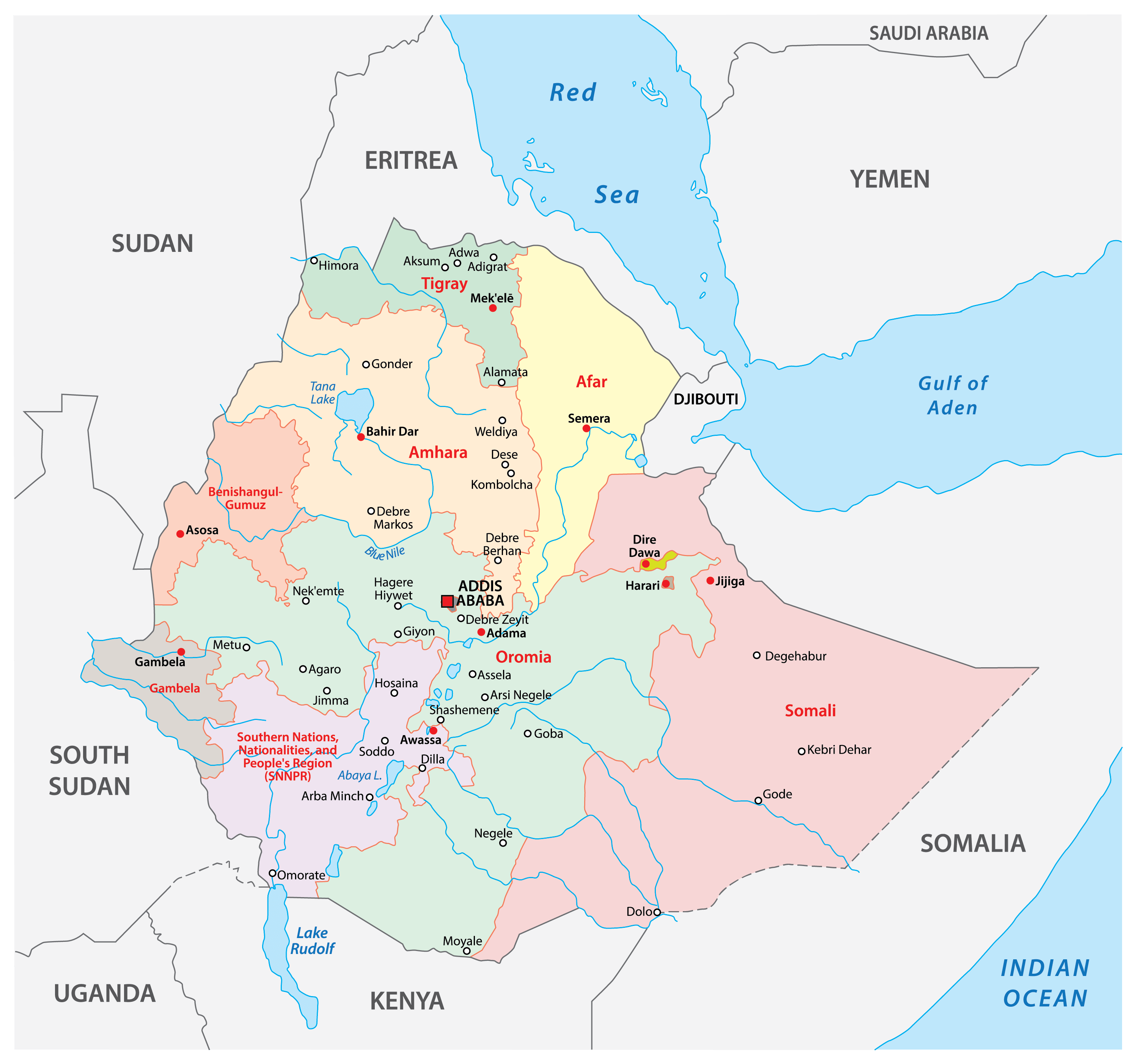
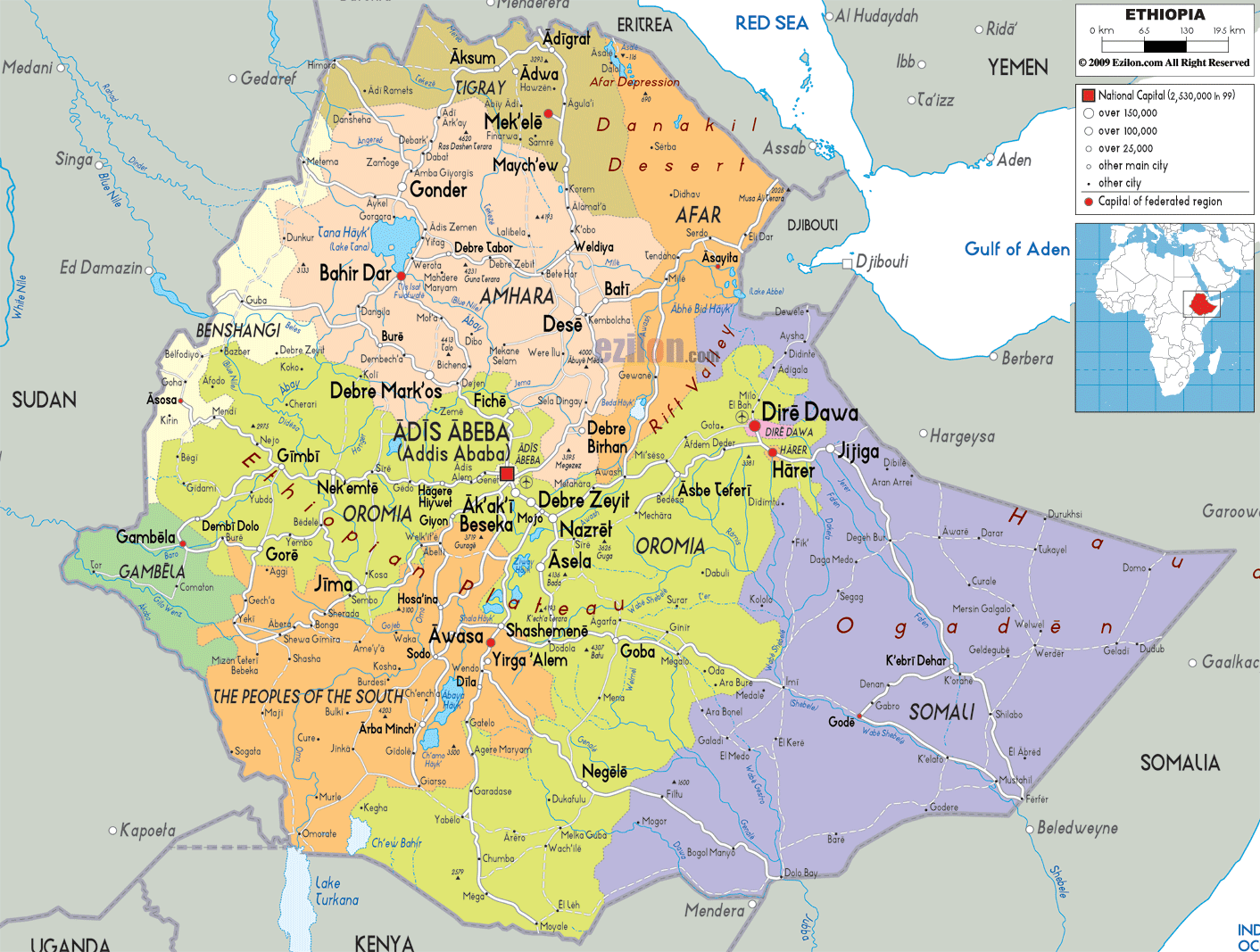
Ethiopia is divided into 9 ethnically based regional states and 2 self-governing administrations. The regional states are Afar, Amara (Amhara), Binshangul Gumuz, Gambela Hizboch (Gambela Peoples), Hareri Hizb (Harari People), Oromiya (Oromia), Sumale (Somali), Tigray, and Ye Debub Biheroch Bihereseboch na Hizboch (Southern Nations, Nationalities and Peoples). The two self-governing administrations are Adis Abeba (Addis Ababa) and Dire Dawa.
With an area of 284,537.84 sq. km, Oromia Region is the largest major subdivision of Ethiopia by area. Addis Ababa, the national capital, is the most populous one.
The regions are further subdivided into 68 zones which are further subdivided into districts or Woreda and then into Kebele or municipalities.
Location Maps
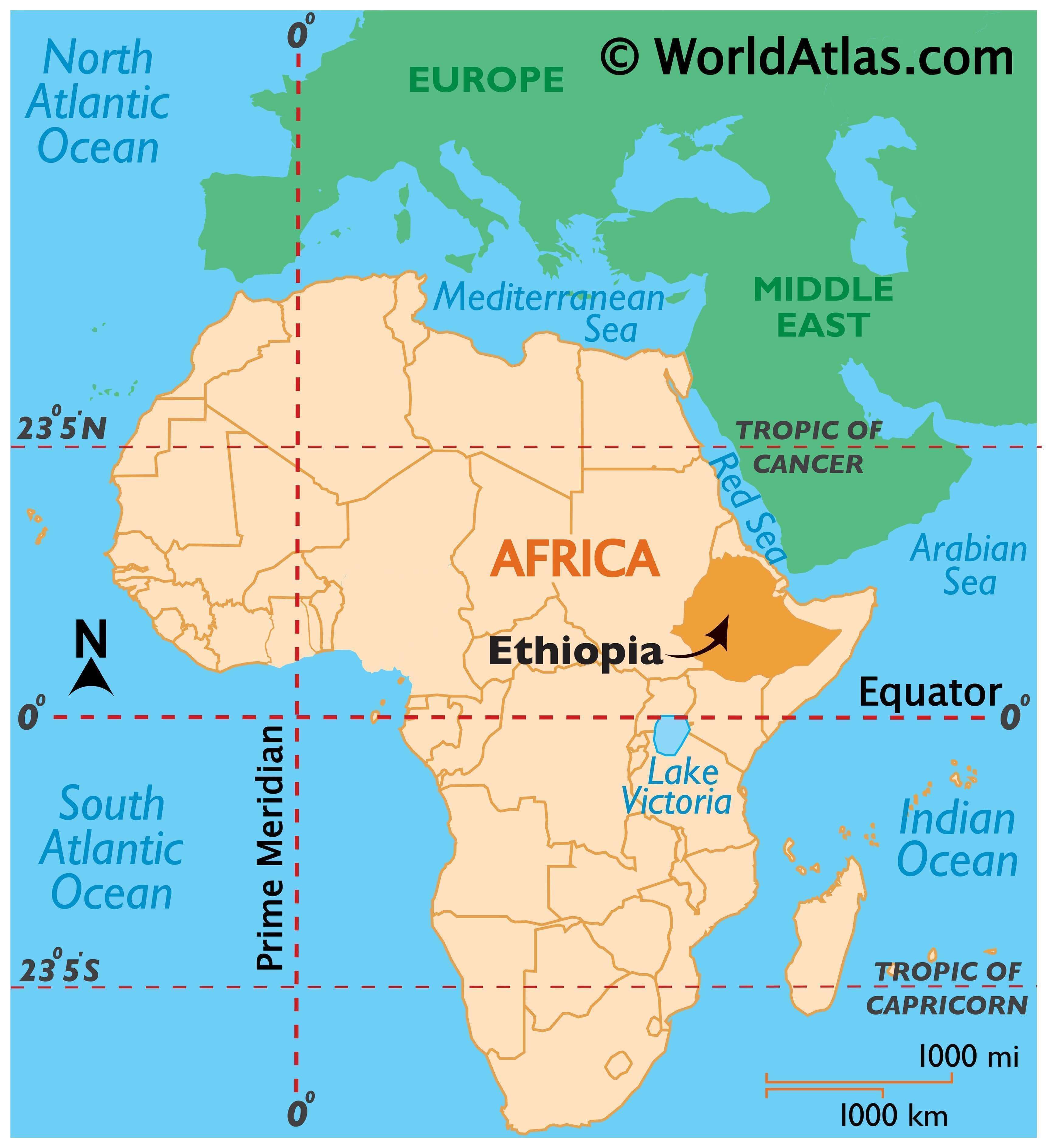
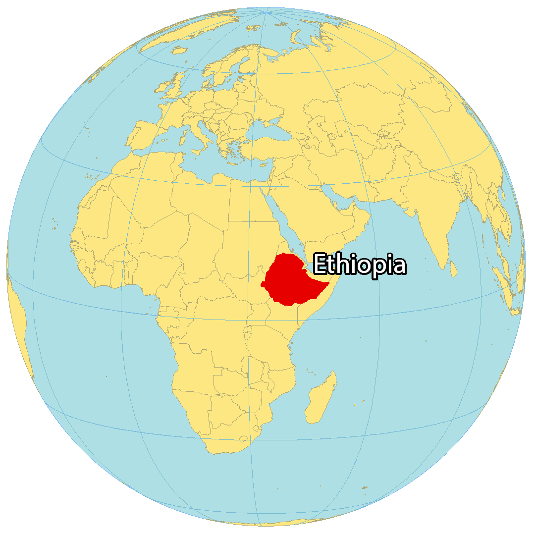
Where is Ethiopia?
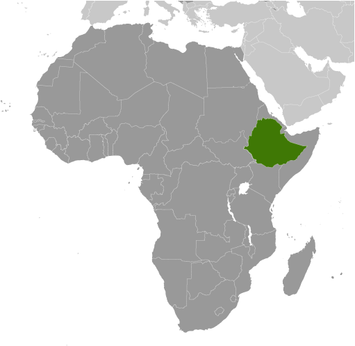
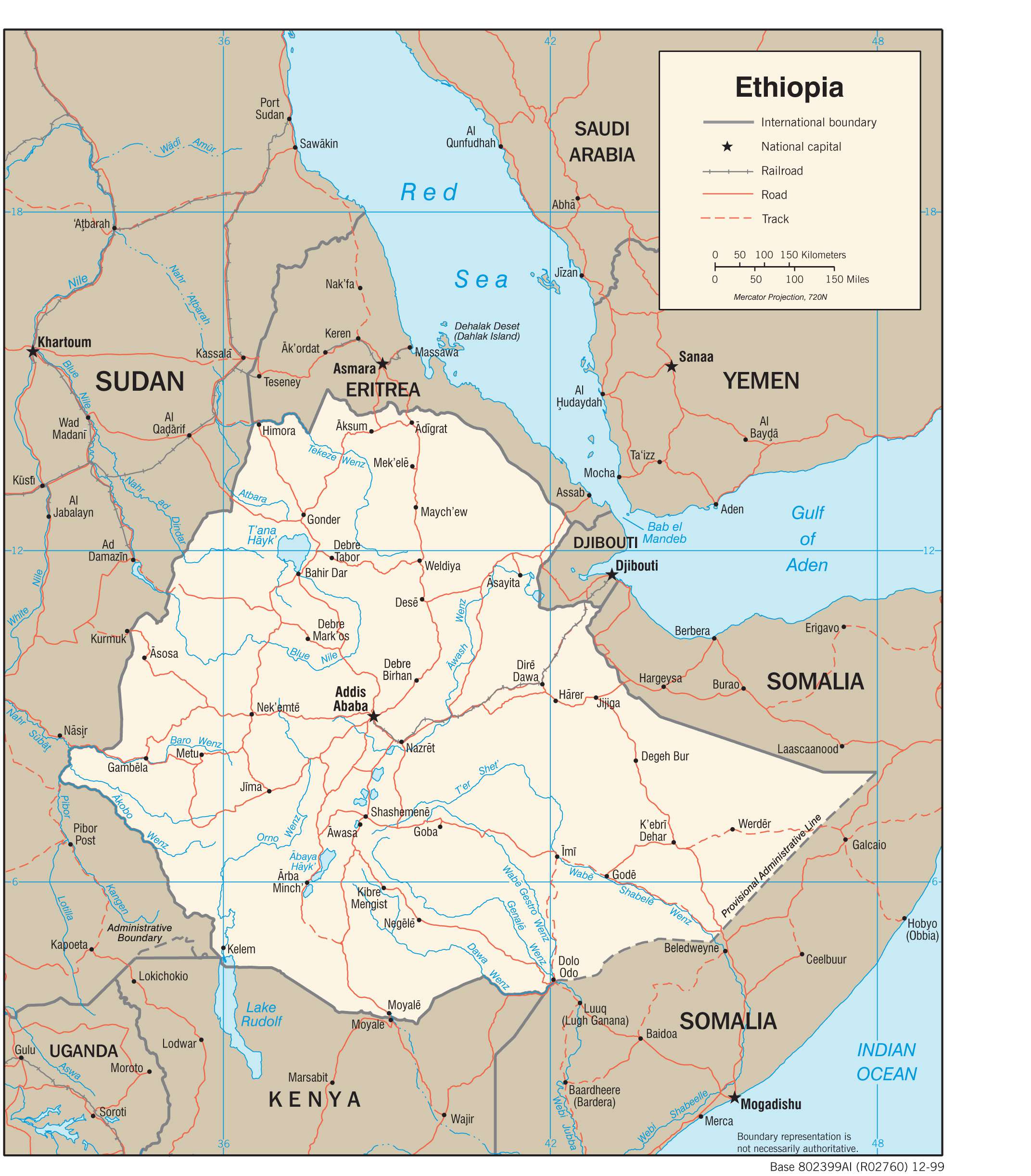
Ethiopia is a landlocked country in Eastern Africa, located between Eritrea and Djibouti to the north, Somalia to the east, Kenya to the south, Sudan and South Sudan to the northwest and west. It is the second most populous country in the world, with close to 120 million people. The capital and largest city of Ethiopia is Addis Ababa, which translates to “New Flower”.
High Definition Political Map of Ethiopia
Physical Map of Ethiopia
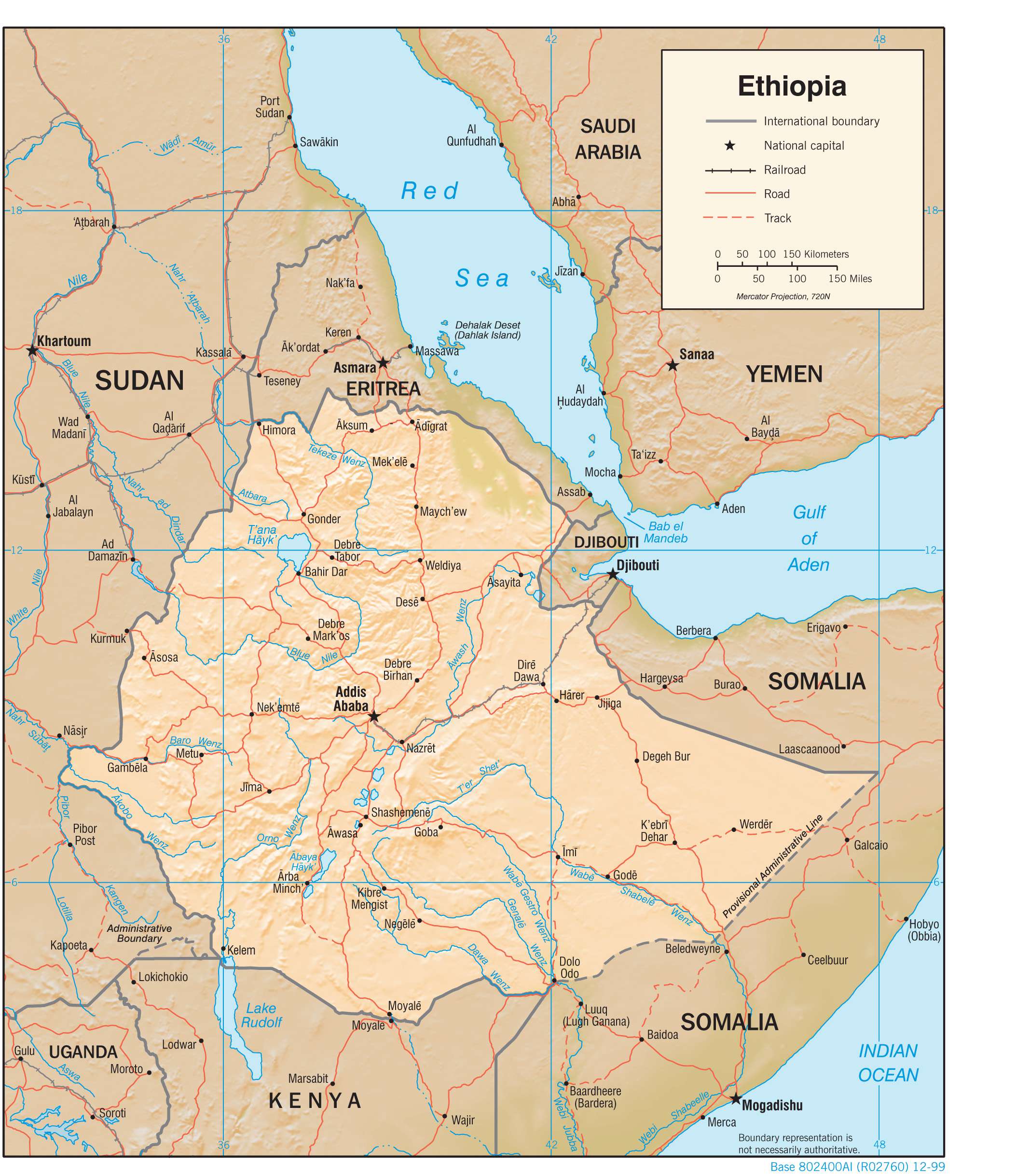
Transportation Map of Ethiopia
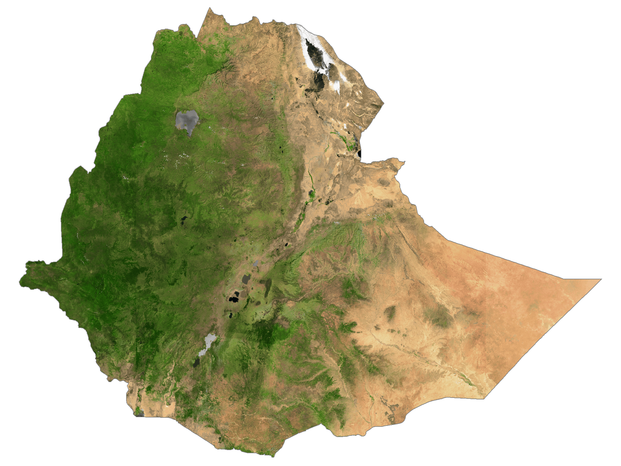
Ethiopia Satellite Map
Topo Map