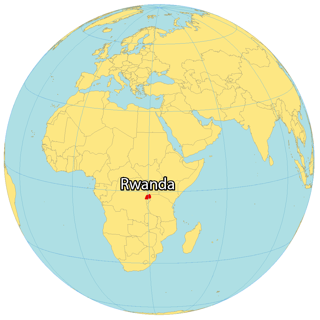
The landlocked country of Rwanda in the African Great Lakes region of Central/Eastern Africa covers an area of 26,338 sq. km.
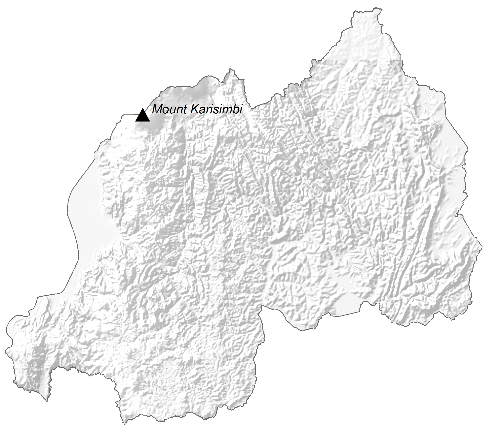
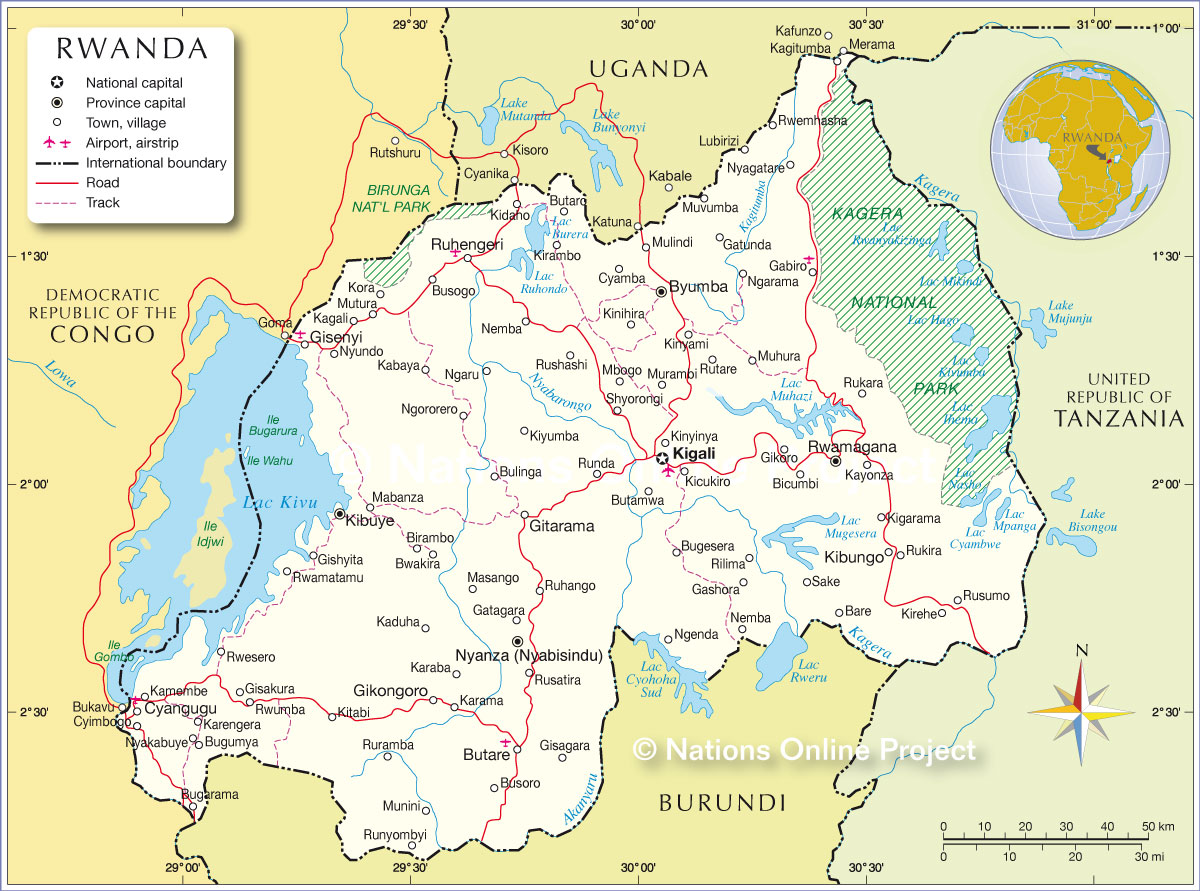
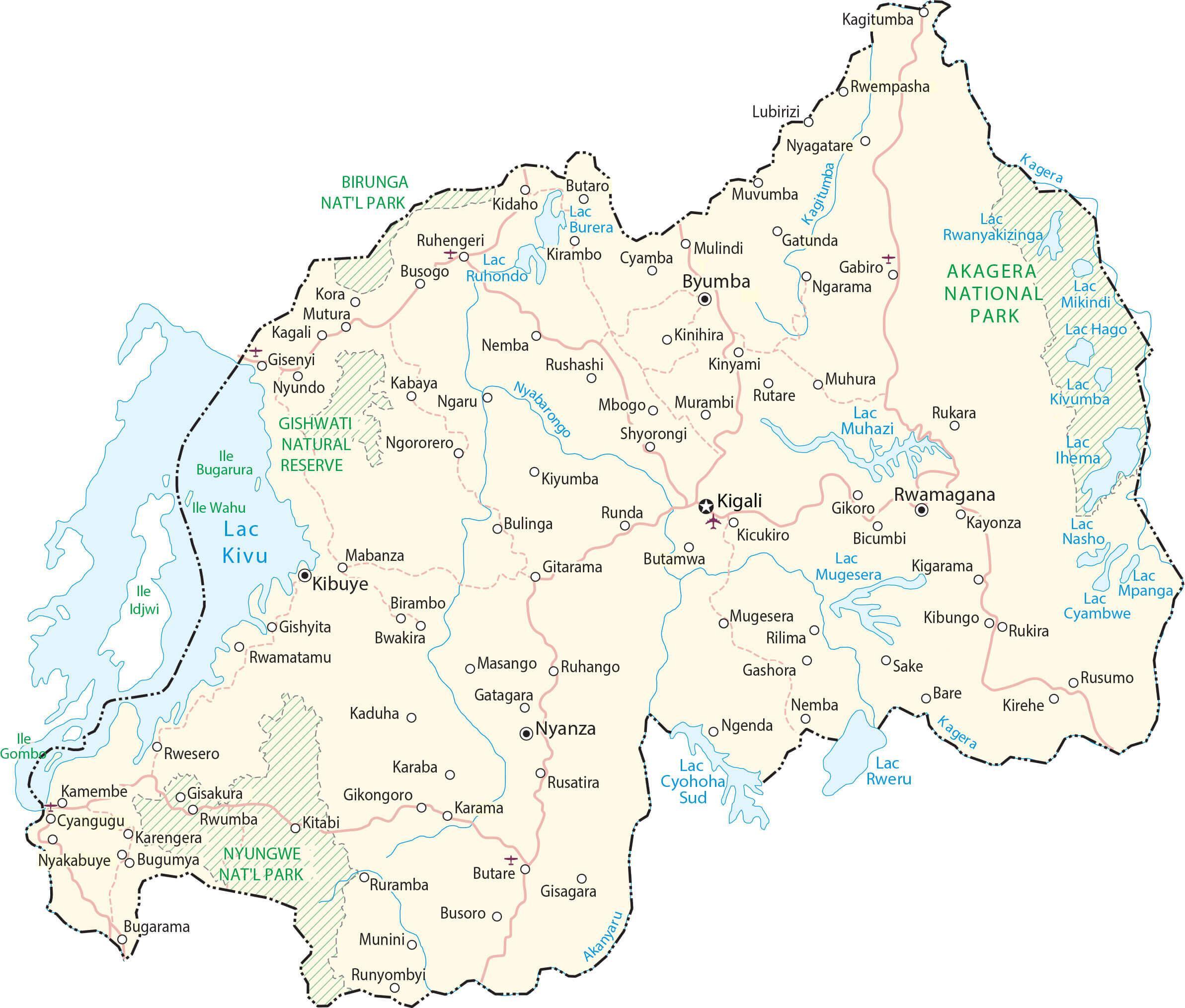
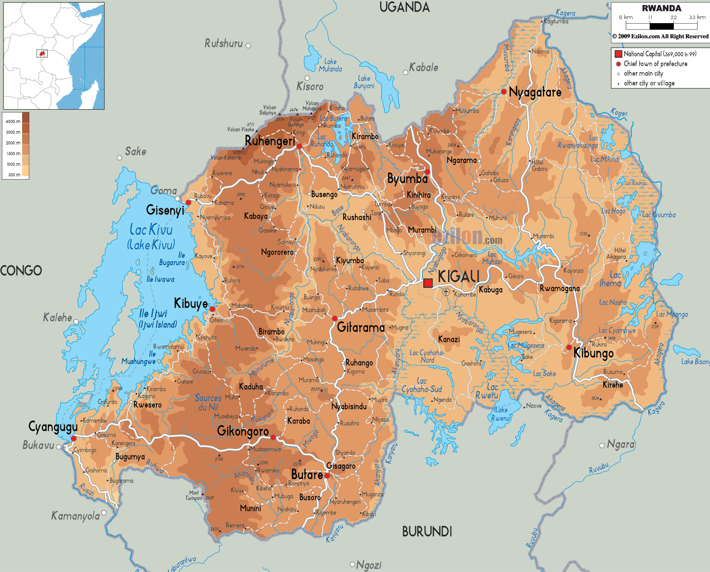
Mountains dominate the landscape of western Rwanda. They are part of the Albertine Rift Mountains. The Virunga Mountains to the northwest of the country host the highest peak of Rwanda, Mount Karisimbi (marked on the physical map above) which is 4,507 m tall.
Central Rwanda features rolling hills giving way to savanna, plains, and swamps eastwards.
As observed on the map, Rwanda is also dotted by numerous lakes. Lake Kivu, located on the western border of the country with DRC, is the largest among them. It is one of the 20 deepest lakes in the world and has a maximum depth of 480 m.
Other notable lakes include Burera, Cohana, Ruhondo, Muhazi, Rweru, and Ihema.
80% of Rwanda drains into the Nile through Lake Victoria while the remaining 20% drains into the Congo via the Rusizi River which also has the lowest elevation of Rwanda at 950 m. Rising in the southwest is the longest river of Rwanda – Nyabarongo. The river merges with the Ruvubu in the southeast, forming the Kagera River which ultimately enters Lake Victoria after crossing into Tanzania.
| Flag: |  |
|---|---|
| Legal Name: | Republic of Rwanda |
| Capital Value: | Kigali |
| Largest City: |
Kigali (1,132,101) |
| Official languages: |
|
| Demonym(s): |
|
| Government: | Unitary presidential republic under an authoritarian government |
| Legislature: | Parliament |
| Total Area: | 26,338 km² |
| Land Area: | 24,668 km² |
| Water Area: | 1,670 km² |
| Population: | 12,626,950 |
| Density: | 470/km (1,217.3/sq mi) (22nd) |
| GDP: | $10.12 Billion |
| GDP Per Capita: | $801.66 |
| Currency Value: | Rwandan francs (RWF) |
| Driving side: | right |
| Calling code: | +250 |
| Internet TLD: | .rw |
Explore Rwanda’s Geography with this Detailed Map
Rwanda is a small East African country with a unique geography. From its deep valleys to its high mountains, Rwanda offers a diverse landscape that can be explored through this detailed map. With this map, you can explore cities, roads, water, satellite imagery, and elevation. You can also get a better understanding of the country’s prominent geographic features, such as the African Great Lakes and Albertine Rift Mountains.
Online Interactive Political Map
Click on ![]() to view map in "full screen" mode.
to view map in "full screen" mode.
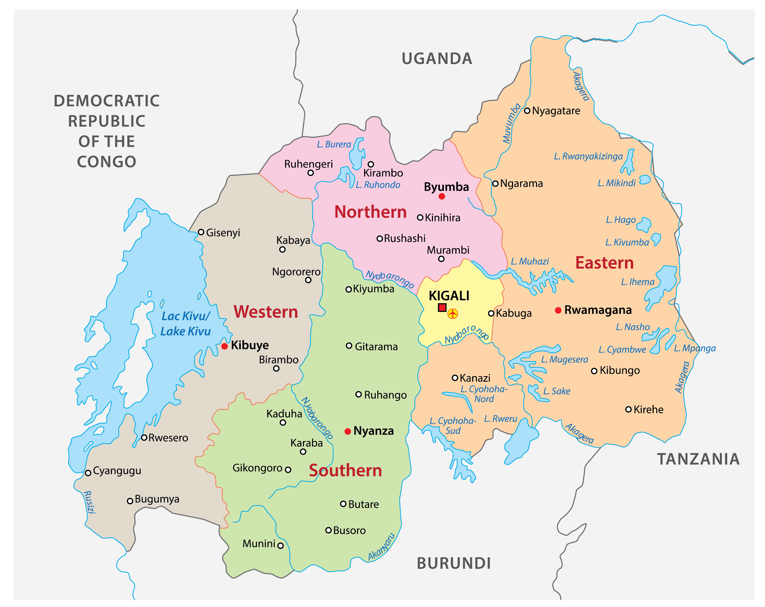
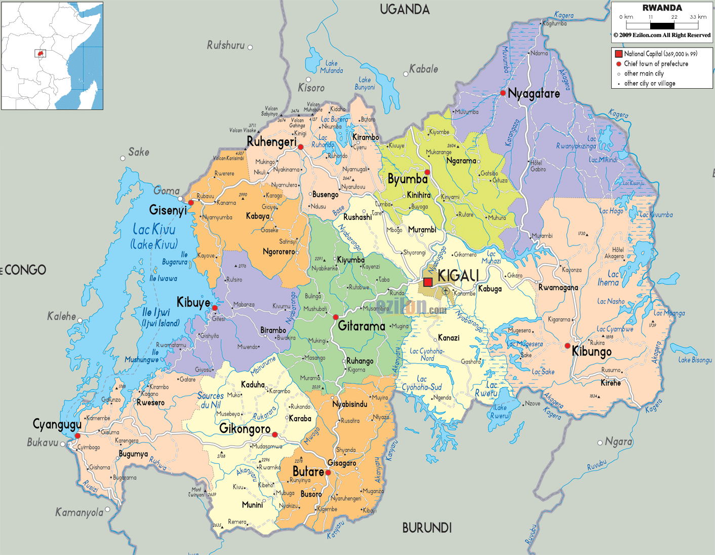
Rwanda is divided into five provinces. These are Kigali, Northern, Eastern, Southern, and Western. These provinces were formed in 2006. Before this, the country had 12 provinces.
The provinces are further divided into 30 districts.
With an area of 9,458 sq. km, the Eastern Province is the largest by area as well as the most populous one. The capital and largest city of Rwanda, Kigali City, is located in the Kigali Province.
Location Maps
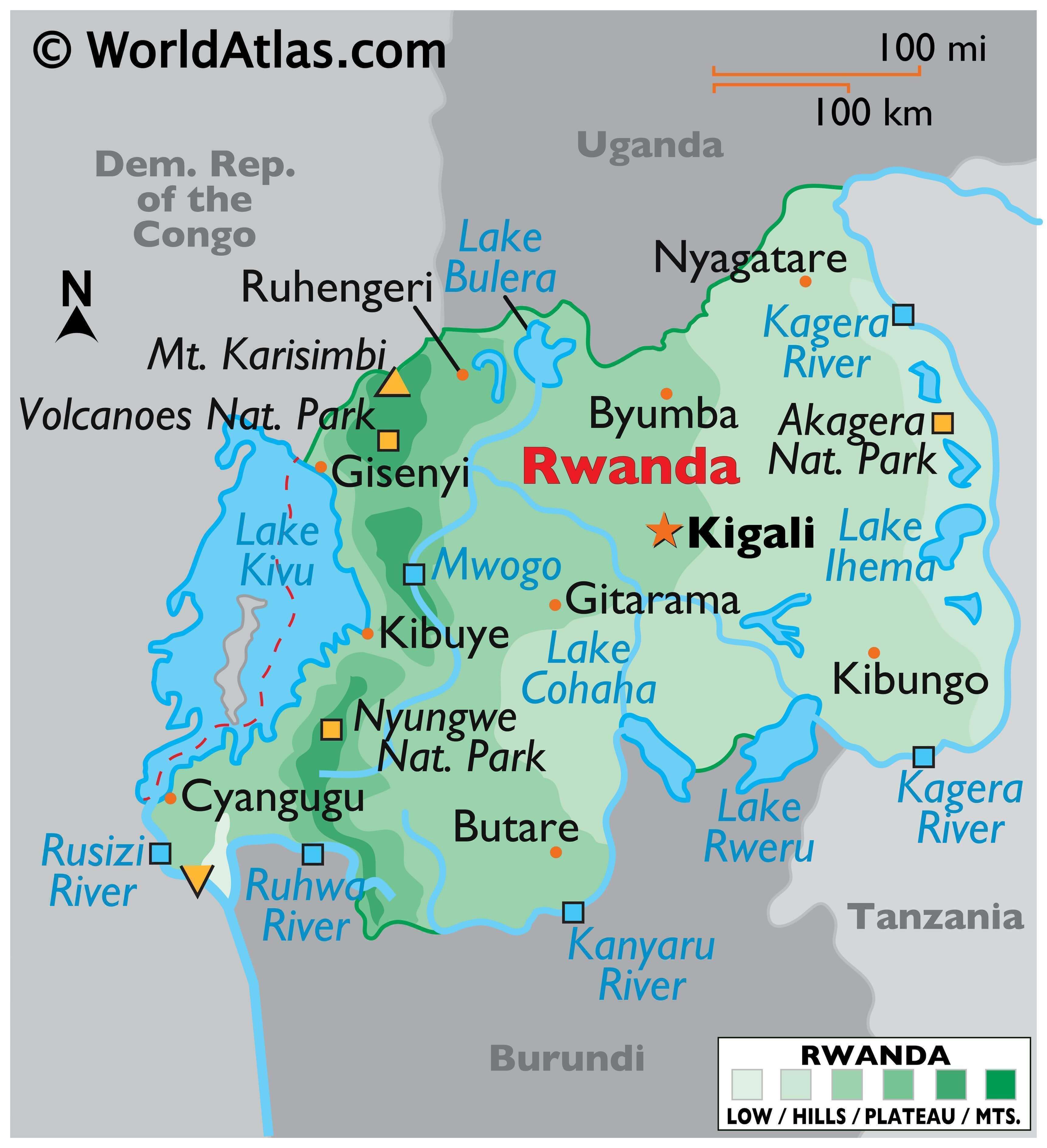
Where is Rwanda?
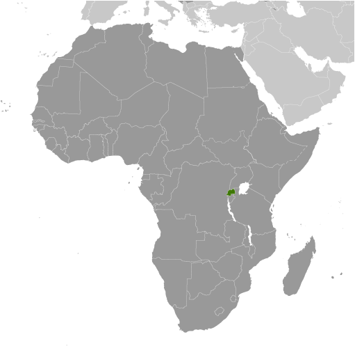
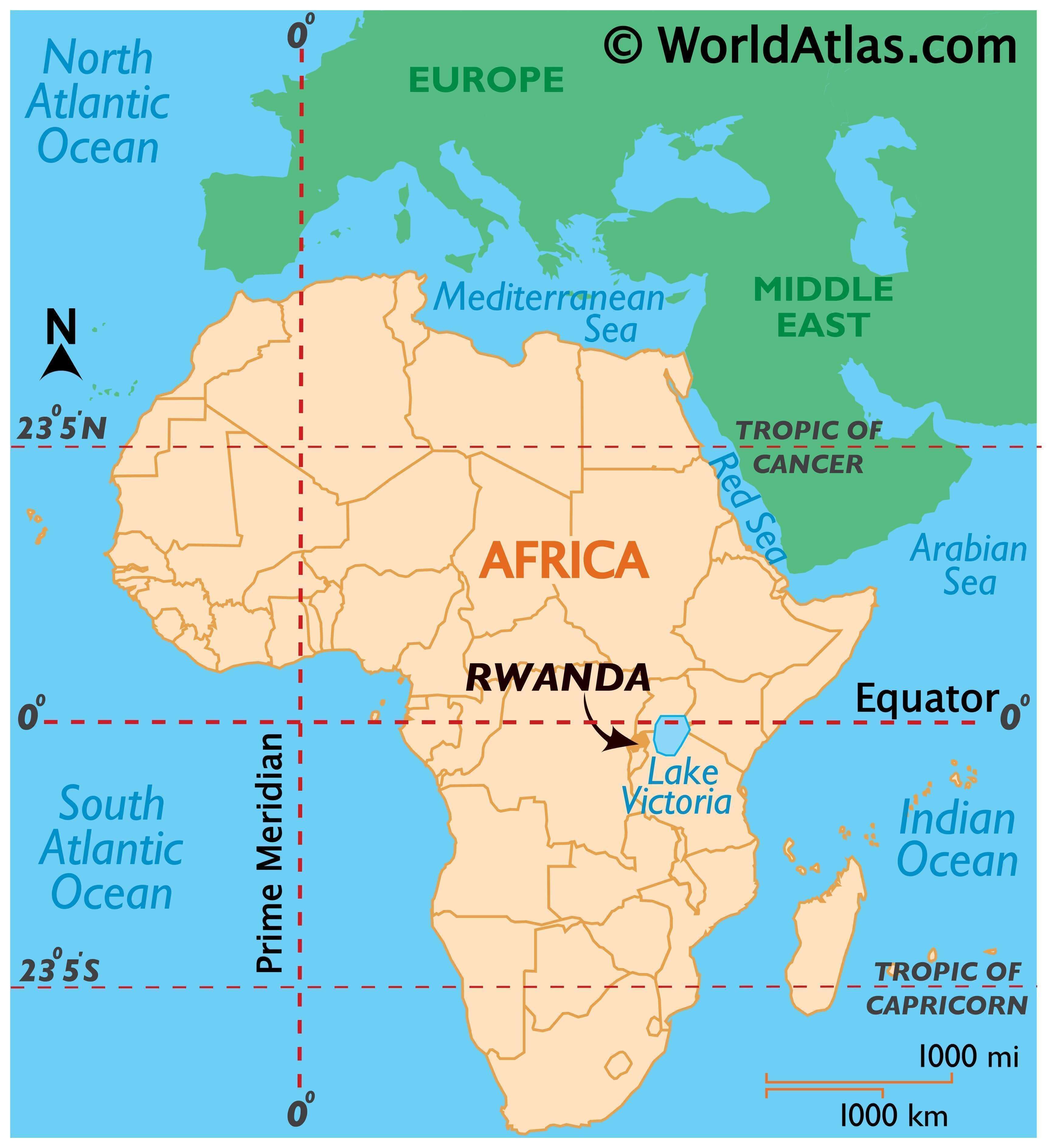
Rwanda is a landlocked country located in the central region of Africa, slightly below the equator and part of the Great Rift Valley. It borders four other countries: Burundi to the south, Tanzania to the east, Uganda to the north, and the Democratic Republic of Congo to the west.
Kigali is the capital and largest city in Rwanda, but other major cities include Butare, Gitarama, and Ruhengeri.
High Definition Political Map of Rwanda
History
Modern human settlement of what is now Rwanda dates from, at the latest, the last glacial period, either in the Neolithic period around 8000 BC, or in the long humid period which followed, up to around 3000 BC. Archaeological excavations have revealed evidence of sparse settlement by hunter-gatherers in the late Stone Age, followed by a larger population of early Iron Age settlers, who produced dimpled pottery and iron tools. These early inhabitants were the ancestors of the Twa, aboriginal pygmy hunter-gatherers who remain in Rwanda today. Between 700 BC and 1500 AD, a number of Bantu groups migrated into Rwanda, clearing forest land for agriculture. The forest-dwelling Twa lost much of their habitat and moved to the mountain slopes. Historians have several theories regarding the nature of the Bantu migrations; one theory is that the first settlers were Hutu, while the Tutsi migrated later to form a distinct racial group, possibly of Nilo-hamitic origin. An alternative theory is that the migration was slow and steady, with incoming groups integrating into rather than conquering the existing society. Under this theory, the Hutu and Tutsi distinction arose later and was a class distinction rather than a racial one.
The earliest form of social organisation in the area was the clan (ubwoko). The clans were not limited to genealogical lineages or geographical area, and most included Hutu, Tutsi, and Twa. From the 15th century, the clans began to merge into kingdoms. One kingdom, under King Gihanga, managed to incorporate several of its close neighbor territories establishing the Kingdom of Rwanda. By 1700, around eight kingdoms had existed in the present-day Rwanda. One of these, the Kingdom of Rwanda ruled by the Tutsi Nyiginya clan, became increasingly dominant from the mid-eighteenth century. The kingdom reached its greatest extent during the nineteenth century under the reign of King Kigeli Rwabugiri. Rwabugiri conquered several smaller states, expanded the kingdom west and north, and initiated administrative reforms; these included ubuhake, in which Tutsi patrons ceded cattle, and therefore privileged status, to Hutu or Tutsi clients in exchange for economic and personal service, and uburetwa, a corvée system in which Hutu were forced to work for Tutsi chiefs. Rwabugiri’s changes caused a rift to grow between the Hutu and Tutsi populations. The Twa were better off than in pre-Kingdom days, with some becoming dancers in the royal court, but their numbers continued to decline.
The Berlin Conference of 1884 assigned the territory to the German Empire, who declared it as part of the German East Africa. In 1894, explorer Gustav Adolf von Götzen was the first European to cross the entire territory of Rwanda, he crossed from the south-east to Lake Kivu and met the king. In 1897, Germany established a presence in Rwanda with the formation of an alliance with the king, beginning the colonial era. The Germans did not significantly alter the social structure of the country, but exerted influence by supporting the king and the existing hierarchy, and delegating power to local chiefs. Belgian forces invaded Rwanda and Burundi in 1916, during World War I, and later, in 1922, they started to rule both Rwanda and Burundi as a League of Nations mandate called Ruanda-Urundi and started a period of more direct colonial rule The Belgians simplified and centralised the power structure, introduced large-scale projects in education, health, public works, and agricultural supervision, including new crops and improved agricultural techniques to try to reduce the incidence of famine. Both the Germans and the Belgians, in the wake of New Imperialism, promoted Tutsi supremacy, considering the Hutu and Tutsi different races. In 1935, Belgium introduced an identity card system, which labelled each individual as either Tutsi, Hutu, Twa or Naturalised. While it had been previously possible for particularly wealthy Hutu to become honorary Tutsi, the identity cards prevented any further movement between the classes.
Belgium continued to rule Ruanda-Urundi (of which Rwanda formed the northern part) as a UN trust territory after the Second World War, with a mandate to oversee eventual independence. Tensions escalated between the Tutsi, who favoured early independence, and the Hutu emancipation movement, culminating in the 1959 Rwandan Revolution: Hutu activists began killing Tutsi and destroying their houses, forcing more than 100,000 people to seek refuge in neighbouring countries. In 1961, the suddenly pro-Hutu Belgians held a referendum in which the country voted to abolish the monarchy. Rwanda was separated from Burundi and gained independence on 1 July 1962, which is commemorated as Independence Day, a national holiday. Cycles of violence followed, with exiled Tutsi attacking from neighbouring countries and the Hutu retaliating with large-scale slaughter and repression of the Tutsi. In 1973, Juvénal Habyarimana took power in a military coup. Pro-Hutu discrimination continued, but there was greater economic prosperity and a reduced amount of violence against Tutsi. The Twa remained marginalised, and by 1990 were almost entirely forced out of the forests by the government; many became beggars. Rwanda’s population had increased from 1.6 million people in 1934 to 7.1 million in 1989, leading to competition for land.
In 1990, the Rwandan Patriotic Front (RPF), a rebel group composed of nearly 500,000 Tutsi refugees, invaded northern Rwanda from their base in Uganda, initiating the Rwandan Civil War. The group condemned the Hutu-dominated government for failing to democratize and confront the problems facing these refugees. Neither side was able to gain a decisive advantage in the war, but by 1992 it had weakened Habyarimana’s authority; mass demonstrations forced him into a coalition with the domestic opposition and eventually to sign the 1993 Arusha Accords with the RPF. The cease-fire ended on 6 April 1994 when Habyarimana’s plane was shot down near Kigali Airport, killing him. The shooting down of the plane served as the catalyst for the Rwandan genocide, which began within a few hours. Over the course of approximately 100 days, between 500,000 and 1,000,000 Tutsi and politically moderate Hutu were killed in well-planned attacks on the orders of the interim government. Many Twa were also killed, despite not being directly targeted.
The Tutsi RPF restarted their offensive, and took control of the country methodically, gaining control of the whole country by mid-July. The international response to the genocide was limited, with major powers reluctant to strengthen the already overstretched UN peacekeeping force. When the RPF took over, approximately two million Hutu fled to neighbouring countries, in particular Zaïre, fearing reprisals; additionally, the RPF-led army was a key belligerent in the First and Second Congo Wars. Within Rwanda, a period of reconciliation and justice began, with the establishment of the International Criminal Tribunal for Rwanda (ICTR) and the reintroduction of Gacaca, a traditional village court system. Since 2000 Rwanda’s economy, tourist numbers, and Human Development Index have grown rapidly; between 2006 and 2011 the poverty rate reduced from 57% to 45%, while life expectancy rose from 46.6 years in 2000 to 65.4 years in 2021.
Physical Map of Rwanda
Geography
At 26,338 square kilometres (10,169 sq mi), Rwanda is the world’s 149th-largest country, and the fourth smallest on the African mainland after Gambia, Eswatini, and Djibouti. It is comparable in size to Burundi, Haiti and Albania. The entire country is at a high altitude: the lowest point is the Rusizi River at 950 metres (3,117 ft) above sea level. Rwanda is located in Central/Eastern Africa, and is bordered by the Democratic Republic of the Congo to the west, Uganda to the north, Tanzania to the east, and Burundi to the south. It lies a few degrees south of the equator and is landlocked. The capital, Kigali, is located near the centre of Rwanda.
The watershed between the major Congo and Nile drainage basins runs from north to south through Rwanda, with around 80% of the country’s area draining into the Nile and 20% into the Congo via the Rusizi River and Lake Tanganyika. The country’s longest river is the Nyabarongo, which rises in the south-west, flows north, east, and southeast before merging with the Ruvubu to form the Kagera; the Kagera then flows due north along the eastern border with Tanzania. The Nyabarongo-Kagera eventually drains into Lake Victoria, and its source in Nyungwe Forest is a contender for the as-yet undetermined overall source of the Nile. Rwanda has many lakes, the largest being Lake Kivu. This lake occupies the floor of the Albertine Rift along most of the length of Rwanda’s western border, and with a maximum depth of 480 metres (1,575 ft), it is one of the twenty deepest lakes in the world. Other sizeable lakes include Burera, Ruhondo, Muhazi, Rweru, and Ihema, the last being the largest of a string of lakes in the eastern plains of Akagera National Park.
Mountains dominate central and western Rwanda and the country is sometimes called “Pays des mille collines” in French (“Land of a thousand hills”). They are part of the Albertine Rift Mountains that flank the Albertine branch of the East African Rift, which runs from north to south along Rwanda’s western border. The highest peaks are found in the Virunga volcano chain in the northwest; this includes Mount Karisimbi, Rwanda’s highest point, at 4,507 metres (14,787 ft). This western section of the country lies within the Albertine Rift montane forests ecoregion. It has an elevation of 1,500 to 2,500 metres (4,921 to 8,202 ft). The centre of the country is predominantly rolling hills, while the eastern border region consists of savanna, plains and swamps.
Climate
Rwanda has a temperate tropical highland climate, with lower temperatures than are typical for equatorial countries because of its high elevation. Kigali, in the centre of the country, has a typical daily temperature range between 15 and 28 °C (59 and 82 °F), with little variation through the year. There are some temperature variations across the country; the mountainous west and north are generally cooler than the lower-lying east. There are two rainy seasons in the year; the first runs from February to June and the second from September to December. These are separated by two dry seasons: the major one from June to September, during which there is often no rain at all, and a shorter and less severe one from December to February. Rainfall varies geographically, with the west and northwest of the country receiving more precipitation annually than the east and southeast. Global warming has caused a change in the pattern of the rainy seasons. According to a report by the Strategic Foresight Group, change in climate has reduced the number of rainy days experienced during a year, but has also caused an increase in frequency of torrential rains. Both changes have caused difficulty for farmers, decreasing their productivity. Strategic Foresight also characterise Rwanda as a fast warming country, with an increase in average temperature of between 0.7 °C to 0.9 °C over fifty years.
Biodiversity
In prehistoric times montane forest occupied one-third of the territory of present-day Rwanda. Naturally occurring vegetation is now mostly restricted to the three national parks, with terraced agriculture dominating the rest of the country. Nyungwe, the largest remaining tract of forest, contains 200 species of tree as well as orchids and begonias. Vegetation in the Volcanoes National Park is mostly bamboo and moorland, with small areas of forest. By contrast, Akagera has a savanna ecosystem in which acacia dominates the flora. There are several rare or endangered plant species in Akagera, including Markhamia lutea and Eulophia guineensis.
The greatest diversity of large mammals is found in the three national parks, which are designated conservation areas. Akagera contains typical savanna animals such as giraffes and elephants, while Volcanoes is home to an estimated one-third of the worldwide mountain gorilla population. Nyungwe Forest boasts thirteen primate species including common chimpanzees and Ruwenzori colobus arboreal monkeys; the Ruwenzori colobus move in groups of up to 400 individuals, the largest troop size of any primate in Africa.
Rwanda’s population of lions was destroyed in the aftermath of the genocide of 1994, as national parks were turned into camps for displaced people and the remaining animals were poisoned by cattle herders. In June 2015, two South African parks donated seven lions to Akagera National Park, reestablishing a lion population in Rwanda. The lions were held initially in a fenced-off area of the park, and then collared and released into the wild a month later.
Eighteen endangered black rhinos were brought to Rwanda in 2017 from South Africa. The animals adapted very well so in 2019, five more black rhinos were delivered to Akagera National Park from zoos all over Europe.
Similarly, the white rhino population is growing in Rwanda. In 2021, Rwanda received 30 white rhinos from South Africa with the goal of Akagera being a safe breeding ground for the near-threatened species.
There are 670 bird species in Rwanda, with variation between the east and the west. Nyungwe Forest, in the west, has 280 recorded species, of which 26 are endemic to the Albertine Rift; endemic species include the Rwenzori turaco and handsome spurfowl. Eastern Rwanda, by contrast, features savanna birds such as the black-headed gonolek and those associated with swamps and lakes, including storks and cranes.
Recent entomological work in the country has revealed a rich diversity of praying mantises, including a new species Dystacta tigrifrutex, dubbed the “bush tiger mantis”.
Rwanda contains three terrestrial ecoregions: Albertine Rift montane forests, Victoria Basin forest-savanna mosaic, and Ruwenzori-Virunga montane moorlands. The country had a 2019 Forest Landscape Integrity Index mean score of 3.85/10, ranking it 139th globally out of 172 countries.
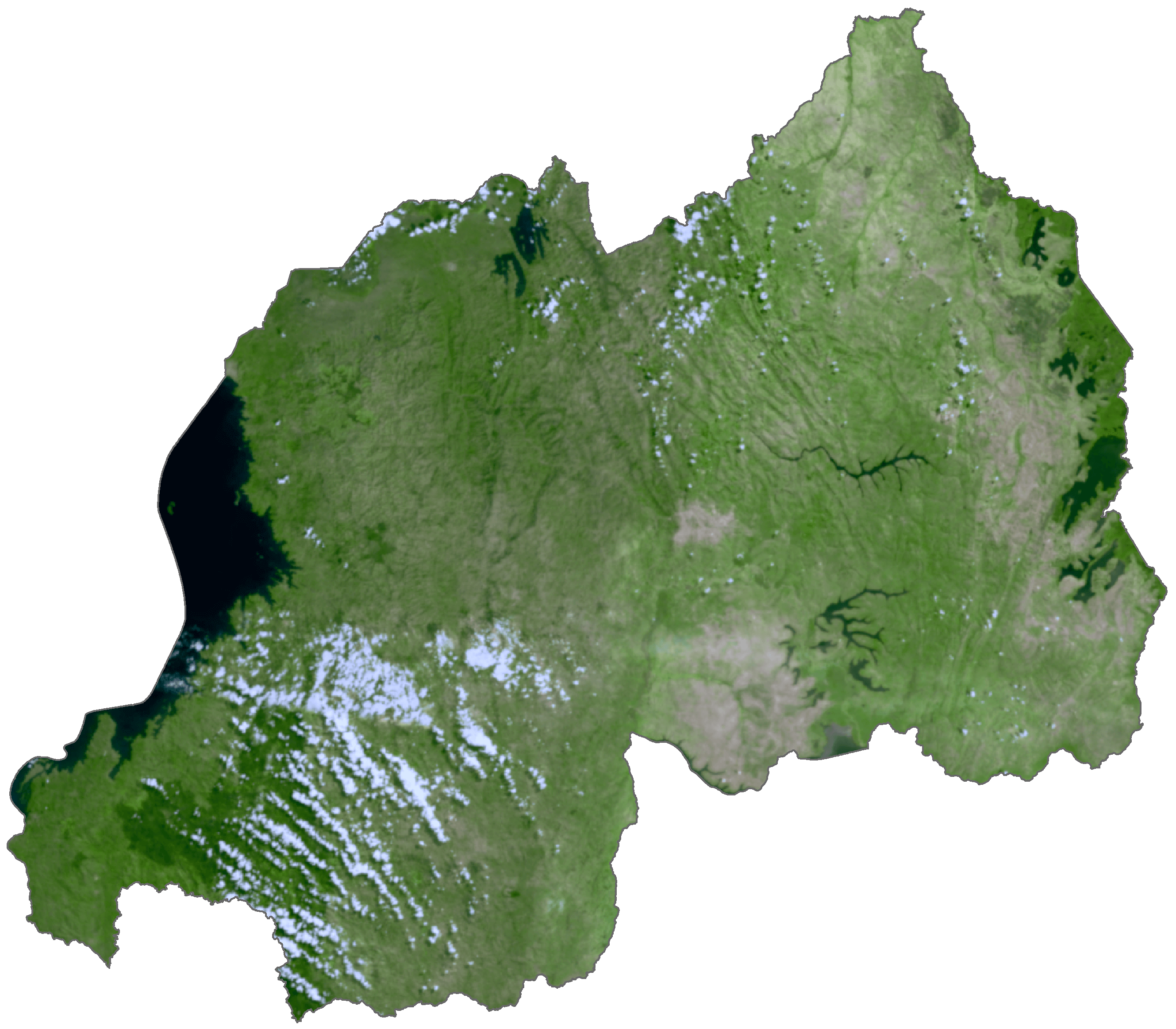
Rwanda Satellite Map
Elevation Map