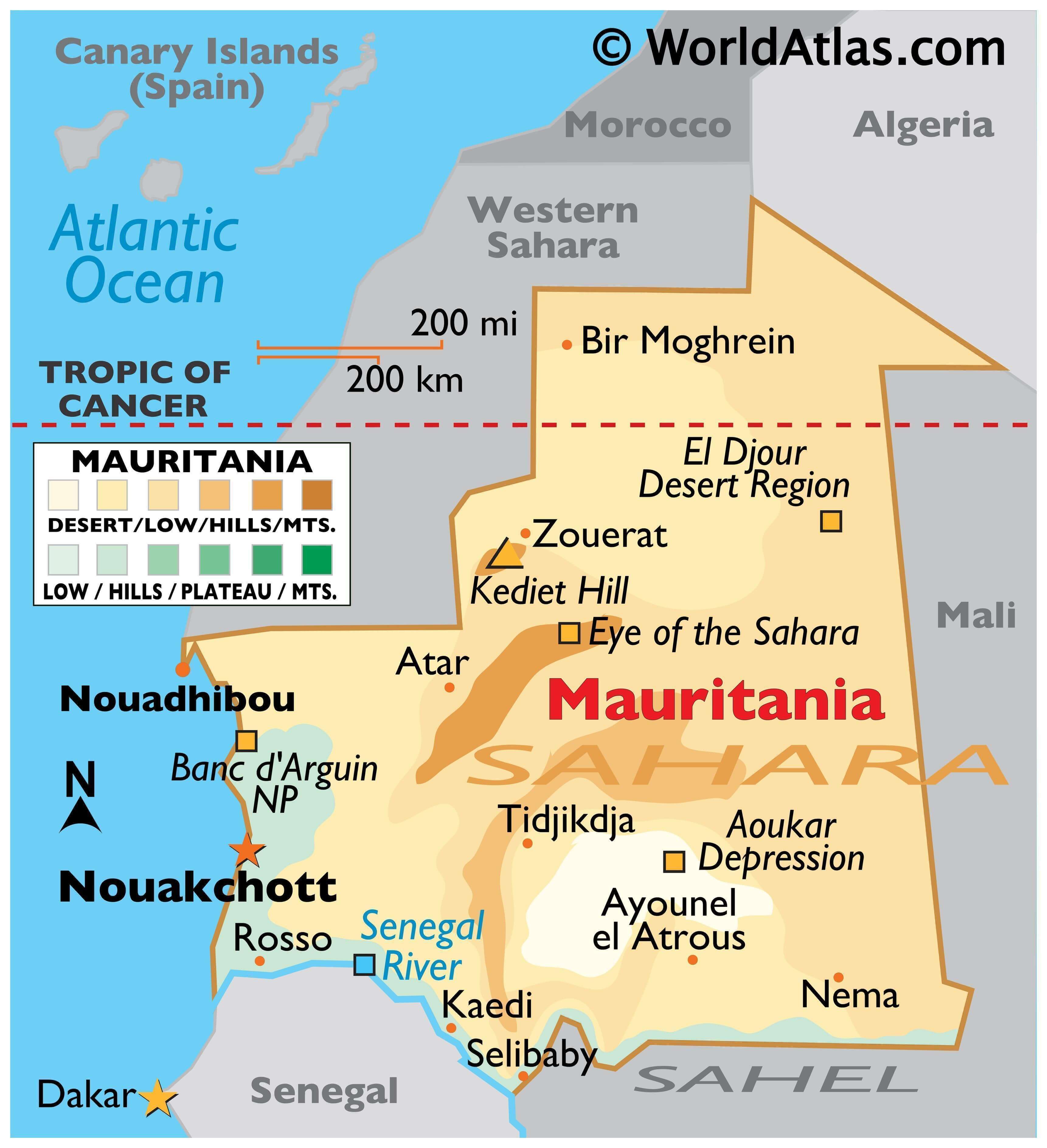
Mauritania, a country in Northwest Africa, occupies an area of 1,030,000 sq. km.
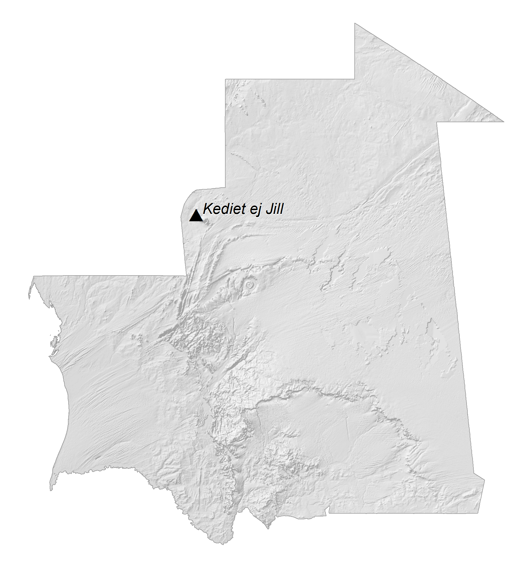
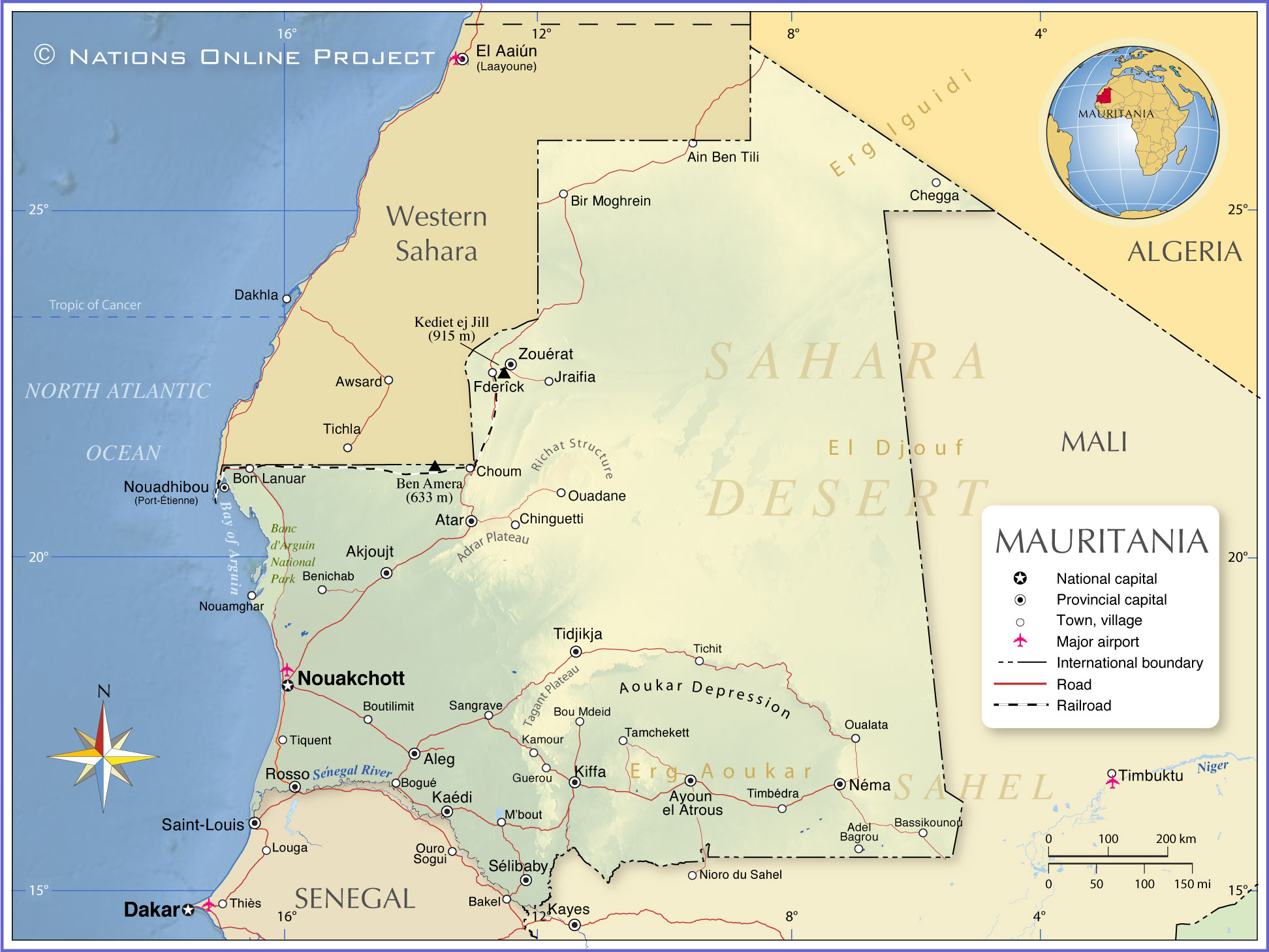
Mauritania has a generally flat landscape with vast plains that are punctuated by the occasional ridge or cliff-like outcropping.Bisecting the plains in the center of the country is a series of sandstone plateaus giving way to spring-fed oases.The most prominent feature of this region is the Guelb er Richat, also known as the Eye of the Sahara, which is a deeply eroded dome consisting of a variety of intrusive and extrusive igneous rocks.
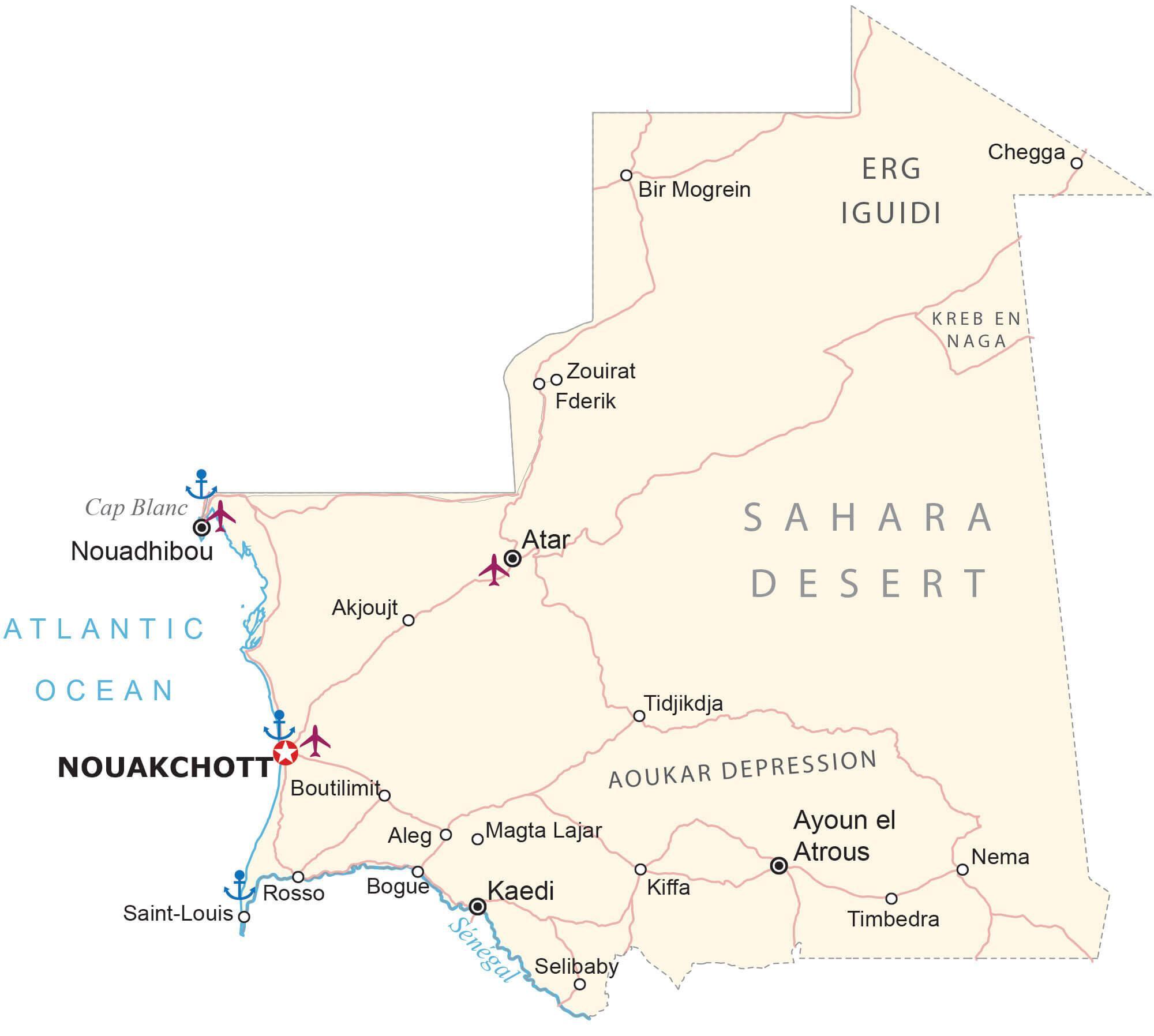
As observed on the map, three-quarters of the Mauritania landscape is desert or semidesert, and as a result of severe drought, the arid land has been expanding. There are no significant lakes or rivers in the country.
As marked on the map, the highest point of the country is Kediet Ijill at 3,001 ft (915 m); the lowest point of Mauritania is Te-n-Dghamcha at -16 ft (-5 m).
| Flag: |  |
|---|---|
| Legal Name: | Islamic Republic of Mauritania |
| Capital Value: | Nouakchott |
| Largest City: |
Nouakchott (1,314,636) |
| Official languages: |
|
| Demonym(s): | Mauritanian |
| Government: | Unitary semi-presidential Islamic republic |
| Legislature: | National Assembly |
| Total Area: | 1,030,700 km² |
| Land Area: | 1,030,700 km² |
| Population: | 4,525,696 |
| Density: | 3.4/km (8.8/sq mi) |
| GDP: | $7.59 Billion |
| GDP Per Capita: | $1,677.92 |
| Currency Value: | Ouguiyas (MRO) |
| Driving side: | right |
| Calling code: | +222 |
| Internet TLD: | .mr |
Explore the beauty of Mauritania with this interactive map. See the Saharan Desert, the Richat Structure, and the cities, towns, water, and roads that make up this fascinating country. Zoom in and out to get a better view of the terrain, and take in the stunning satellite imagery and elevation map.
Online Interactive Political Map
Click on ![]() to view map in "full screen" mode.
to view map in "full screen" mode.
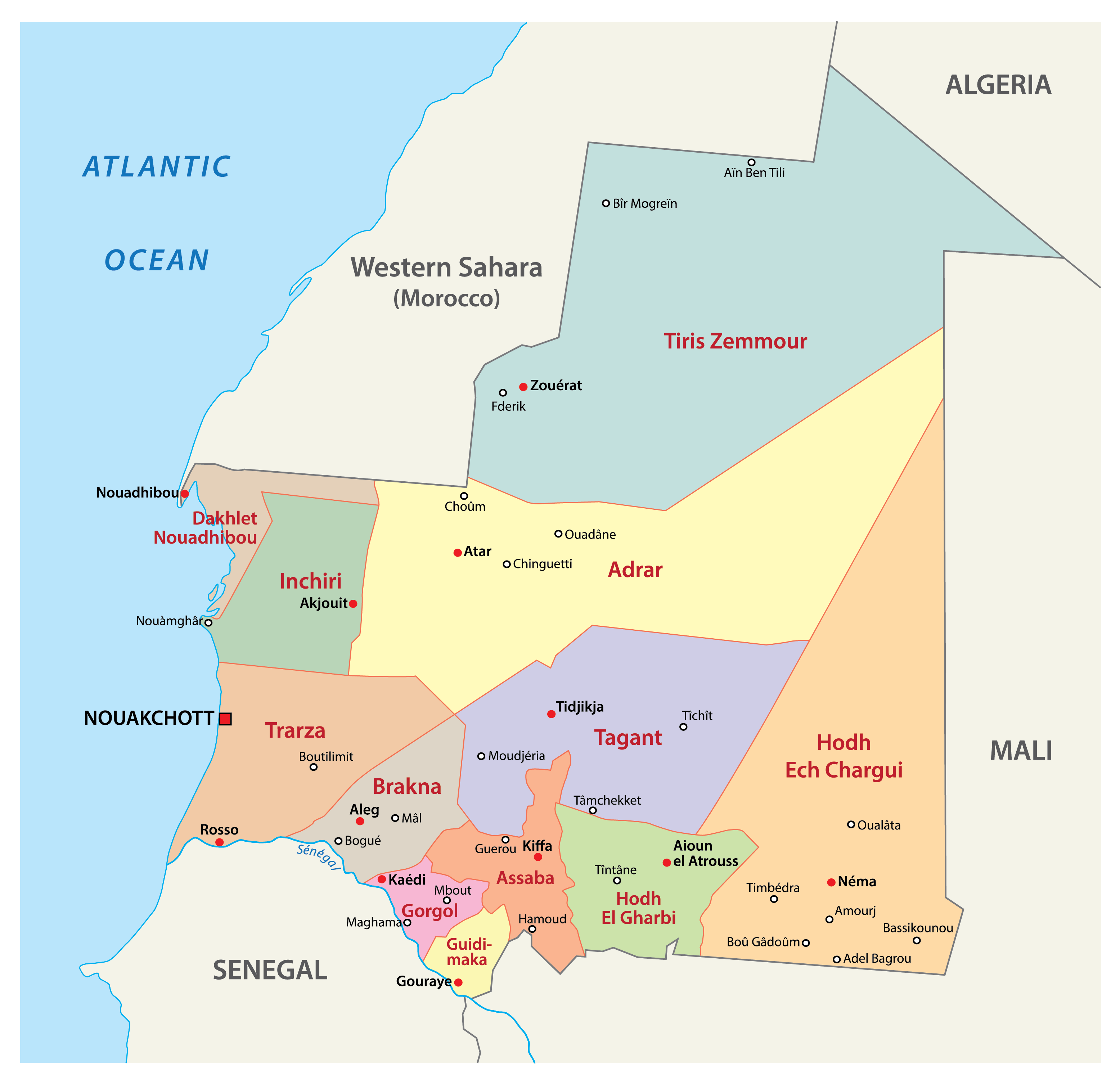
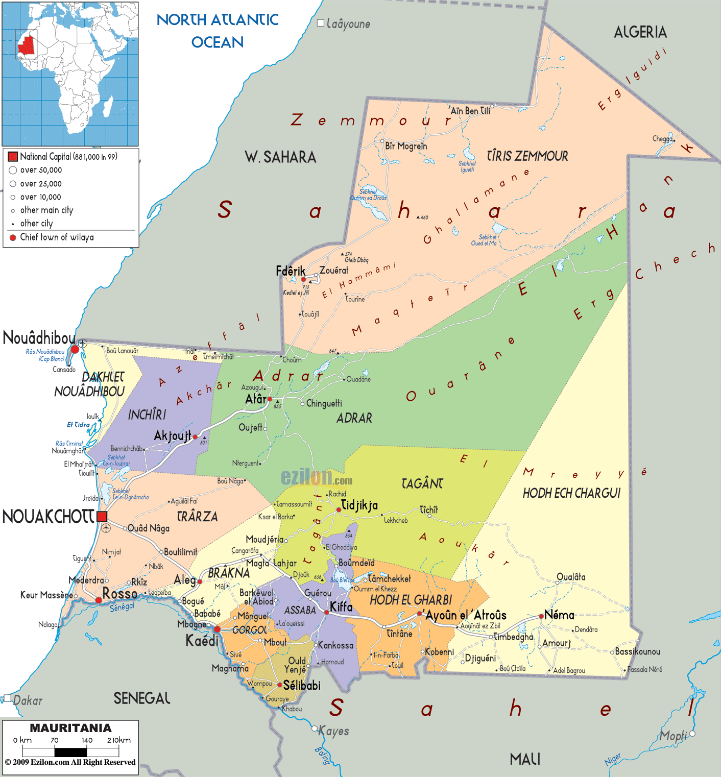
Mauritania has 12 major administrative divisions called regions or wilayah. In alphabetical order, they are as follows: Adrar, Assaba, Brakna, Dakhlet Nouadhibou, Gorgol, Guidimaka, Hodh ech Chargui, Hodh El Gharbi, Inchiri, Tagant, Tiris Zemmour, and Trarza. It also has one capital district called Nouakchott. These regions are subdivided into 44 moughataa or departments which, in turn, are divided into 216 communes.
With an area of 252,900 sq. km, Tiris Zemmour is the largest region while Hodh ech Chargui is the most populous one.
Location Maps
Where is Mauritania?
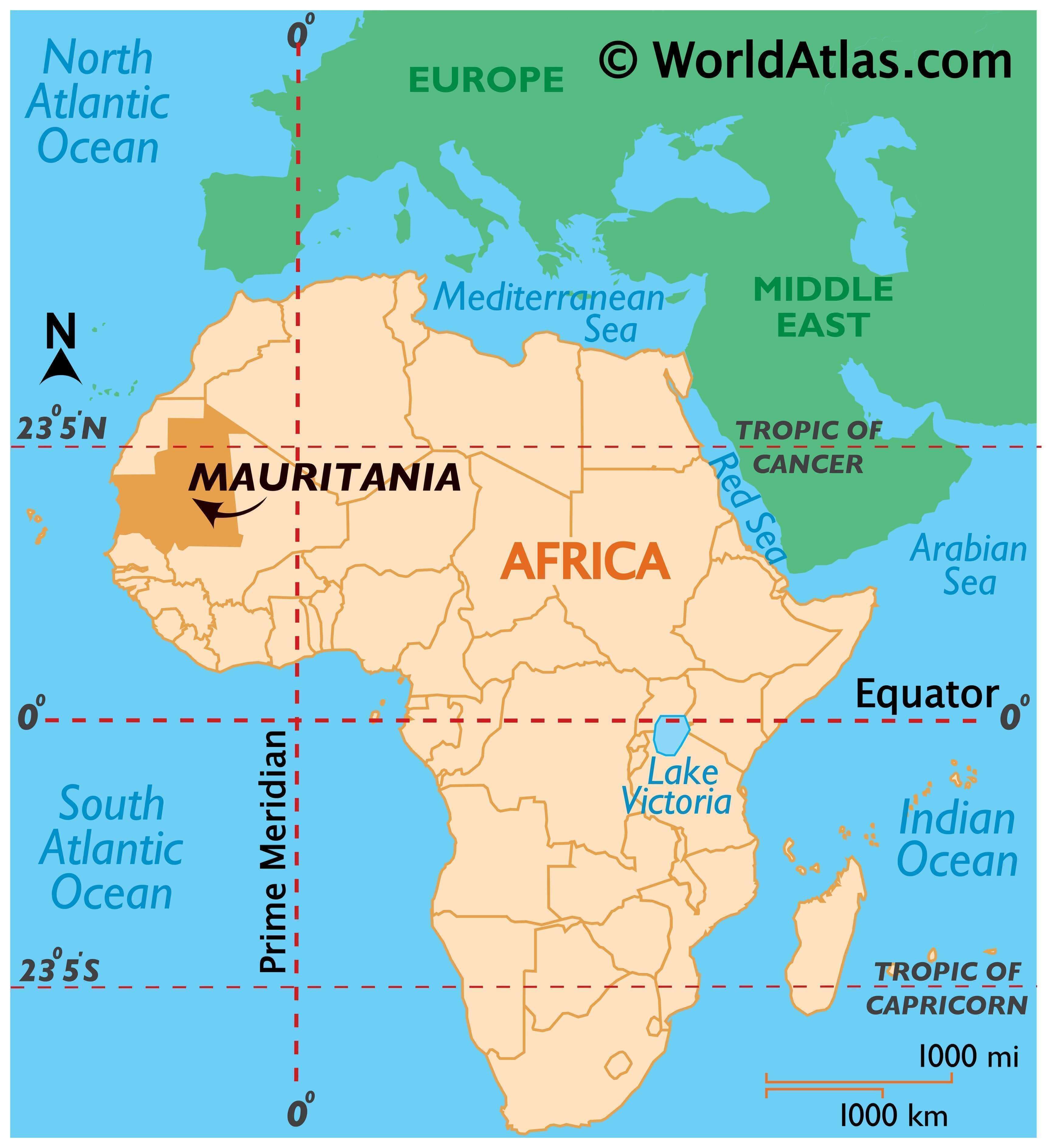
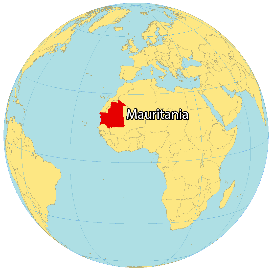
Mauritania is located in Northwest Africa, bordering Western Sahara to the northwest, Algeria to the northeast, Mali to the east and southeast, and Senegal to the southwest. Its coastline with the Atlantic Ocean is 700 kilometers (435 miles) in length. The country is rich in mining resources, has a long and complex history of slavery, and is known for its expansive desert-filled landscape. The population of Mauritania is around 4.4 million, with the capital city of Nouakchott being the most populous.

High Definition Political Map of Mauritania
Physical Map of Mauritania

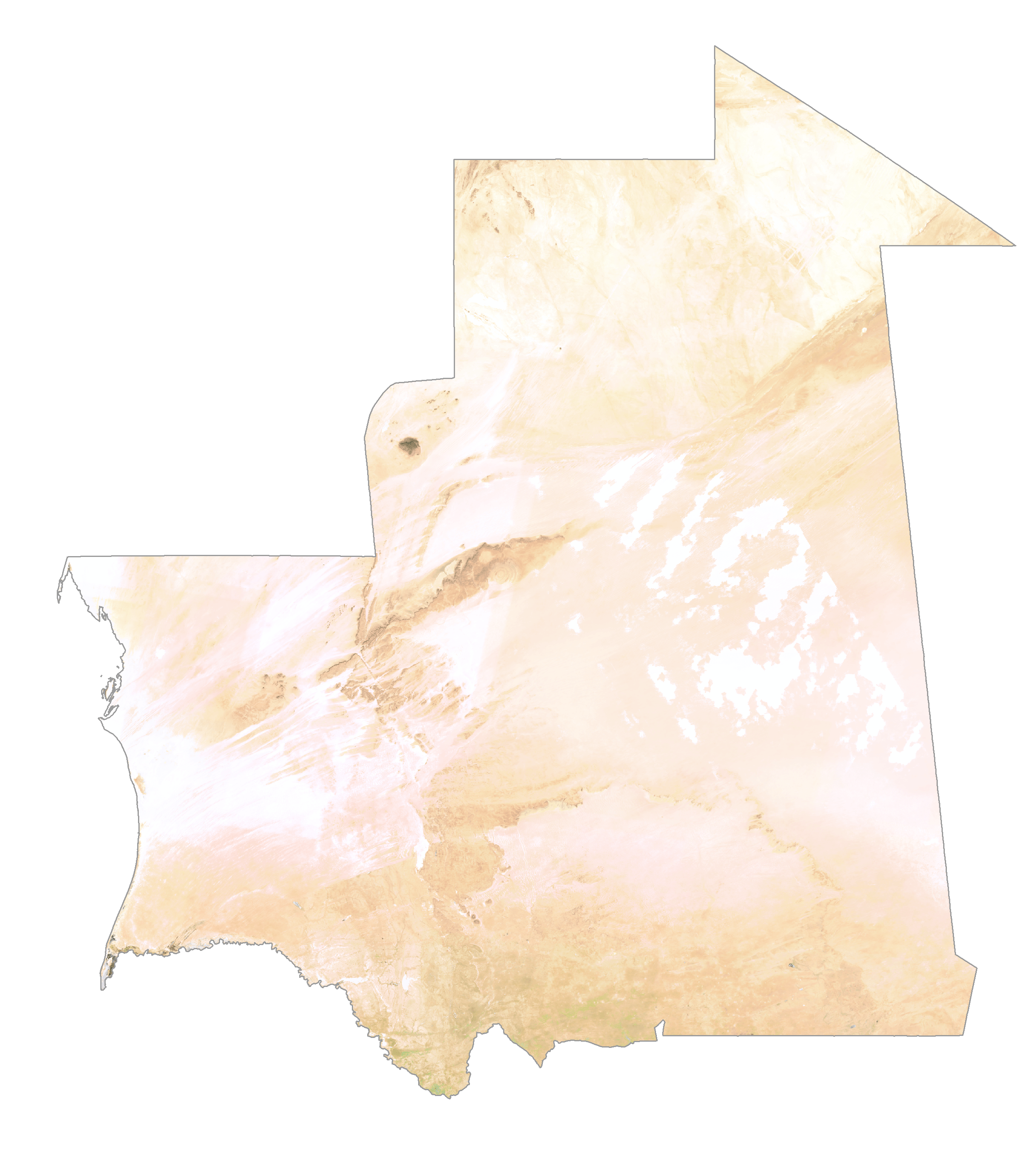
Mauritania Satellite Map
Elevation Map