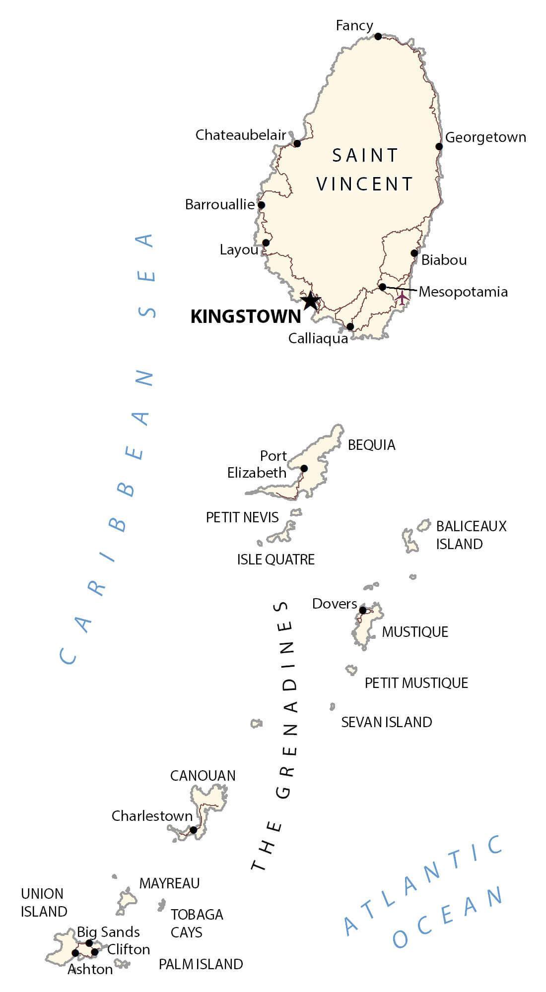
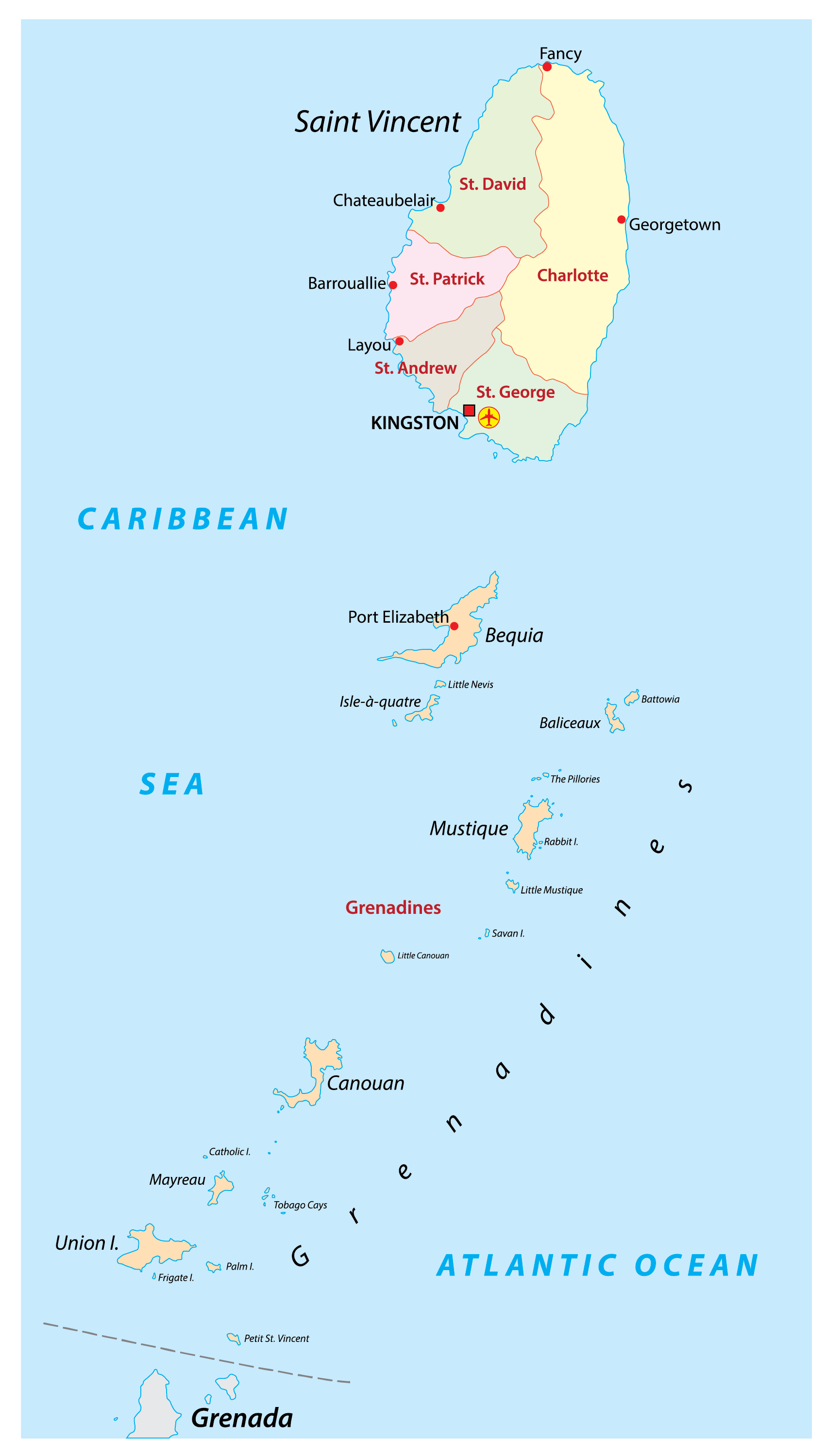
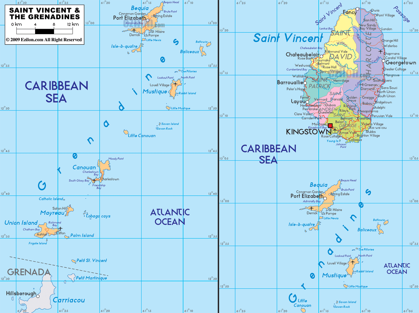
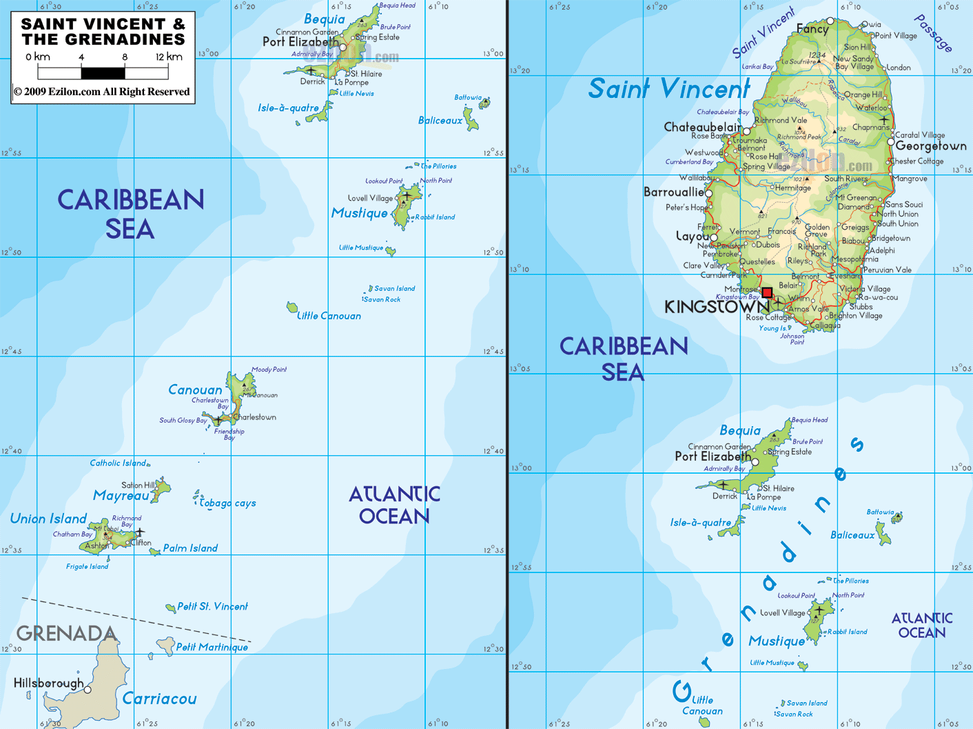
St. Vincent and the Grenadines are a group of islands located in the Caribbean Sea and the North Atlantic Ocean. Covering a total area of 389 sq. km (150 sq mi), the island country of St. Vincent and the Grenadines comprises of the larger St. Vincent Island and the northern Grenadine islands, along with some 32 islands and hundreds of islets, all stretching southward (about 48 miles) to the country of Grenada.
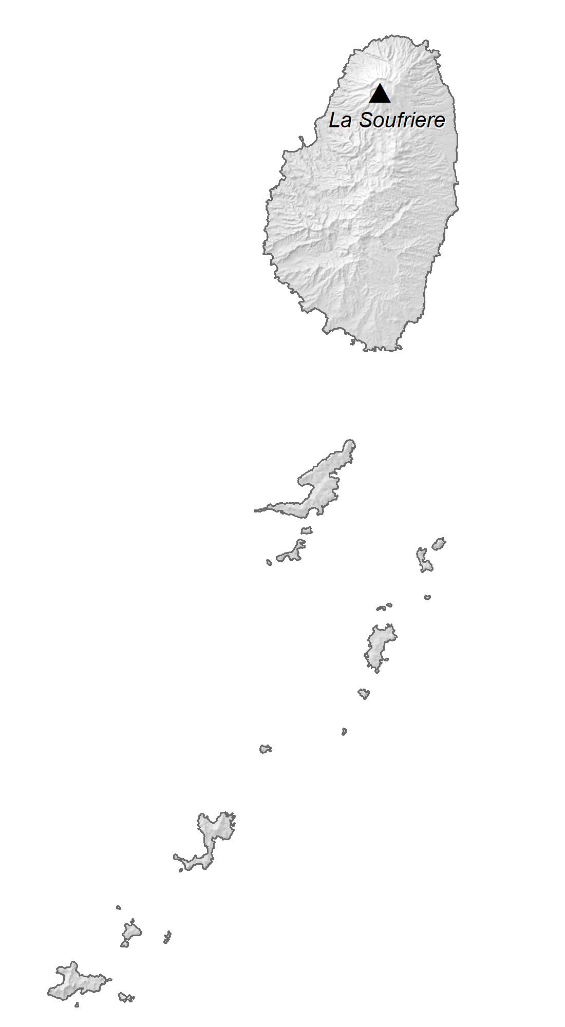
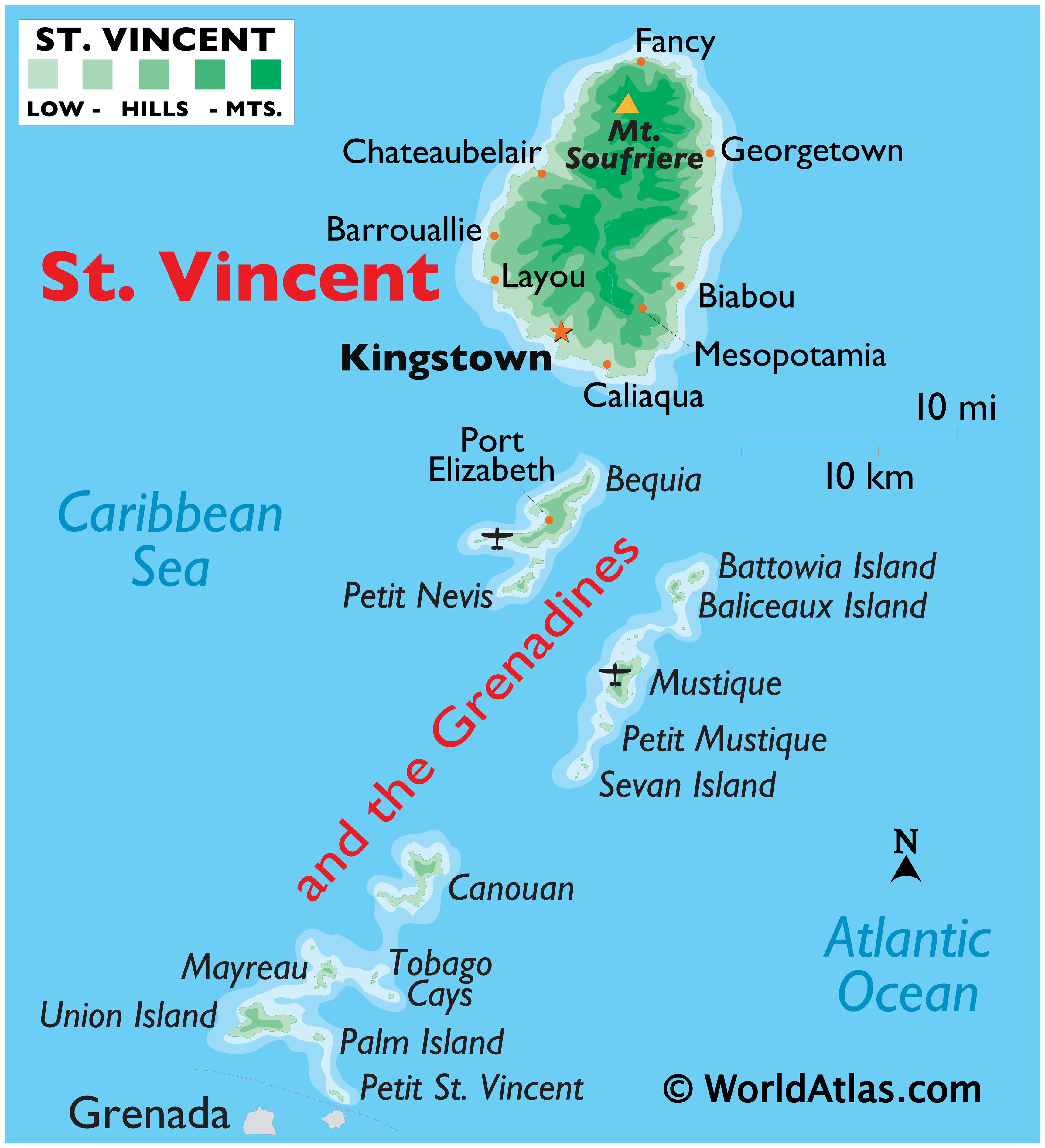
As observed on the physical map of the country above, the larger island of St. Vincent is volcanic in origin and has rugged mountainous terrain covered by lush forests with very little level ground. On the island, there are a few very small rivers that drain the mountain slopes.
Marked on the map above is the island’s as well as the country’s highest peak – Mt. Soufrière. It is 4,048 ft. (1234 m) tall and located in the northern part of St. Vincent Islands.
The Grenadines include the main islands of Bequia, Balliceau, Canouan, Mayreau, Mustique, Isle D’Quatre, Petit Saint Vincent, and Union Island, and over 600 rocky islets, all low-lying and ringed by coral reefs.
| Flag: |  |
|---|---|
| Legal Name: | Saint Vincent and the Grenadines |
| Capital Value: | Kingstown |
| Official languages: | English |
| Demonym(s): | Vincentian and Grenadinian Vincy (colloquial) |
| Government: | Unitary parliamentary constitutional monarchy |
| Legislature: | House of Assembly |
| Total Area: | 389 km² |
| Land Area: | 389 km² |
| Population: | 110,589 |
| Density: | 307/km (795.1/sq mi) (39th) |
| GDP: | $825.39 Million |
| GDP Per Capita: | $7,463.54 |
| Currency Value: | East Caribbean dollars (XCD) |
| Driving side: | left |
| Calling code: | +1 784 |
| Internet TLD: | .vc |
Explore the Caribbean island nation of St Vincent and Grenadines with this detailed map. From its capital city of Kingstown to its large stratovolcano La Soufrière, you can gain a better understanding of its geography. This map features cities, towns, highways, roads, and airports, as well as a reference map, satellite imagery, and an elevation map.
Online Interactive Political Map
Click on ![]() to view map in "full screen" mode.
to view map in "full screen" mode.
St. Vincent and the Grenadines is administratively divided into 6 parishes. The parishes situated in St. Vincent island are: Charlotte, Saint Andrew, Saint David, Saint George and Saint Patrick. The Grenadines parish is a part of Grenadines islands.
Covering a total area of 369 sq. km, the island country of St. Vincent and the Grenadines, comprises of the larger St. Vincent Island and the northern Grenadine islands along with some 32 islands and hundreds of islets.
Located on the south western coast of St. Vincent island, overlooking the Kingstown Harbour is, Kingstown – the capital, the largest and the most populous city of St. Vincent and the Grenadines. It is the chief port and an important economic and commercial center of the island country.
Location Maps
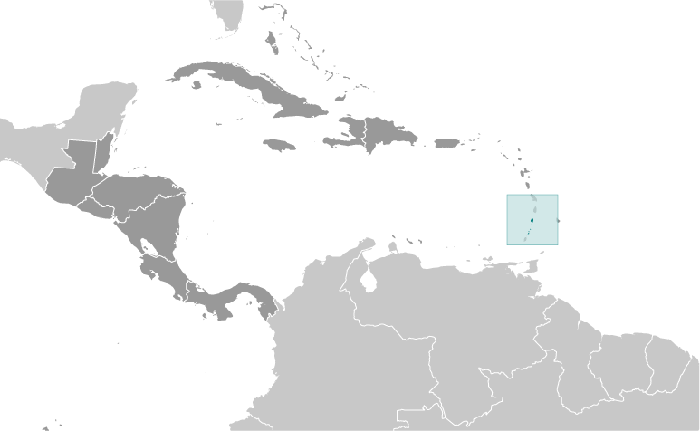
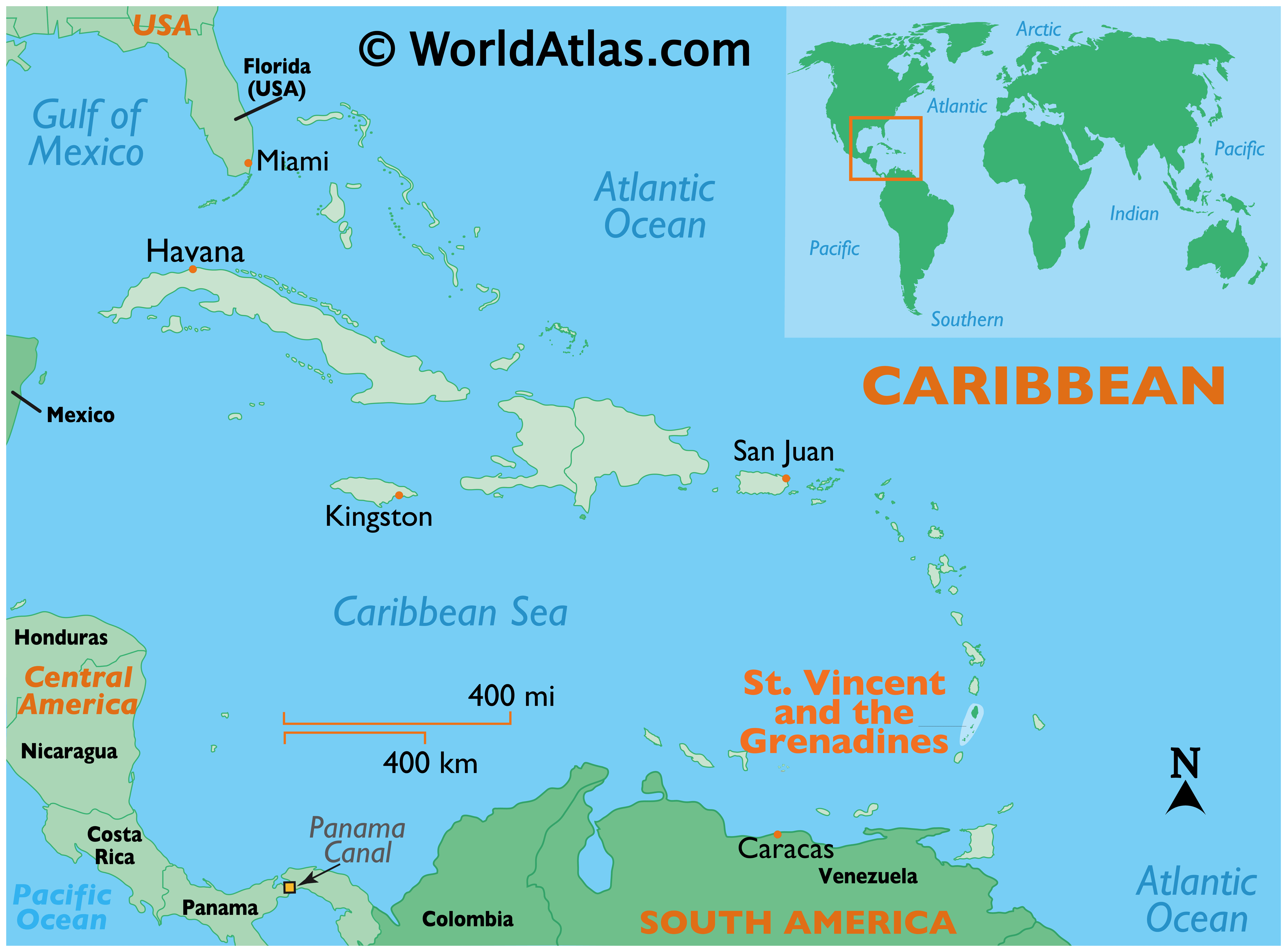
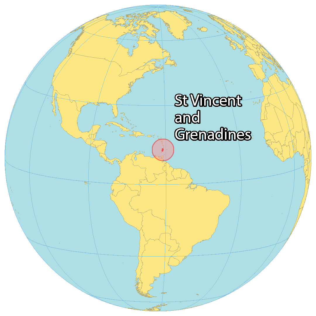
Where is Saint Vincent & the Grenadines?
St Vincent and the Grenadines is a Caribbean nation made up of the main island of Saint Vincent and a chain of smaller islands known as the Grenadines. It is part of the Windward Islands and lies near Barbados to the east, Saint Lucia to the north, and Grenada to the south.
The country is renowned for its stunning volcanic landscapes, yachting opportunities, beautiful white sand beaches, and private islands. Kingstown is the capital and largest city of St Vincent and the Grenadines, while other major villages include Georgetown, Byera Village, and Biabou.
High Definition Political Map of Saint Vincent & the Grenadines
History
Pre-colonial period
Before the arrival of Europeans and Africans in the 16th century, various Amerindian groups passed through or settled on St. Vincent and the Grenadines, including the Ciboney, Arawak, and Kalinago people. The island now known as Saint Vincent was originally named Youloumain by the native Island Caribs who called themselves Kalina.
European arrival and early colonial period
It is thought that Christopher Columbus sighted the island in 1498, giving it the name St Vincent. The indigenous Garifuna people, who became known as the “Black Caribs”, aggressively prevented European settlement on Saint Vincent.
French and British colonisation and the First Kalinago War
Various attempts by the English and Dutch to claim the island proved unsuccessful, and it was the French who were first able to colonise the island, settling in the town of Barrouallie on the leeward side of St Vincent in 1719. The French brought with them enslaved African prisoners of war to work the plantations of sugar, coffee, indigo, tobacco, cotton and cocoa.
The British captured the island and drove out the French from Barrouallie during the Seven Years’ War, a claim confirmed by the Treaty of Paris (1763). On taking control of the island in 1763, the British laid the foundations of Fort Charlotte and also brought with them enslaved African prisoners of war to work on the island plantations. The Black Caribs however, opposed to the British presence, entered into open conflict against the British, starting the First Carib War, which lasted from 1772 to 1773.
During the Anglo-French War (1778–1783), the French recaptured St Vincent in 1779. However, the British regained control under the Treaty of Versailles (1783).
British colonial period and the Second Kalinago War
The uneasy peace between the British and the Black Caribs led to the Second Carib War, which lasted from 1795 to 1797. The Black Caribs were led by Garifuna Paramount Chief Joseph Chatoyer and supported by the French, notably the radical Victor Hugues from the island of Martinique. Their revolt and the uprising was eventually put down in 1797 by British General Sir Ralph Abercromby; a peace treaty agreement was made which resulted in almost 5,000 Black Caribs being exiled to Roatán, an island off the coast of Honduras, and to Belize and Baliceaux in the Grenadines.
In 1806, the construction of Fort Charlotte has completed.
The La Soufrière volcano erupted in 1812, resulting in considerable destruction.
The British abolished slavery in Saint Vincent (as well as in all other British West Indies colonies) in 1834, and an apprenticeship period followed which ended in 1838. After its end, labour shortages on the plantations resulted, and were initially addressed by the immigration of indentured servants; in the late 1840s, many Portuguese immigrants arrived from Madeira, and between 1861 and 1888 shiploads of Indian labourers arrived.
20th century
In 1902, the La Soufrière volcano erupted again, killing 1,500–2,000 people; much farmland was damaged, and the economy deteriorated.
Saint Vincent and the Grenadines passed through various stages of colonial status under the British. A representative assembly was authorised in 1776, Crown Colony government was installed in 1877, a legislative council was created in 1925 with a limited franchise, and universal adult suffrage was granted in 1951. During the period of its control of Saint Vincent and the Grenadines, Britain made several attempts to unify the island with the other Windward Islands as a single entity, to simplify British control in the sub-region through a single unified administration. In the 1960s, the British again tried to unify all of its regional islands, including Saint Vincent, into a single politically unified entity under British control. The unification was to be called the West Indies Federation and was driven by a desire to gain independence from the British government. However, the attempt collapsed in 1962.
Saint Vincent was granted “associate statehood” status by Britain on 27 October 1969. This gave Saint Vincent complete control over its internal affairs but fell short of full independence in law.
In April 1979, La Soufrière erupted once more. Although no one was killed, thousands were evacuated and extensive agricultural damage occurred.
On 27 October 1979, Saint Vincent and the Grenadines gained full independence; the date is now the country’s Independence Day, a public holiday. The country opted to remain within the Commonwealth of Nations, retaining the then-Queen Elizabeth II as Monarch, represented locally by a Governor-General.
Post-independence era
Milton Cato of the centre-left Saint Vincent Labour Party (SVLP) was the country’s first Prime Minister (he had been Premier since 1974), ruling until his defeat in the 1984 Vincentian general election by James Fitz-Allen Mitchell of the centre-right New Democratic Party (NDP). During Cato’s time in office, there was a brief rebellion on Union Island in December 1979 led by Lennox ‘Bumba’ Charles. Inspired by the recent revolution on Grenada, Charles alleged neglect of the Union by the central government. However, the revolt was swiftly put down and Charles was arrested. There were also a series of strikes in the early 1980s. James Mitchell remained Prime Minister for 16 years until 2000, winning three consecutive elections. Mitchell was at the forefront of attempts to improve regional integration. In 1980 and 1987, hurricanes damaged many banana and coconut plantations. Hurricane seasons were also very active in 1998 and 1999, with Hurricane Lenny in 1999 causing extensive damage to the west coast of the island.
In 2000, Arnhim Eustace became Prime Minister after taking over the leadership of the NDP following Mitchell’s retirement; he was defeated a year later by Ralph Gonsalves of the Unity Labour Party (successor party to the SVLP). Gonsalves—a left-winger known in the country as “Comrade Ralph”—argued that European nations owe Caribbean nations reparations for their role in the Atlantic slave trade. Gonsalves won a second term in 2005, a third in 2010, and a fourth in 2015.
In 2009, a referendum was held on a proposal to adopt a new constitution that would make the country a republic, replacing Queen Elizabeth II as head of state with a non-executive President, a proposal supported by Prime Minister Gonsalves. A two-thirds majority was required, but the referendum was defeated 29,019 votes (55.64 per cent) to 22,493 (43.13 per cent).
Saint Vincent and the Grenadines was elected as a non-permanent member of the United Nations Security Council 2020–21.
In November 2020, Ralph Gonsalves, Prime Minister of Saint Vincent and the Grenadines since 2001, made history by securing the fifth consecutive victory of his Unity Labour Party (ULP) in general election.
In 2021, on 9 April, the La Soufrière volcano erupted, sending ash several miles into the atmosphere. Approximately 16,000 people were evacuated in the days leading up to the eruption.
Physical Map of Saint Vincent & the Grenadines
Geography
Saint Vincent and the Grenadines lies to the west of Barbados, south of Saint Lucia and north of Grenada in the Windward Islands of the Lesser Antilles, an island arc of the Caribbean Sea. The islands of Saint Vincent and the Grenadines include the main island of Saint Vincent 344 km (133 sq mi) and the northern two-thirds of the Grenadines 45 km (17 sq mi), which are a chain of smaller islands stretching south from Saint Vincent to Grenada. There are 32 islands and cays that make up St Vincent and the Grenadines (SVG). Nine are inhabited, including the mainland St Vincent and the Grenadines islands: Young Island, Bequia, Mustique, Canouan, Union Island, Mayreau, Petit St Vincent and Palm Island. Prominent uninhabited islands of the Grenadines include Petit Nevis, used by whalers, and Petit Mustique, which was the centre of a prominent real-estate scam in the early 2000s.
The capital of Saint Vincent and the Grenadines is Kingstown, Saint Vincent. The main island of Saint Vincent measures 26 km (16 mi) long, 15 km (9.3 mi) in width and 344 km (133 sq mi) in area. From the most northern to the most southern points, the Grenadine islands belonging to Saint Vincent span 60.4 km (37.5 mi), with a combined area of 45 km (17 sq mi).
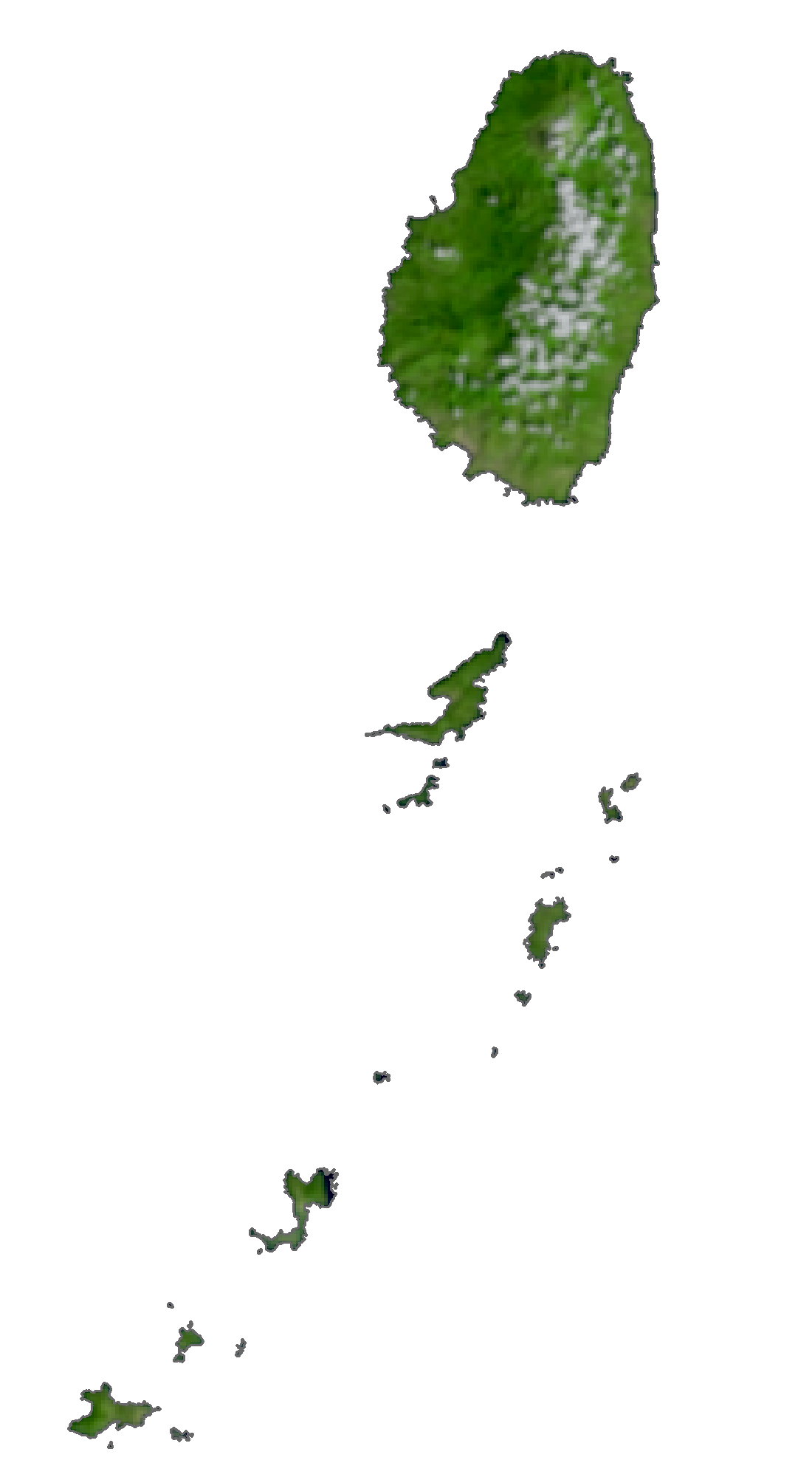
The island of Saint Vincent is volcanic and heavily forested and includes little level ground. The windward side of the island is very rocky and steep, while the leeward side has more sandy beaches and bays. Saint Vincent’s highest peak is La Soufrière volcano at 1,234 m (4,049 ft). Other major mountains on St Vincent are (from north to south) Richmond Peak, Mount Brisbane, Colonarie Mountain, Grand Bonhomme, Petit Bonhomme and Mount St Andrew.
The country is home to two terrestrial ecoregions: Windward Islands moist forests and the Lesser Antillean dry forests. It had a 2019 Forest Landscape Integrity Index mean score of 6.95/10, ranking it 61st globally out of 172 countries.
Saint Vincent & the Grenadines Satellite Map
Elevation Map