Covering a total land area of only 26 sq. km, Tuvalu is a Polynesian island nation located in the west-central Pacific Ocean.
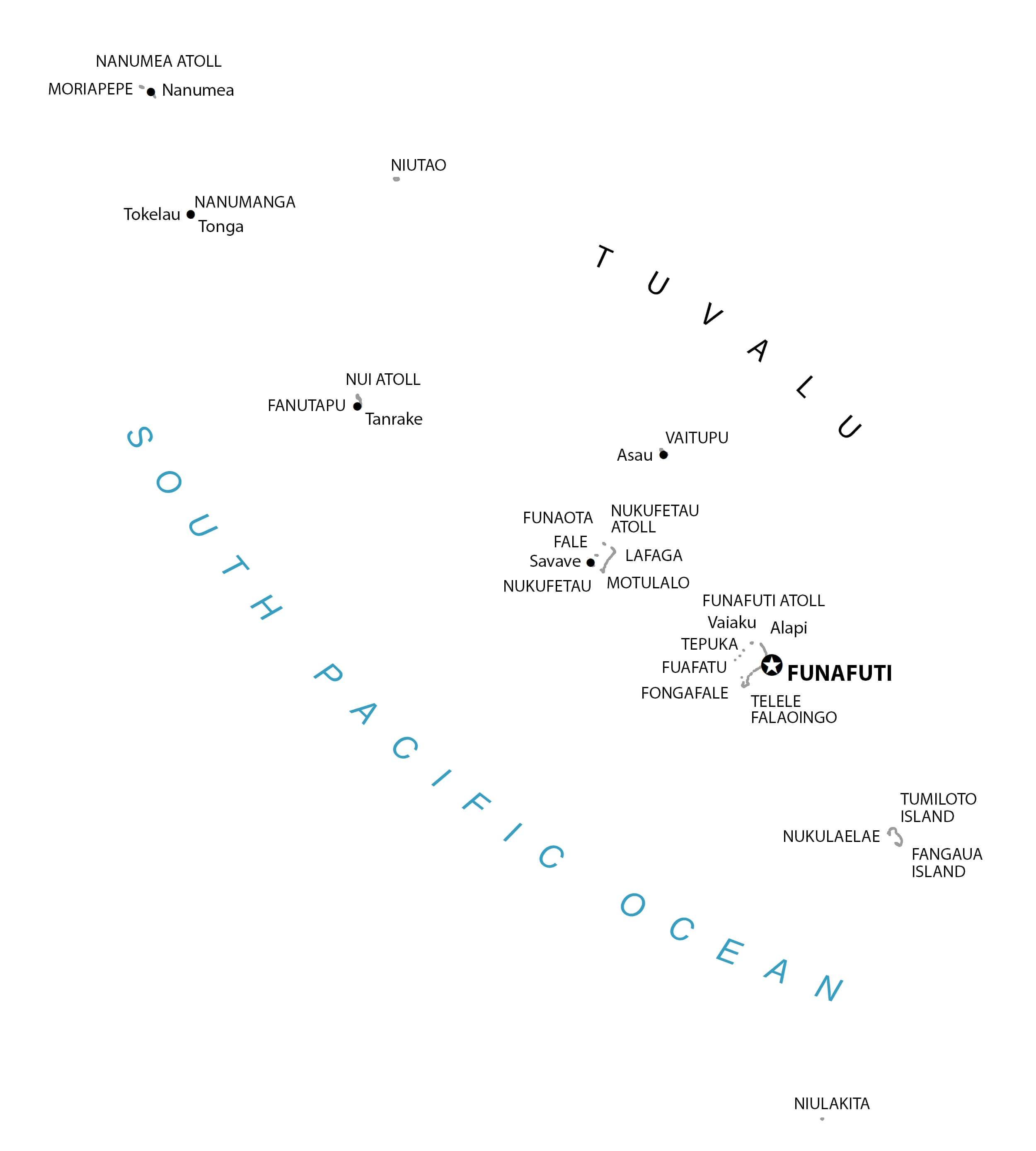
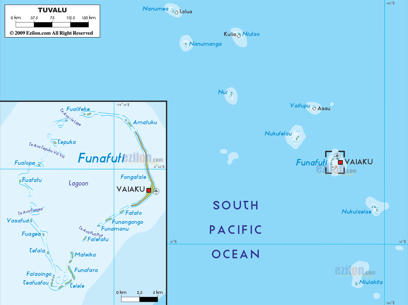
As observed on the map, Tuvalu is an archipelago that is composed of three reef islands (Nanumanga, Niutao, and Niulakita) and six true coral atolls (Funafuti, Nanumea, Nui, Nukulaelae, and Vaitupu), along with more than 100 small islets, all of which are scattered over a very large area. These low-lying islands are famous for their reefs and beautiful lagoons. Funafuti, the largest atoll comprises several small islets encircling a large central lagoon. The highest point in Tuvalu is an unnamed location on Niulakita island, which rises to an elevation of 15ft (4.5m). The lowest point is at the South Pacific Ocean (0m).
| Flag: |  |
|---|---|
| Legal Name: | Tuvalu |
| Capital Value: | Funafuti; note – the capital is an atoll of some 29 islets; administrative offices are in Vaiaku Village on Fongafale Islet |
| Official languages: |
|
| Demonym(s): | Tuvaluan |
| Government: | Unitary non-partisan parliamentary constitutional monarchy |
| Legislature: | Parliament |
| Total Area: | 26 km² |
| Land Area: | 26 km² |
| Population: | 11,646 |
| Density: | 475.88/km (1,232.5/sq mi) (27th) |
| GDP: | $47.27 Million |
| GDP Per Capita: | $4,059.03 |
| Currency Value: | Tuvaluan dollars or Australian dollars (AUD) |
| Driving side: | left |
| Calling code: | +688 |
| Internet TLD: | .tv |
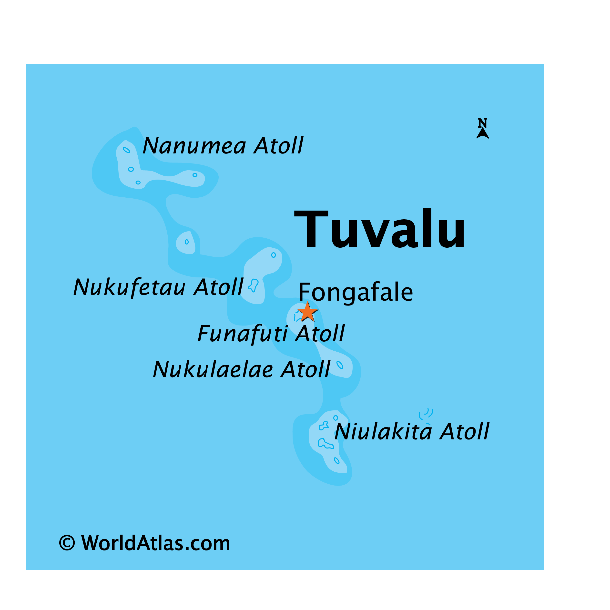
Explore Tuvalu with this Reference Map
Discover the small island nation of Tuvalu, located in the South Pacific Ocean within the British commonwealth. This reference map of Tuvalu provides an overview of the settlements, islands, atolls, and water features that make up this beautiful country.
Tuvalu is made up of four reef islands and five atolls, with a total land area of only 26 square kilometers. Its highest point is only 4.5 meters above sea level, making it the second-lowest country in the world. The country is composed of nine islands, which together form the Ellice Island chain.
This reference map of Tuvalu allows you to explore the country’s geography in detail. You can find the islands, atolls, and water features of Tuvalu, as well as the settlements and other points of interest.
Take a look at this reference map of Tuvalu, and discover the beauty of this small island nation in the South Pacific Ocean.
Online Interactive Political Map
Click on ![]() to view map in "full screen" mode.
to view map in "full screen" mode.
Tuvalu is administratively divided into 7 island councils and 1 town council. In alphabetical order, the island councils are Nanumanga, Nanumea, Niutao, Nui, Nukufetau, Nukulaelae, and Vaitupu. Funafuti is the town council.
Covering a total land area of only 26 sq. km, Tuvalu is a Polynesian island nation located in the west-central Pacific Ocean. It is an archipelago comprising of three reef islands and six coral atolls. The Funafuti atoll is the capital of Tuvalu and is also the most populous among all the 9 atolls. Situated on the Fongafale islet of the Funafuti Atoll is the Vaiaku village – where most of the country’s government administrative offices are located.
Location Maps
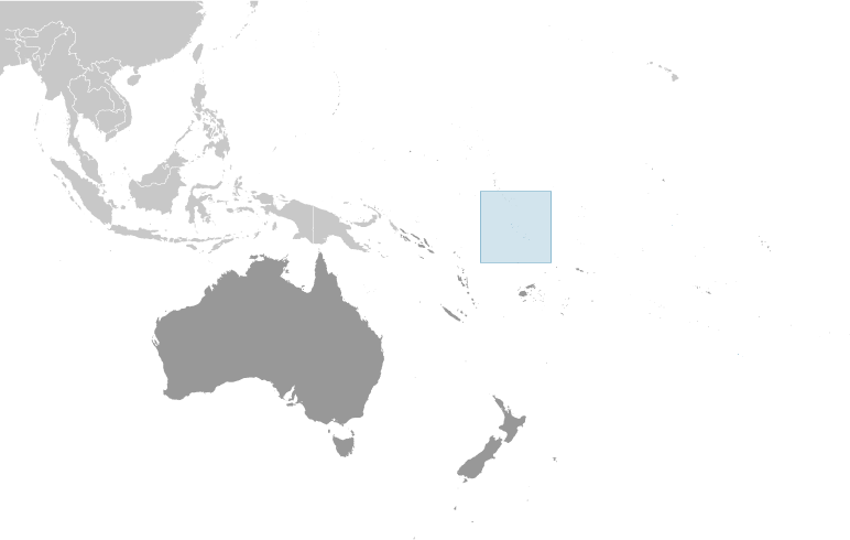
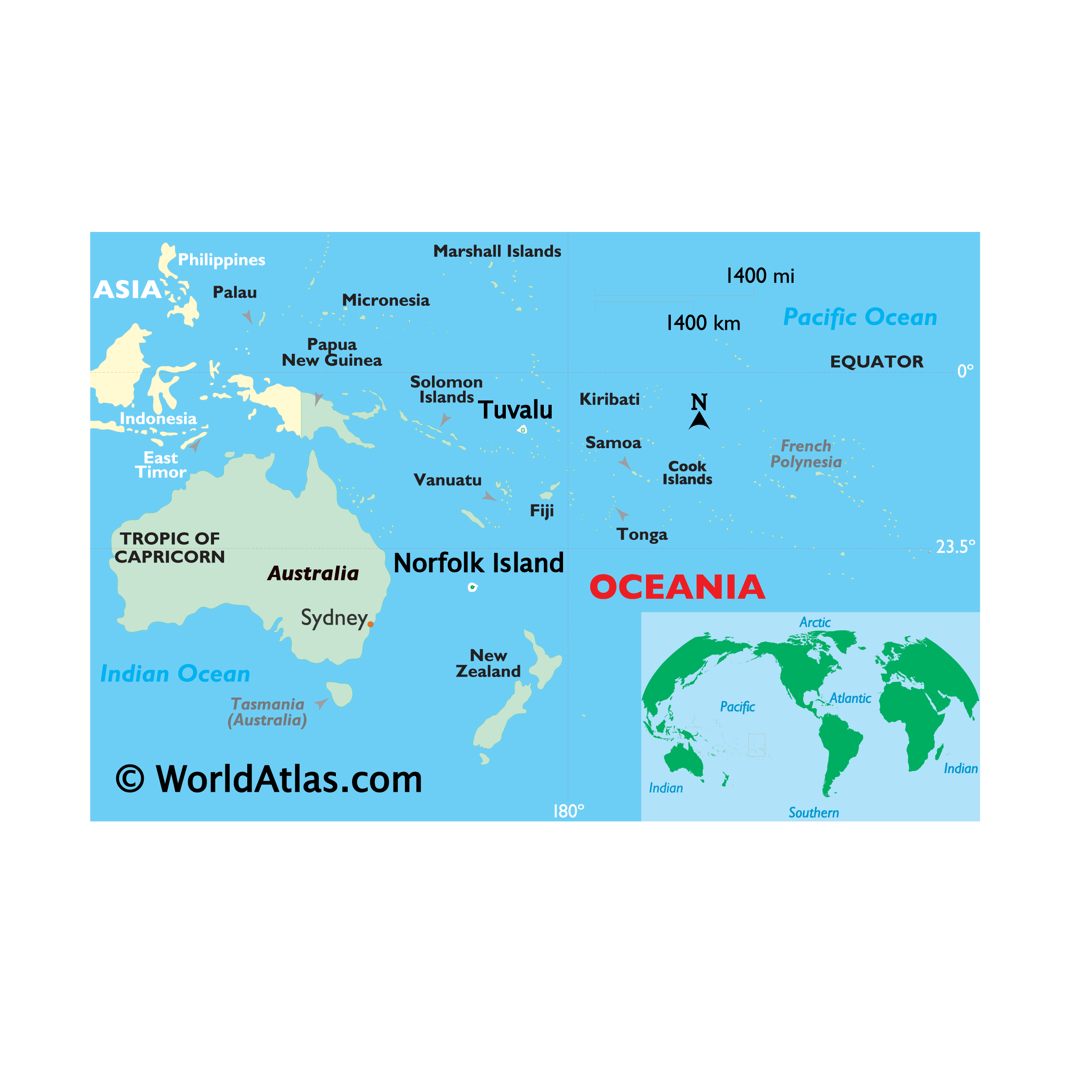
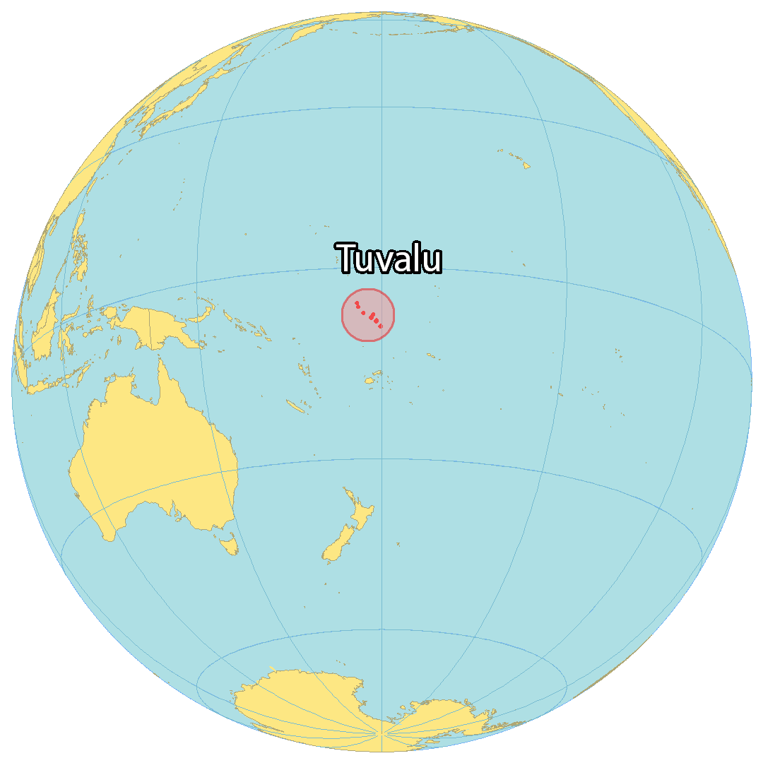
Where is Tuvalu?
Tuvalu Map
This map of Tuvalu (formerly Ellice Islands) shows populated places, islands, and atolls. Tuvalu consists of 9 islands and atolls (3 reefs and 6 atolls) in the South Pacific Ocean. Tuvalu is located in the Polynesia region of Oceania. The Fiji Islands are situated to the south, Vanuatu to the southwest, the Solomon Islands to the west, and Nauru to the northwest.
The population is sparse with only approximately 10,500 people. Funafuti is the capital and largest city of Tuvalu. It occupies an area of just 26 square kilometers (10 sq mi) making it one of the smallest countries in the world.
High Definition Political Map of Tuvalu
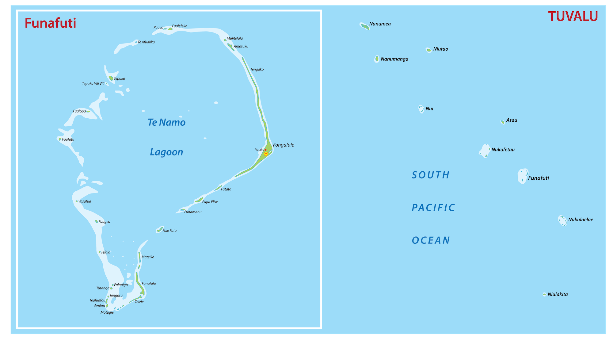
Physical Map of Tuvalu