Covering an area of 462,840 sq.km (178,700 sq mi), Papua New Guinea is the 3rd largest island nation and the world’s 54th largest country.
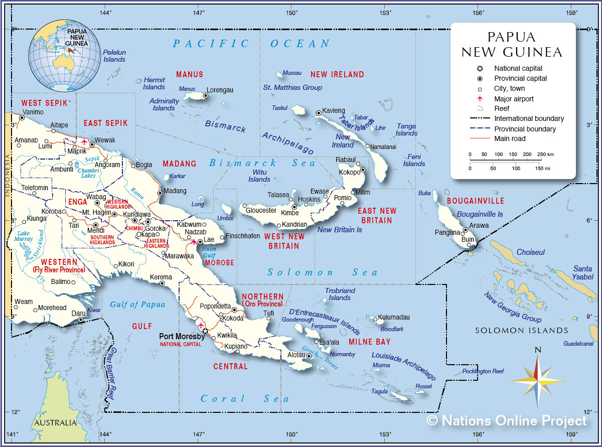
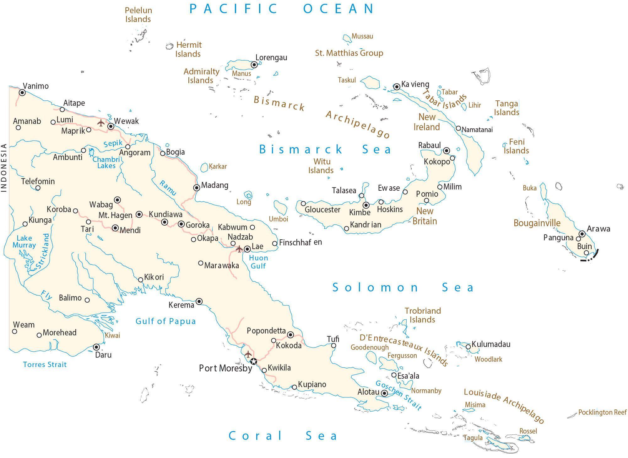
The nation of Papua New Guinea contains the eastern half of the island of New Guinea, as well as the islands of New Ireland, New Britain, and Bougainville, in addition to numerous smaller islands.
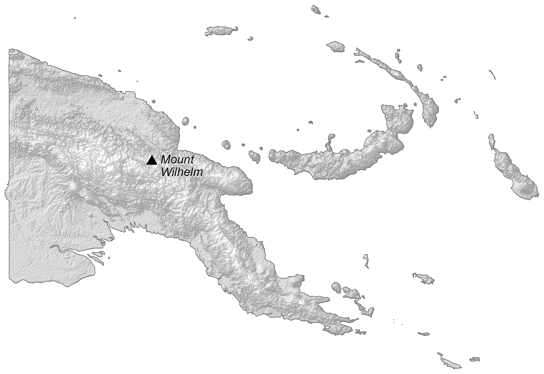
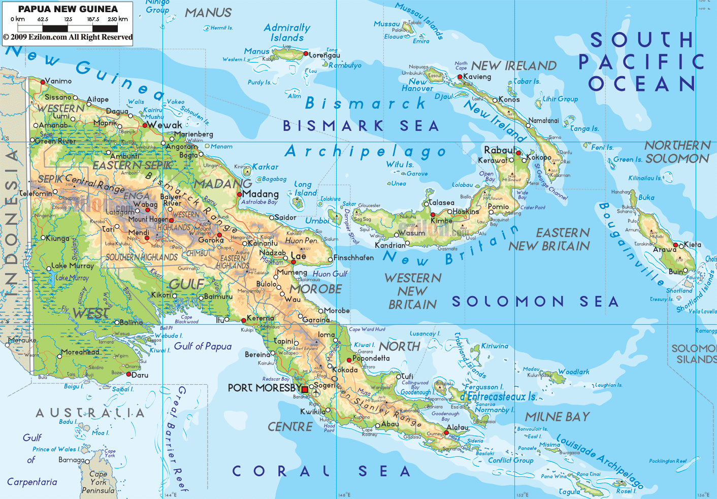
As observed on the physical map of Papua New Guinea above, much of the island nation is mountainous and covered in tropical rainforests. The New Guinea Highlands – a chain of mountains and river valleys, runs the length of the New Guinea island.
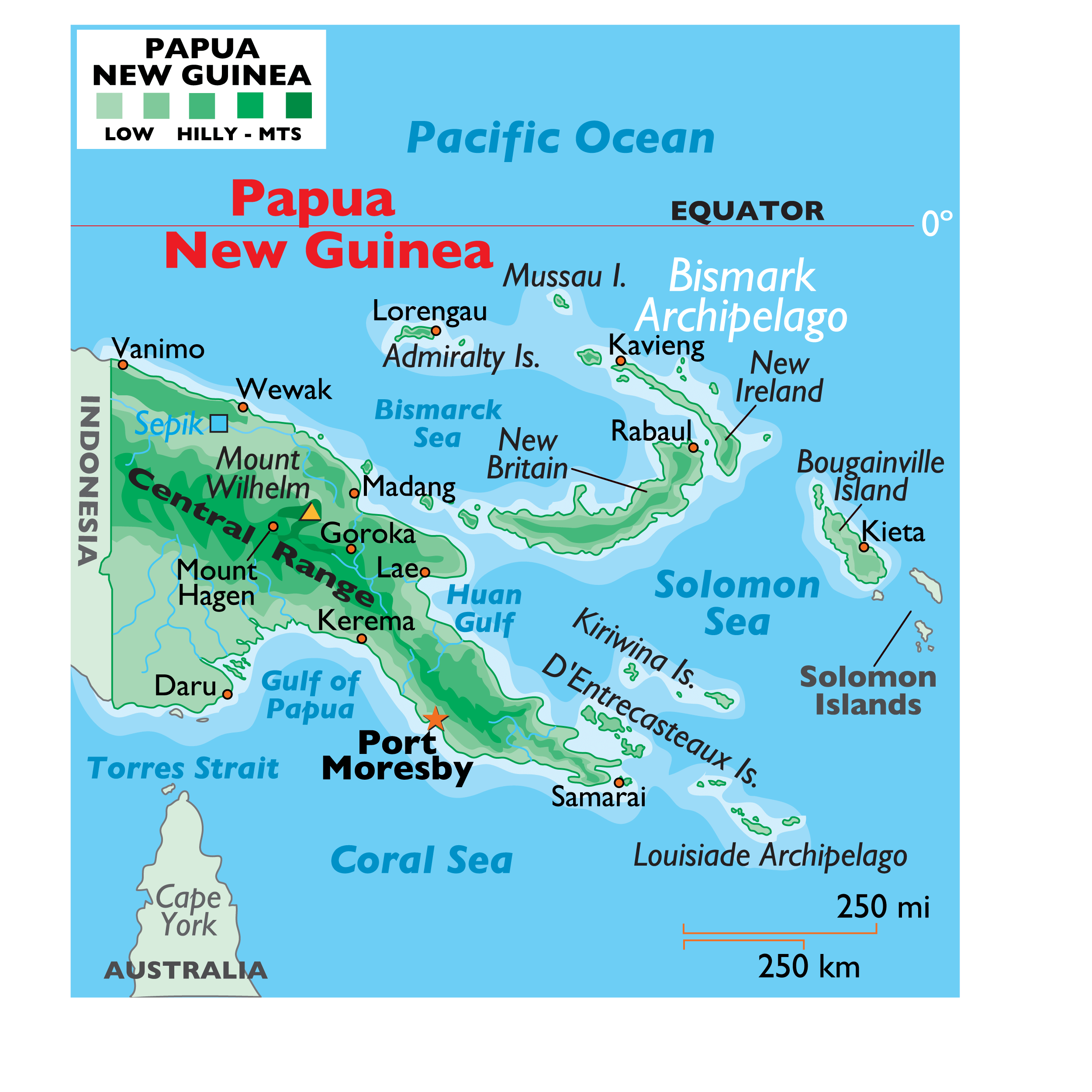
As marked on the map by an upright yellow triangle, the highest point of Papua New Guinea is Mount Wilhelm – at an elevation of 14,793 ft (4,509 m). The lowest point of Papua New Guinea is the Pacific Ocean (0m).
Rivers of note include the Sepik River which winds its way through lowland swamp plains to the northern coast, and the Fly River which flows through one of the largest swamplands in the world on its way to the south coast of the island.
Due to its location along the Pacific Ring of Fire, Papua New Guinea has several volcanoes and is prone to earthquakes and tsunamis. It’s most active volcano, Rabaul Caldera, is situated on the island of New Britain, and as of March 2013 is engaged in an eruptive phase that began in January 2013.
| Flag: |  |
|---|---|
| Legal Name: | Independent State of Papua New Guinea |
| Capital Value: | Port Moresby |
| Largest City: |
Port Moresby (382,516) |
| Official languages: |
|
| Demonym(s): | Papua New Guinean |
| Government: | Unitary parliamentaryconstitutional monarchy |
| Legislature: | National Parliament |
| Total Area: | 462,840 km² |
| Land Area: | 452,860 km² |
| Water Area: | 9,980 km² |
| Population: | 8,776,109 |
| Density: | 15/km (38.8/sq mi) (201st) |
| GDP: | $24.97 Billion |
| GDP Per Capita: | $2,845.18 |
| Currency Value: | Kina (PGK) |
| Driving side: | left |
| Calling code: | +675 |
| Internet TLD: | .pg |
Explore the stunning topography, islands, and landscape of Papua New Guinea with this interactive map. This map displays cities, roads, and islands, and uses satellite imagery and elevation data to show the amazing terrain of Papua New Guinea.
Online Interactive Political Map
Click on ![]() to view map in "full screen" mode.
to view map in "full screen" mode.
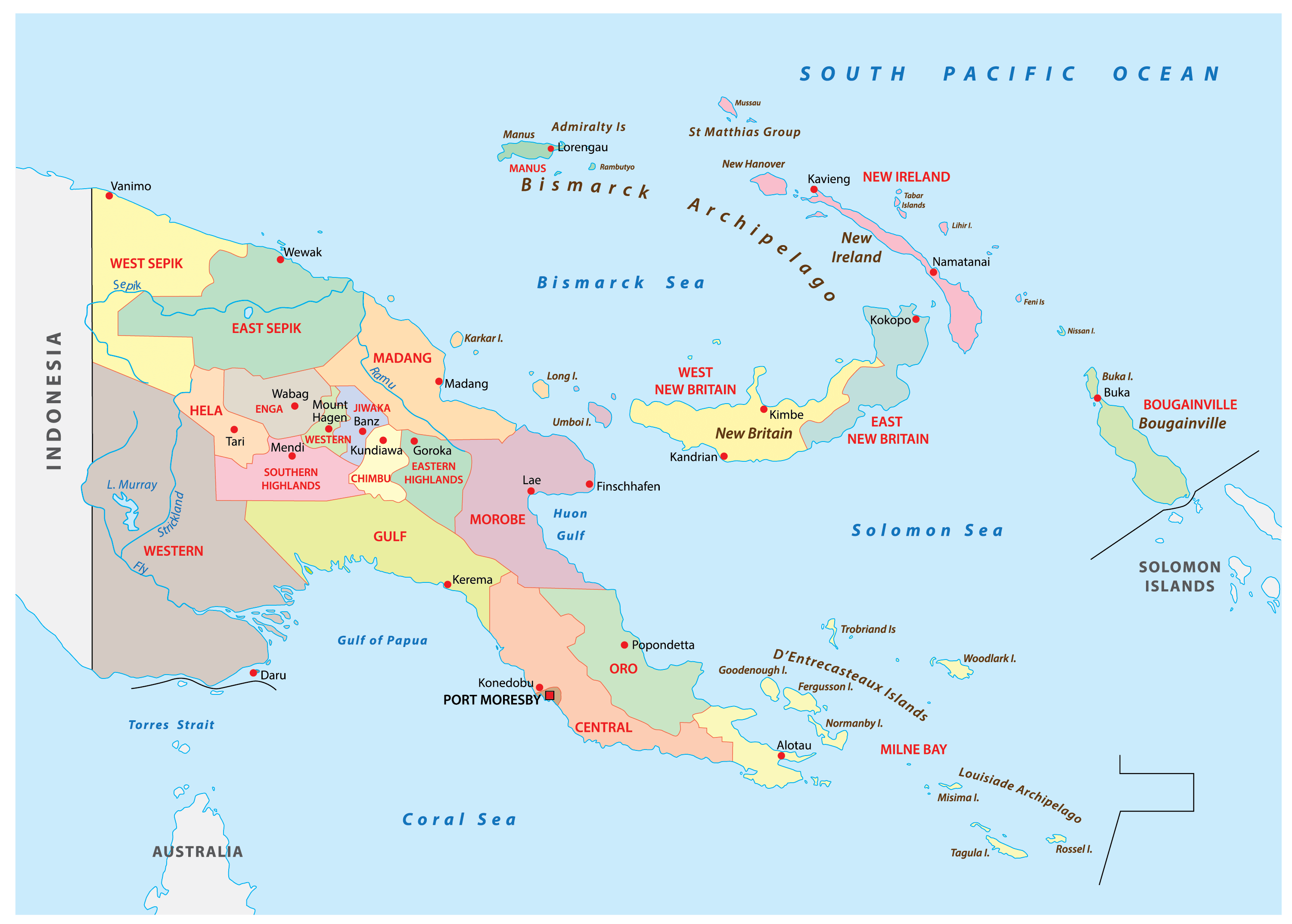
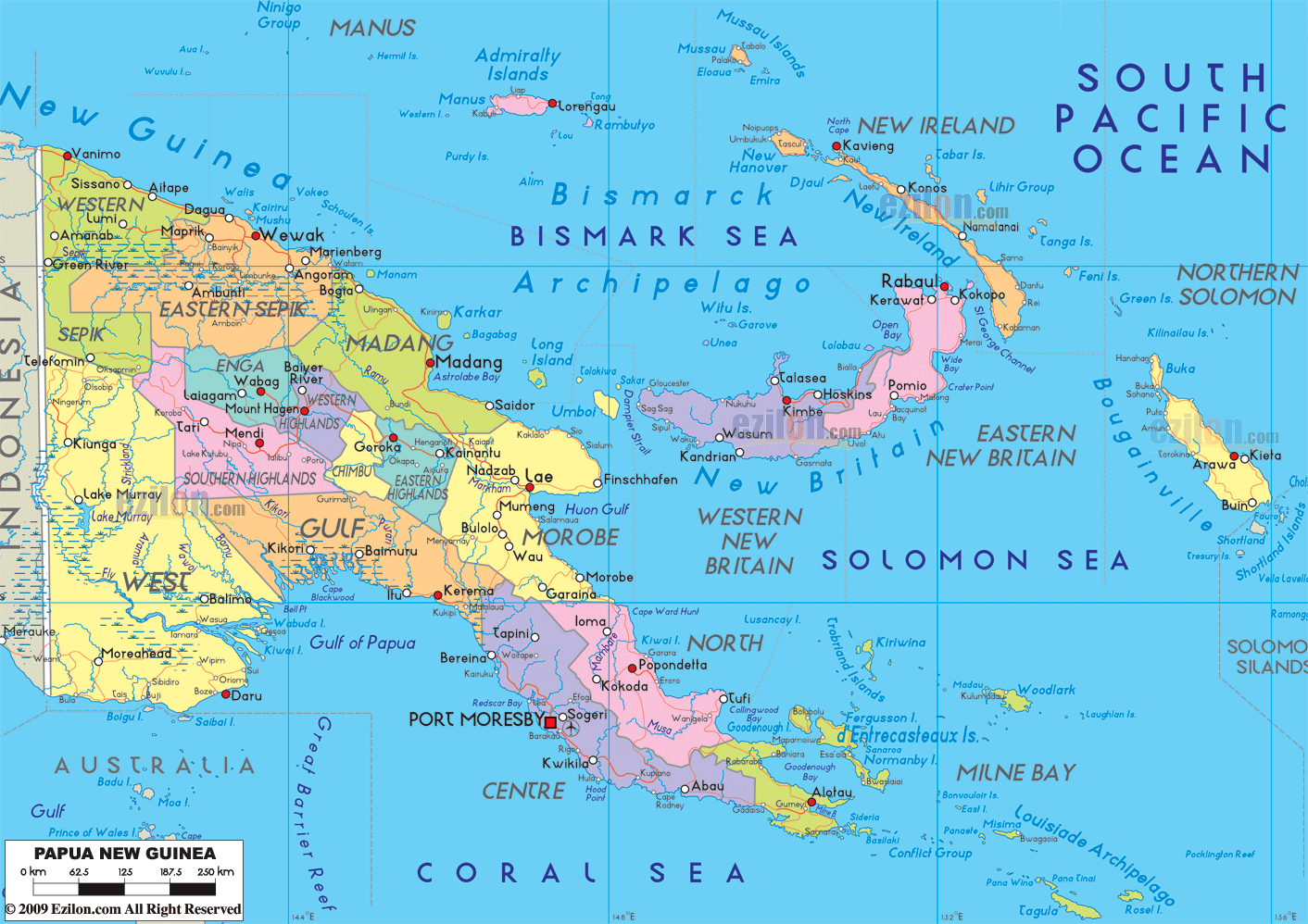
Papua New Guinea (officially, the Independent State of Papua New Guinea) is divided into 20 provinces, Bougainville autonomous region and National Capital District. In alphabetical order, these provinces are: Central, Chimbu, Eastern Highlands, East New Britain, East Sepik, Enga, Gulf, Hela, Jiwaka, Madang, Manus, Milne Bay, Morobe, New Ireland, Northern, Southern Highlands, Western, Western Highlands, West New Britain and West Sepik. Each of these provinces are further divided into one or more districts. These districts are further subdivided into one or more local-level government areas (LLG).
Covering an area of 462,840 sq.km, Papua New Guinea is the world’s 3rd largest island nation and the world’s 54th largest country. Located on the southeastern coast of the island country, along the shores of the Gulf of Papua is, Port Moresby – the capital and the largest city of Papua New Guinea. It is also the largest city in the South Pacific region which is located outside Australia and New Zealand.
Location Maps
Where is Papua New Guinea?
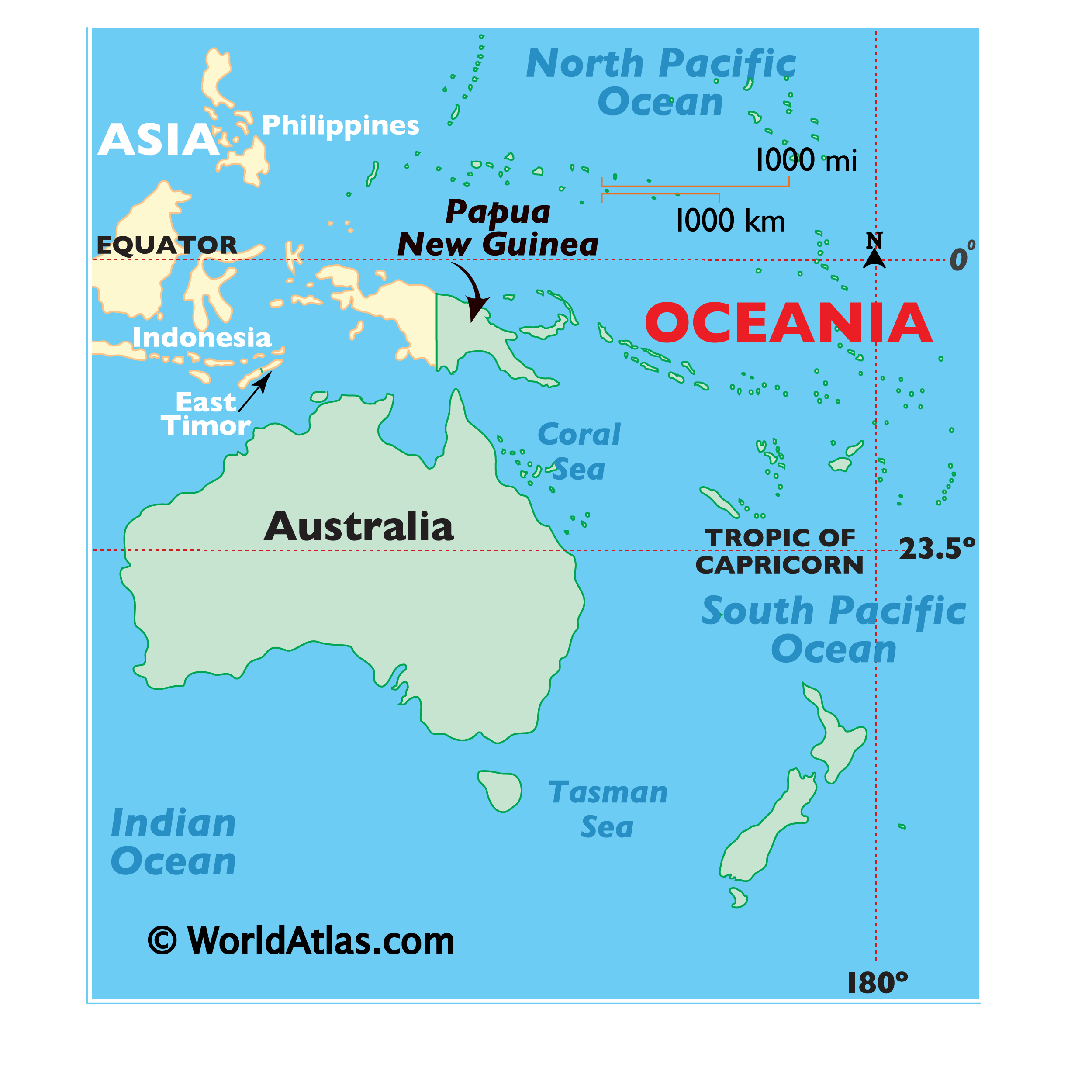
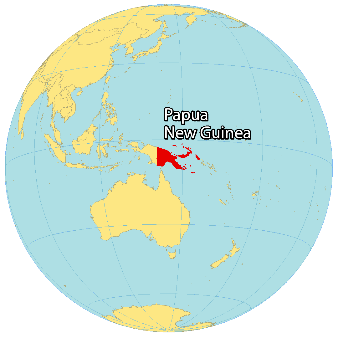
Papua New Guinea is a country in Oceania that consists of the eastern region of New Guinea and its offshore islands in the Pacific Ocean. Altogether, there are over 600 main islands but New Guinea itself contains 85% of its landmass which is split between Indonesia. Further to the east, the Bismarck Sea separates New Britain Island from the Bismarck Archipelago. To its south, the Solomon Sea divides it from the Louisiade Archipelago and the D’Entrecasteaux Islands. The capital and most populous city of Papua New Guinea is Port Moresby located on the mainland within the Gulf of Papua. Other major cities are Lae, Arawa, and Mount Hagen.
High Definition Political Map of Papua New Guinea
Physical Map of Papua New Guinea
Geography
At 462,840 km (178,704 sq mi), Papua New Guinea is the world’s 54th-largest country and the third-largest island country. Papua New Guinea is part of the Australasian realm, which also includes Australia, New Zealand, eastern Indonesia, and several Pacific island groups, including the Solomon Islands and Vanuatu. Including all its islands, it lies between latitudes 0° and 12°S, and longitudes 140° and 160°E. It has an exclusive economic zone of 2,402,288 km (927,529 sq mi). The mainland of the country is the eastern half of New Guinea island, where the largest towns are also located, including Port Moresby (capital) and Lae; other major islands within Papua New Guinea include New Ireland, New Britain, Manus and Bougainville.
Located north of the Australian mainland, the country’s geography is diverse and, in places, extremely rugged. A spine of mountains, the New Guinea Highlands, runs the length of the island of New Guinea, forming a populous highlands region mostly covered with tropical rainforest, and the long Papuan Peninsula, known as the ‘Bird’s Tail’. Dense rainforests can be found in the lowland and coastal areas as well as very large wetland areas surrounding the Sepik and Fly rivers. This terrain has made it difficult for the country to develop transportation infrastructure. This has made it so that air travel is often the most efficient and reliable means of transportation. The highest peak is Mount Wilhelm at 4,509 metres (14,793 ft). Papua New Guinea is surrounded by coral reefs which are under close watch, in the interests of preservation. Papua New Guinea’s largest rivers are in New Guinea and include Sepik, Ramu, Markham, Musa, Purari, Kikori, Turama, Wawoi and Fly.
The country is situated on the Pacific Ring of Fire, at the point of collision of several tectonic plates. Geologically, the island of New Guinea is a northern extension of the Indo-Australian tectonic plate, forming part of a single land mass which is Australia-New Guinea (also called Sahul or Meganesia). It is connected to the Australian segment by a shallow continental shelf across the Torres Strait, which in former ages lay exposed as a land bridge, particularly during ice ages when sea levels were lower than at present. As the Indo-Australian Plate (which includes landmasses of India, Australia, and the Indian Ocean floor in between) drifts north, it collides with the Eurasian Plate. The collision of the two plates pushed up the Himalayas, the Indonesian islands, and New Guinea’s Central Range. The Central Range is much younger and higher than the mountains of Australia, so high that it is home to rare equatorial glaciers.
There are several active volcanoes, and eruptions are frequent. Earthquakes are relatively common, sometimes accompanied by tsunamis. On 25 February 2018, an earthquake of magnitude 7.5 and depth of 35 kilometres struck the middle of Papua New Guinea. The worst of the damage was centred around the Southern Highlands region. Papua New Guinea is one of the few regions close to the equator that experience snowfall, which occurs in the most elevated parts of the mainland.
The border between Papua New Guinea and Indonesia was confirmed by treaty with Australia before independence in 1974. The land border comprises a segment of the 141° E meridian from the north coast southwards to where it meets the Fly River flowing east, then a short curve of the river’s thalweg to where it meets the 141°01’10” E meridian flowing west, then southwards to the south coast. The 141° E meridian formed the entire eastern boundary of Dutch New Guinea according to its 1828 annexation proclamation. By the Treaty of The Hague (1895) the Dutch and British agreed to a territorial exchange, bringing the entire left bank of the Fly River into British New Guinea and moving the southern border east to the Torasi Estuary. The maritime boundary with Australia was confirmed by a treaty in 1978. In the Torres Strait it runs close to the mainland of New Guinea, keeping the adjacent North Western Torres Strait Islands (Dauan, Boigu and Saibai) under Australian sovereignty. Maritime boundaries with the Solomon Islands were confirmed by a 1989 treaty.
Biodiversity
Many species of birds and mammals found on New Guinea have close genetic links with corresponding species found in Australia. One notable feature in common for the two landmasses is the existence of several species of marsupial mammals, including some kangaroos and possums, which are not found elsewhere. Papua New Guinea is a megadiverse country.
Many of the other islands within PNG territory, including New Britain, New Ireland, Bougainville, the Admiralty Islands, the Trobriand Islands, and the Louisiade Archipelago, were never linked to New Guinea by land bridges. As a consequence, they have their own flora and fauna; in particular, they lack many of the land mammals and flightless birds that are common to New Guinea and Australia.
Australia and New Guinea are portions of the ancient supercontinent of Gondwana, which started to break into smaller continents in the Cretaceous period, 65–130 million years ago. Australia finally broke free from Antarctica about 45 million years ago. All the Australasian lands are home to the Antarctic flora, descended from the flora of southern Gondwana, including the coniferous podocarps and Araucaria pines, and the broad-leafed southern beech (Nothofagus). These plant families are still present in Papua New Guinea. New Guinea is part of the humid tropics, and many Indomalayan rainforest plants spread across the narrow straits from Asia, mixing together with the old Australian and Antarctic floras. New Guinea has been identified as the world’s most floristically diverse island in the world, with 13,634 known species of vascular plants.
Papua New Guinea includes a number of terrestrial ecoregions:
- Admiralty Islands lowland rain forests – forested islands to the north of the mainland, home to a distinct flora.
- Central Range montane rain forests Green tropical rainforest of Papua New Guinea bears a sharp contrast to nearby arid Australia.
- Huon Peninsula montane rain forests
- Louisiade Archipelago rain forests
- New Britain-New Ireland lowland rain forests
- New Britain-New Ireland montane rain forests
- New Guinea mangroves
- Northern New Guinea lowland rain and freshwater swamp forests
- Northern New Guinea montane rain forests
- Solomon Islands rain forests (includes Bougainville Island and Buka)
- Southeastern Papuan rain forests
- Southern New Guinea freshwater swamp forests
- Southern New Guinea lowland rain forests
- Trobriand Islands rain forests
- Trans-Fly savanna and grasslands
- Central Range sub-alpine grasslands
Three new species of mammals were discovered in the forests of Papua New Guinea by an Australian-led expedition in the early 2010s. A small wallaby, a large-eared mouse and shrew-like marsupial were discovered. The expedition was also successful in capturing photographs and video footage of some other rare animals such as the Tenkile tree kangaroo and the Weimang tree kangaroo. Nearly one quarter of Papua New Guinea’s rainforests were damaged or destroyed between 1972 and 2002. Papua New Guinea had a Forest Landscape Integrity Index mean score of 8.84/10, ranking it 17th globally out of 172 countries. Mangrove swamps stretch along the coast, and in the inland it is inhabited by nipa palm (Nypa fruticans), and deeper in the inland the sago palm tree inhabits areas in the valleys of larger rivers. Trees such as oaks, red cedars, pines, and beeches are becoming predominant in the uplands above 3,300 feet. Papua New Guinea is rich in various species of reptiles, indigenous freshwater fish and birds, but it is almost devoid of large mammals.
Climate
The climate on the island is essentially tropical, but it varies by region. The maximum mean temperature in the lowlands is 30 to 32 °C, and the minimum 23–24 °C. In the highlands above 2100 meters, colder conditions prevail and night frosts are common there, while the daytime temperature exceeds 22 °C, regardless of the season.
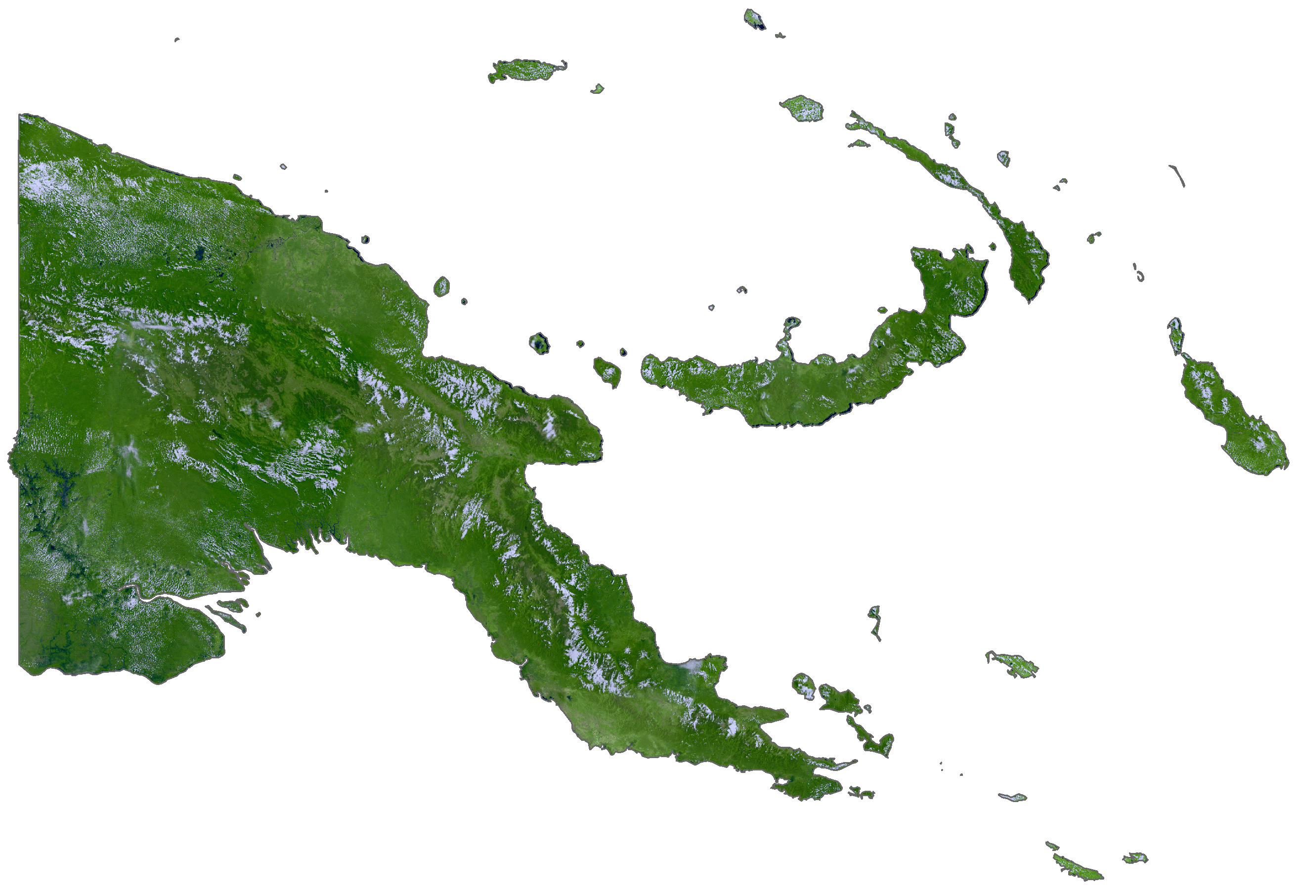
Papua New Guinea Satellite Map
Elevation Map