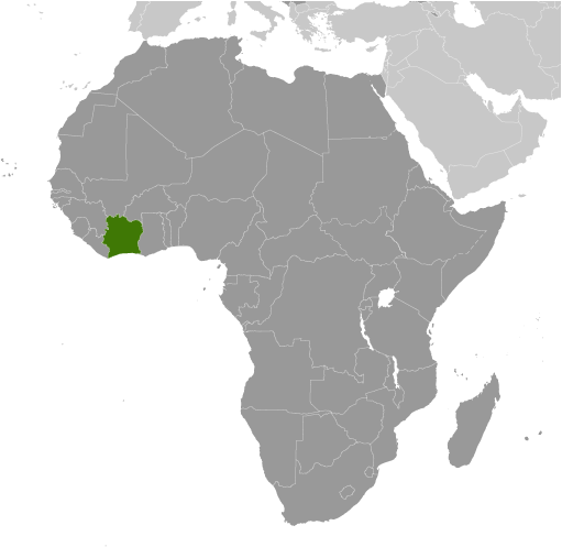
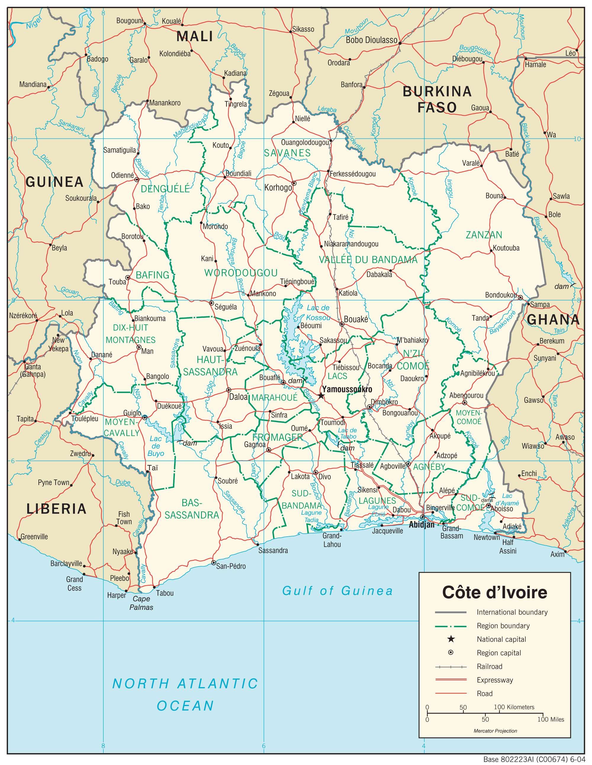
The Ivory Coast or Côte d’Ivoire is a country in West Africa covering an area of 322,463 sq. km.
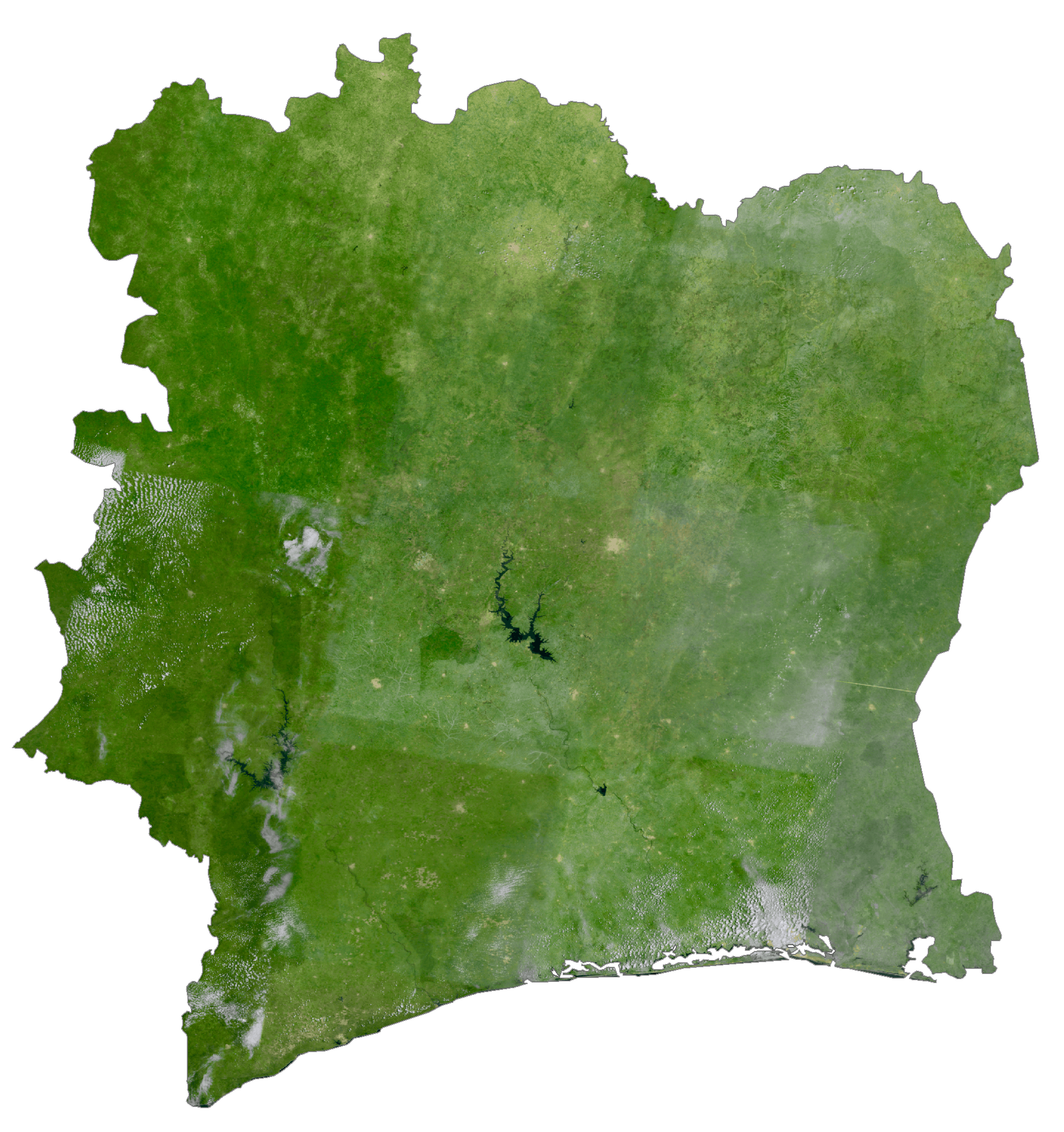
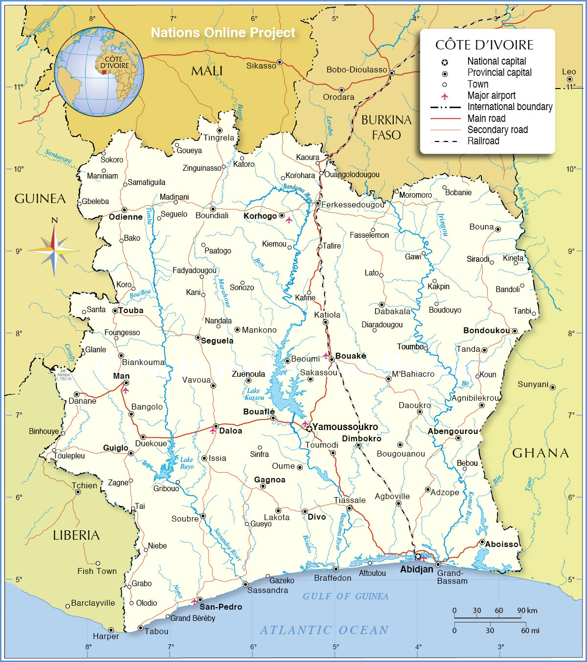
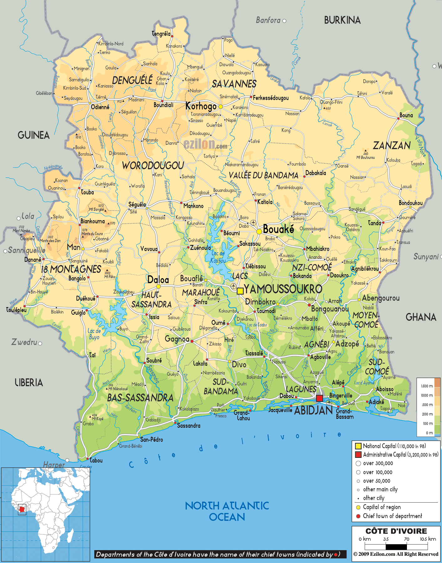
Most of Cote d’Ivoire (north to south) is a forested plateau, one that gradually slopes down to the Atlantic Ocean coastal areas. Exceptions are the edges of the Guinea Highlands (4000 – 5000 ft. peaks) on its western border with Guinea, in the far northwest, and the elevated savanna and forest of the northeast.
The coast of the country is about 64 km wide and is dotted with lagoons to the east. A long submarine sandbar just offshore of the coast makes the sea difficult to access.
Extending across the middle of the country is the Guinean forest-savanna mosaic, a transition zone between the coastal forests and interior savannas.
Marked on the map with a yellow upright triangle, the highest point of Cote d’Ivoire is Mount Nimba at 1,752 m. It is located on its western highland region in the Mount Nimba Strict Nature Reserve. It is a UNESCO World Heritage Site.
The lowest point is the Gulf of Guinea (0 m).
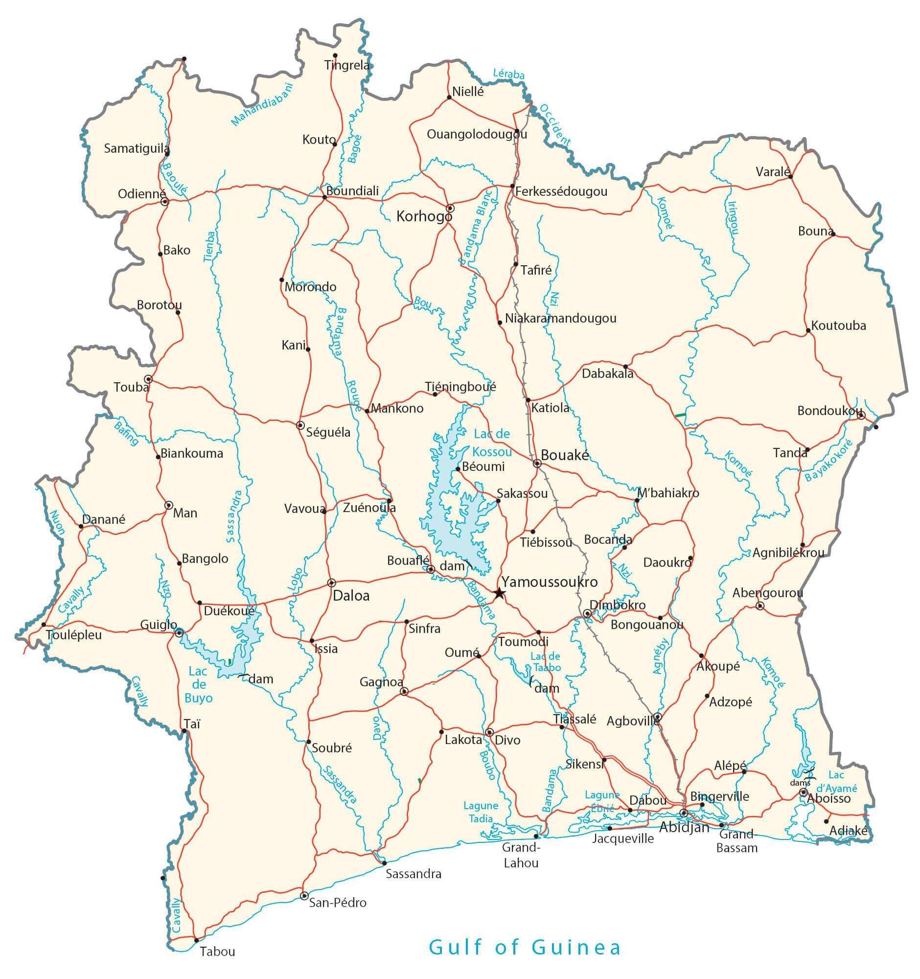
Major rivers, including the Bandama, Komoe and Sassandra, drain the plateau and enter the Gulf of Guinea. These rivers are not easy to navigate due to the presence of numerous waterfalls and rapids. Large lakes include Loc de Buya and Loc de Kossou and are marked on the map above.
| Flag: |  |
|---|---|
| Legal Name: | Republic of Cote d’Ivoire |
| Capital Value: | Yamoussoukro (legislative capital), Abidjan (administrative capital); note – although Yamoussoukro has been the official capital since 1983, Abidjan remains the administrative capital as well as the officially designated economic capital; the US, like oth |
| Official languages: | French |
| Demonym(s): |
|
| Government: | Unitary presidential republic |
| Legislature: | Parliament of Ivory Coast |
| Total Area: | 322,463 km² |
| Land Area: | 318,003 km² |
| Water Area: | 4,460 km² |
| Population: | 25,716,544 |
| Density: | 91.1/km (235.9/sq mi) (139th) |
| GDP: | $58.79 Billion |
| GDP Per Capita: | $2,286.16 |
| Currency Value: | Communaute Financiere Africaine francs (XOF) |
| Driving side: | right |
| Calling code: | +225 |
| Internet TLD: | .ci |
Explore the geography of the Ivory Coast with this interactive map. Discover the major cities, rivers, and lakes of this West African nation, as well as the highest peak, Mount Nimba.
Ivory Coast is a West African nation bordered by Ghana, Burkina Faso, Mali, Guinea, and Liberia. The country is renowned for its lush tropical forests and its many national parks.
This interactive map of Ivory Coast gives you an overview of the country’s geography. From the capital, Yamoussoukro, to the largest city, Abidjan, and the highest peak, Mount Nimba, you’ll be able to explore the country’s major cities, rivers, and lakes.
Online Interactive Political Map
Click on ![]() to view map in "full screen" mode.
to view map in "full screen" mode.
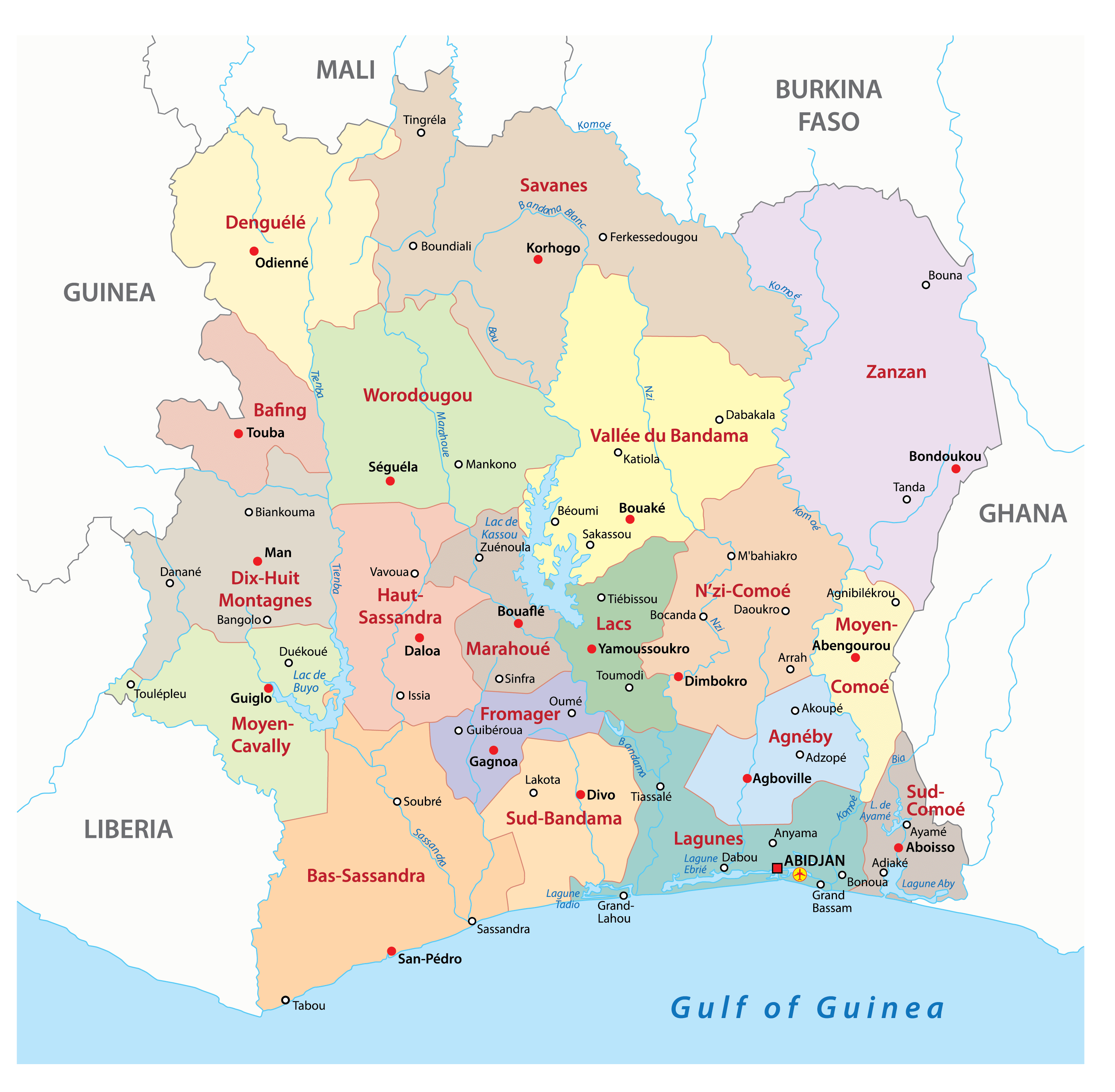
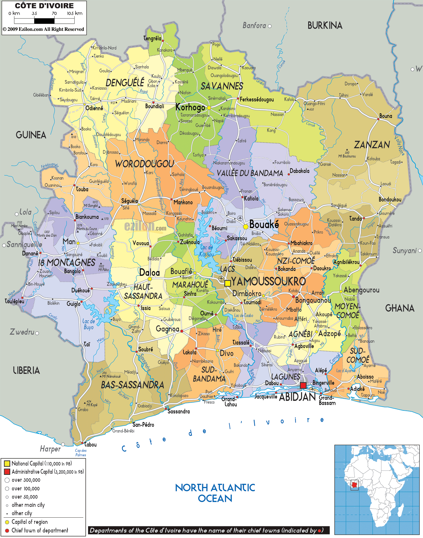
Ivory Coast has 14 districts including two cities designated as autonomous districts. The 12 non-city districts are Bas-Sassandra, Comoe, Denguele, Goh-Djiboua, Lacs, Lagunes, Montagnes, Sassandra-Marahoue, Savanes, Vallee du Bandama, Woroba, and, Zanzan. The two cities that are autonomous districts are Abidjan and Yamoussoukro. The districts are further divided into 31 regions which are divided into 108 departments and then sub-prefectures. Abidjan is the capital city of Ivory Coast.
Location Maps
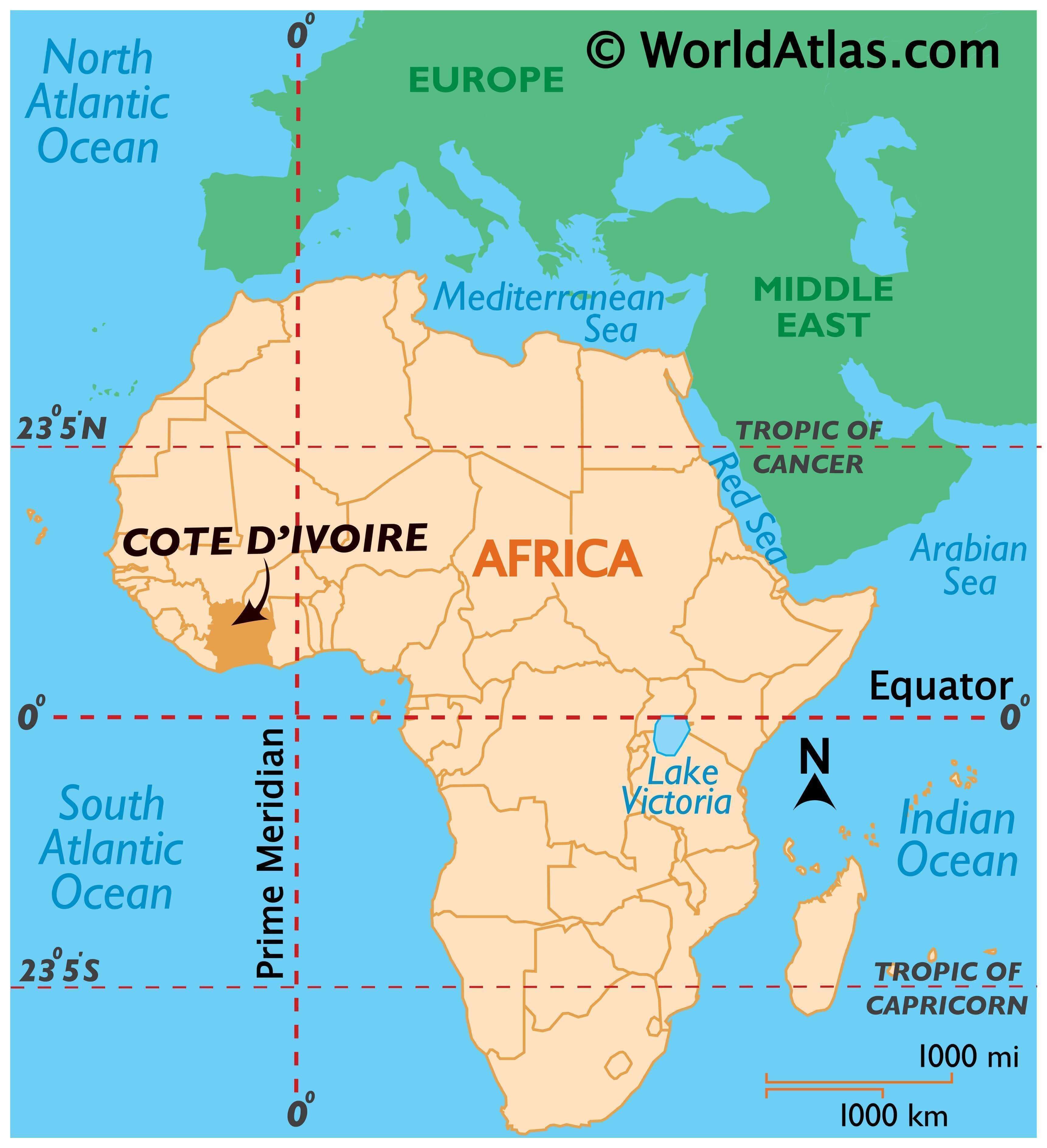
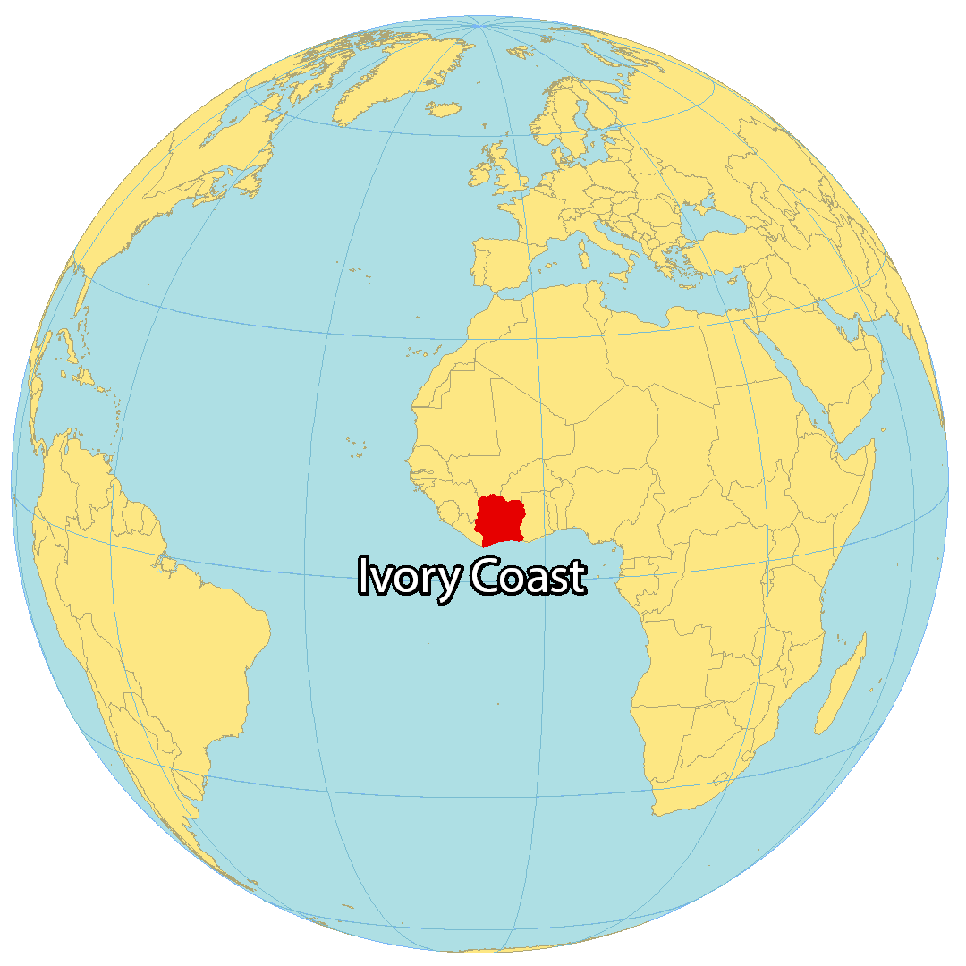
Where is Ivory Coast?
Ivory Coast is located in western Africa, along the Gulf of Guinea. It borders five other African countries, including Liberia and Guinea to the west, Mali and Burkina Faso to the north, and Ghana to the east. Despite its years of civil war, Ivory Coast has a relatively higher level of income. French is the official language, but there are over 75 different spoken languages in the country. Yamoussoukro is the capital city, while Abidjan is the largest city.
High Definition Political Map of Ivory Coast
Physical Map of Ivory Coast
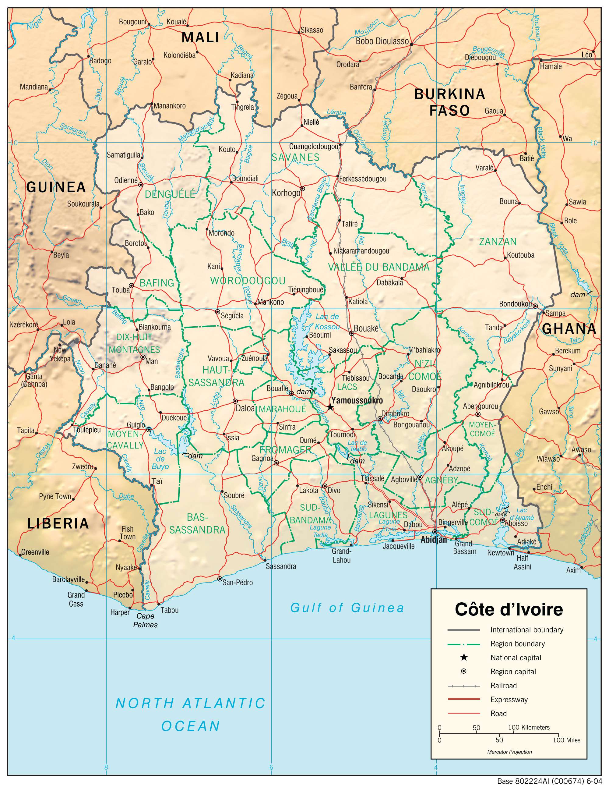

Transportation Map of Ivory Coast
Ivory Coast Satellite Map