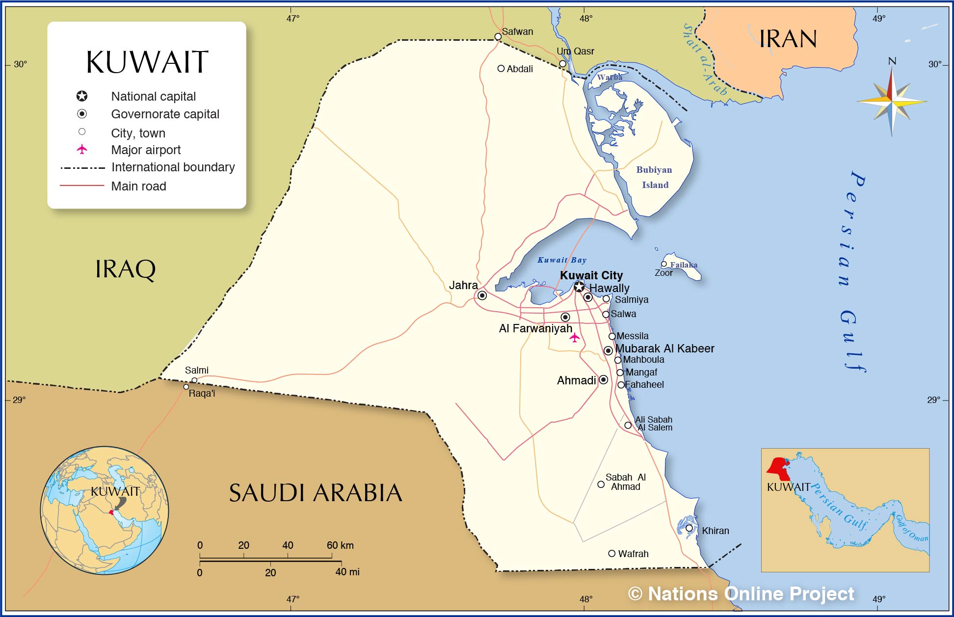
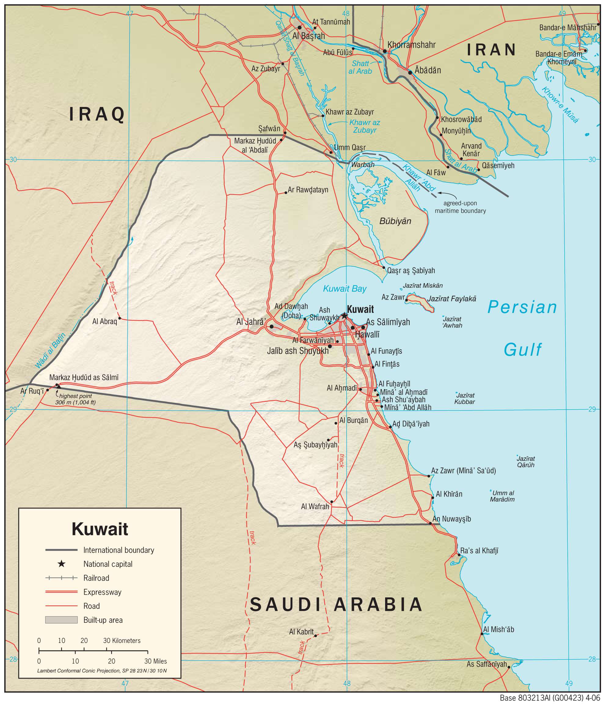
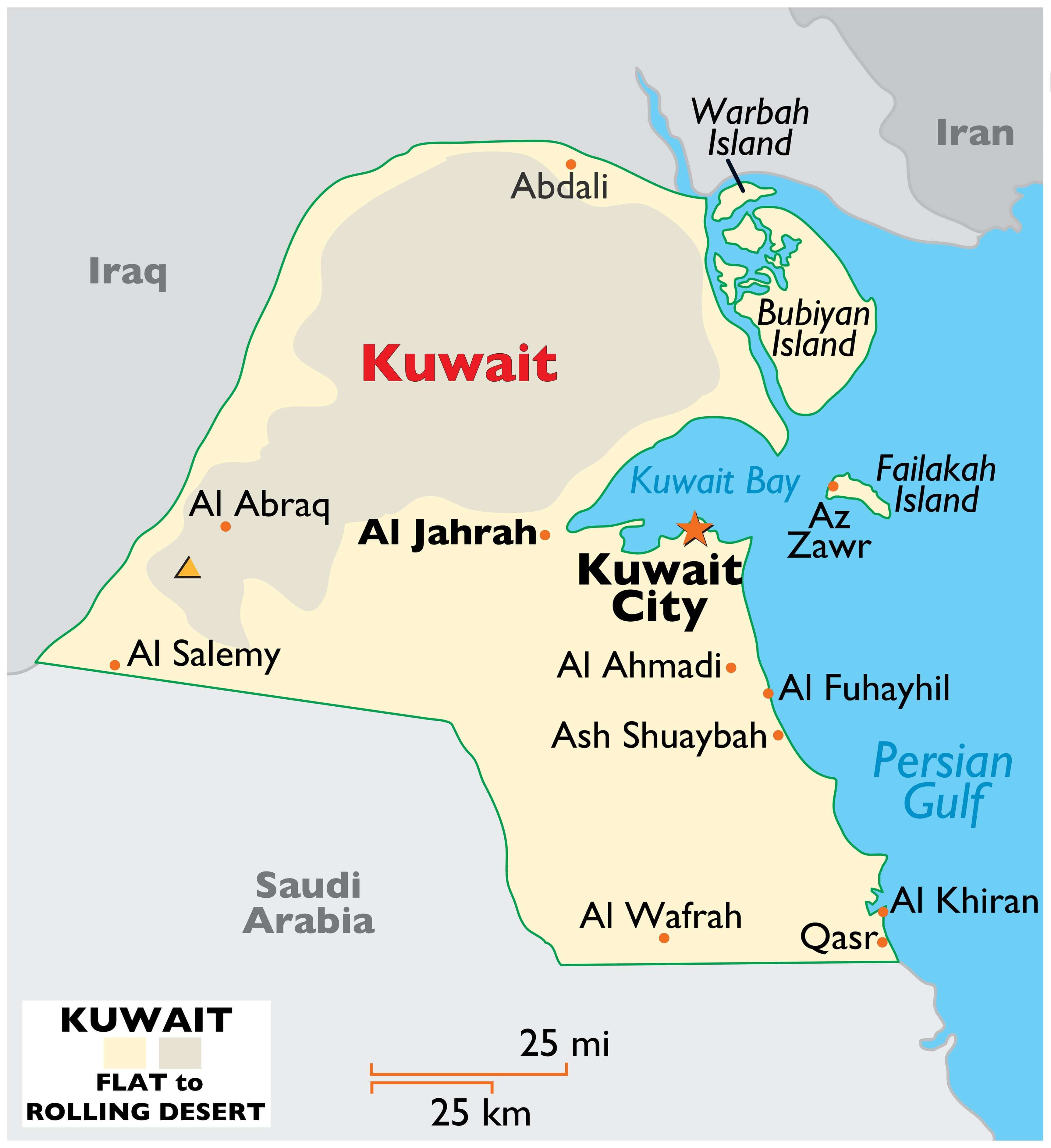
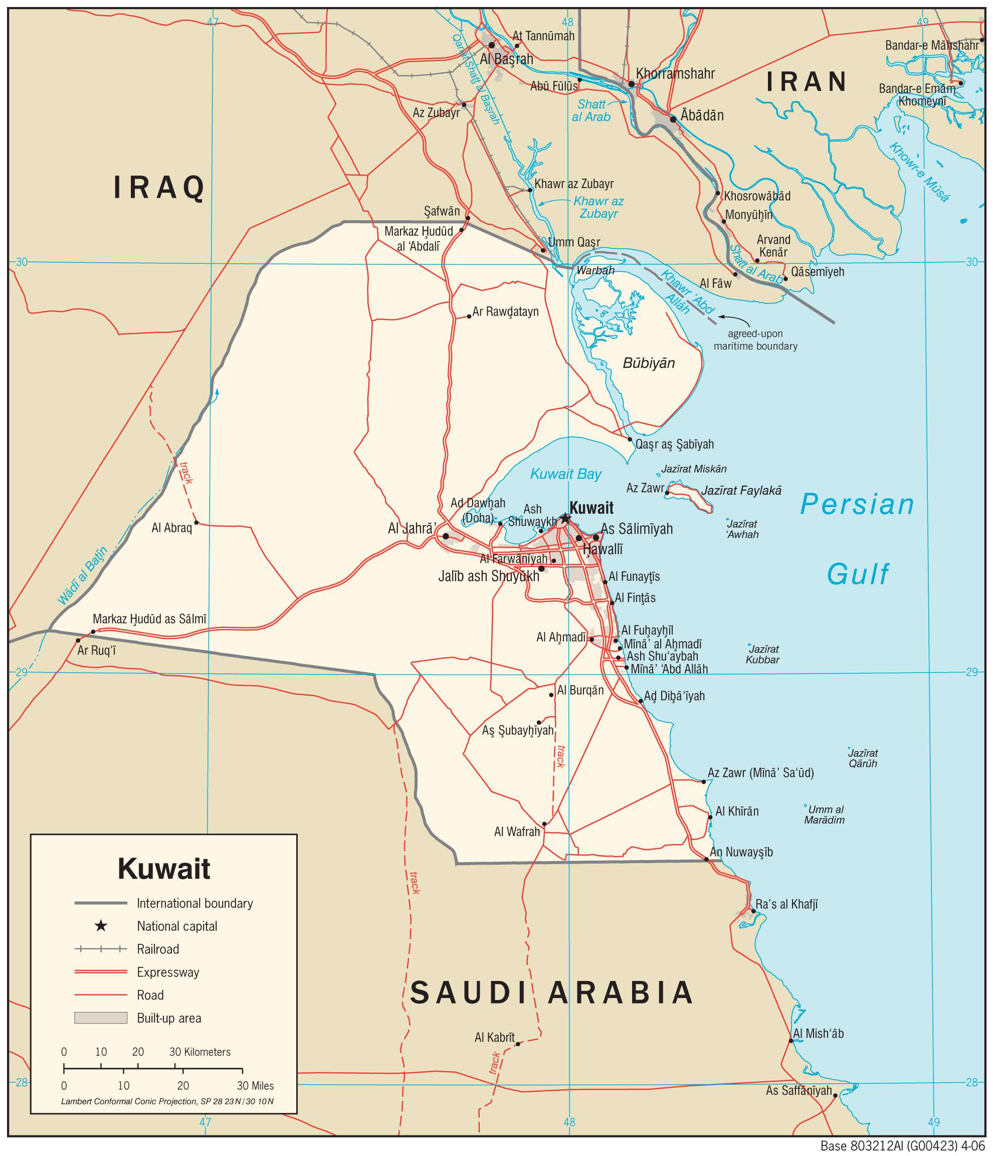
Kuwait occupies an area of 17,818 sq. km on the Arabian Peninsula at the head of the Persian Gulf.
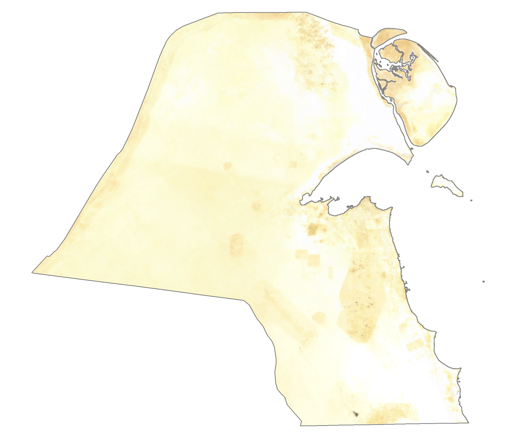
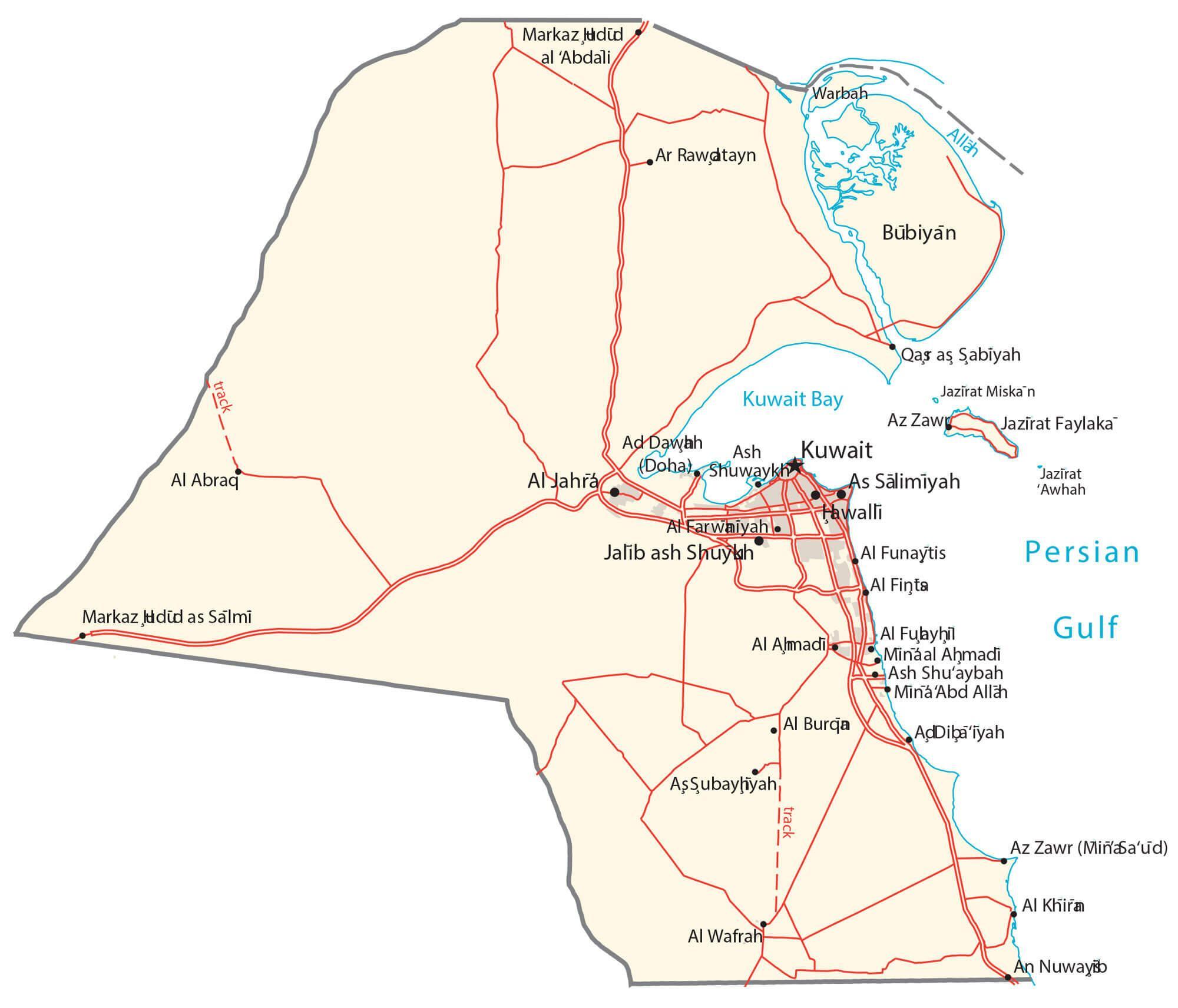
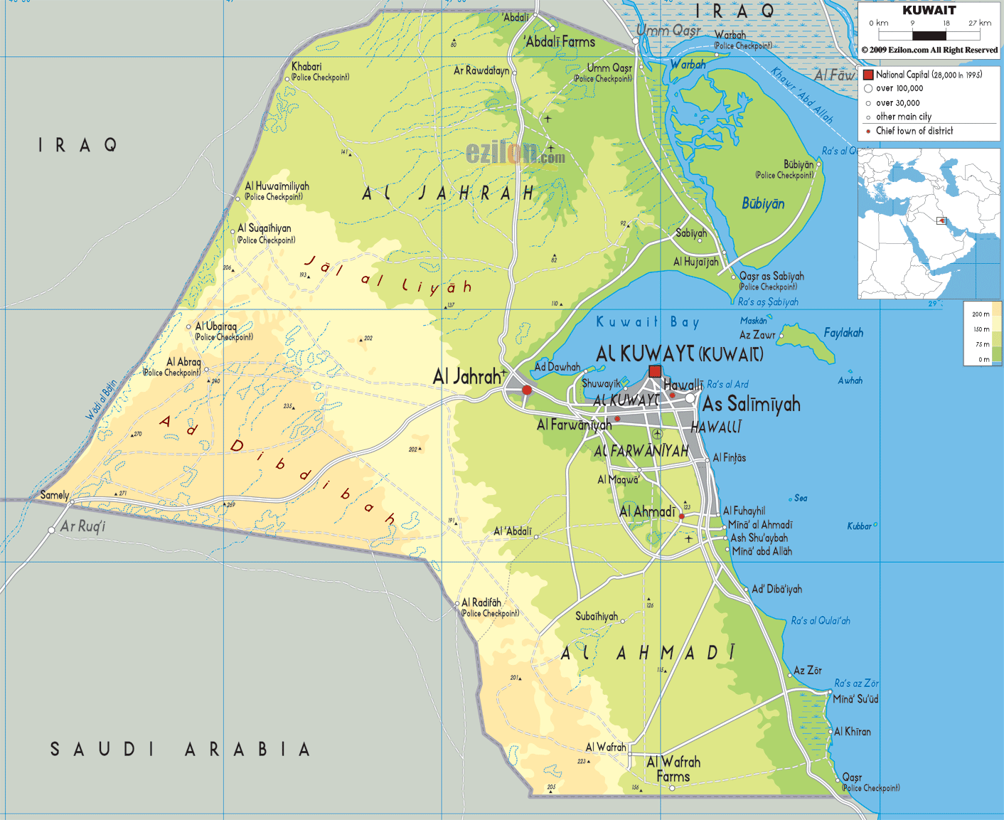
As observed on the physical map of Kuwait above, the country also has several islands like Warbah, Bubiyan, and Failakah Islands.
Marked on the map is the Kuwait Bay which a major geographic feature in the country. It covers nearly 50% of the country’s shoreline and shelters the port of Kuwait.
Most of Kuwait is an entirely flat and dry barren desert of sandy plains broken by occasional shallow depressions and low hills. The land (desert) begins to rise slightly in the southwest, along the border with Saudi Arabia.
The country’s highest point is an unnamed hill that peaks at 1,003 ft. (306 m). The yellow upright triangle on the map represents this point.
There are no perennial lakes or rivers. Instead, there are wadis or transient watercourses that end in inland basins.
The lowest point in the country is the Persian Gulf at 0 m.
| Flag: |  |
|---|---|
| Legal Name: | State of Kuwait |
| Capital Value: | Kuwait City |
| Largest City: |
Al Kuwayt (Kuwait City) (3,114,553) |
| Official languages: | Arabic |
| Demonym(s): | Kuwaiti |
| Government: | Unitary parliamentary semi-constitutional monarchy |
| Legislature: | National Assembly |
| Total Area: | 17,818 km² |
| Land Area: | 17,818 km² |
| Population: | 4,207,083 |
| Density: | 200.2/km (518.5/sq mi) (62st) |
| GDP: | $134.76 Billion |
| GDP Per Capita: | $32,031.98 |
| Currency Value: | Kuwaiti dinars (KD) |
| Driving side: | right |
| Calling code: | +965 |
| Internet TLD: | .kw |
Explore the stunning beauty of Kuwait with this interactive map! Discover the country’s diverse geography, from its vast sand dunes and desert landscape to its proximity to the Persian Gulf. Trace the roads and towns that make up the major cities, and take in the lakes and rivers that add to the beauty of the nation. Get a deeper understanding of Kuwait and its geography with this map!
Online Interactive Political Map
Click on ![]() to view map in "full screen" mode.
to view map in "full screen" mode.
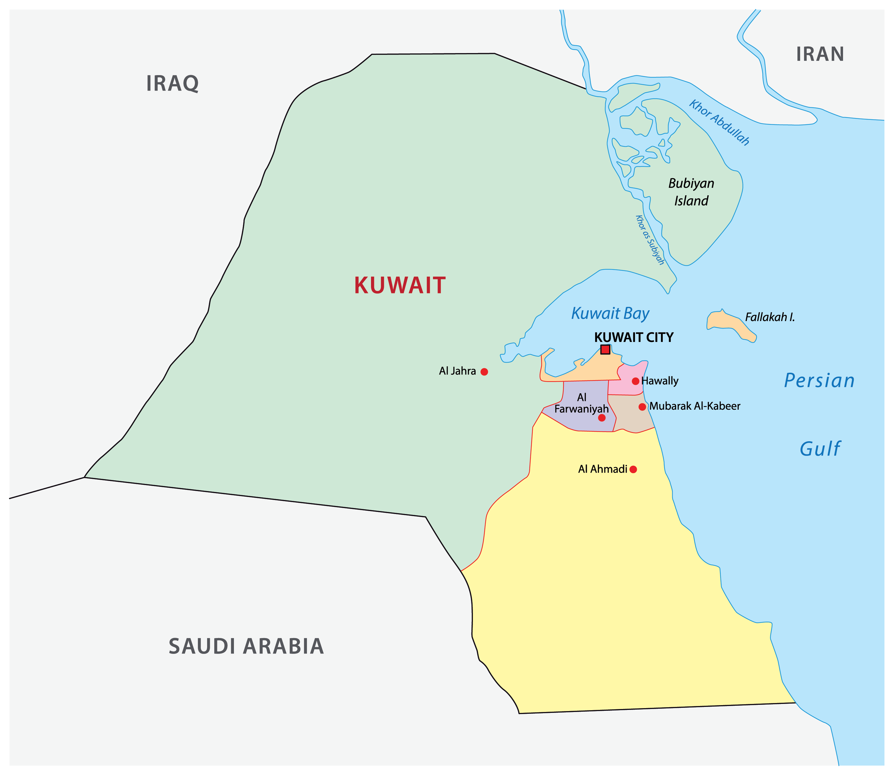
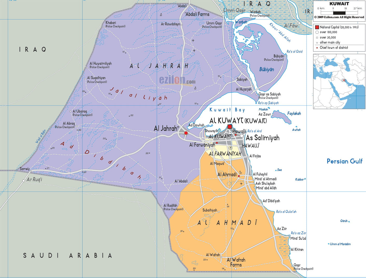
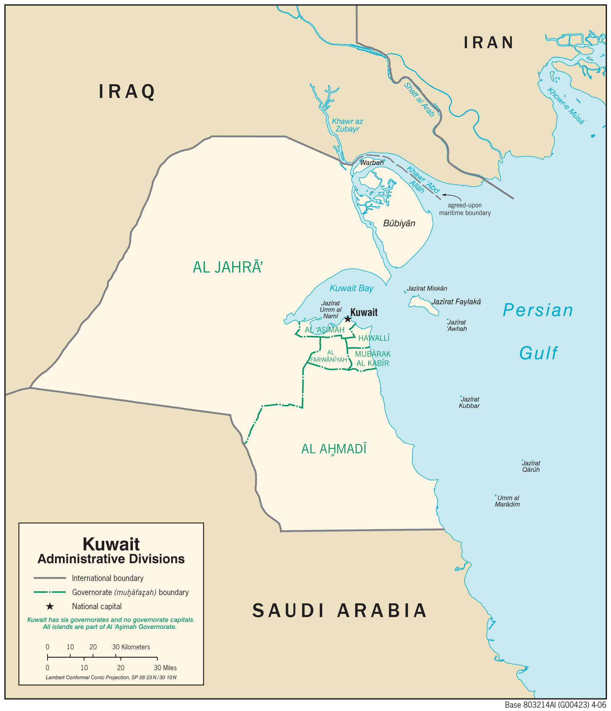
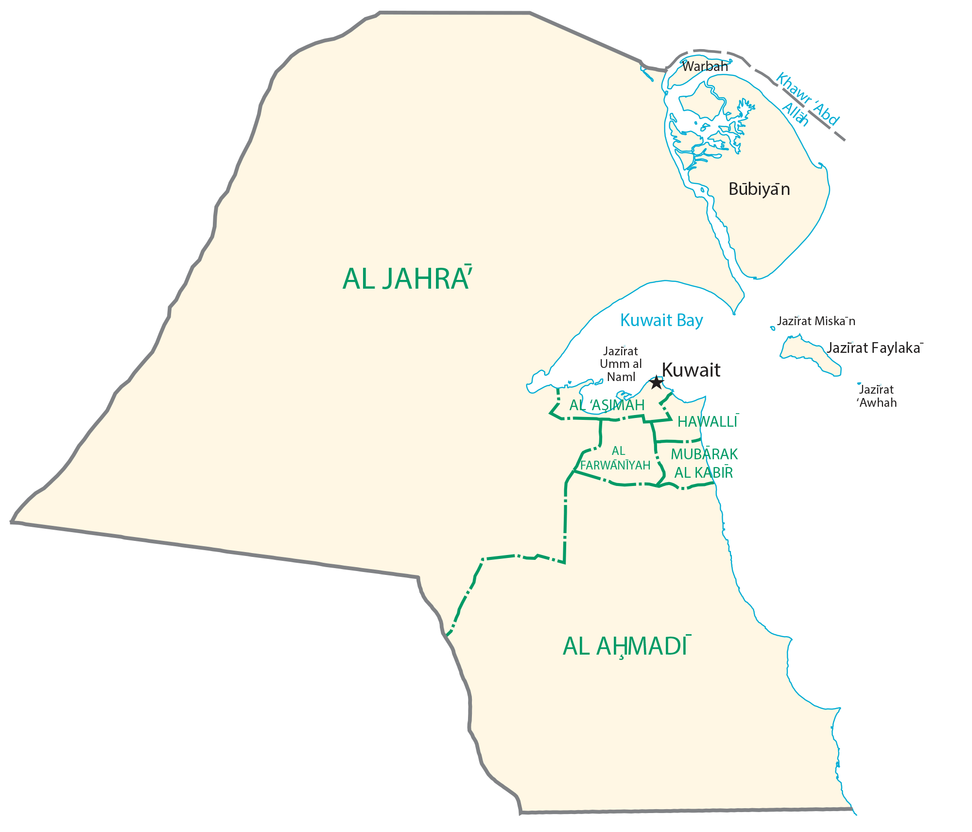
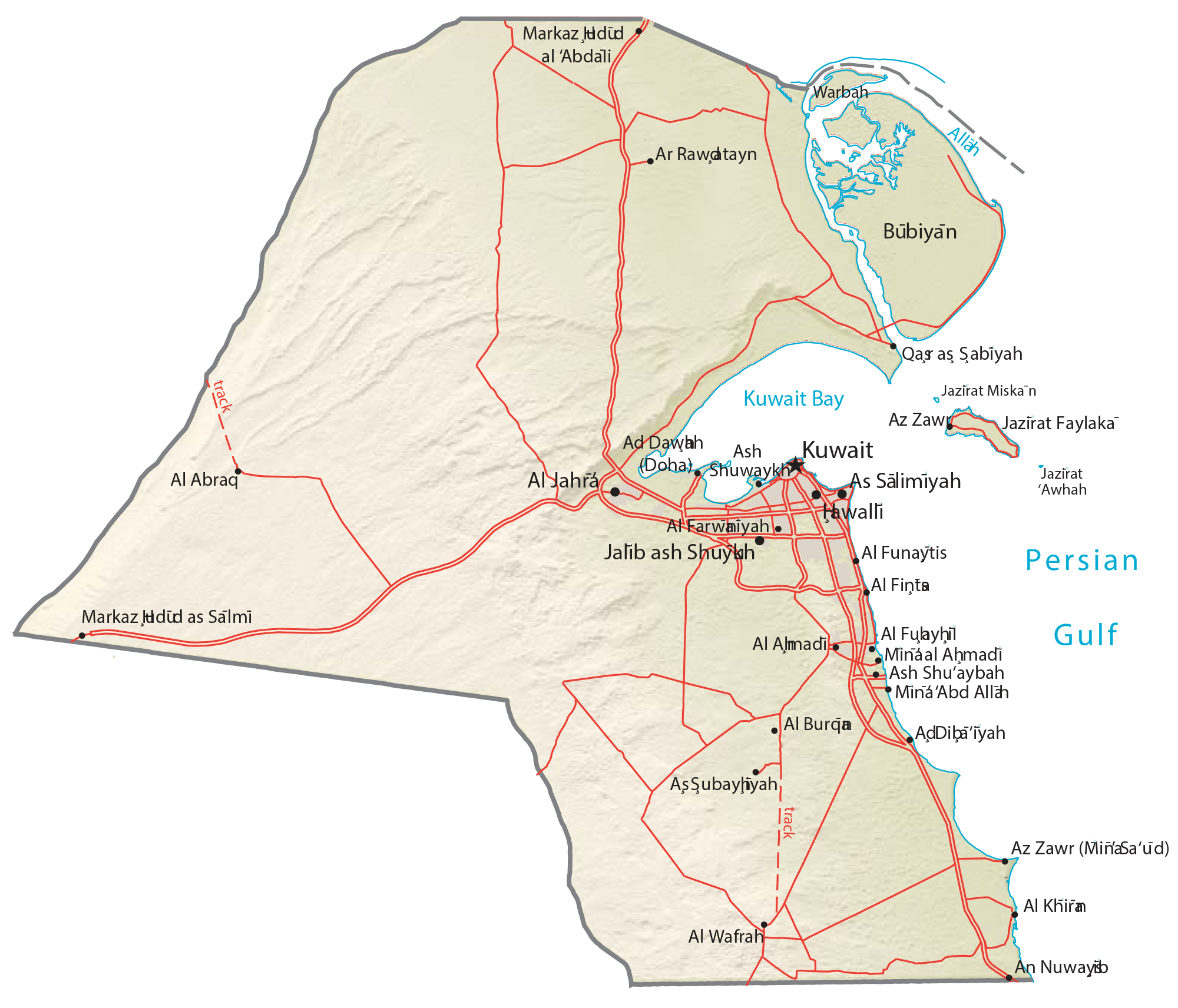
Kuwait (officially, the State of Kuwait) is divided into 6 governorates. In alphabetical order, these governorates are: Ahmadi, Al Asimah, Farwaniya, Hawalli, Mubarak Al-Kabeer and Jahra. These governorates are further subdivided into areas.
With an area of 17,818 sq. km, Kuwait is one of the smallest countries in the world. Kuwait City is the capital and largest city of Kuwait. It is located at the heart of the country on the southern shores of Kuwait Bay on the Persian Gulf. Kuwait City is the country’s political, cultural and economic center.
Location Maps
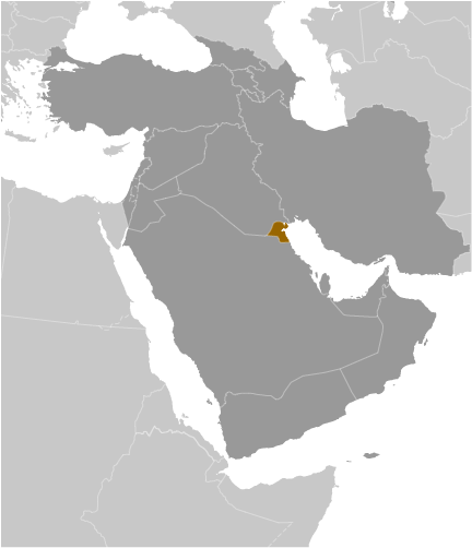
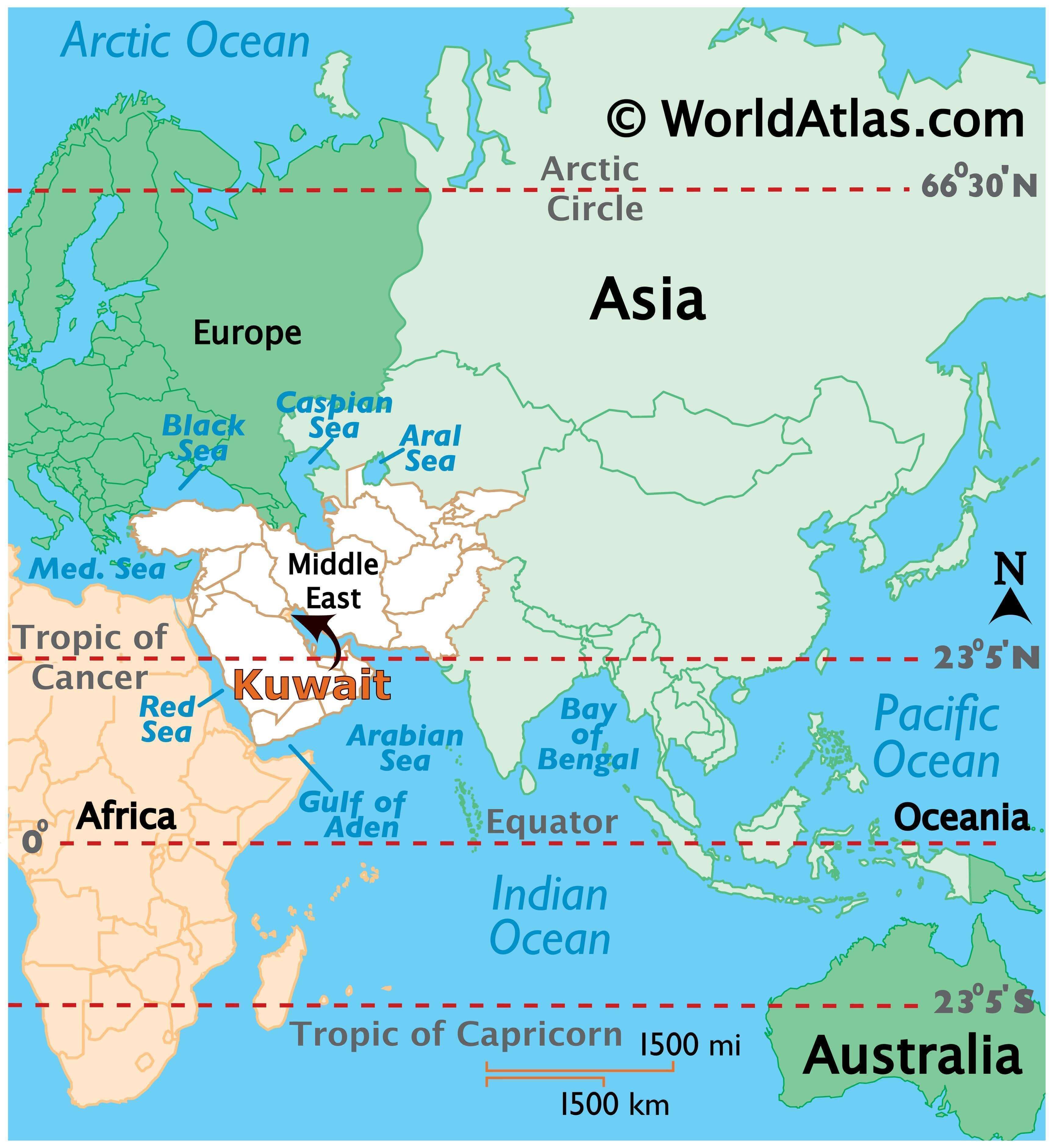
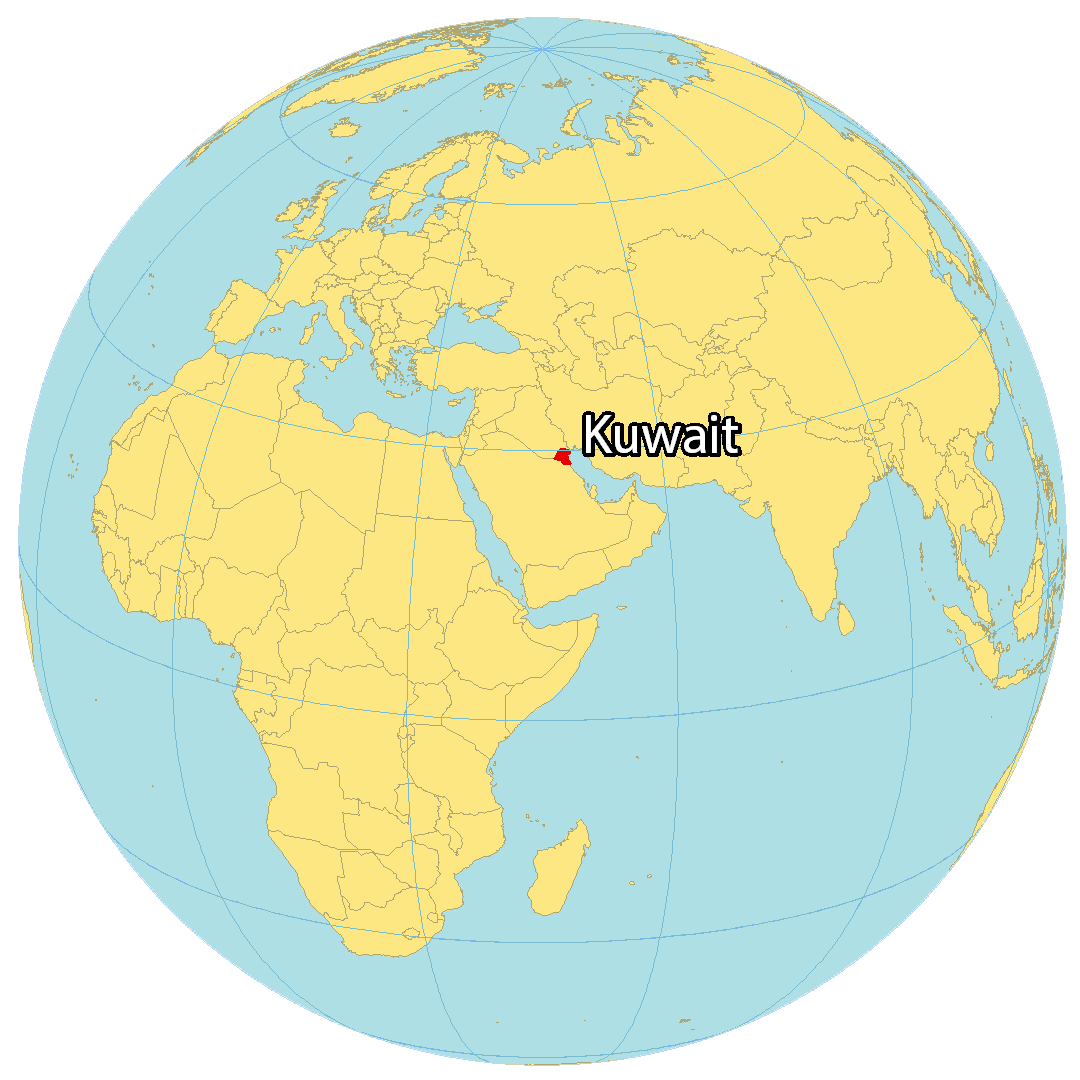
Where is Kuwait?
Kuwait is situated in the Middle East, along the Persian Gulf. It shares borders with two countries; Iraq in the north and Saudi Arabia in the south. Kuwait’s coastline is 500 kilometers (310 mi) long.
Kuwait is renowned for its dry desert climate and the abundance of oil production and exports, which makes it one of the wealthiest countries in the world. The capital and largest city is Kuwait City, but Al Ahmadi, Hawalli, and As Salimiyah are other significant populated places. Kuwait is home to nine islands, including Bubiyan, Warbah Island, and Failaka Islands.
High Definition Political Map of Kuwait
Kuwait Administrative Map
Physical Map of Kuwait
Transportation Map of Kuwait
Kuwait Satellite Map