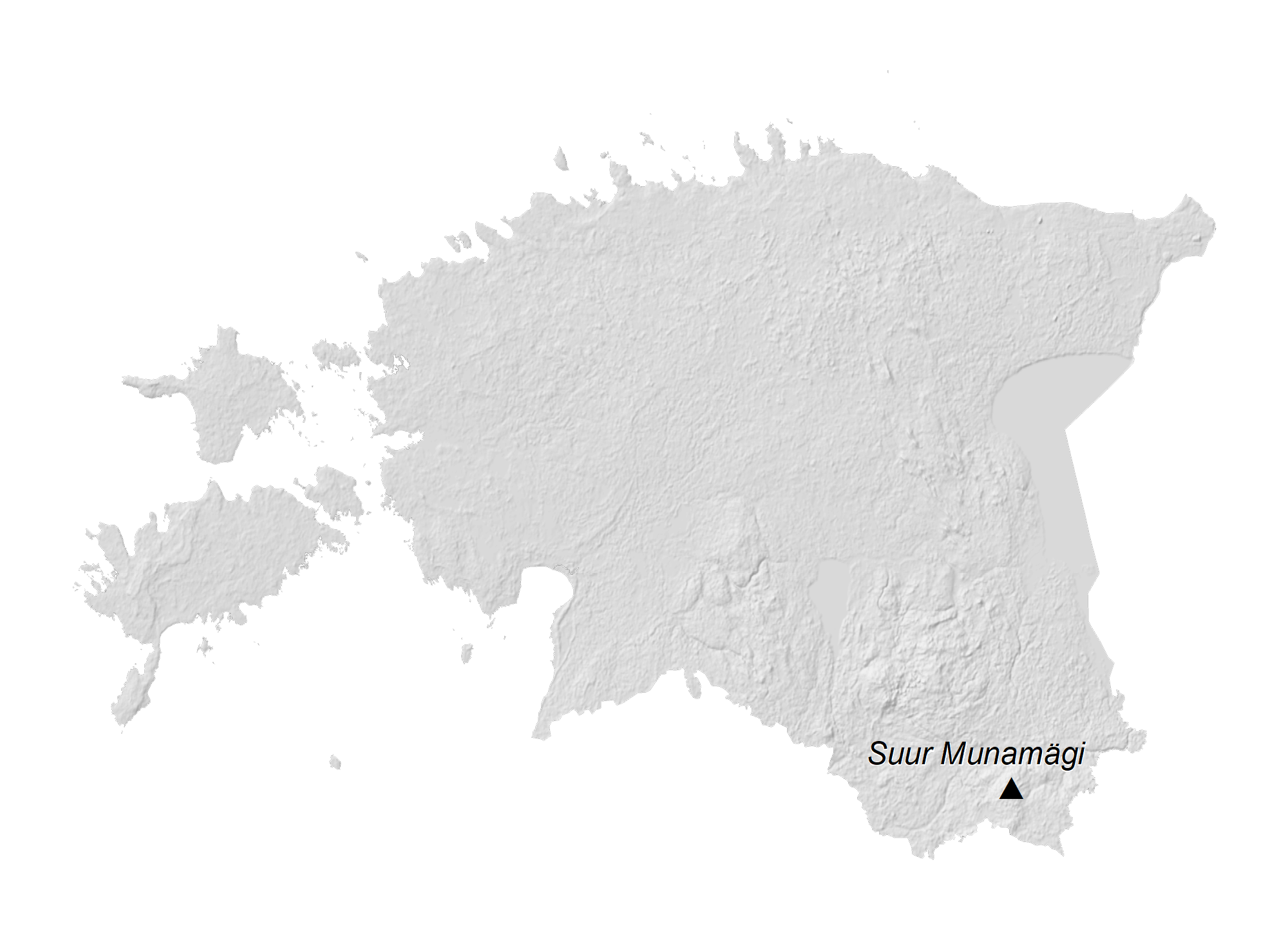
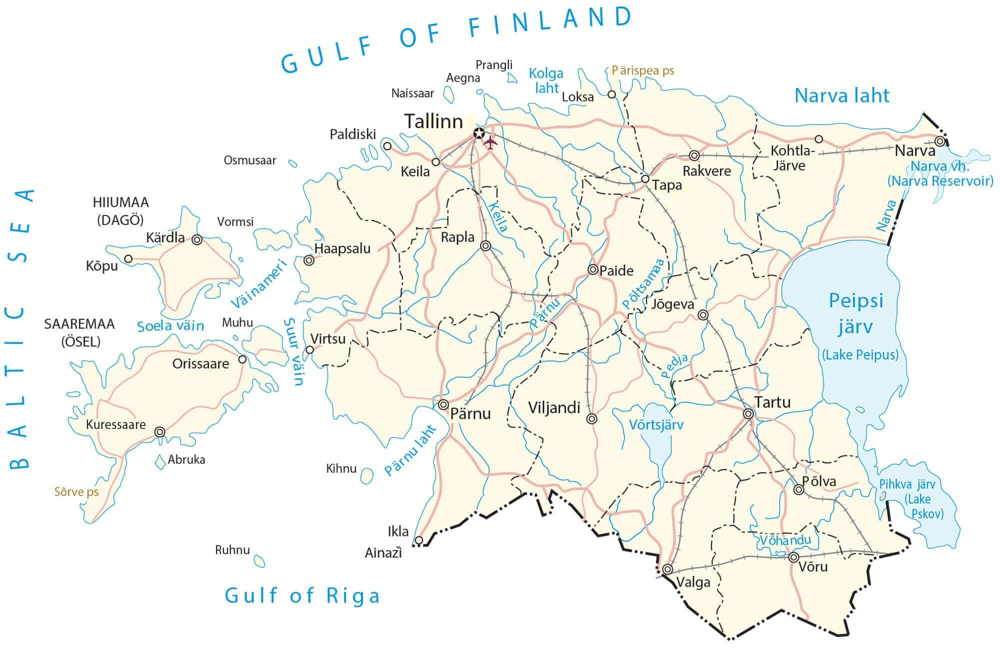
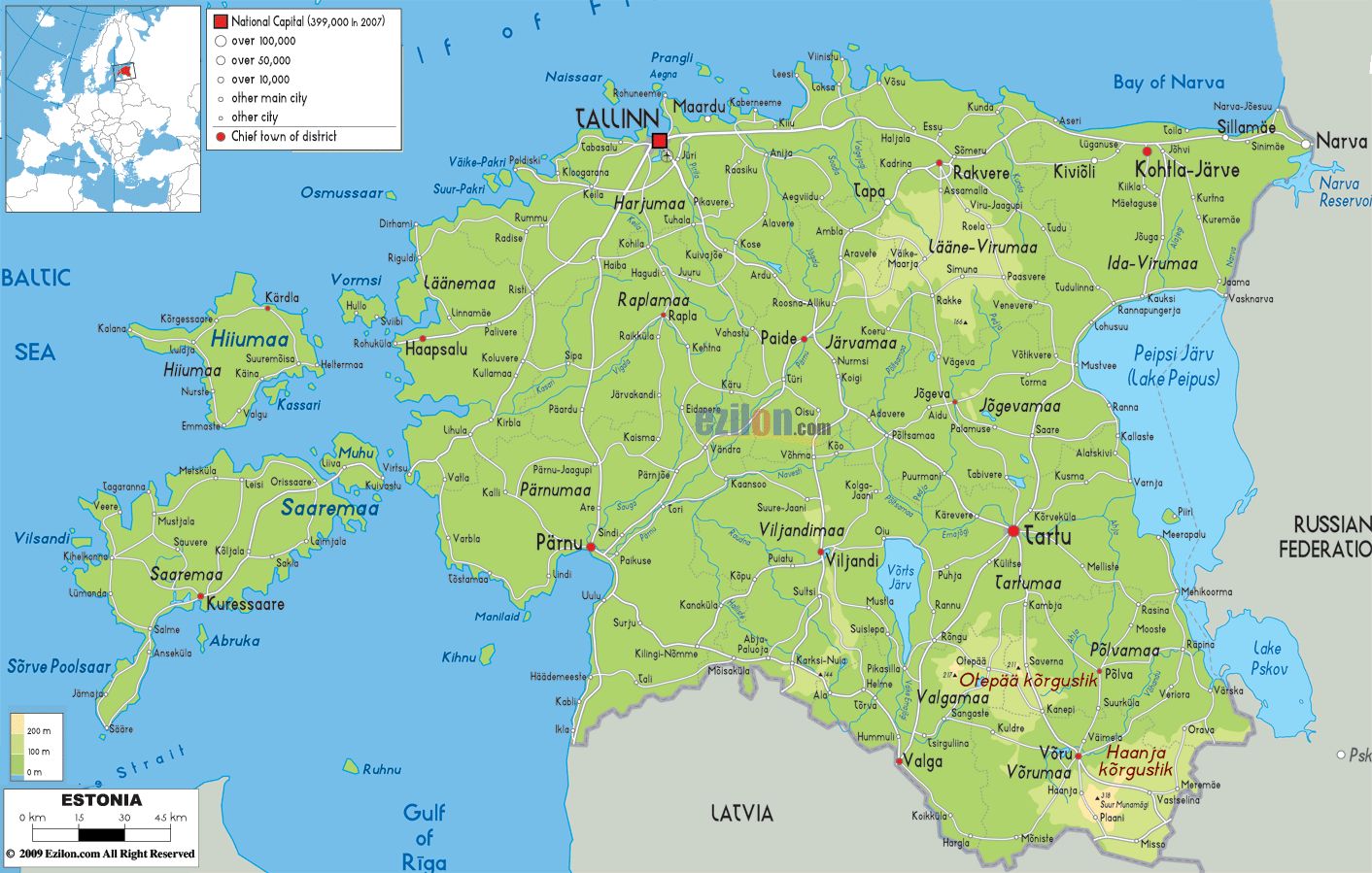
Estonia is a Baltic country in Northern Europe with an area of 45,227 km2(17,462 sq mi). As observed on the physical map of Estonia, the country is mostly low and flat (close to sea level). It is also nearly surrounded by water on all sides.
Estonia has 3,794 km (2,357 mi) of coastline indented by numerous bays, straits, and inlets. The number of islands and islets is estimated at some 2,222; most are small with a few large islands off the western coastline. Some of the major islands like Saaremaa, Vormsi, Kardla, Muhu, Kihnu, etc., have been shown on the map above.
Central and south, the land is hillier, rising to its highest point – the Munamagi – at 1,042 ft. (318m). A yellow upright triangle marks the position of this point on the map. The country’s average elevation reaches only 50 meters (164 ft).
Over 1,400 small lakes dot the western parts of the country. The largest lakes includes Peipus and Pskov, (shared with Russia) and Lake Vorts-Jarv.
Rivers of size include the Emojogi, Manamagi and Parnu. The lowest point in Estonia is 0 m at sea level.
| Flag: |  |
|---|---|
| Legal Name: | Republic of Estonia |
| Capital Value: | Tallinn |
| Largest City: |
Tallinn (445,259) |
| Demonym(s): | Estonian |
| Government: | Unitary parliamentary republic |
| Legislature: | Riigikogu |
| Total Area: | 45,228 km² |
| Land Area: | 42,388 km² |
| Water Area: | 2,840 km² |
| Population: | 1,326,590 |
| Density: | 30.6/km (79.3/sq mi) (148th) |
| GDP: | $31.39 Billion |
| GDP Per Capita: | $23,659.87 |
| Currency Value: | Euros (EUR) |
| Driving side: | right |
| Calling code: | +372 |
| Internet TLD: | .ee |
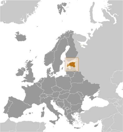
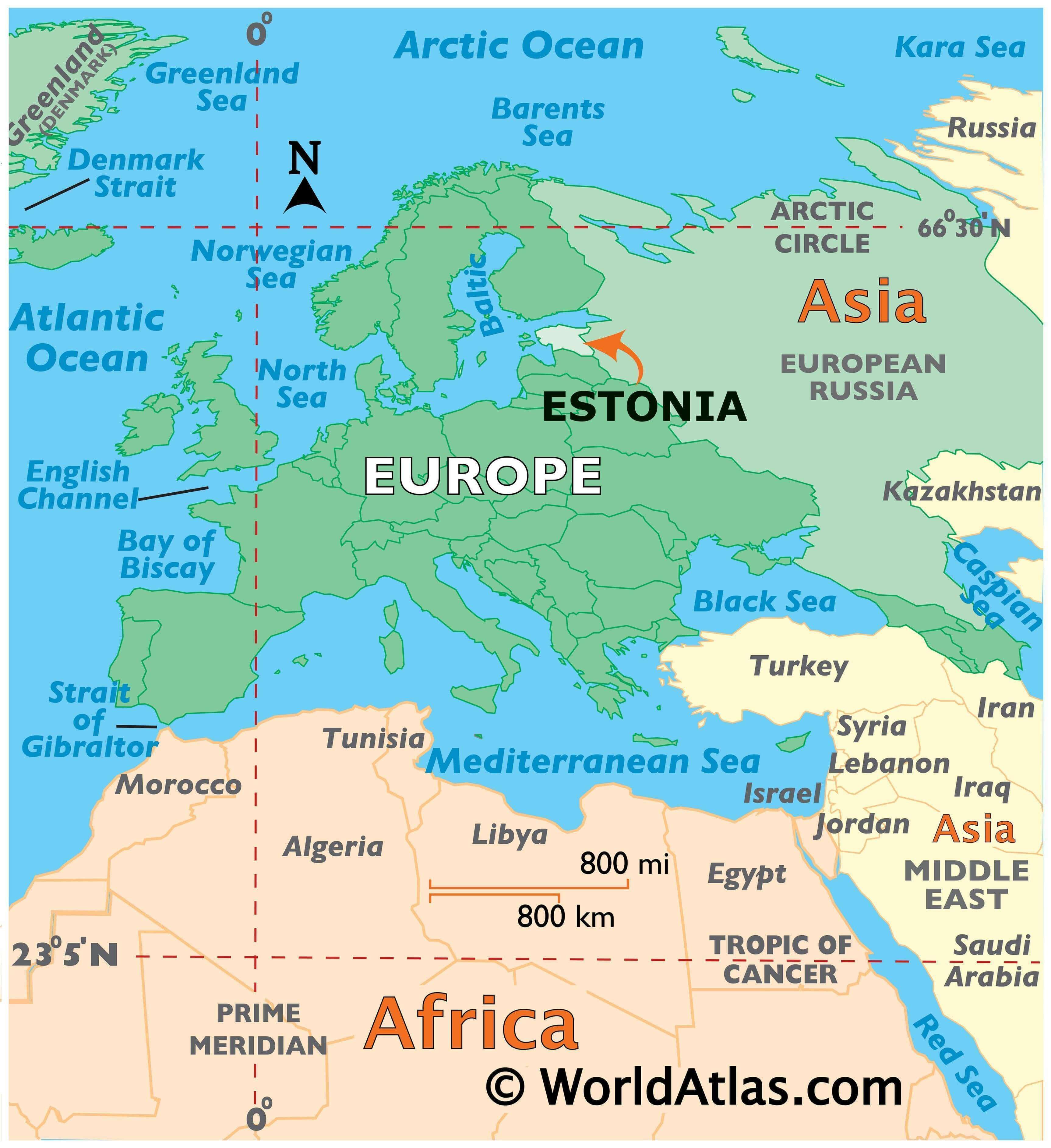
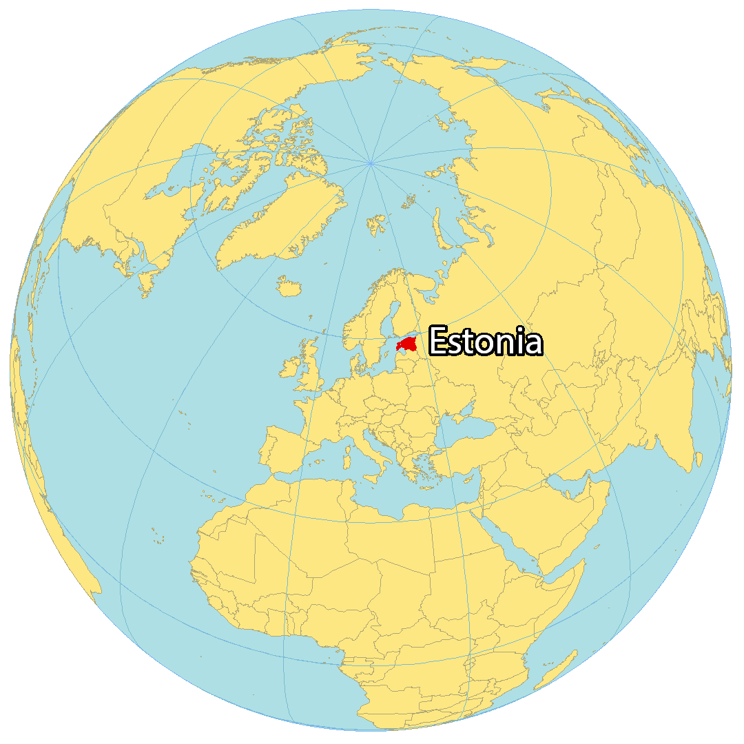
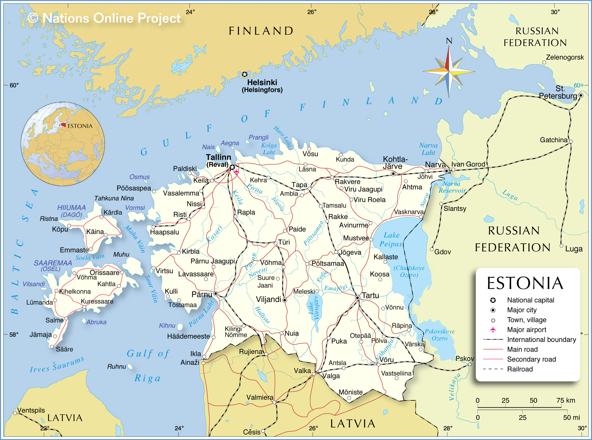
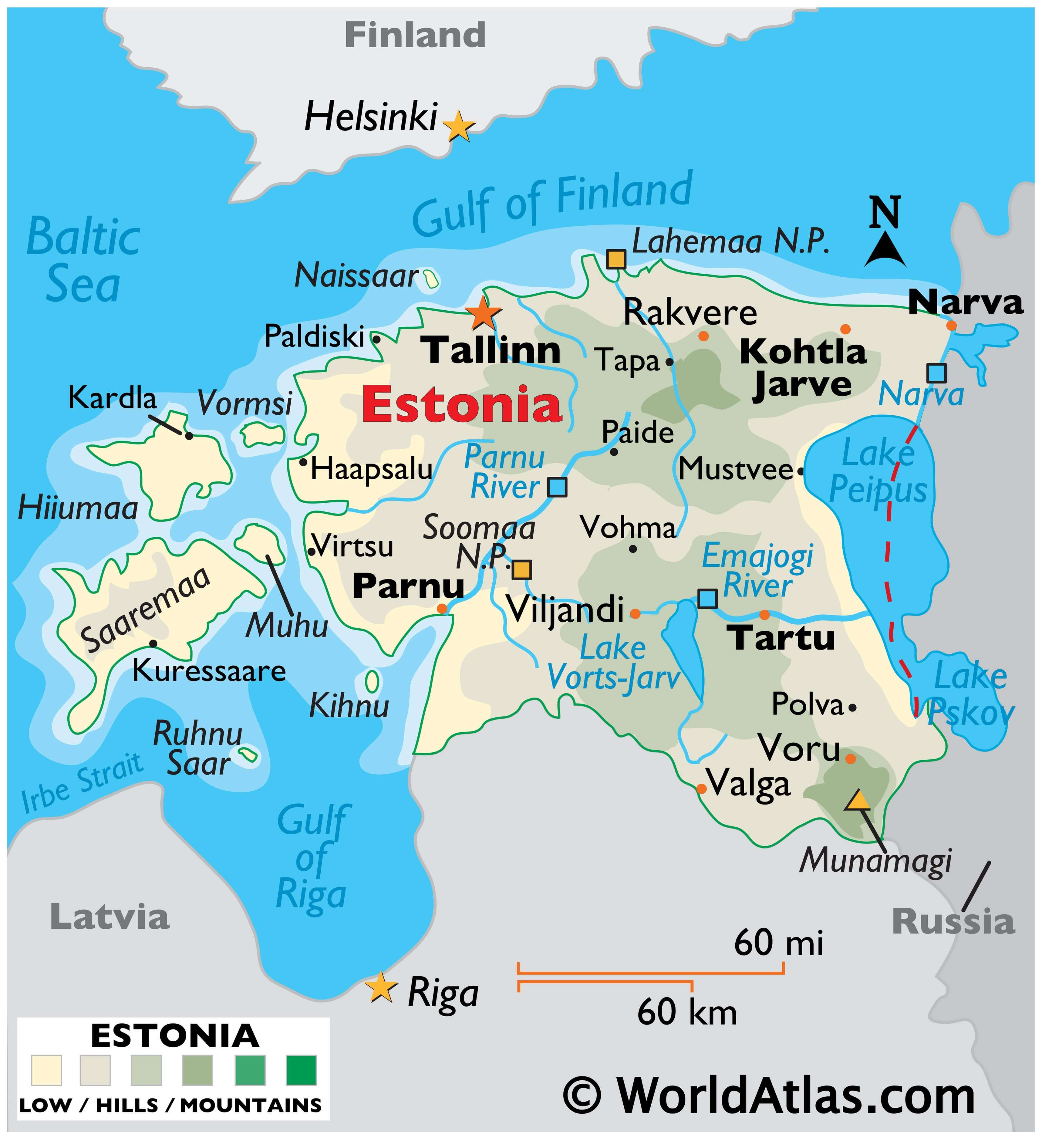
Estonia is a country located in northern Europe, bordered by the Baltic Sea, the Gulf of Finland, Latvia, and Russia. It is a small country with an area of just over 45,000 square kilometers and a population of just over 1.3 million people. Despite its small size, Estonia is a vibrant country with a rich cultural and historical heritage.
This map of Estonia showcases the country’s diverse landscape, featuring major cities, rivers, lakes, airports, and highways. The satellite and elevation map also highlights Estonia’s upland regions and its unique transboundary lakes. With this map, you can explore Estonia’s fascinating geography and discover its many hidden gems!
Online Interactive Political Map
Click on ![]() to view map in "full screen" mode.
to view map in "full screen" mode.
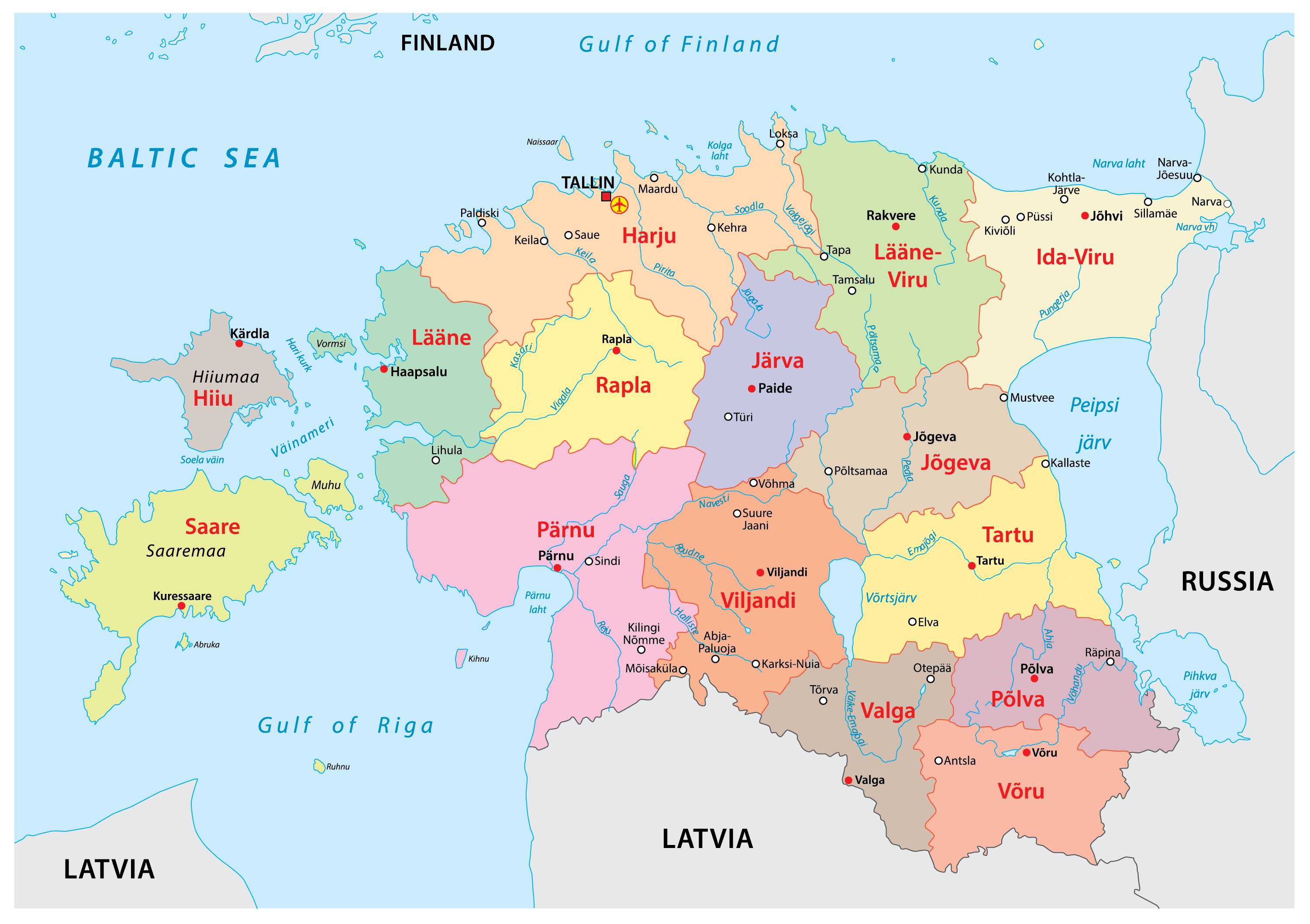
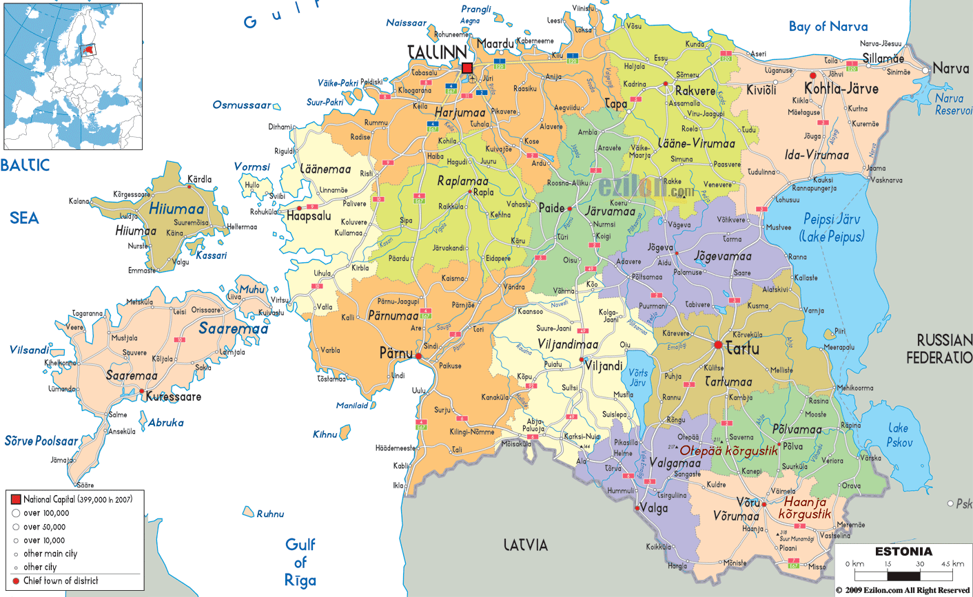
Estonia (officially, the Republic of Estonia) is divided into 15 counties (maakonnad, sing. maakond) and further into 64 parishes or municipalities. The counties are: Harju, Hiiu, Ida-Viru, Jarva, Jogeva, Laane, Laane-Viru, Parnu, Polva, Rapla, Saare, Tartu, Valga, Viljandi, and Voru.
Estonia occupies an area of 45,227 sq. km, including a mainland and 2,222 islands. Located in north-western Estonia on the southern coast of the Gulf of Finland is, Tallinn – the capital, the largest and the most populous city of Estonia. It is also the administrative, cultural, educational and financial center of the country.
Location Maps
Where is Estonia?
Estonia is located in the northern part of Europe, along the coast of the Baltic Sea and the Gulf of Riga. It is bordered by two countries, Latvia to the south and Russia to the east. It is also separated by the Gulf of Finland with Scandinavia (Finland and Sweden) to the north. Tallinn is the capital and largest city in Estonia, situated along the Gulf of Finland in the north. Tartu is also considered the cultural capital.
Estonia consists of several islands on the west coast, including Saaremaa and Hiiumaa, which are the two largest islands. Muhu, Vormsi and Naissaar are smaller islands off mainland Estonia. The geography of Estonia is diverse, with forests covering about half of the country and more than 2,300 islands dotting its coastline.
High Definition Political Map of Estonia
Physical Map of Estonia
Estonia Satellite Map
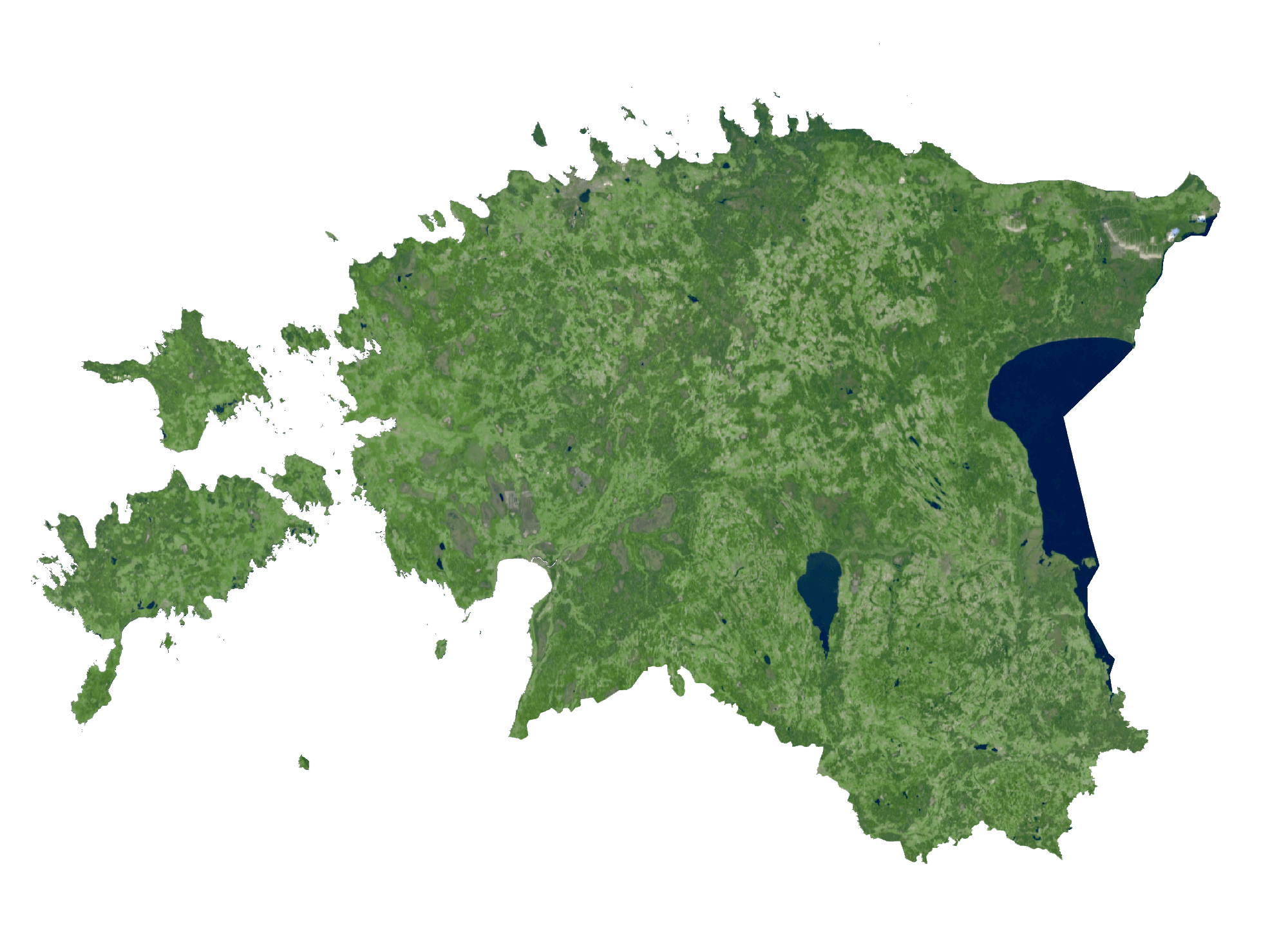
Elevation Map