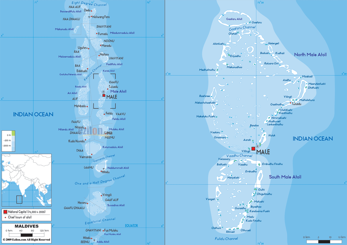
Maldives is an archipelagic nation with a total land area of 298 sq. km in the Indian Ocean. It is Asia’s smallest country. Here, over 1,110 islands are grouped into a double chain of 26 atolls. The islands of the country are dispersed across about 90,000 sq. km of the ocean. This fact makes Maldives one of the world’s most geographically dispered nations.
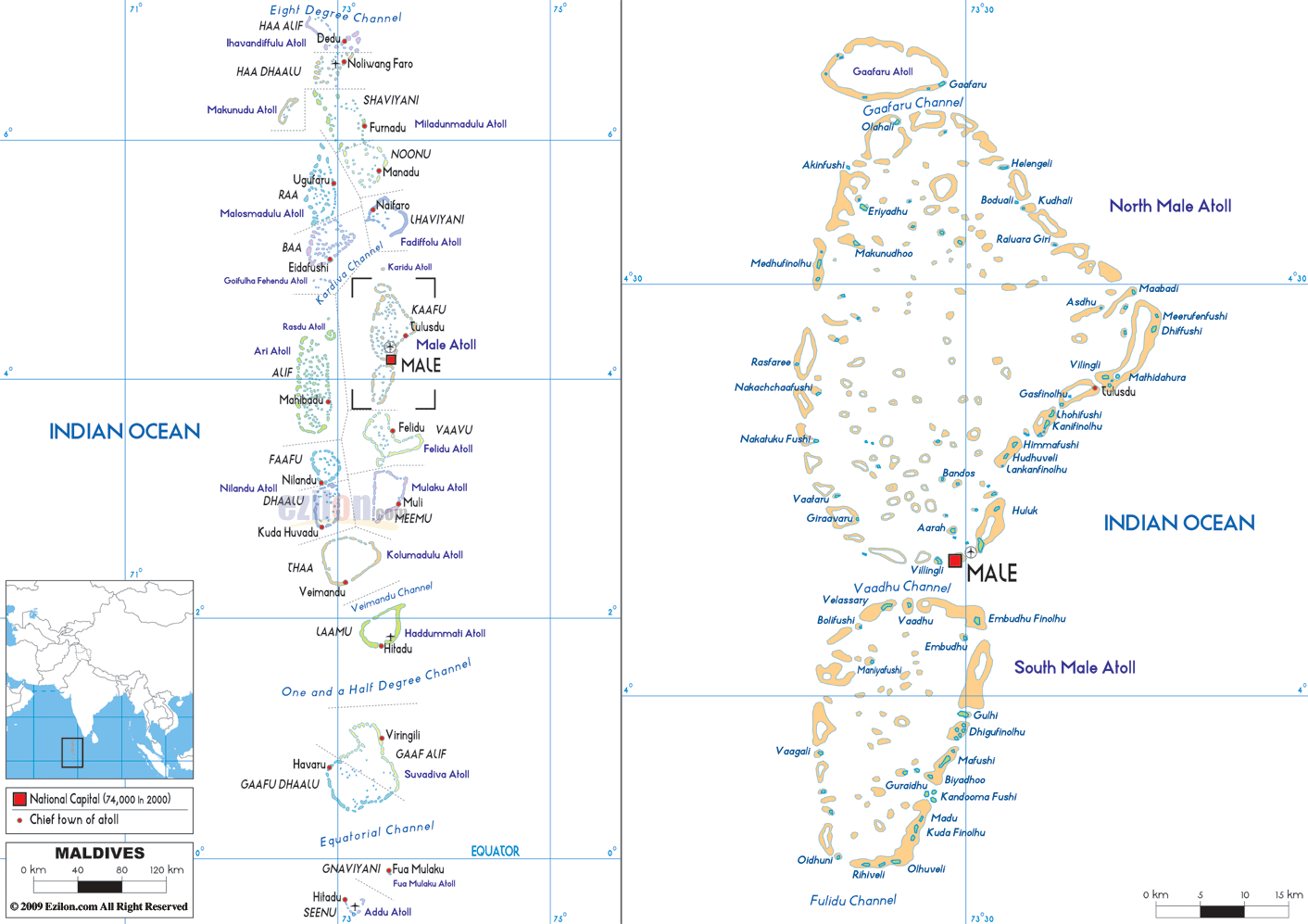
The double chain of atolls of Maldives can be observed on the physical map of the country above. They lie across the Equator on both the Northern and Southern hemispheres of the Earth.
The atolls of Maldives sit atop a submarine ridge. This ridge rises from the bed of the ocean and runs for 960 km (600 mi) in the north-south directions. The atolls are composed of sand bars and live coral reefs.
Gan is the country’s largest island and is located in the Laamu Atoll.
The topography of each of the islands vary from mostly sand to marshy wetlands.
Its highest point, an unnamed point on Wilingili Island, is only 7.87 ft. (2.4 m); while its lowest is the Indian Ocean (0 m).
| Flag: |  |
|---|---|
| Legal Name: | Republic of Maldives |
| Capital Value: | Male |
| Official languages: | Dhivehi |
| Demonym(s): | Maldivian |
| Government: | Unitary presidential constitutional republic |
| Legislature: | People’s Majlis |
| Total Area: | 298 km² |
| Land Area: | 298 km² |
| Population: | 530,953 |
| Density: | 1,102.5/km (2,855.5/sq mi) (8th) |
| GDP: | $5.73 Billion |
| GDP Per Capita: | $10,790.50 |
| Currency Value: | Rufiyaa (MVR) |
| Driving side: | left |
| Calling code: | +960 |
| Internet TLD: | .mv |
The Maldives is an archipelago of small islands and atolls located in the Indian Ocean, south of India and Sri Lanka. This map of the Maldives shows the capital city of Malé, as well as other populated places and channels.
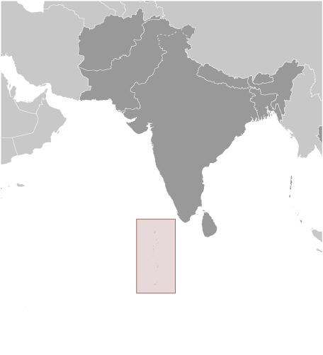
Location Maps
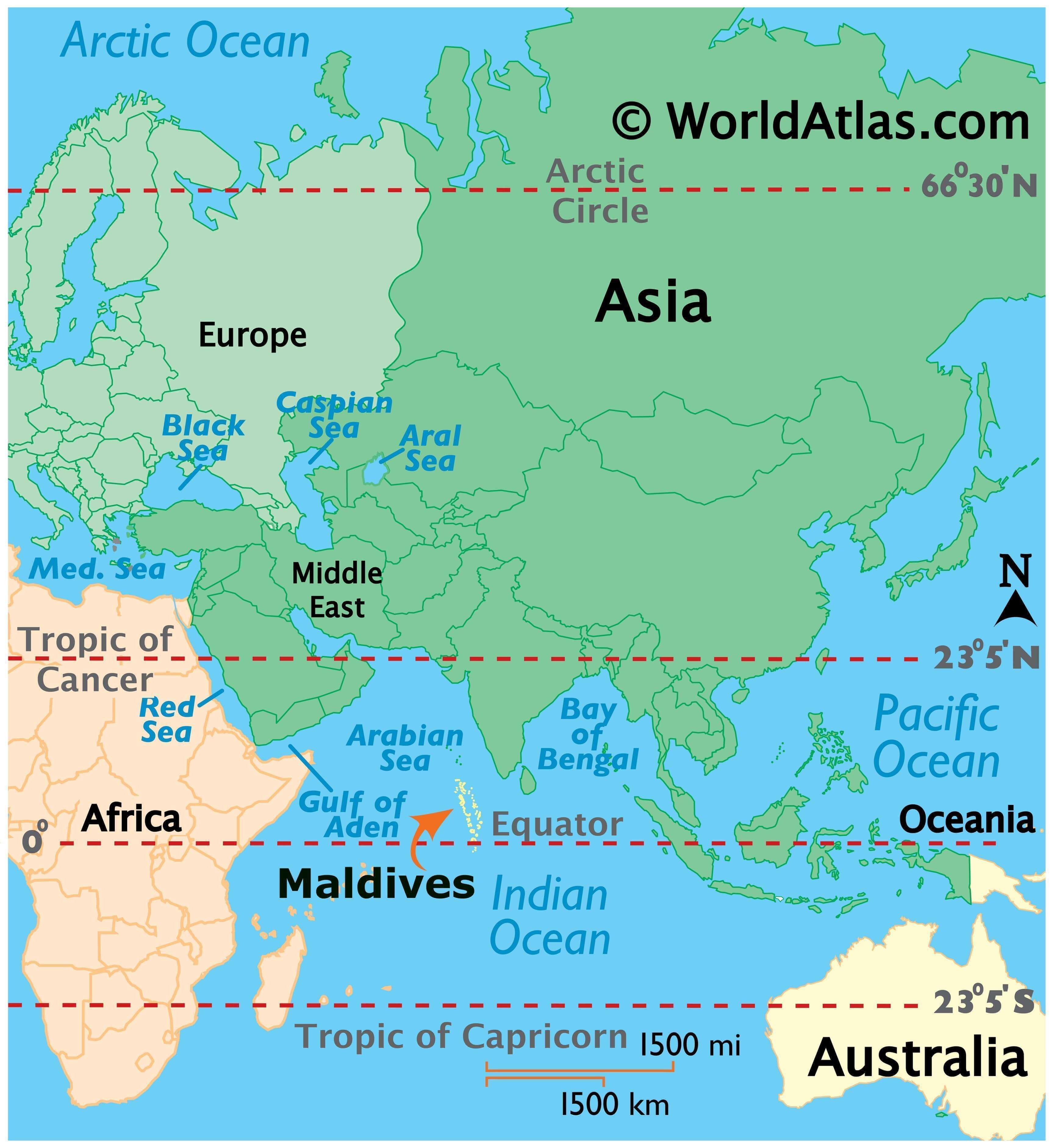
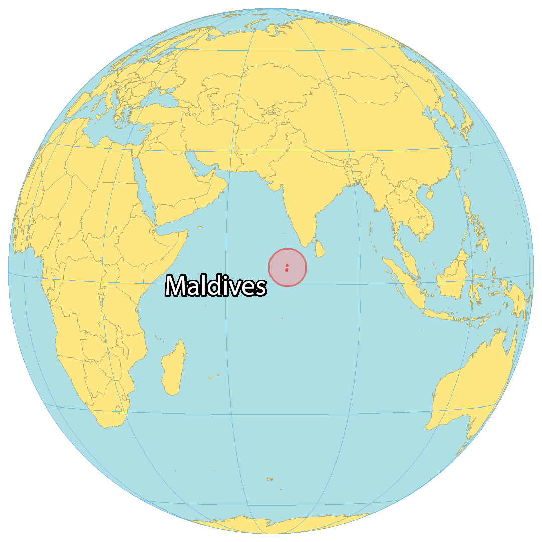
Where is Maldives?
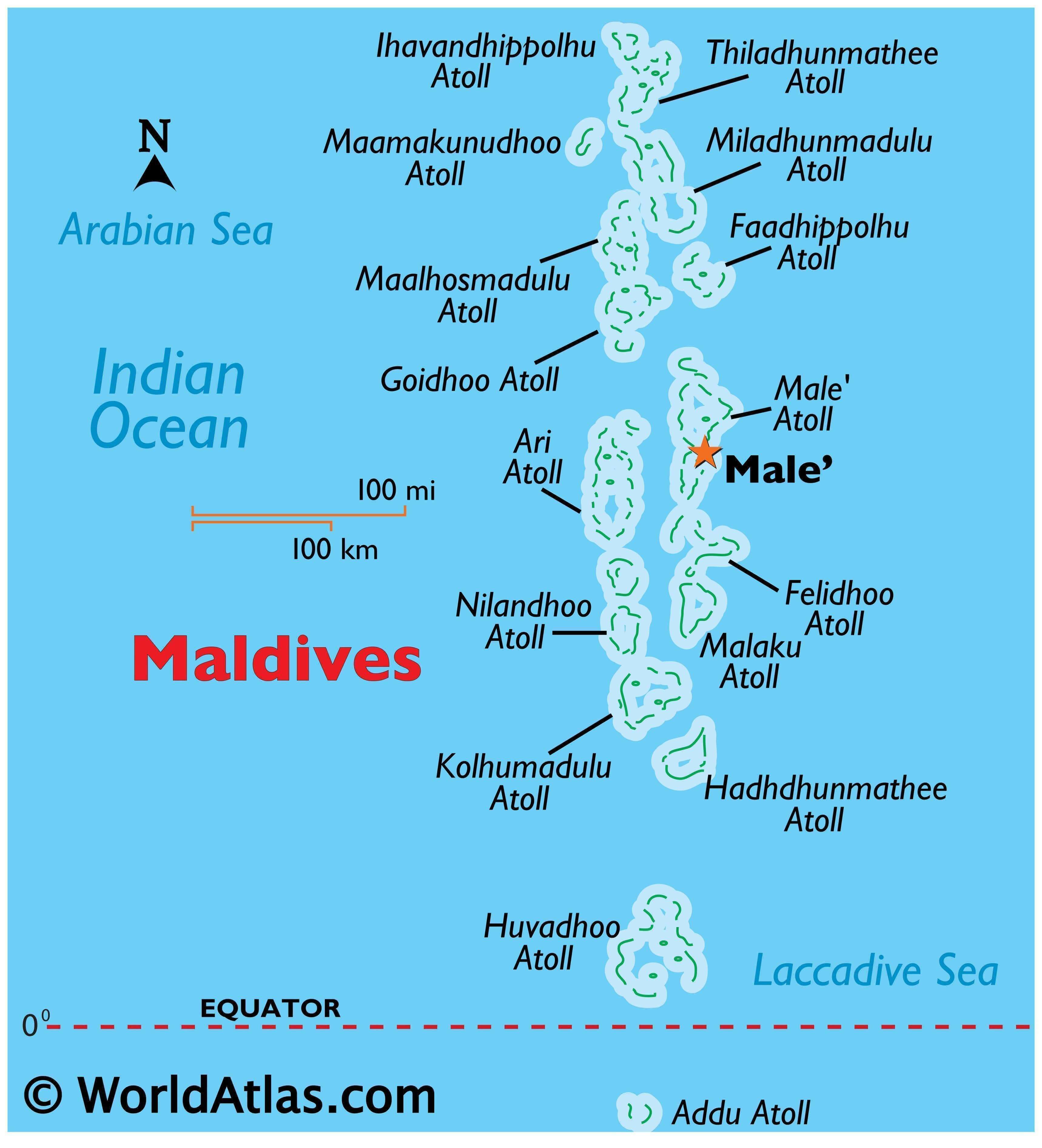
The Maldives is an archipelago in the Indian Ocean southwest of India and Sri Lanka, consisting of 20 atolls and other smaller islands. Spanning 298 square kilometers, it is the smallest Asian country with a population of 557,500, making it the second least populous in Asia. The country is renowned for its stunning beaches, coral reefs, and diverse marine life, with Malé being the capital and largest city.
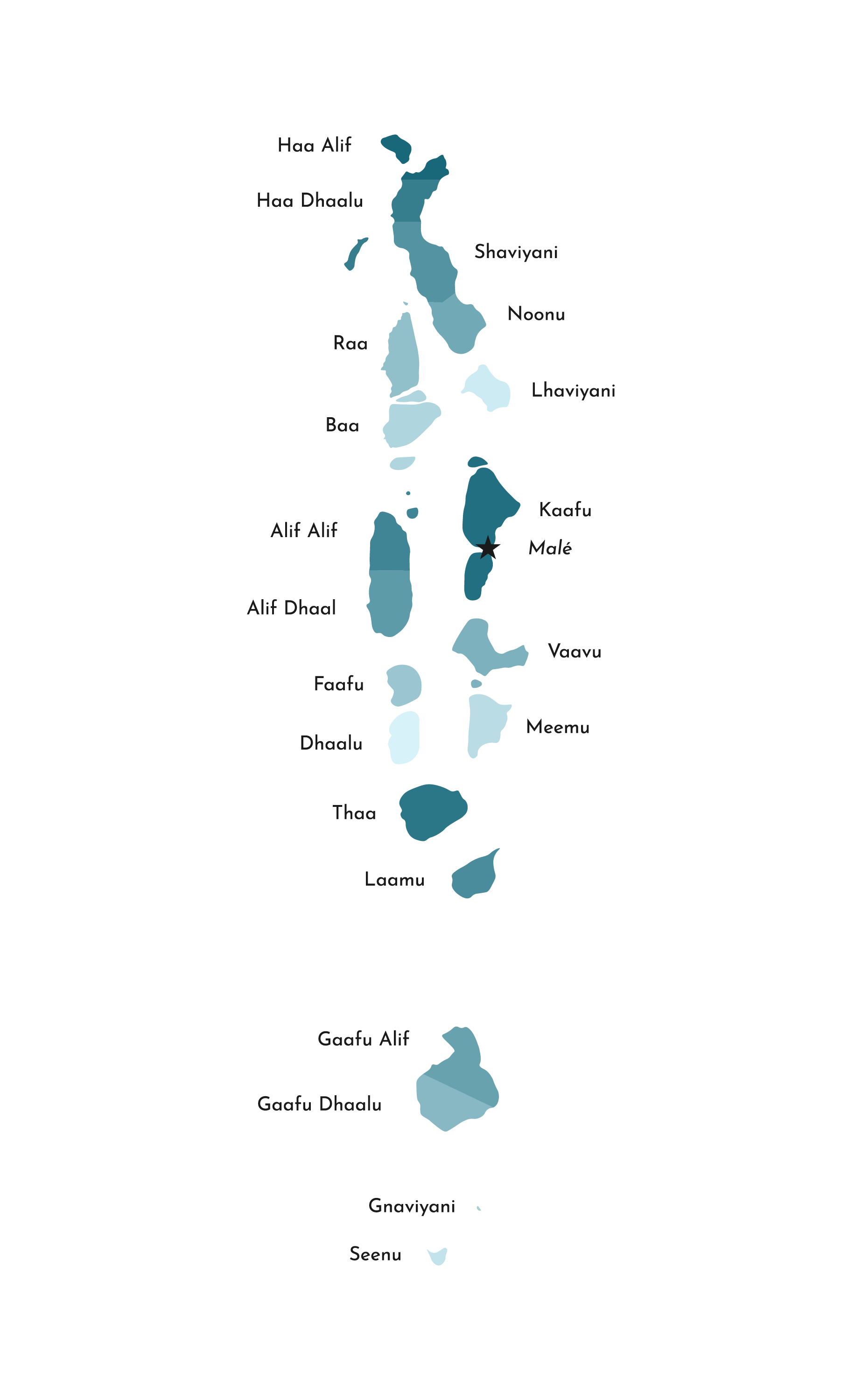
High Definition Political Map of Maldives
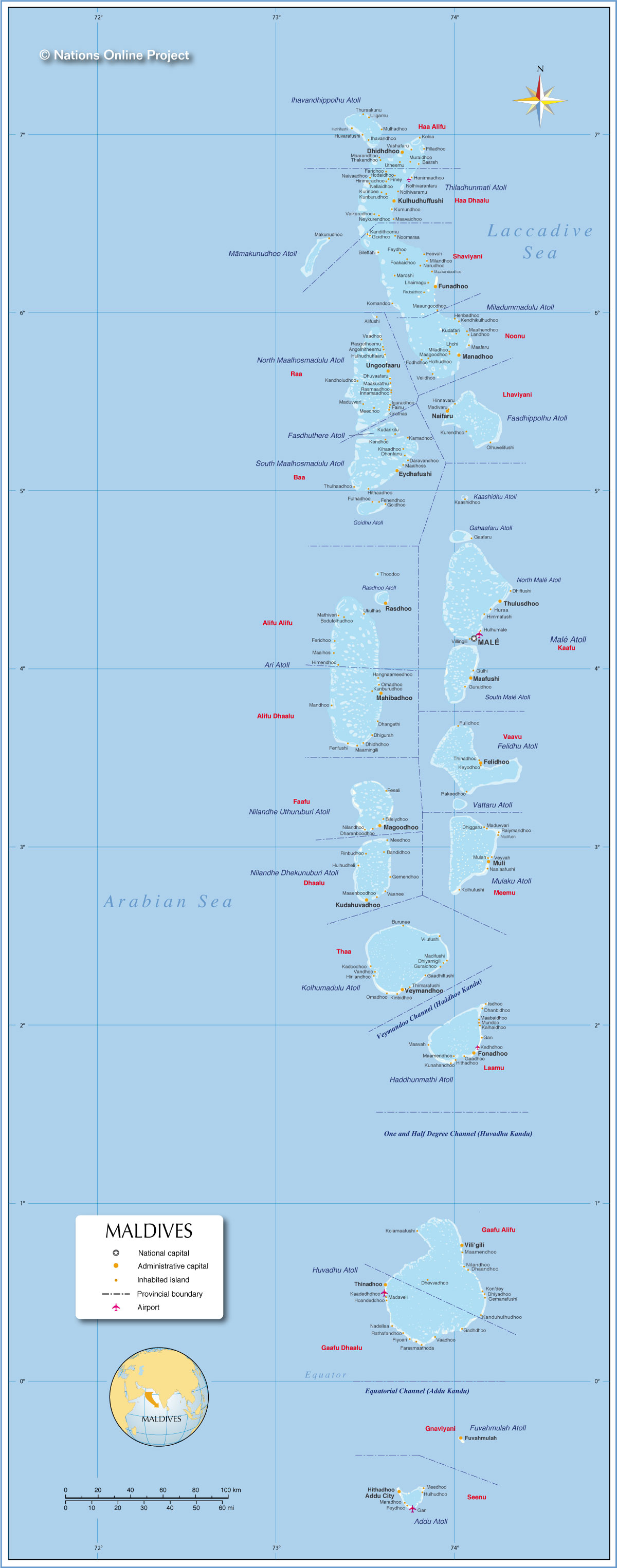
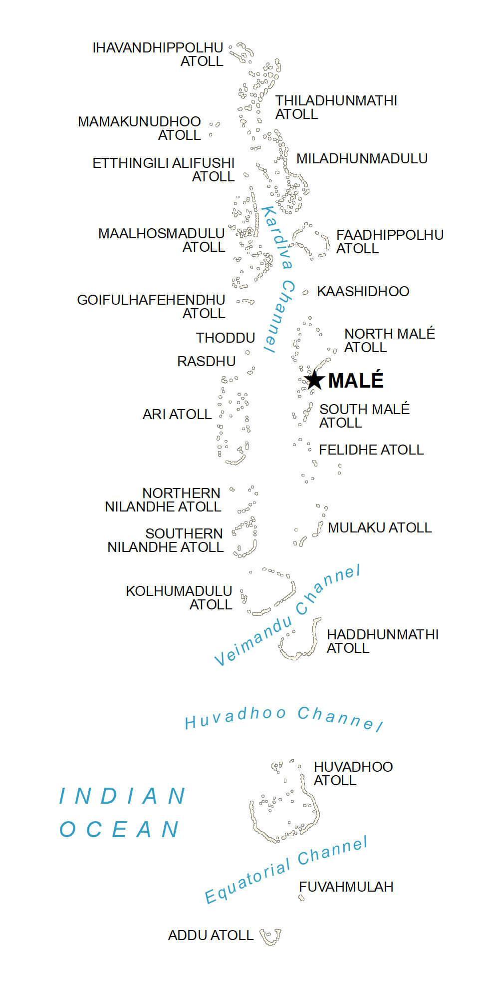
Physical Map of Maldives