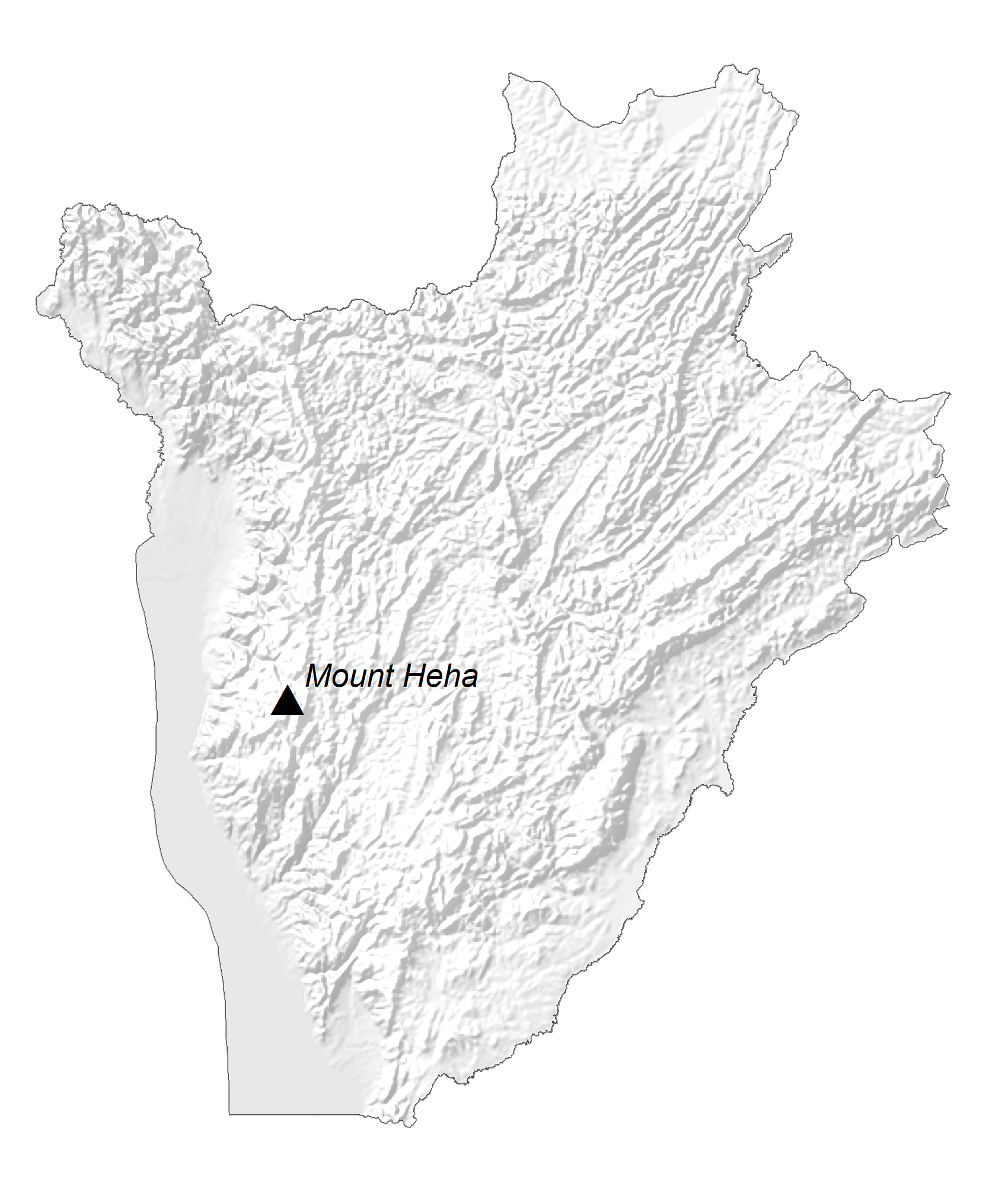
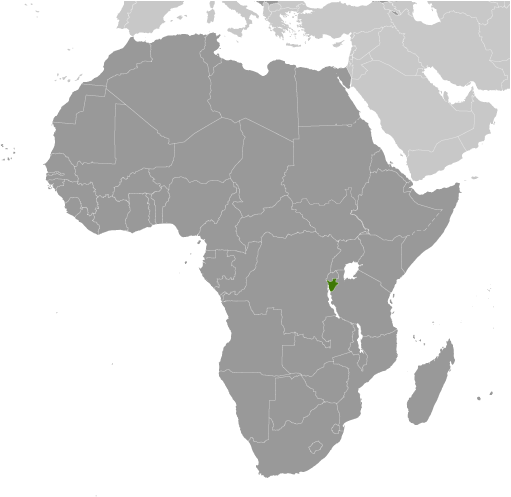
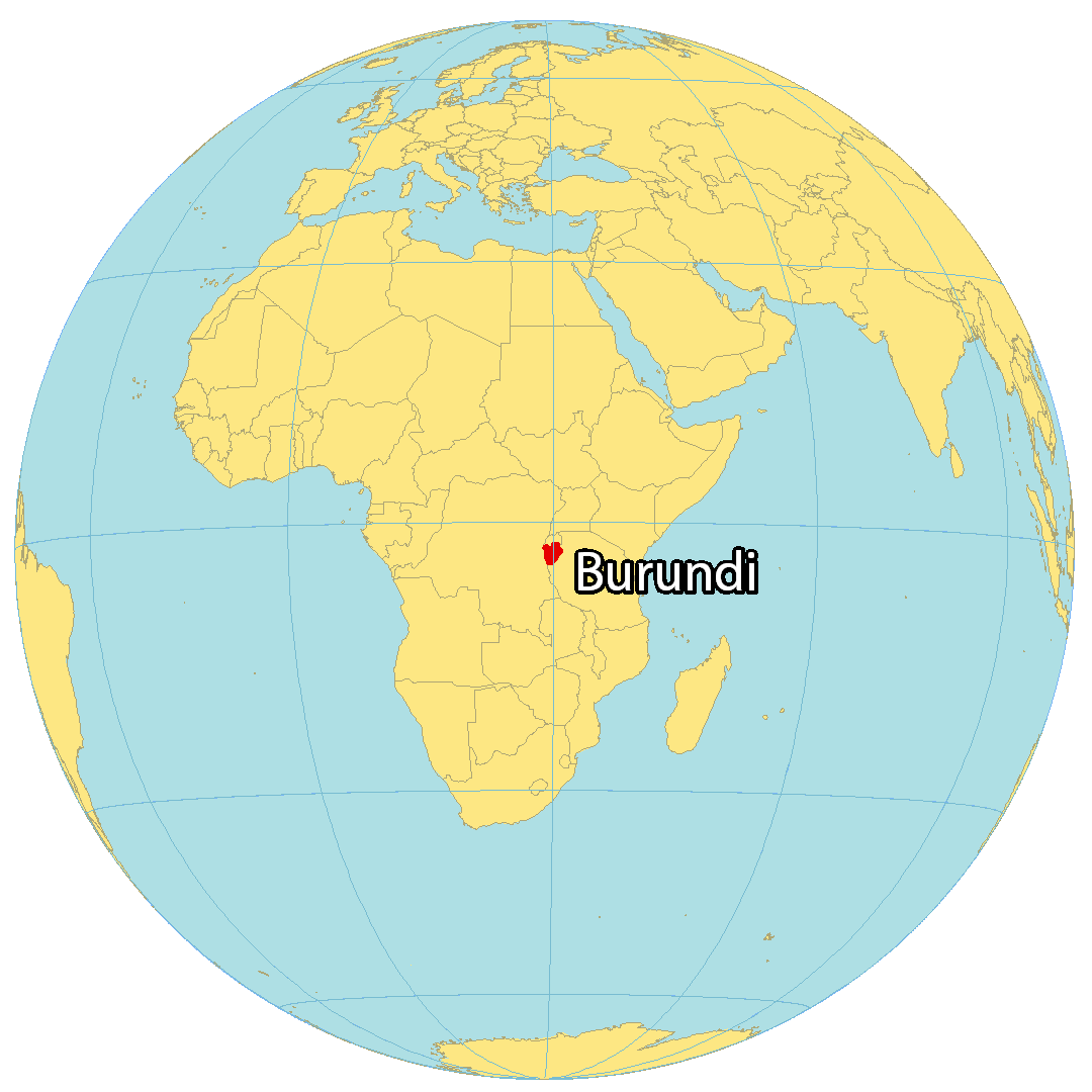
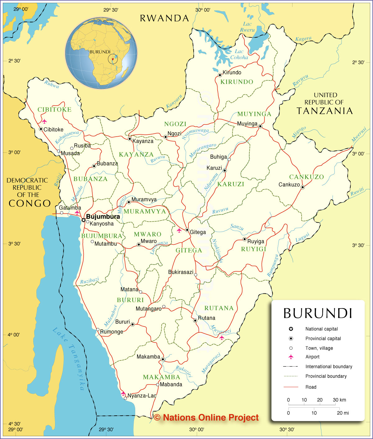
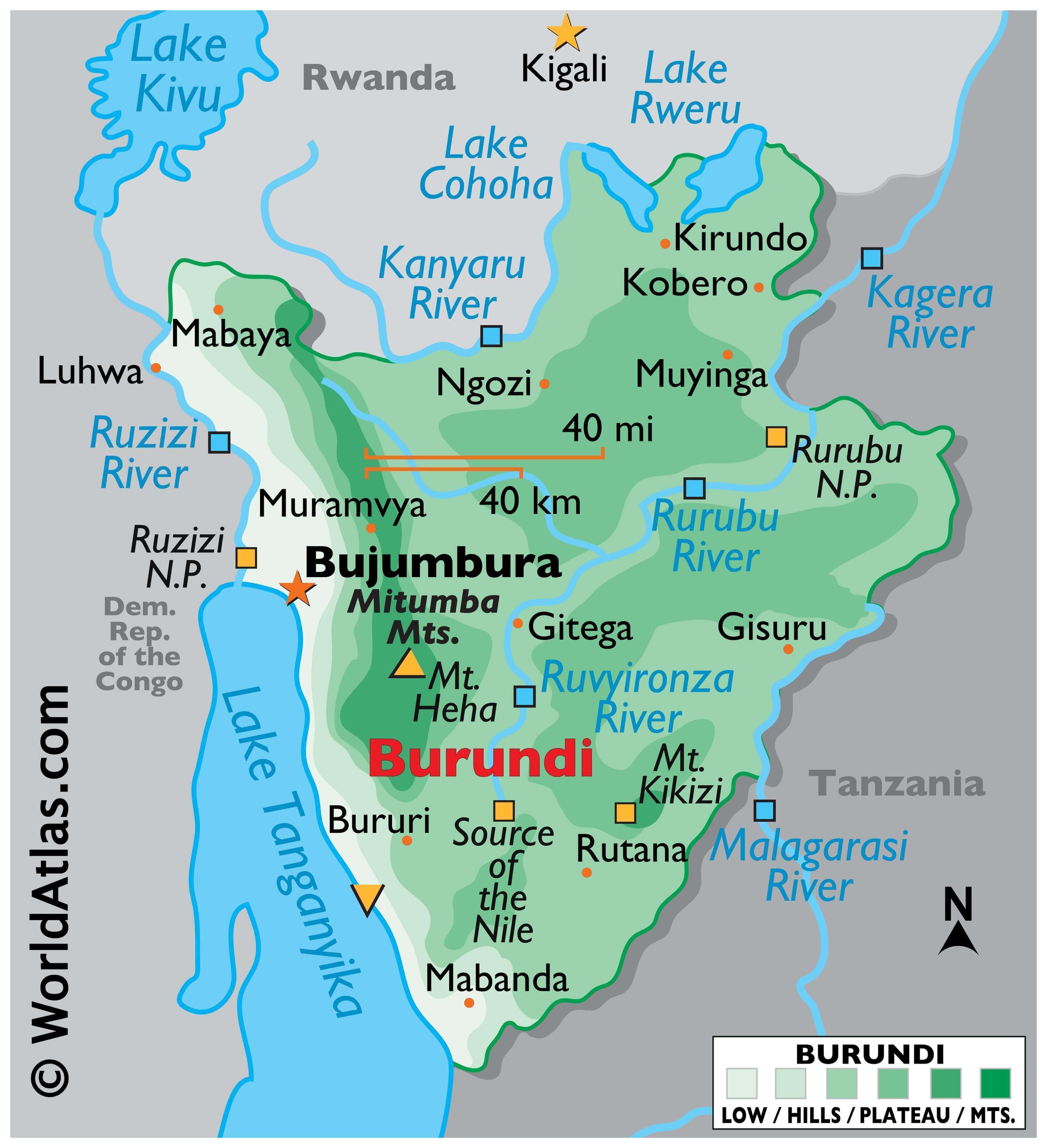
As shown on the map, the small landlocked country of Burundi is located on the northeastern shoreline of Lake Tanganyika. It occupies an area of 27,834 sq. km in Central-East Africa.
Burundi has a largely hilly and mountainous terrain with the wooded Mitumba Mountains in the west giving way to a plateau eastwards. As marked on the map, the highest point in Burundi is the 2,670 m high Mount Heha located in the western mountainous region. The country’s lowest point is at 772 m in Lake Tanganyika. Estimated to be the second-largest freshwater lake in the world, Lake Tanganyika is divided amongst four different countries, including Burundi. Its waters flow into the Congo River, which leads to the Atlantic Ocean. Some major rivers like Kanyaru, Malagarasi, Ruvyironza, and Rurubu have been marked on the map above. Significant lakes include the Cohoha, Rwero, and of course, Lake Tanganyika.
| Flag: |  |
|---|---|
| Legal Name: | Republic of Burundi |
| Capital Value: | Gitega (political capital), Bujumbura (commercial capital); note – in January 2019, the Burundian parliament voted to make Gitega the political capital of the country while Bujumbura would remain its economic capital; all branches of the government are ex |
| Largest City: |
Bujumbura (1,012,996) |
| Official languages: |
|
| Demonym(s): |
|
| Government: | Unitary dominant-party presidential republic |
| Legislature: | Parliament |
| Total Area: | 27,830 km² |
| Land Area: | 25,680 km² |
| Water Area: | 2,150 km² |
| Population: | 11,530,580 |
| Density: | 401.6/km (1,040.1/sq mi) (20th) |
| GDP: | $3.01 Billion |
| GDP Per Capita: | $261.25 |
| Currency Value: | Burundi francs (BIF) |
| Driving side: | right |
| Calling code: | +257 |
| Internet TLD: | .bi |
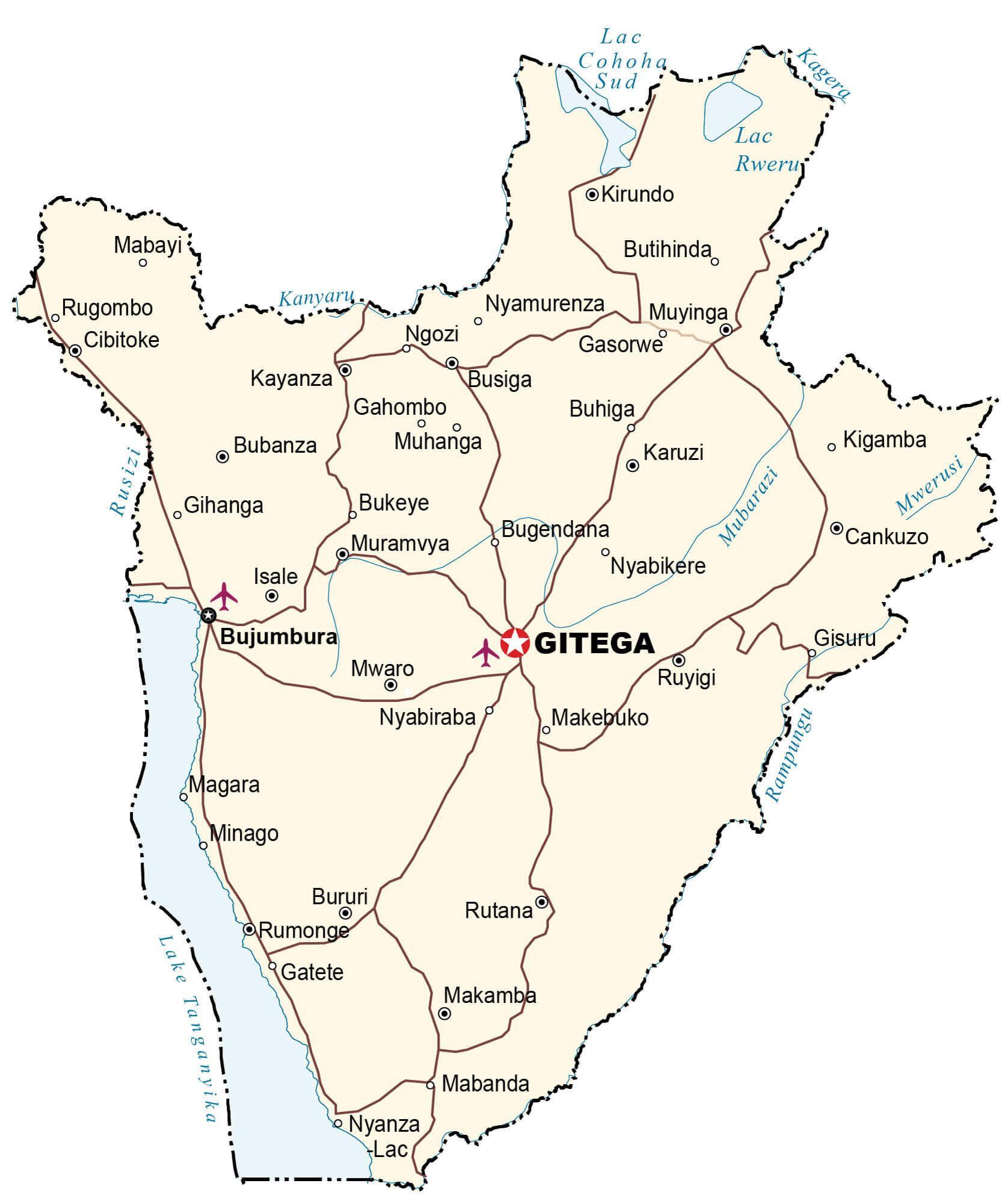
Explore the wonders of Burundi with this interactive map. Take a look at the major cities, towns, rivers, lakes, and roads that make up this beautiful country. You can also view its topography and landscape with an elevation map and satellite imagery.
Online Interactive Political Map
Click on ![]() to view map in "full screen" mode.
to view map in "full screen" mode.
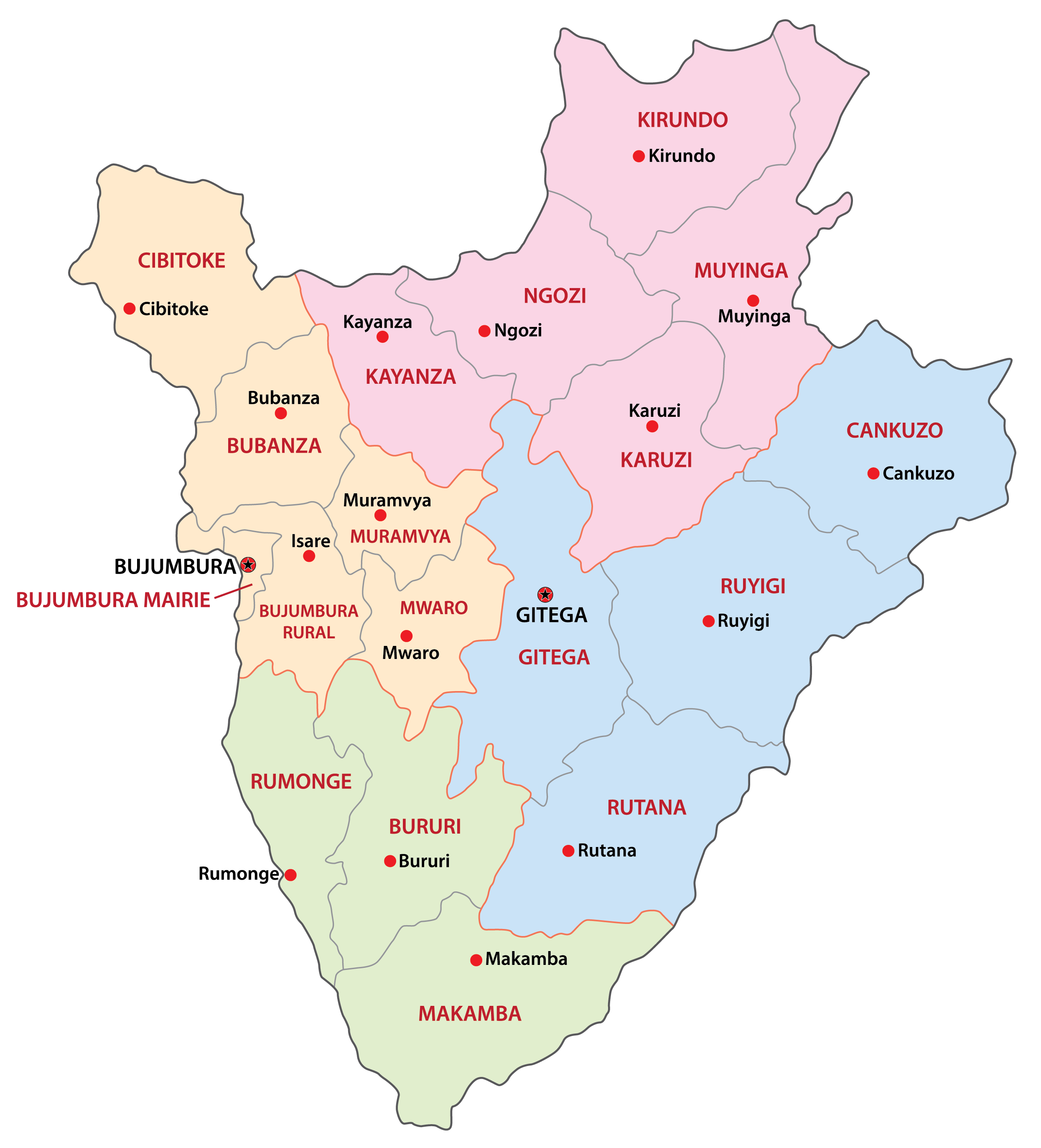
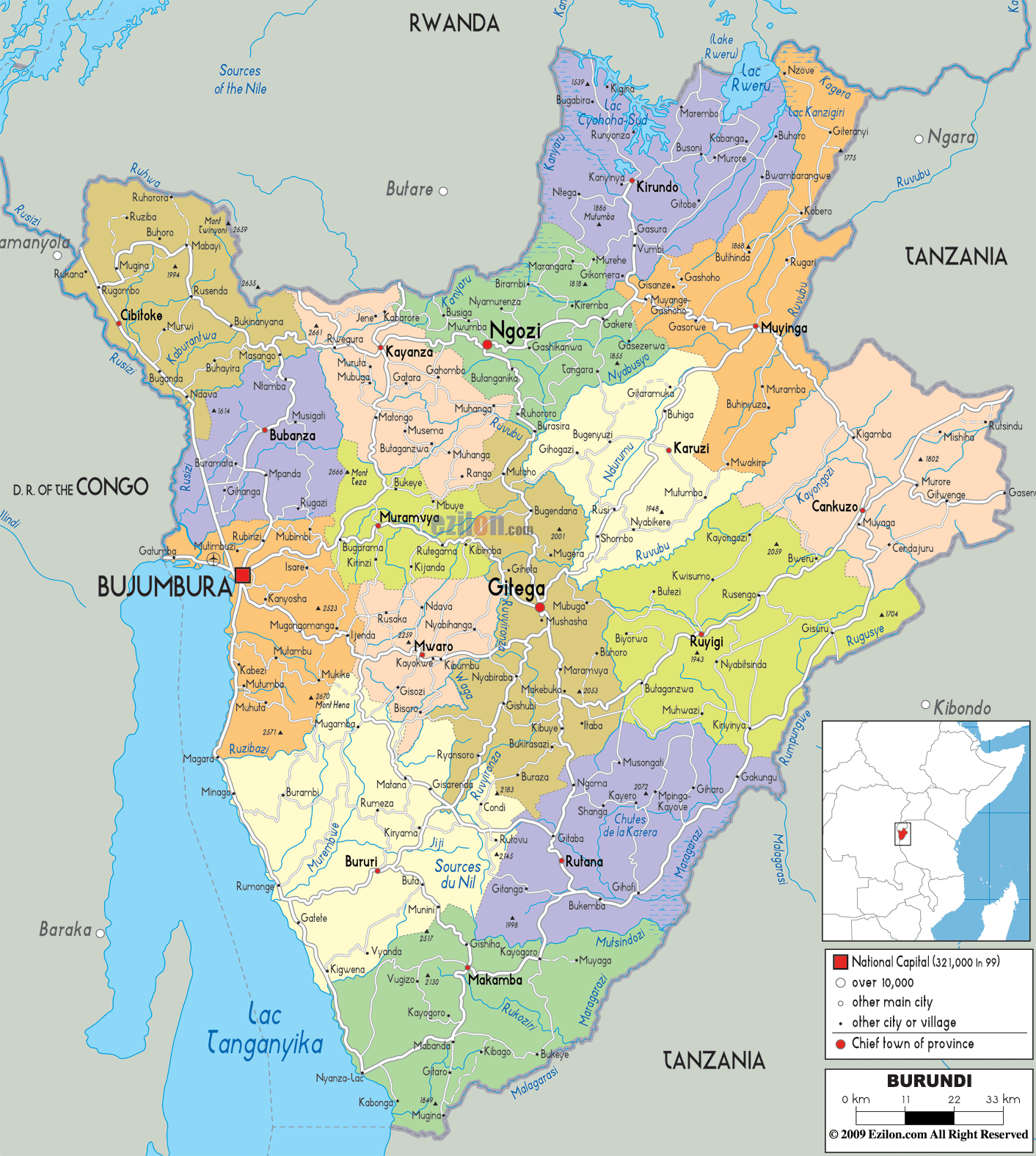
The political map of Burundi shows the 18 provinces and their capital cities. The most populated province is Bubanza with a population of 338,023 people. The largest city of Burundi, and its former capital, is Bujumbura, and its current capital, Gitega, is the second largest city, located in the middle of the country. The largest province by area is Ruyigi, with 2,339 km2.
The provinces of Burundi are: Bubanza, Bujumbura Mairie, Bujumbura Rural, Bururi, Cankuzo, Cibitoke, Gitega, Karuzi, Kayanza, Kirundo, Makamba, Muramvya, Muyinga, Mwaro, Ngozi, Rumonge, Rutana, Ruyigi.
Provinces are divided into 117 communies which are further subdivided into 2,638 collines.
Location Maps
Where is Burundi?
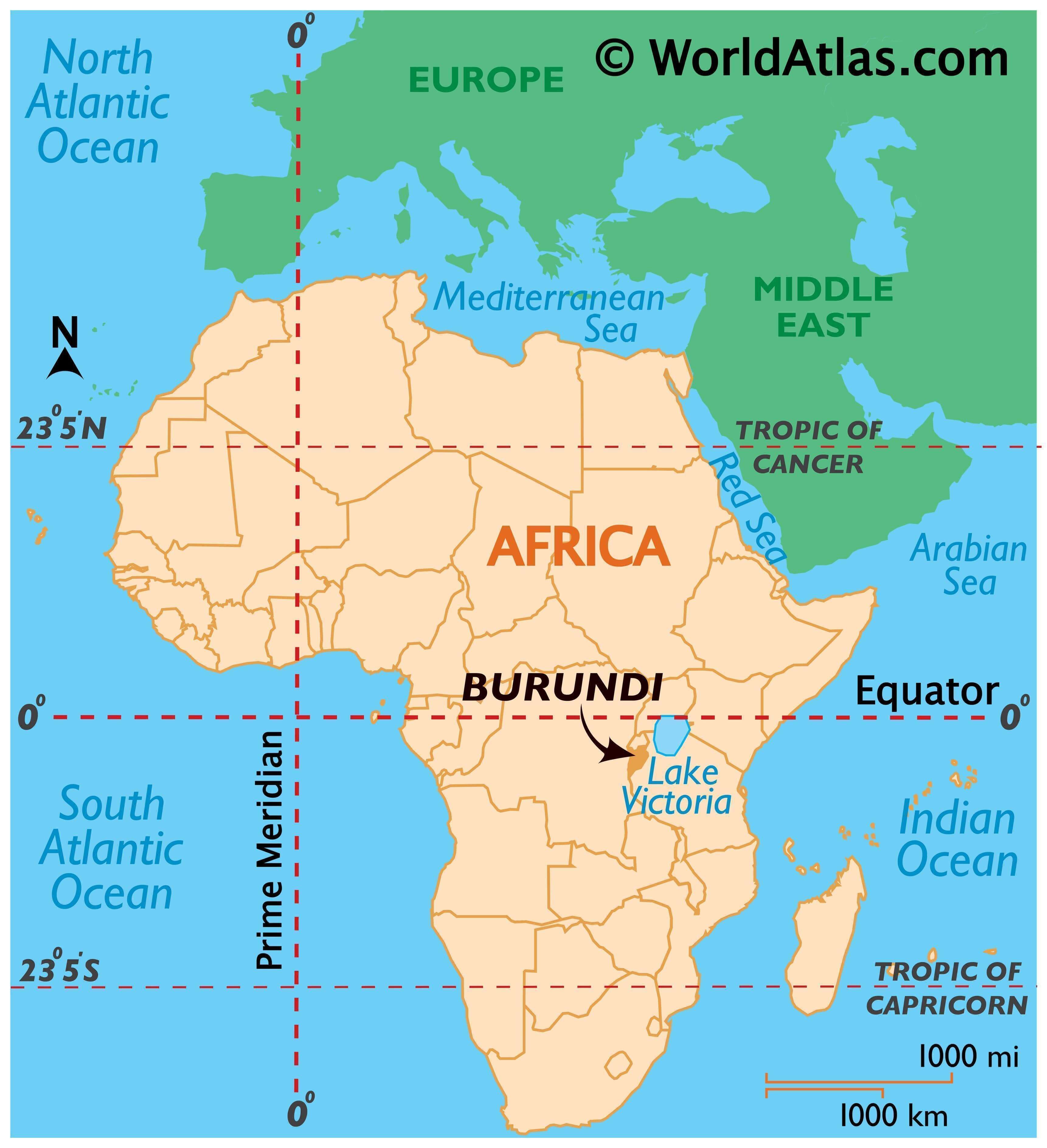
Burundi is a small, landlocked nation located in east-central Africa. Spanning an area of 27,834 square kilometers (10,747 sq mi), it is smaller than Equatorial Guinea but larger than Rwanda. Burundi is bordered by the Democratic Republic of Congo to the west, Tanzania to the east, and Rwanda to the north. The capital city of Burundi is Gitega, while Bujumbura is the economic capital and the largest city.
Burundi is home to approximately 11.6 million people, making it one of the ten poorest countries in the world. It has a history of civil war, corruption, and HIV/AIDS transmission.
High Definition Political Map of Burundi
Physical Map of Burundi

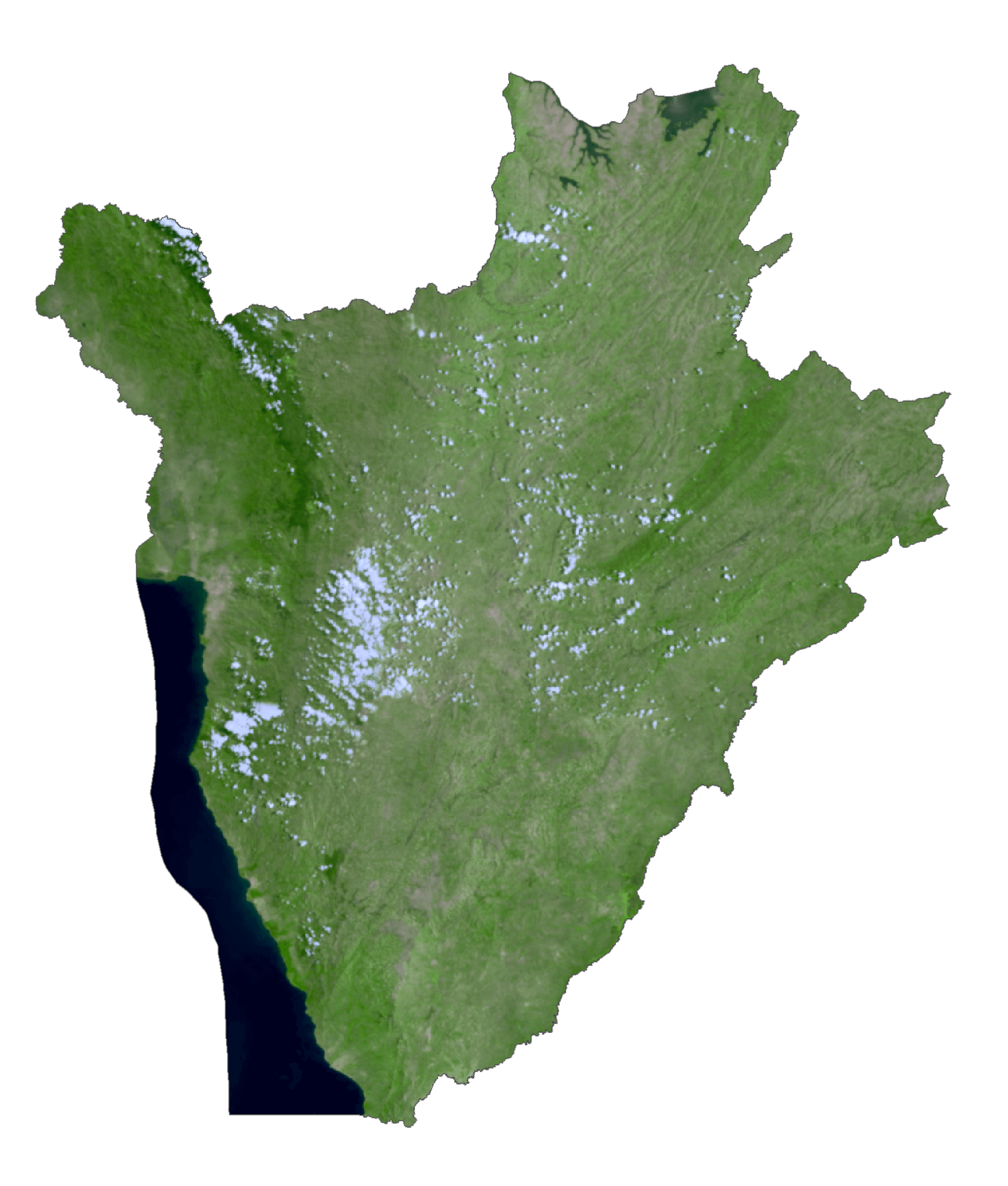
Burundi Satellite Map
Elevation Map