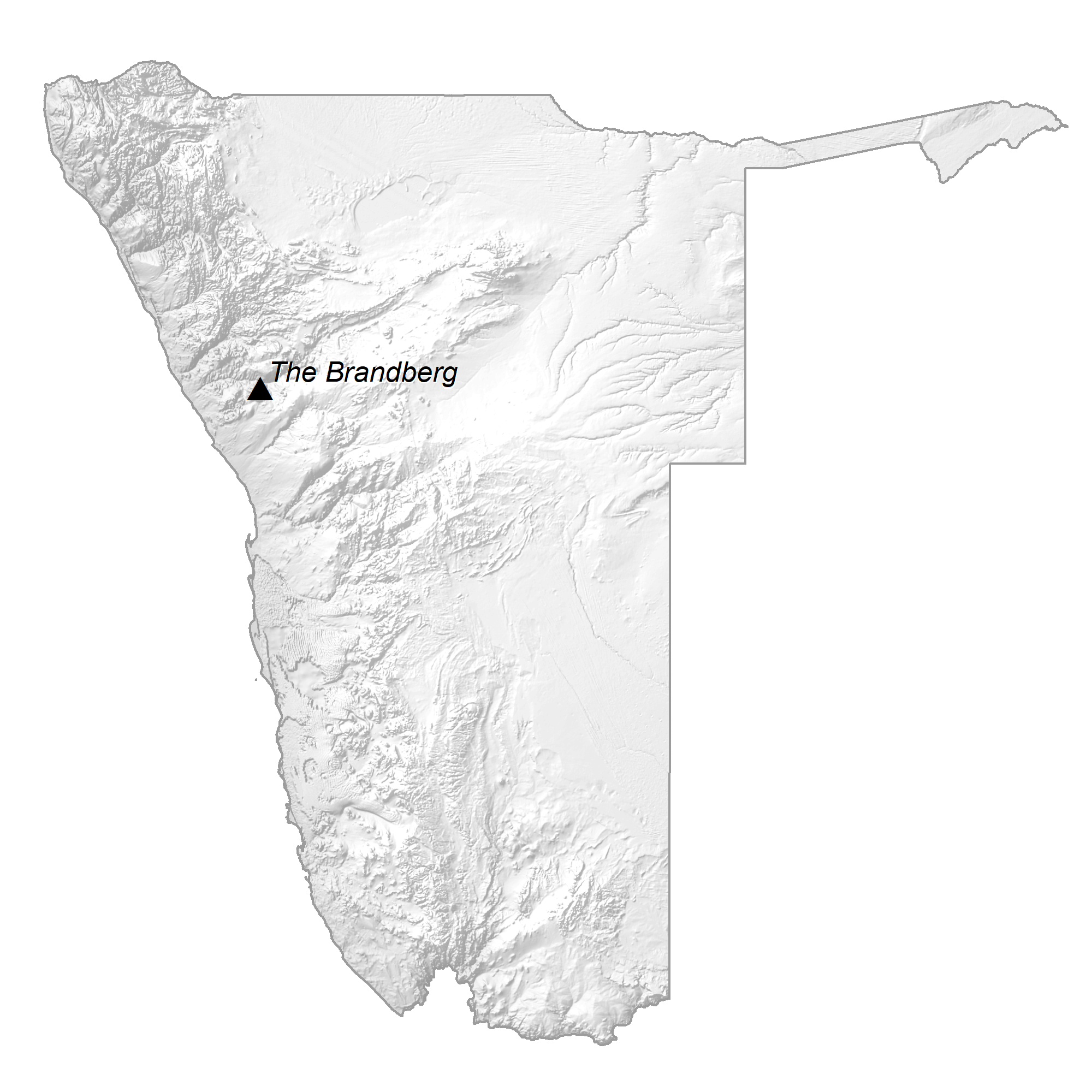
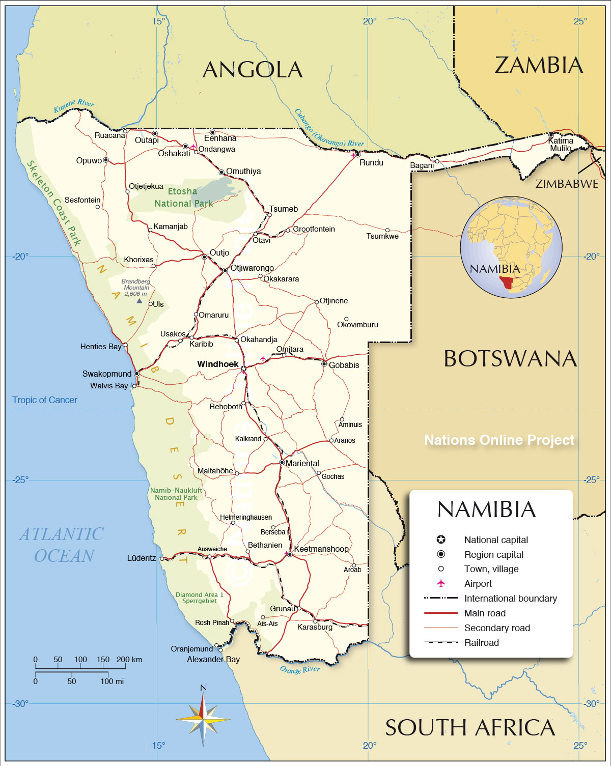
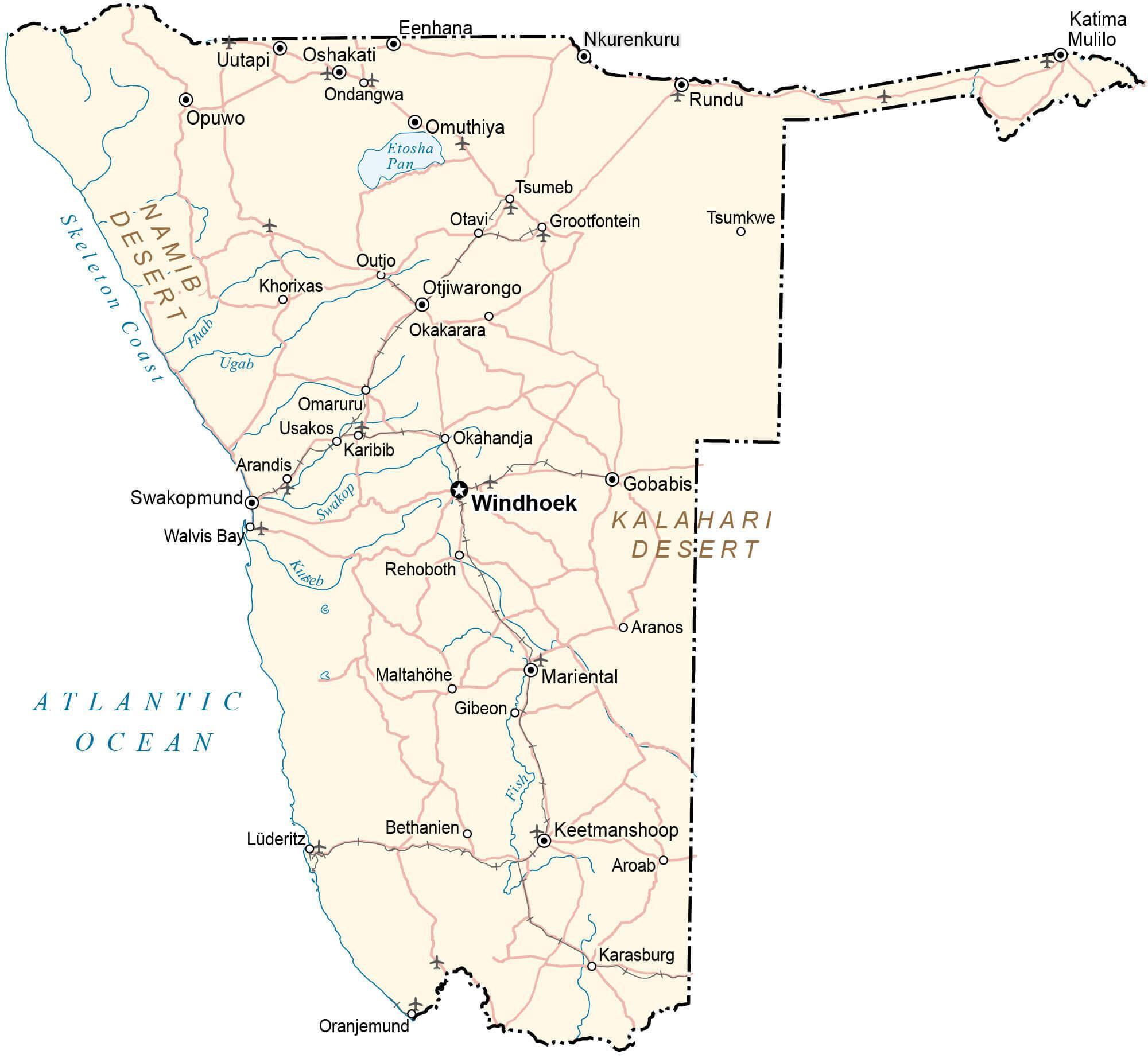
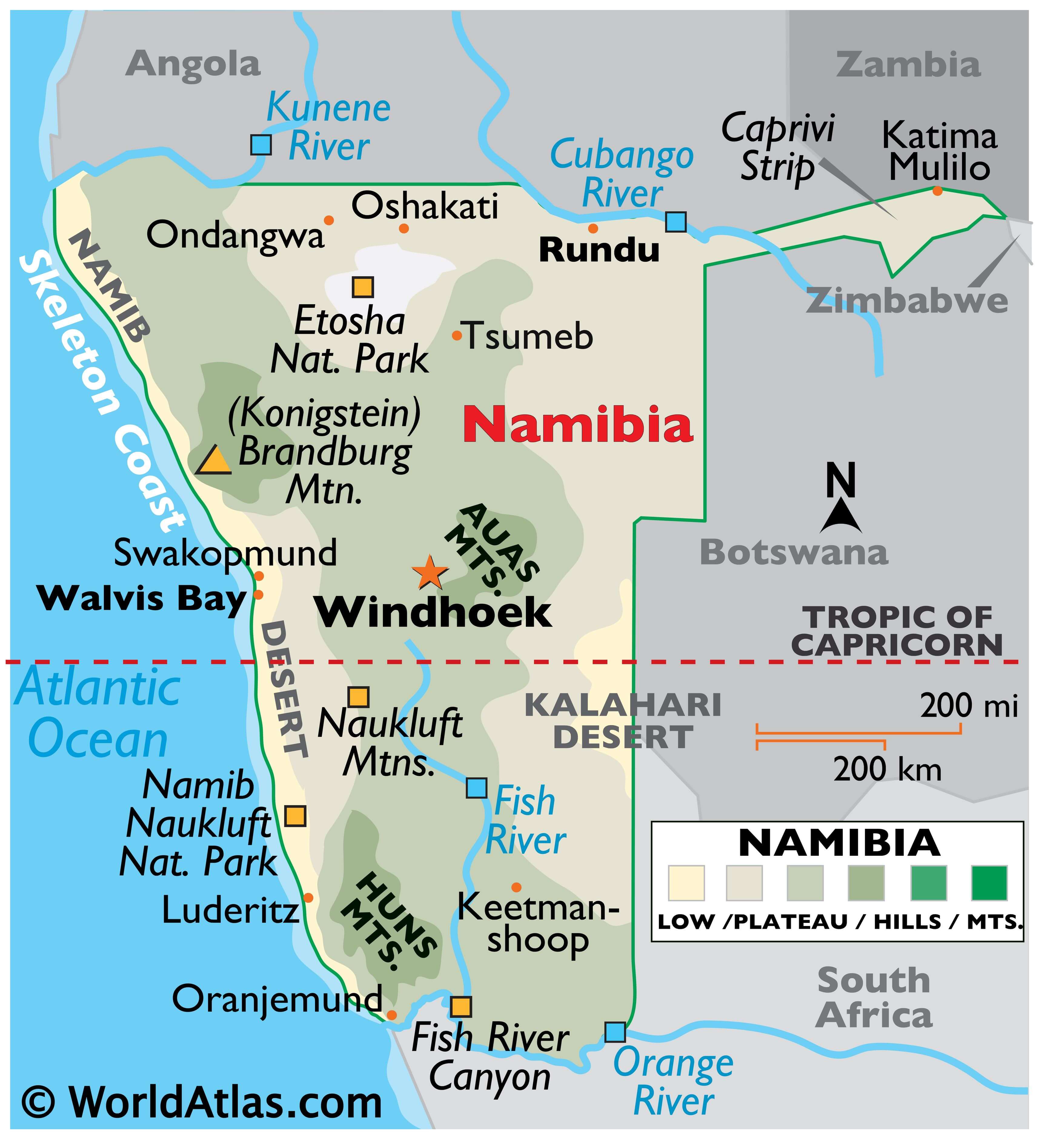
Namibia’s extent can be divided into three topographic zones from west to east. The coastal Namib Desert runs along the country’s coast on the Atlantic Ocean. It gives way to the Central Plateau to the west with the Kalahari Desert located further inwards.
The Namib Desert is both rocky and sandy. It has an average width of around 50 to 80 miles. The elevation of the Central Plateau varies from 975 to 1,980 m. Most of the country’s farmlands are confined to this region. Large parts of the plateau are covered by savanna, scrub, and woodlands. To the north, the plateau gives way to several river valleys like Kunene and Okavango. The Orange River Valley lies to the south of this plateau. The 2,573 m tall Mount Brand, Namibia’s highest mountain, is located on the western edge of the plateau.
Swakop, Kuiseb, and Fish are some of the major rivers of the country.
The Skeleton Coast of Namibia, as shown on the map, is infamous for its dense fogs that results in numerous shipwrecks in the region.
The lowest point in the country is the Atlantic Ocean at 0 m or sea level.
| Flag: |  |
|---|---|
| Legal Name: | Republic of Namibia |
| Capital Value: | Windhoek |
| Largest City: |
Windhoek (431,171) |
| Official languages: | English |
| Demonym(s): | Namibian |
| Government: | Unitary dominant-party semi-presidential republic |
| Legislature: | Parliament |
| Total Area: | 824,292 km² |
| Land Area: | 823,290 km² |
| Water Area: | 1,002 km² |
| Population: | 2,494,530 |
| Density: | 3.2/km (8.3/sq mi) (235th) |
| GDP: | $12.37 Billion |
| GDP Per Capita: | $4,957.46 |
| Currency Value: | Namibian dollars (NAD) |
| Driving side: | left |
| Calling code: | +264 |
| Internet TLD: | .na |
Explore Namibia’s stunning landscape with this interactive map. View the country’s major cities, roads, lakes, and rivers, as well as satellite imagery and an elevation map that highlights topographic features such as the Skeleton Coast and Central Plateau. See the beauty of Namibia right from your computer!
Online Interactive Political Map
Click on ![]() to view map in "full screen" mode.
to view map in "full screen" mode.
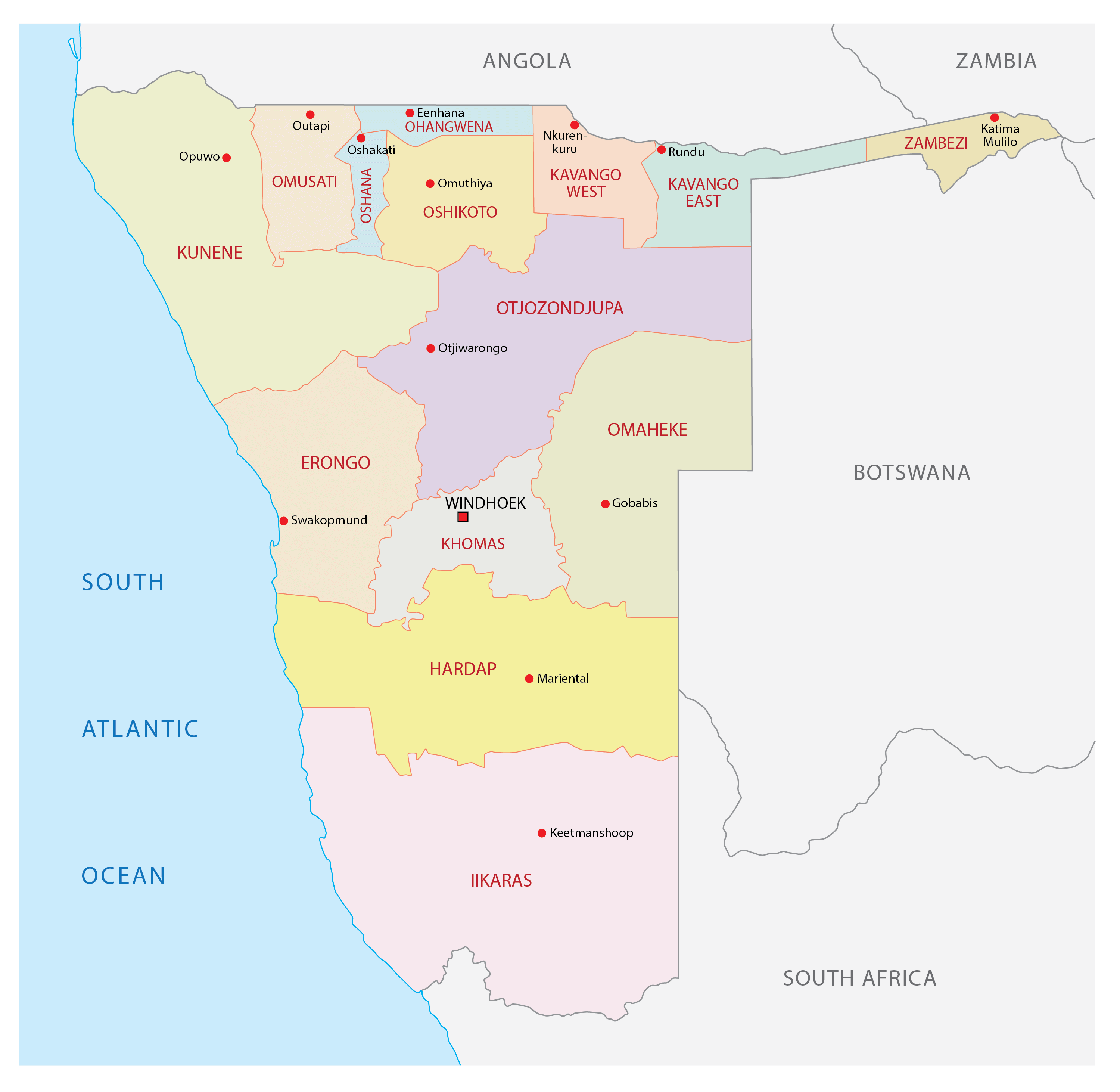
Namibia is divided into 14 regions for administrative efficiency. The political map of the country represents these divisions and their capital cities. In alphabetical order, these regions are as follows: Erongo, Hardap, //Karas, Kavango East, Kavango West, Khomas, Kunene, Ohangwena, Omaheke, Omusati, Oshana, Oshikoto, Otjozondjupa, Zambezi; note – the Karas Region was renamed //Karas in September 2013 to include the alveolar lateral click of the Khoekhoegowab language.
With an area of 161,514sq. km, the //Karas Region is the largest by area in the country while the Khomas Region is the most populous one. Windhoek, Namibia’s capital and largest city is located in the Khomas Region.
Location Maps
Where is Namibia?
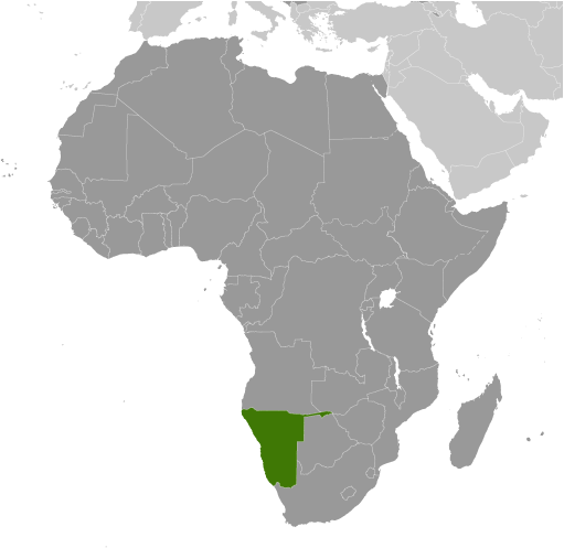
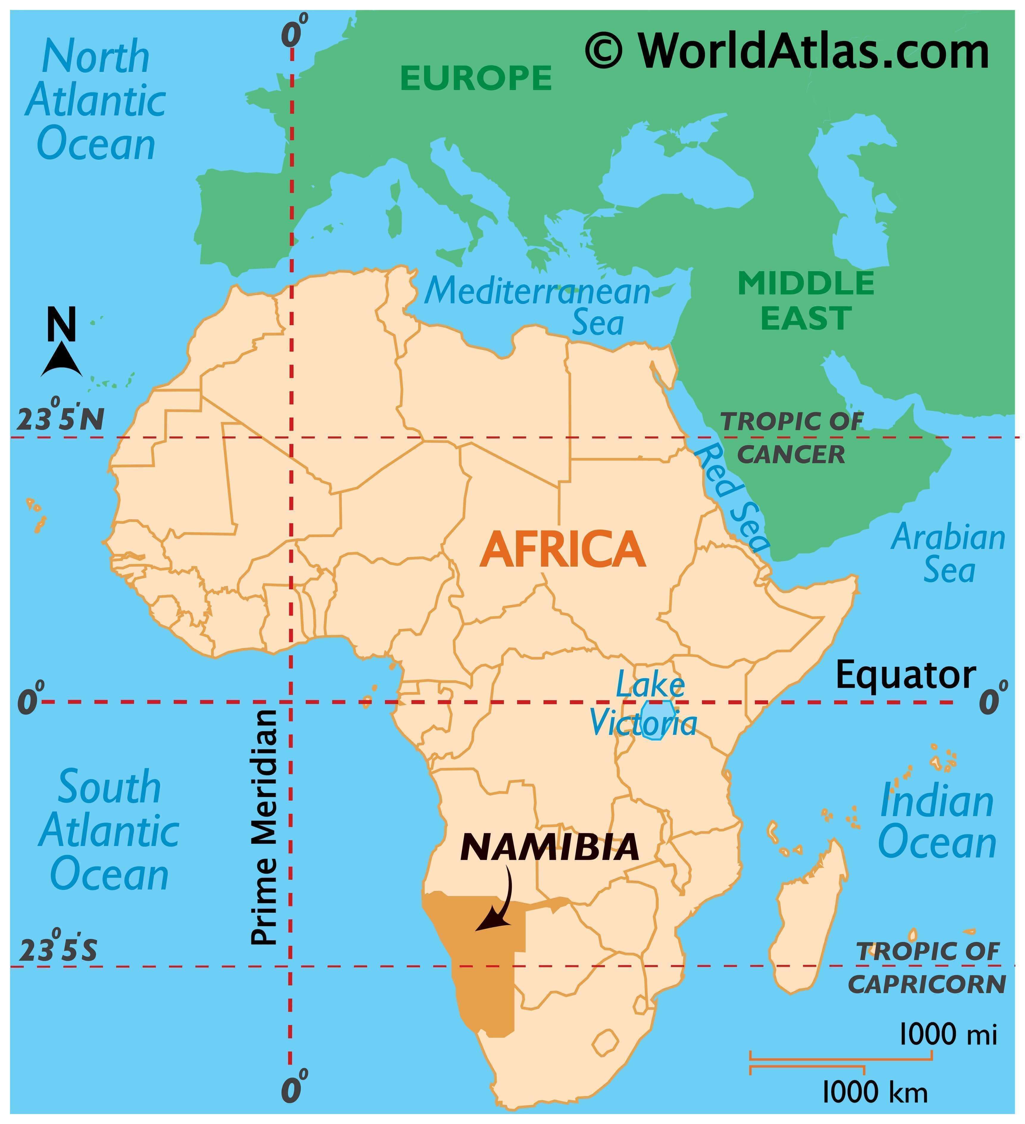
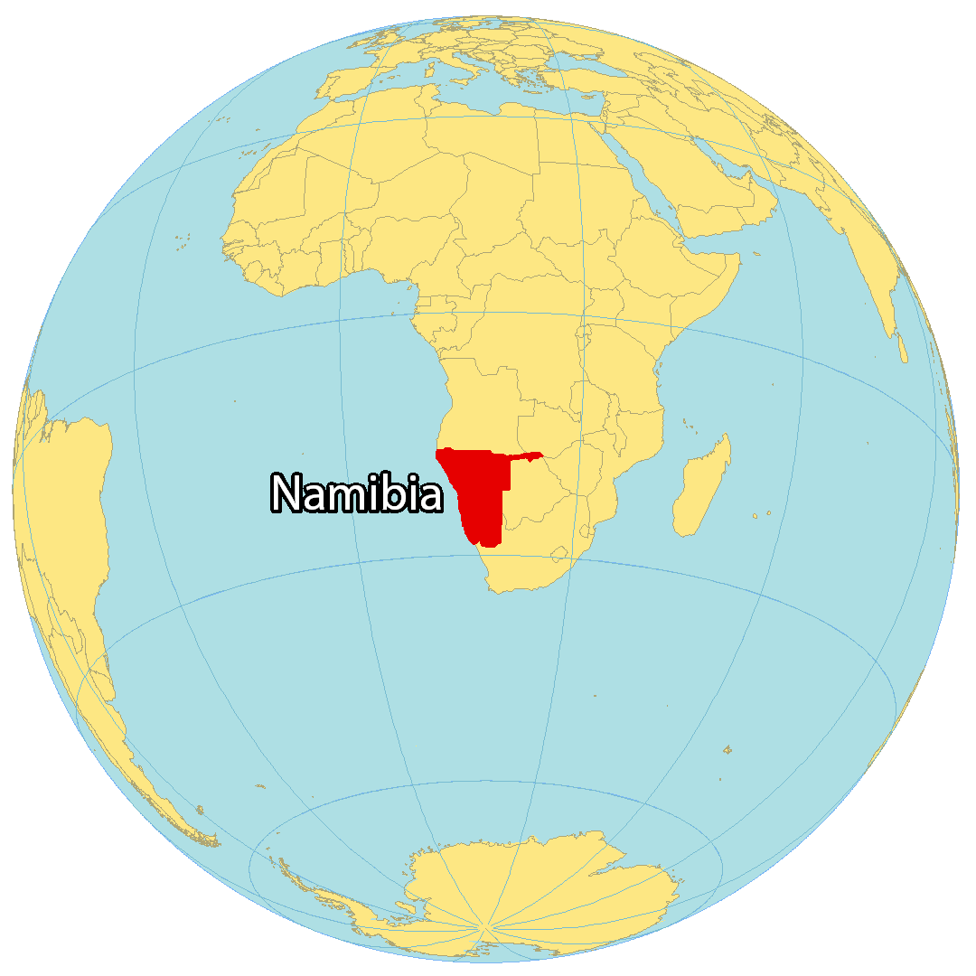
Namibia is a country located in Southeastern Africa. It has an incredibly unique landscape, featuring vast deserts, granite mountains, and the Skeleton Coast. The country is bordered by Angola to the north, Zambia to the northeast, Zimbabwe to the east, Botswana to the east, and South Africa to the south. Namibia also has a 1,572-kilometer (977 mi) coastline along the South Atlantic Ocean. The most notable feature of the country is the panhandle-shaped Caprivi Strip in the northeast. Windhoek is the capital and largest city of Namibia, with other major cities including Rundu, Walvis Bay, and Oshakati.
High Definition Political Map of Namibia

History
Etymology
The name of the country is derived from the Namib desert, the oldest desert in the world. The name Namib itself is of Nama origin and means “vast place”. That word for the country was chosen by Mburumba Kerina, who originally proposed the name the “Republic of Namib”. Before its independence in 1990, the area was known first as German South-West Africa (Deutsch-Südwestafrika), then as South West Africa, reflecting the colonial occupation by the Germans and South Africans.
Pre-colonial period
The dry lands of Namibia have been inhabited since prehistoric times by the San, Damara, and Nama. Around the 14th century, immigrating Bantu people began to arrive during the Bantu expansion from central Africa.
From the late 18th century onward, Oorlam people from Cape Colony crossed the Orange River and moved into the area that today is southern Namibia. Their encounters with the nomadic Nama tribes were largely peaceful. They received the missionaries accompanying the Oorlam very well, granting them the right to use waterholes and grazing against an annual payment. On their way further north, however, the Oorlam encountered clans of the OvaHerero at Windhoek, Gobabis, and Okahandja, who resisted their encroachment. The Nama-Herero War broke out in 1880, with hostilities ebbing only after the German Empire deployed troops to the contested places and cemented the status quo among the Nama, Oorlam, and Herero.
In 1878, the Cape of Good Hope, then a British colony, annexed the port of Walvis Bay and the offshore Penguin Islands; these became an integral part of the new Union of South Africa at its creation in 1910.
The first Europeans to disembark and explore the region were the Portuguese navigators Diogo Cão in 1485 and Bartolomeu Dias in 1486, but the Portuguese did not try to claim the area. Like most of the interior of Sub-Saharan Africa, Namibia was not extensively explored by Europeans until the 19th century. At that time traders and settlers came principally from Germany and Sweden. In 1870, Finnish missionaries came to the northern part of Namibia to spread the Lutheran religion among the Ovambo and Kavango people. In the late 19th century, Dorsland Trekkers crossed the area on their way from the Transvaal to Angola. Some of them settled in Namibia instead of continuing their journey.
German rule
Namibia became a German colony in 1884 under Otto von Bismarck to forestall perceived British encroachment and was known as German South West Africa (Deutsch-Südwestafrika). The Palgrave Commission by the British governor in Cape Town determined that only the natural deep-water harbour of Walvis Bay was worth occupying and thus annexed it to the Cape province of British South Africa.
From 1904 to 1907, the Herero and the Namaqua took up arms against brutal German colonialism. In a calculated punitive action by the German occupiers, government officials ordered the extinction of the natives in the OvaHerero and Namaqua genocide. In what has been called the “first genocide of the 20th century”, the Germans systematically killed 10,000 Nama (half the population) and approximately 65,000 Herero (about 80% of the population). The survivors, when finally released from detention, were subjected to a policy of dispossession, deportation, forced labour, racial segregation, and discrimination in a system that in many ways foreshadowed the apartheid established by South Africa in 1948.
Most Africans were confined to so-called native territories, which under South African rule after 1949 were turned into “homelands” (Bantustans). Some historians have speculated that the German genocide in Namibia was a model for the Nazis in the Holocaust. The memory of genocide remains relevant to ethnic identity in independent Namibia and to relations with Germany. The German minister for aid development apologised for the Namibian genocide in 2004, however, the German government distanced itself from this apology.
South African mandate
During World War I, South African troops under General Louis Botha occupied the territory and deposed the German colonial administration. The end of the war and the Treaty of Versailles resulted in South West Africa remaining a possession of South Africa, at first as a League of Nations mandate, until 1990. The mandate system was formed as a compromise between those who advocated for an Allied annexation of former German and Ottoman territories and a proposition put forward by those who wished to grant them to an international trusteeship until they could govern themselves. It permitted the South African government to administer South West Africa until that territory’s inhabitants were prepared for political self-determination. South Africa interpreted the mandate as a veiled annexation and made no attempt to prepare South West Africa for future autonomy.
As a result of the Conference on International Organization in 1945, the League of Nations was formally superseded by the United Nations (UN) and former League mandates by a trusteeship system. Article 77 of the United Nations Charter stated that UN trusteeship “shall apply…to territories now held under mandate”; furthermore, it would “be a matter of subsequent agreement as to which territories in the foregoing territories will be brought under the trusteeship system and under what terms”. The UN requested all former League of Nations mandates be surrendered to its Trusteeship Council in anticipation of their independence. South Africa declined to do so and instead requested permission from the UN to formally annex South West Africa, for which it received considerable criticism. When the UN General Assembly rejected this proposal, South Africa dismissed its opinion and began solidifying control of the territory. The UN Generally Assembly and Security Council responded by referring the issue to the International Court of Justice (ICJ), which held a number of discussions on the legality of South African rule between 1949 and 1966.
South Africa began imposing apartheid, its codified system of racial segregation and discrimination, on South West Africa during the late 1940s. Black South West Africans were subject to pass laws, curfews, and a host of residential regulations that restricted their movement. Development was concentrated in the southern region of the territory adjacent to South Africa, known as the “Police Zone”, where most of the major settlements and commercial economic activity were located. Outside the Police Zone, indigenous peoples were restricted to theoretically self-governing tribal homelands.
During the late 1950s and early 1960s, the accelerated decolonisation of Africa and mounting pressure on the remaining colonial powers to grant their colonies self-determination resulted in the formation of nascent nationalist parties in South West Africa. Movements such as the South West African National Union (SWANU) and the South West African People’s Organisation advocated for the formal termination of South Africa’s mandate and independence for the territory. In 1966, following the ICJ’s controversial ruling that it had no legal standing to consider the question of South African rule, SWAPO launched an armed insurgency that escalated into part of a wider regional conflict known as the South African Border War.
Independence
As SWAPO’s insurgency intensified, South Africa’s case for annexation in the international community continued to decline. The UN declared that South Africa had failed in its obligations to ensure the moral and material well-being of South West Africa’s indigenous inhabitants, and had thus disavowed its own mandate. On 12 June 1968, the UN General Assembly adopted a resolution proclaiming that, in accordance with the desires of its people, South West Africa be renamed Namibia. United Nations Security Council Resolution 269, adopted in August 1969, declared South Africa’s continued occupation of Namibia illegal. In recognition of this landmark decision, SWAPO’s armed wing was renamed the People’s Liberation Army of Namibia (PLAN).
Namibia became one of several flashpoints for Cold War proxy conflicts in southern Africa during the latter years of the PLAN insurgency. The insurgents sought out weapons and sent recruits to the Soviet Union for military training. As the PLAN war effort gained momentum, the Soviet Union and other sympathetic states such as Cuba continued to increase their support, deploying advisers to train the insurgents directly as well as supplying more weapons and ammunition. SWAPO’s leadership, dependent on Soviet, Angolan, and Cuban military aid, positioned the movement firmly within the socialist bloc by 1975. This practical alliance reinforced the external perception of SWAPO as a Soviet proxy, which dominated Cold War rhetoric in South Africa and the United States. For its part, the Soviet Union supported SWAPO partly because it viewed South Africa as a regional Western ally.
Growing war weariness and the reduction of tensions between the superpowers compelled South Africa, Angola, and Cuba to accede to the Tripartite Accord, under pressure from both the Soviet Union and the United States. South Africa accepted Namibian independence in exchange for Cuban military withdrawal from the region and an Angolan commitment to cease all aid to PLAN. PLAN and South Africa adopted an informal ceasefire in August 1988, and a United Nations Transition Assistance Group (UNTAG) was formed to monitor the Namibian peace process and supervise the return of refugees. The ceasefire was broken after PLAN made a final incursion into the territory, possibly as a result of misunderstanding UNTAG’s directives, in March 1989. A new ceasefire was later imposed with the condition that the insurgents were to be confined to their external bases in Angola until they could be disarmed and demobilised by UNTAG.
By the end of the 11-month transition period, the last South African troops had been withdrawn from Namibia, all political prisoners granted amnesty, racially discriminatory legislation repealed, and 42,000 Namibian refugees returned to their homes. Just over 97% of eligible voters participated in the country’s first parliamentary elections held under a universal franchise. The United Nations plan included oversight by foreign election observers in an effort to ensure a free and fair election. SWAPO won a plurality of seats in the Constituent Assembly with 57% of the popular vote. This gave the party 41 seats, but not a two-thirds majority, which would have enabled it to draft the constitution on its own.
The Namibian Constitution was adopted in February 1990. It incorporated protection for human rights and compensation for state expropriations of private property and established an independent judiciary, legislature, and an executive presidency (the constituent assembly became the national assembly). The country officially became independent on 21 March 1990. Sam Nujoma was sworn in as the first President of Namibia at a ceremony attended by Nelson Mandela of South Africa (who had been released from prison the previous month) and representatives from 147 countries, including 20 heads of state. In 1994, shortly before the first multiracial elections in South Africa, that country ceded Walvis Bay to Namibia.
After independence
Since independence Namibia has completed the transition from white minority apartheid rule to parliamentary democracy. Multiparty democracy was introduced and has been maintained, with local, regional and national elections held regularly. Several registered political parties are active and represented in the National Assembly, although the SWAPO has won every election since independence. The transition from the 15-year rule of President Nujoma to his successor Hifikepunye Pohamba in 2005 went smoothly.
Since independence, the Namibian government has promoted a policy of national reconciliation. It issued an amnesty for those who fought on either side during the liberation war. The civil war in Angola spilled over and adversely affected Namibians living in the north of the country. In 1998, Namibia Defence Force (NDF) troops were sent to the Democratic Republic of the Congo as part of a Southern African Development Community (SADC) contingent.
In 1999, the national government quashed a secessionist attempt in the northeastern Caprivi Strip. The Caprivi conflict was initiated by the Caprivi Liberation Army (CLA), a rebel group led by Mishake Muyongo. It wanted the Caprivi Strip to secede and form its own society.
In December 2014, Prime Minister Hage Geingob, the candidate of ruling SWAPO, won the presidential elections, taking 87% of the vote. His predecessor, President Hifikepunye Pohamba, also of SWAPO, had served the maximum two terms allowed by the constitution. In December 2019, President Hage Geingob was re-elected for a second term, taking 56.3% of the vote.
Physical Map of Namibia

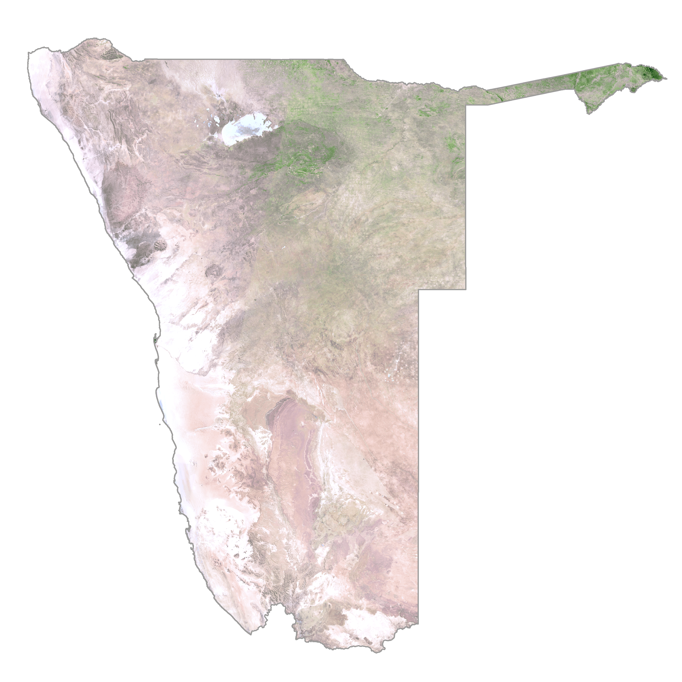
Namibia Satellite Map
Elevation Map