Uzbekistan occupies an area of 447,000 sq. km in Central Asia. It is only one of the two countries in the world that is doubly-landlocked. The other one is Liechtenstein.
As can be observed on the physical map above, the topography of Uzbekistan is about 80% sandy, scrubby desert, including the massive Kyzyl Kum.
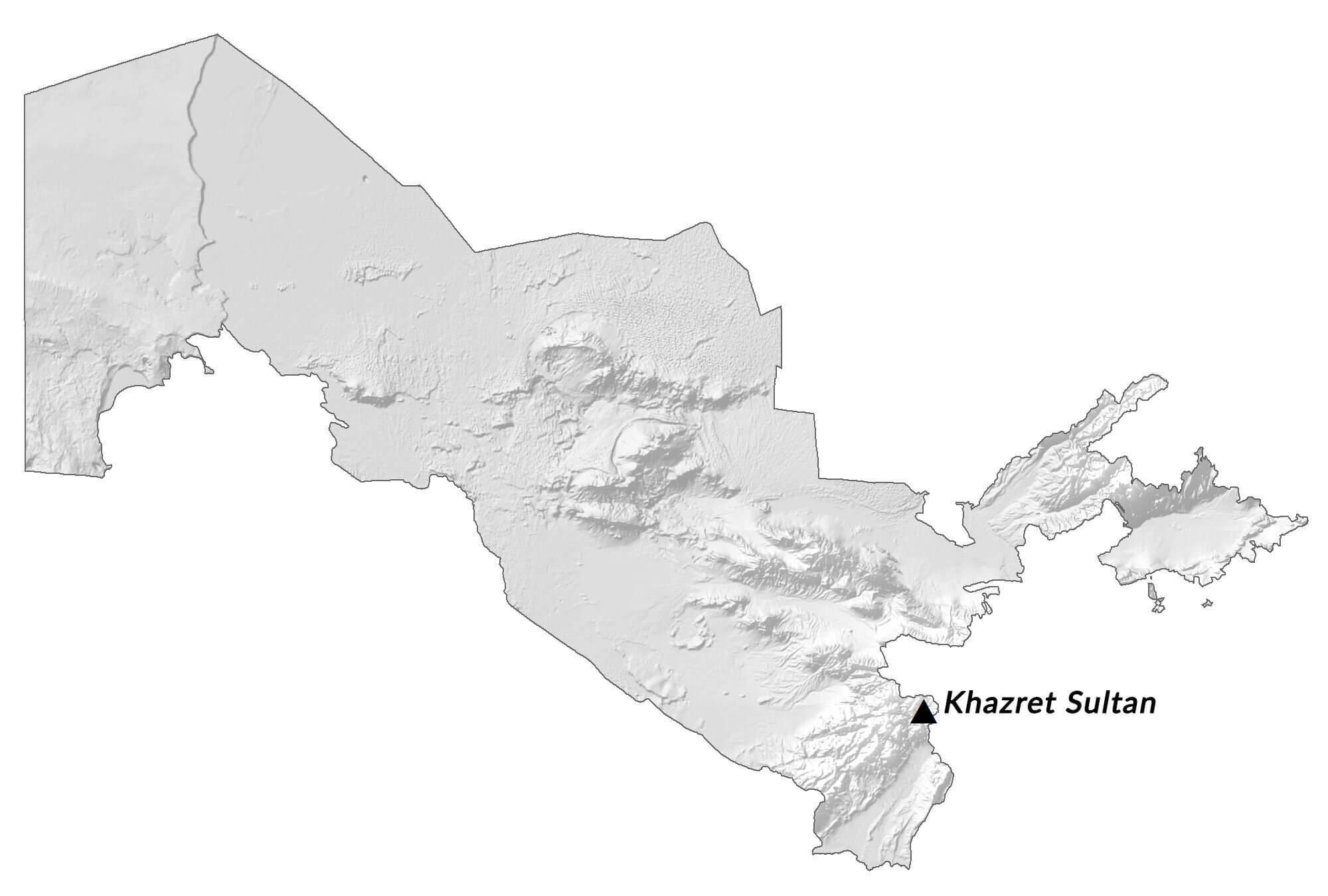
The mountains of the southeast and northeast are foothills and lower mountains of the Tian Shan Range, an extension of the Himalayas. As marked on the map by a yellow upright triangle, the highest point in the country, the 4,301 m tall Adelunga Toghi is located to the extreme northeast of the country.
The Fergana Valley, between the northeast and southeast mountain ranges, is reportedly home to the most desirable agricultural land and climate in all of western Asia.
In the far west, Uzbekistan is dominated by vast lowlands, the Amu Darya River valley, the Ustyurt Plateau, and the southern half of the Aral Sea.
The Aral Sea, located in both Kazakhstan and Uzbekistan, is disappearing. Mismanagement of this valuable sea by the overuse of its tributary rivers is now recognized as one of the world’s worst environmental disasters.
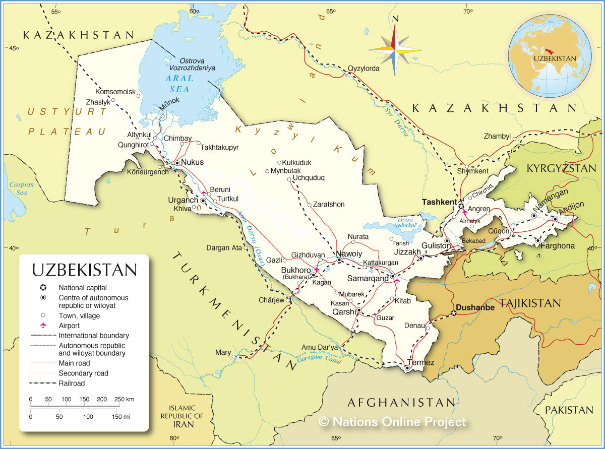
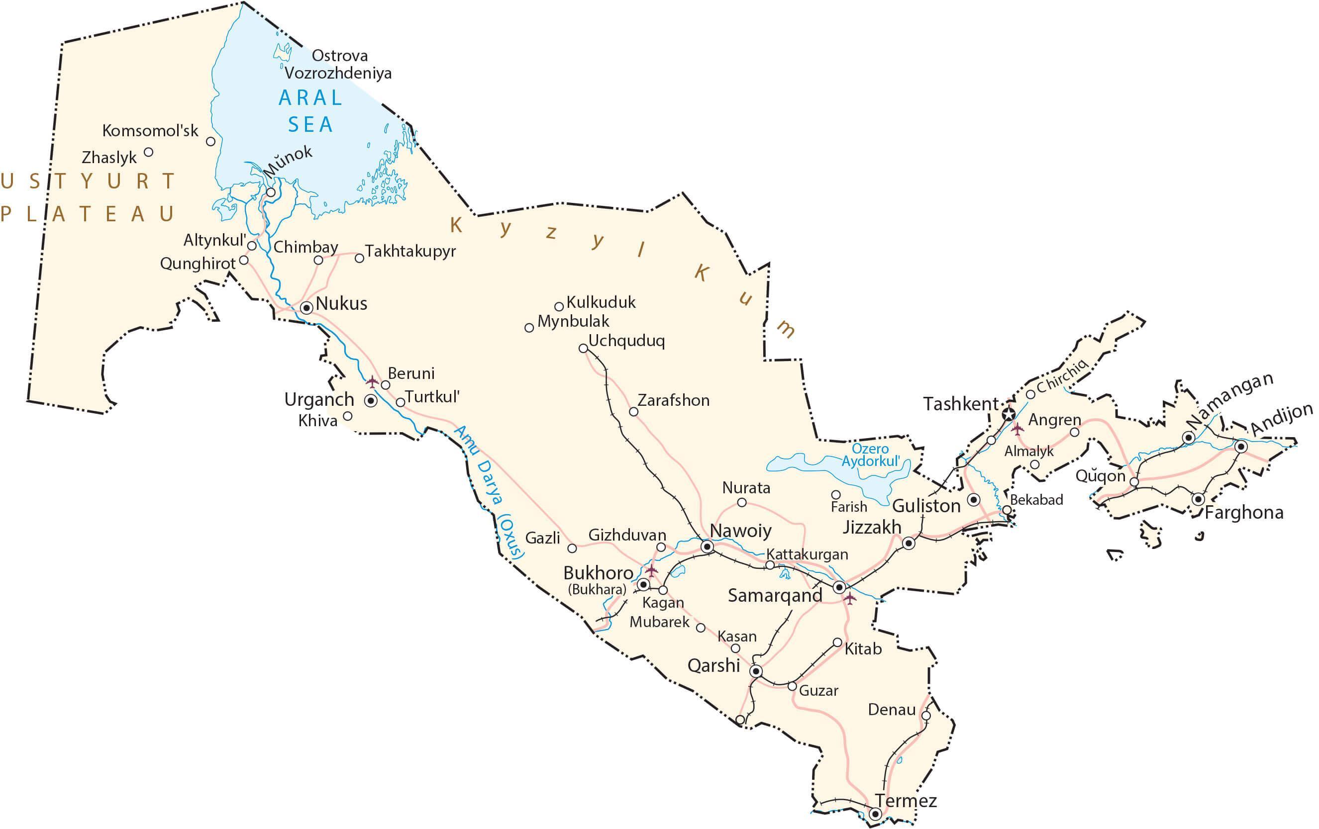
Some of the country’s major rivers and lakes have been marked on the map. The most significant rivers of Uzbekistan include the Amu Darya and the Syr Darya; major lakes include Lake Ayddrkul and Lake Sarykamish.
The lowest point of the country is at -12 m below sea level in Lake Sarykamish.
| Flag: |  |
|---|---|
| Legal Name: | Republic of Uzbekistan |
| Capital Value: | Tashkent (Toshkent) |
| Official languages: | Uzbek |
| Demonym(s): | Uzbekistani |
| Government: | Unitary dominant-party presidential republic |
| Legislature: | Oliy Majlis |
| Total Area: | 447,400 km² |
| Land Area: | 425,400 km² |
| Water Area: | 22,000 km² |
| Population: | 33,580,650 |
| Density: | 74.1/km (191.9/sq mi) (128th) |
| GDP: | $57.92 Billion |
| GDP Per Capita: | $1,724.84 |
| Currency Value: | Uzbekistani soum (UZS) |
| Driving side: | right |
| Calling code: | +998 |
| Internet TLD: | .uz |
Explore the beauty of Uzbekistan with this comprehensive map collection. Uzbekistan is a country located in Central Asia, bordered by Kazakhstan, Kyrgyzstan, Tajikistan, Afghanistan, and Turkmenistan. This map collection features cities, towns, highways, roads, lakes, and rivers, as well as satellite imagery and an elevation map. Discover the breathtaking views of this incredible country and explore the many wonders that Uzbekistan has to offer.
Online Interactive Political Map
Click on ![]() to view map in "full screen" mode.
to view map in "full screen" mode.
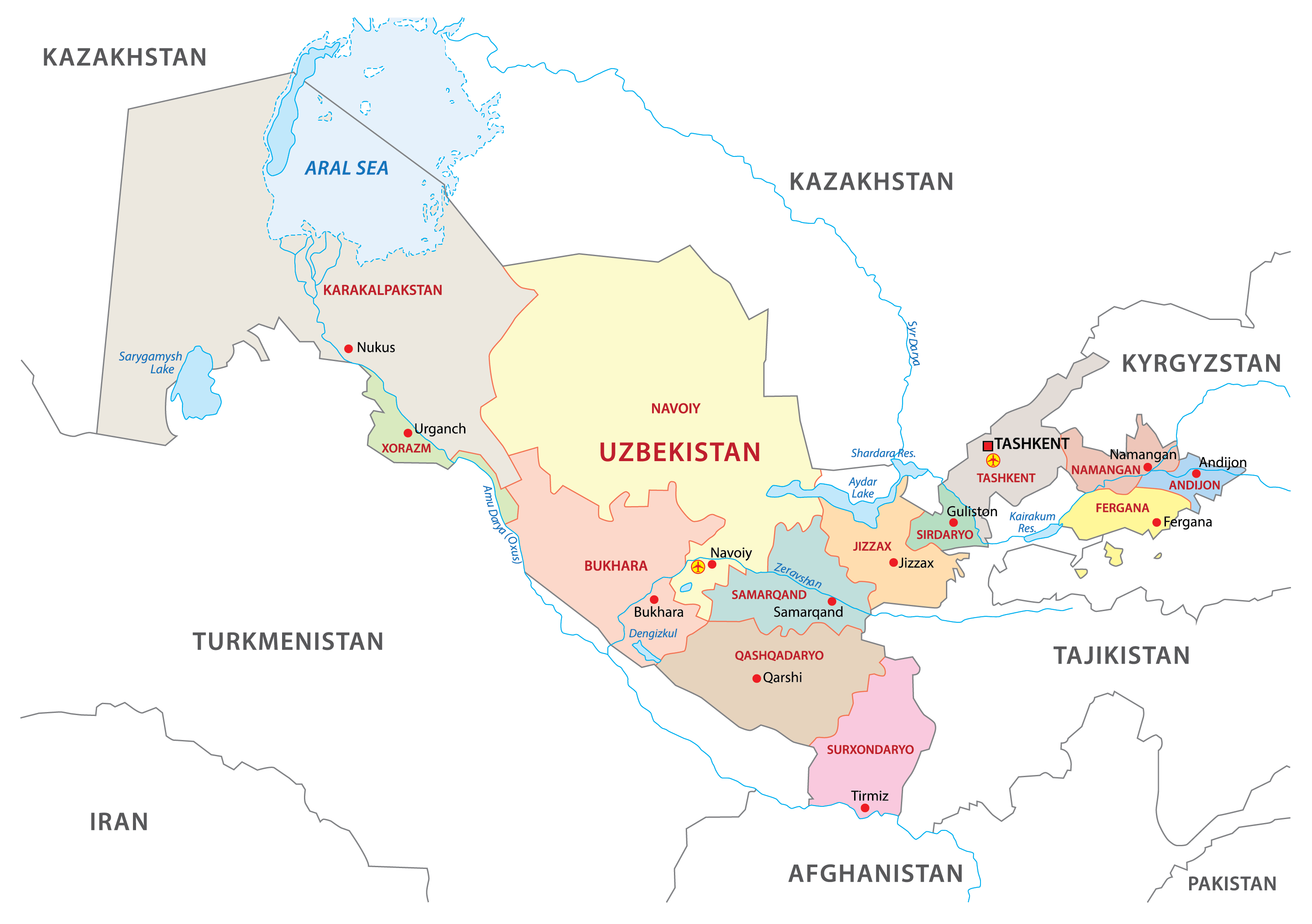
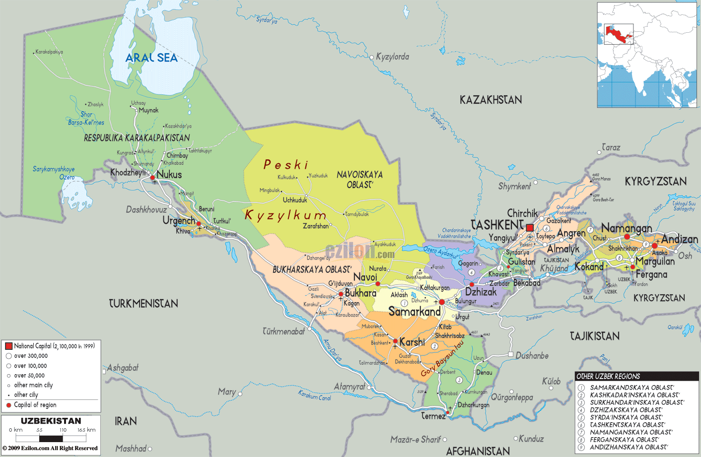
Uzbekistan (Republic of Uzbekistan) is divided into 12 administrative regions, 1 autonomous republic, and 1 independent city. In alphabetical order, these regions are: Andijan, Buxoro, Fergana, Jizzax, Namangan, Navoiy, Qashqadaryo, Samarkand, Sirdaryo, Surxondaryo, Tashkent, and Xorazm; along with the autonomous republic of Karakalpakstan and the independent city of Tashkent. These regions and the Republic are further subdivided into districts and cities. The districts in turn form smaller subdivisions – cities, urban-type settlements, and citizen assemblies of villages.
With an area of 161,358 sq. km, Karakalpakstan is the largest subdivision of the country by area and Samarkand Region is the most populous one.
Tashkent located in the north-eastern part is the national capital.
Location Maps
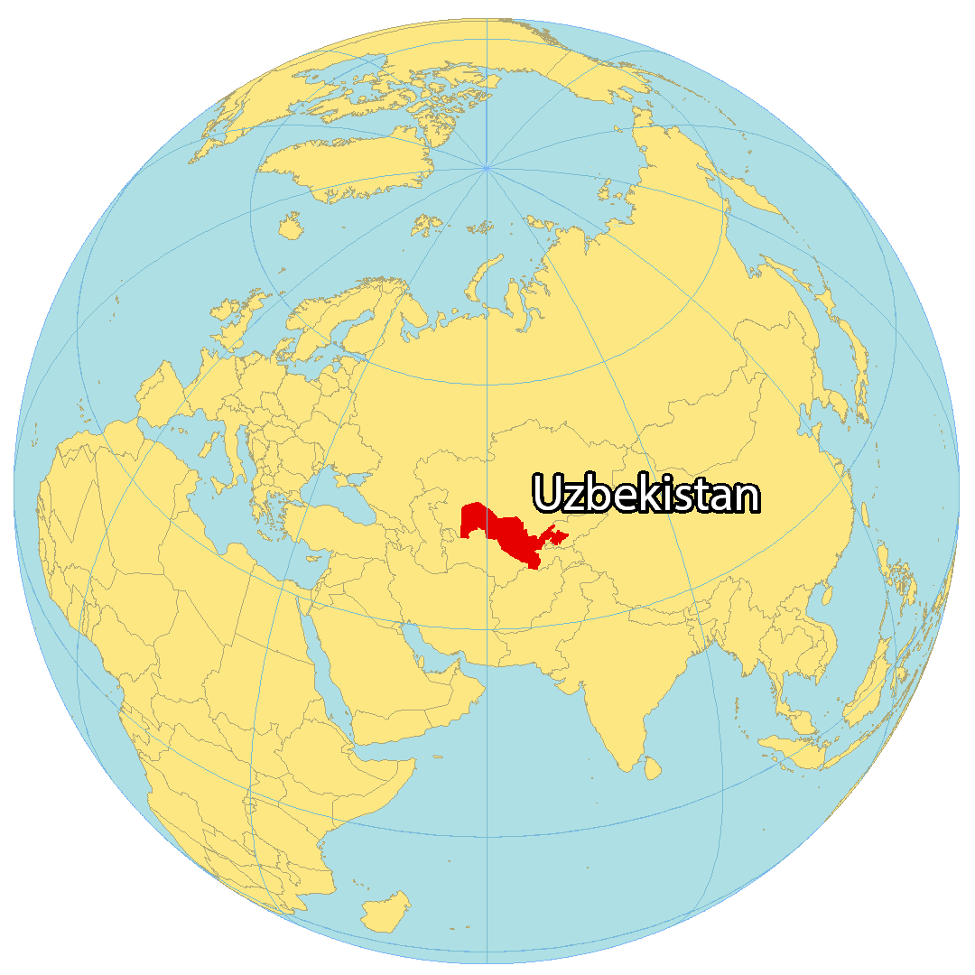
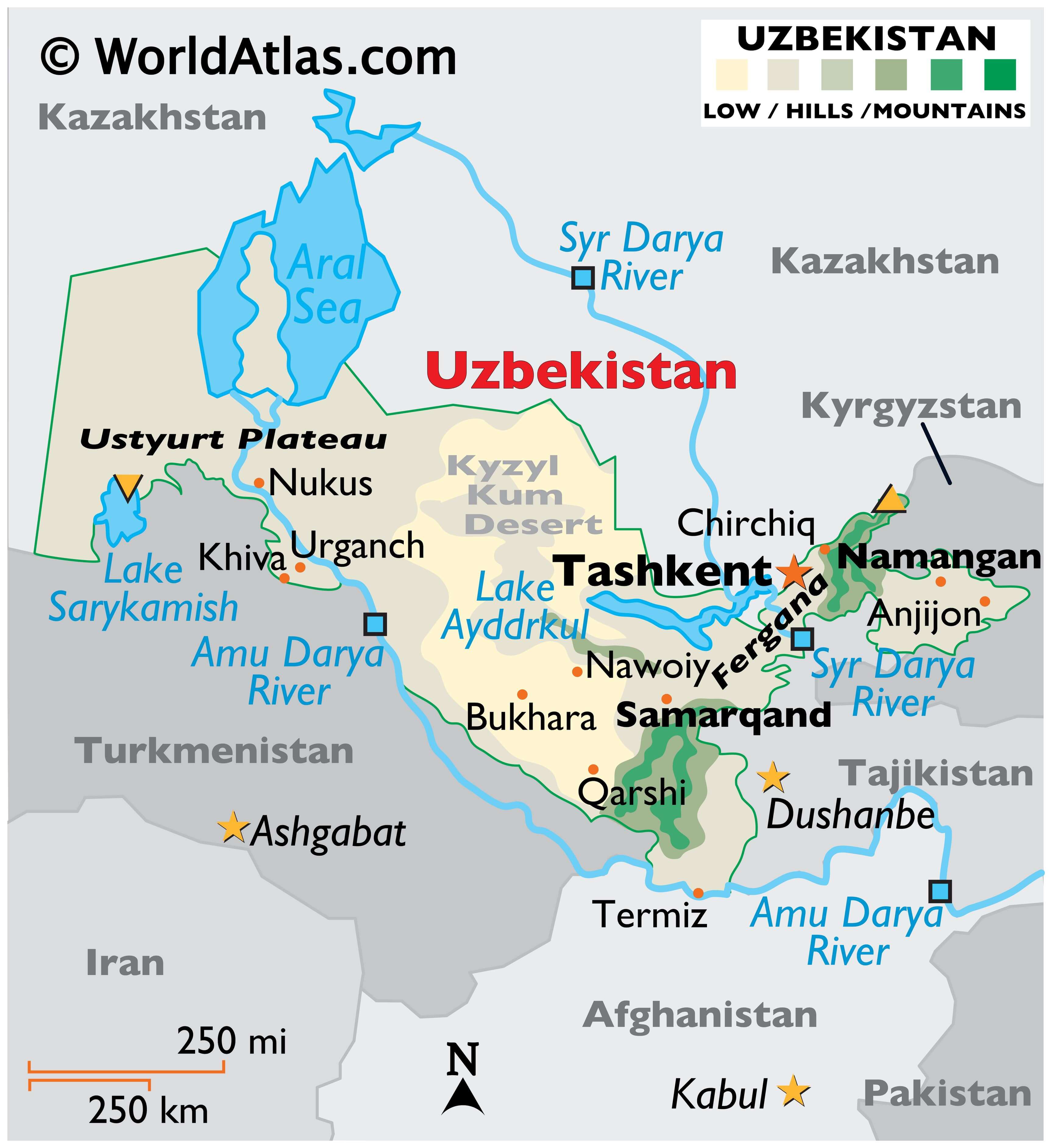
Where is Uzbekistan?
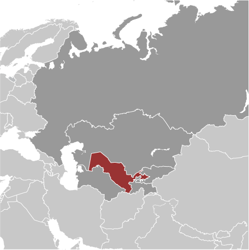
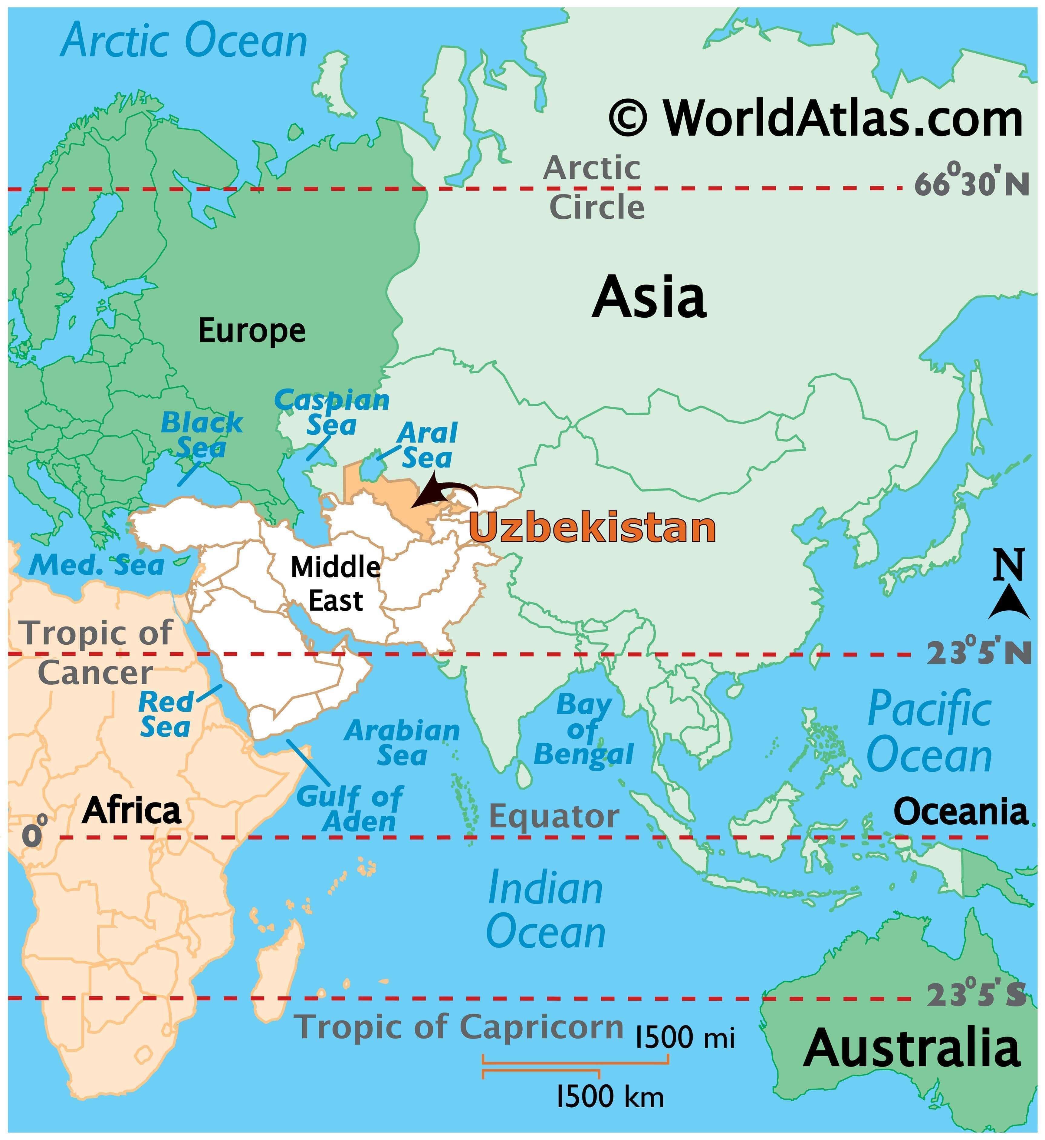
Uzbekistan is a dry, landlocked nation situated in Central Asia with generous parts of deserts. It has five neighboring countries, namely Kazakhstan to the north, Kyrgyzstan to the northeast, Tajikistan to the southeast, Afghanistan to the south, and Turkmenistan to the southwest.
Tashkent is the capital and largest city of Uzbekistan located in the northeast, close to the boundary with Kazakhstan. Other important cities are Samarqand, Fergana, and Namangan.
High Definition Political Map of Uzbekistan
History
The first people known to have inhabited Central Asia were Scythians who came from the northern grasslands of what is now Uzbekistan, sometime in the first millennium BC; when these nomads settled in the region they built an extensive irrigation system along the rivers. At this time, cities such as Bukhoro (Bukhara) and Samarqand (Samarkand) emerged as centres of government and high culture. By the fifth century BC, the Bactrian, Sogdian, and Tokharian states dominated the region.
As East Asia began to develop its silk trade with the West, Persian cities took advantage of this commerce by becoming centres of trade. Using an extensive network of cities and rural settlements in the province of Transoxiana, and further east in what is today Xinjiang, the Sogdian intermediaries became the wealthiest of these Iranian merchants. As a result of this trade on what became known as the Silk Route, Bukhara and Samarkand eventually became extremely wealthy cities, and at times Transoxiana (Mawarannahr) was one of the most influential and powerful Persian provinces of antiquity.
In 327 BC, Macedonian ruler Alexander the Great conquered the Persian Empire provinces of Sogdiana and Bactria, which contained the territories of modern Uzbekistan. Popular resistance to the conquest was fierce, causing Alexander’s army to be bogged down in the region that became the northern part of the Macedonian Greco-Bactrian Kingdom. The kingdom was replaced with the Yuezhi-dominated Kushan Empire in the first century BC. For many centuries thereafter the region of Uzbekistan was ruled by the Persian empires, including the Parthian and Sassanid Empires, as well as by other empires, for example, those formed by the Turko-Persian Hephthalite and Turkic Gokturk peoples.
The Muslim conquests from the seventh century onward saw the Arabs bring Islam to Uzbekistan. In the same period, Islam began to take root among the nomadic Turkic peoples.
In the eighth century, Transoxiana, the territory between the Amudarya and Syrdarya rivers, was conquered by the Arabs (Qutayba ibn Muslim), becoming a focal point soon after the Islamic Golden Age.
In the ninth and tenth centuries, Transoxiana was brought into the Samanid State. Later, it saw the incursion of the Turkic-ruled Karakhanids, as well as the Seljuks (Sultan Sanjar) and Kara-Khitans.
The Mongol conquest under Genghis Khan during the 13th century brought change to the region. The Mongol invasion of Central Asia led to the displacement of some of the Iranian-speaking people of the region, their culture and heritage being superseded by that of the Mongolian-Turkic peoples who came thereafter. The invasions of Bukhara, Samarkand, Urgench and others resulted in mass murders and unprecedented destruction, which saw parts of Khwarezmia being completely razed.
Following the death of Genghis Khan in 1227, his empire was divided among his four sons and his family members. Despite the potential for serious fragmentation, there was an orderly succession for several generations, and control of most of Transoxiana stayed in the hands of the direct descendants of Chagatai Khan, the second son of Genghis Khan. Orderly succession, prosperity, and internal peace prevailed in the Chaghatai lands, and the Mongol Empire as a whole remained a strong and united kingdom, the Golden Horde.
After the decline of the Golden Horde, Khwarezm was briefly ruled by the Sufi Dynasty until Timur’s conquest of it in 1388. Sufids rules Khwarezm as vassals of alternatively Timurids, Golden Horde and the Khanate of Bukhara until Persian occupation in 1510.
In the early 14th century, however, as the empire began to break up into its constituent parts, the Chaghatai territory was disrupted as the princes of various tribal groups competed for influence. One tribal chieftain, Timur (Tamerlane), emerged from these struggles in the 1380s as the dominant force in Transoxiana. Although he was not a descendant of Genghis Khan, Timur became the de facto ruler of Transoxiana and proceeded to conquer all of western Central Asia, Iran, the Caucasus, Mesopotamia, Asia Minor, and the southern steppe region north of the Aral Sea. He also invaded Russia before dying during an invasion of China in 1405. Timur was also known for his extreme brutality and his conquests were accompanied by genocidal massacres in the cities he occupied.
Timur initiated the last flowering of Transoxiana by gathering together numerous artisans and scholars from the vast lands he had conquered into his capital, Samarkand, thus imbuing his empire with a rich Perso-Islamic culture. During his reign and the reigns of his immediate descendants, a wide range of religious and palatial construction masterpieces were undertaken in Samarkand and other population centres. Amir Timur initiated an exchange of medical discoveries and patronised physicians, scientists and artists from the neighbouring regions such as India; His grandson Ulugh Beg was one of the world’s first great astronomers. It was during the Timurid dynasty that Turkic, in the form of the Chaghatai dialect, became a literary language in its own right in Transoxiana, although the Timurids were Persianate in culture. The greatest Chaghataid writer, Ali-Shir Nava’i, was active in the city of Herat (now in northwestern Afghanistan) in the second half of the 15th century.
The Timurid state quickly split in half after the death of Timur. The chronic internal fighting of the Timurids attracted the attention of the Uzbek nomadic tribes living to the north of the Aral Sea. In 1501, the Uzbek forces began a wholesale invasion of Transoxiana. The slave trade in the Emirate of Bukhara became prominent and was firmly established at this time. Before the arrival of the Russians, present-day Uzbekistan was divided between the Emirate of Bukhara and the khanates of Khiva and Kokand.
In the 19th century, the Russian Empire began to expand and spread into Central Asia. There were 210,306 Russians living in Uzbekistan in 1912. The “Great Game” period is generally regarded as running from approximately 1813 to the Anglo-Russian Convention of 1907. A second, less intensive phase followed the Bolshevik Revolution of 1917. At the start of the 19th century, there were some 3,200 kilometres (2,000 mi) separating British India and the outlying regions of Tsarist Russia. Much of the land between was unmapped. In the early 1890s, Sven Hedin passed through Uzbekistan, during his first expedition.
By the beginning of 1920, Central Asia was firmly in the hands of Russia and, despite some early resistance to the Bolsheviks, Uzbekistan and the rest of Central Asia became a part of the Soviet Union. On 27 October 1924 the Uzbek Soviet Socialist Republic was created. From 1941 to 1945, during World War II, 1,433,230 people from Uzbekistan fought in the Red Army against Nazi Germany. A number also fought on the German side. As many as 263,005 Uzbek soldiers died in the battlefields of the Eastern Front, and 32,670 went missing in action.
On 20 June 1990, Uzbekistan declared its state sovereignty. On 31 August 1991, Uzbekistan declared independence after the failed coup attempt in Moscow. 1 September was proclaimed National Independence Day. The Soviet Union was dissolved on 26 December of that year. Islam Karimov, previously first secretary of the Communist Party of Uzbekistan since 1989, was elected president of the Uzbek Soviet Socialist Republic in 1990. After the collapse of the Soviet Union in 1991, he was elected president of independent Uzbekistan. An authoritarian ruler, Karimov died in September 2016. He was replaced by his long-time Prime Minister, Shavkat Mirziyoyev, on 14 December of the same year. On 6 November 2021, Mirziyoyev was sworn into his second term in office, after gaining a landslide victory in presidential election.
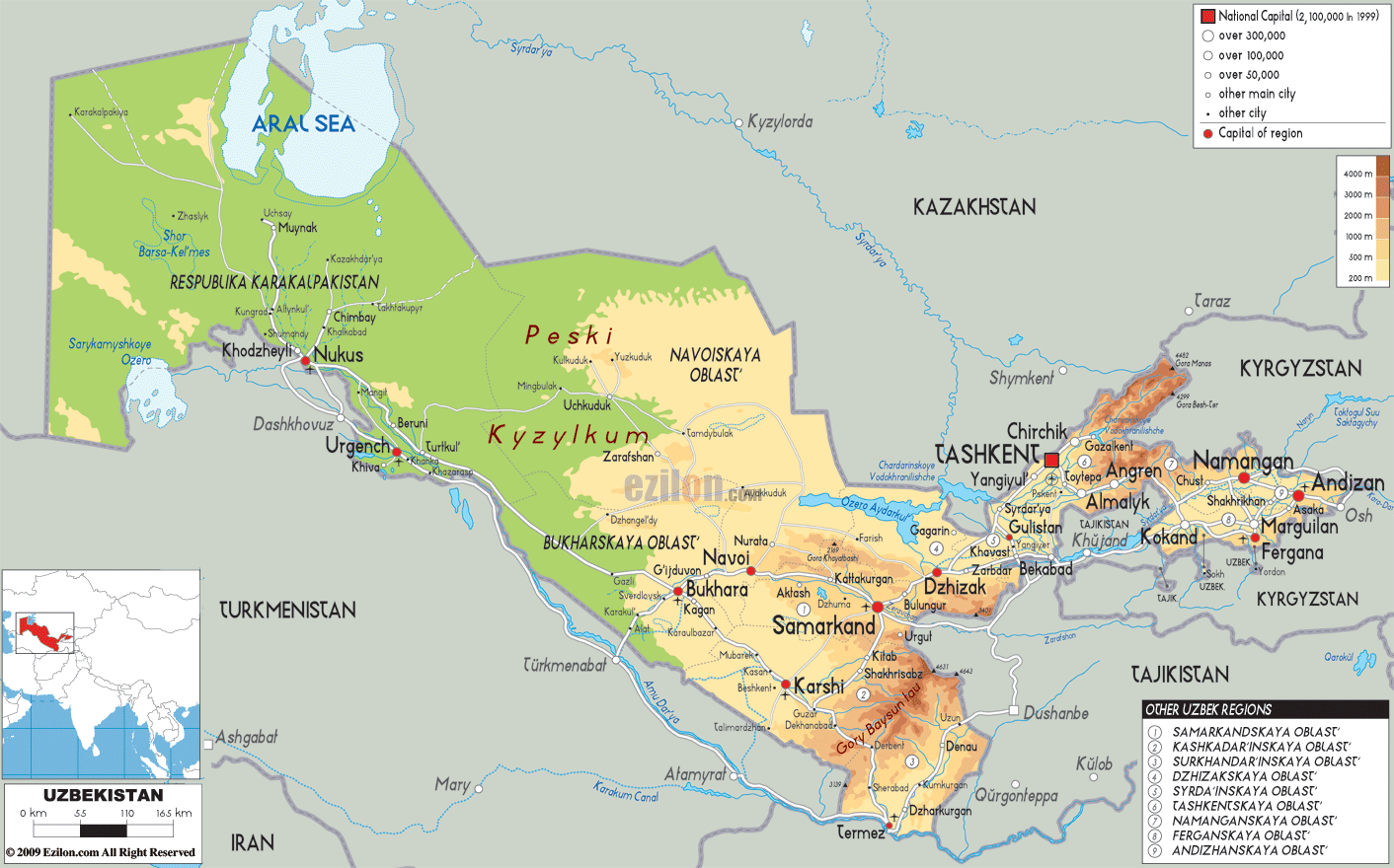
Physical Map of Uzbekistan
Geography
Uzbekistan has an area of 448,978 square kilometres (173,351 sq mi). It is the 56th largest country in the world by area and the 40th by population. Among the CIS countries, it is the fourth largest by area and the second largest by population.
Uzbekistan lies between latitudes 37° and 46° N, and longitudes 56° and 74° E. It stretches 1,425 kilometres (885 mi) from west to east and 930 kilometres (580 mi) from north to south. Bordering Kazakhstan and the Aralkum Desert (former Aral Sea) to the north and northwest, Turkmenistan and Afghanistan to the southwest, Tajikistan to the southeast, and Kyrgyzstan to the northeast, Uzbekistan is one of the largest Central Asian states and the only Central Asian state to border all the other four. Uzbekistan also shares a short border (less than 150 km or 93 mi) with Afghanistan to the south.
Uzbekistan is a hot, dry, landlocked country. It is one of two doubly landlocked countries in the world (that is, a landlocked country completely surrounded by other landlocked countries), the other being Liechtenstein. In addition, due to its location within a series of endorheic basins, none of its rivers lead to the sea. Less than 10% of its territory is intensively cultivated irrigated land in river valleys and oases, and formerly in the Aral Sea, which has largely desiccated in one of the world’s worst environmental disasters. The rest is the vast Kyzylkum Desert and mountains.
The highest point in Uzbekistan is Khazret Sultan at 4,643 metres (15,233 ft) above sea level, in the southern part of the Gissar Range in the Surxondaryo Region on the border with Tajikistan, just northwest of Dushanbe (formerly called Peak of the 22nd Congress of the Communist Party).
The climate in Uzbekistan is continental, with little precipitation expected annually (100–200 millimetres, or 3.9–7.9 inches). The average summer high temperature tends to be 40 °C (104 °F), while the average winter low temperature is around −23 °C (−9 °F).
Uzbekistan is home to six terrestrial ecoregions: Alai-Western Tian Shan steppe, Gissaro-Alai open woodlands, Badghyz and Karabil semi-desert, Central Asian northern desert, Central Asian riparian woodlands, and Central Asian southern desert.
Environment
Uzbekistan has a rich and diverse natural environment. However, decades of Soviet policies in pursuit of greater cotton production have resulted in a catastrophic scenario with the agricultural industry being the main contributor to the pollution and devastation of both air and water in the country.
The Aral Sea was once the fourth-largest inland sea on Earth, humidifying the surrounding air and irrigating the arid land. Since the 1960s, when the overuse of the Aral Sea water began, it has shrunk to about 10% of its former area and divided into parts, with only the southern part of the narrow western lobe of the South Aral Sea remaining permanently in Uzbekistan. Much of the water was and continues to be used for the irrigation of cotton fields, a crop requiring a large amount of water to grow.
Due to the Aral Sea loss, high salinity and contamination of the soil with heavy elements are especially widespread in Karakalpakstan, the region of Uzbekistan adjacent to the Aral Sea. The bulk of the nation’s water resources is used for farming, which accounts for nearly 84% of the water use and contributes to high soil salinity. Heavy use of pesticides and fertilisers for cotton growing further aggravates soil contamination.
According to the UNDP (United Nations Development Program), climate risk management in Uzbekistan should consider its ecological safety.
Numerous oil and gas deposits have been discovered in the south of the country.
Uzbekistan has also been home to seismic activity, as evidenced by the 1902 Andijan earthquake, 2011 Fergana Valley earthquake, and 1966 Tashkent earthquake.
A dam collapse at Sardoba reservoir in May 2020 flooded much farmland and many villages. The devastation extended into areas inside neighbouring Kazakhstan.
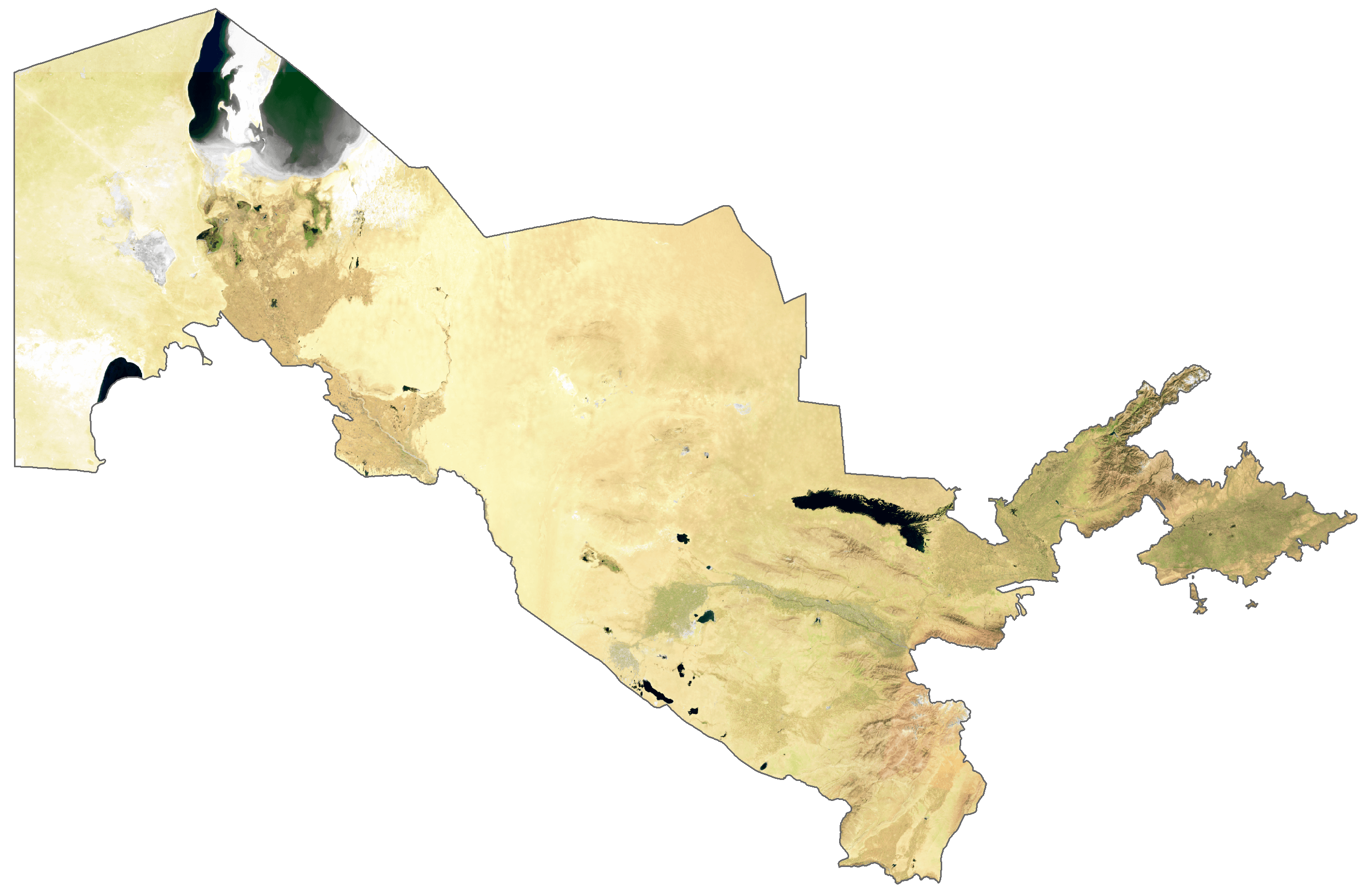
Uzbekistan Satellite Map
Elevation Map