Africa is a vast continent with an area of 30,221,532 km², accounting for 20.4% of the Earth’s total land area. Africa ranks second in population and third in area in the world (after Asia and America).
With 54 countries and an impressive population of 1,225,100,000 people as of 2016, Africa is home to 16.4% of the world’s population. Africa is not only famous for its rich natural resources but is also a continent of diverse and colorful cultural communities.
Let’s explore African countries through high-quality maps selected by Địa Ốc Thông Thái (Wise Real Estate).
Location of Africa on the world map
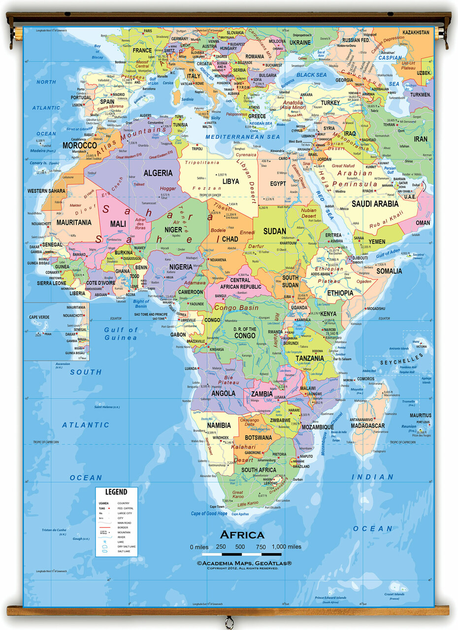
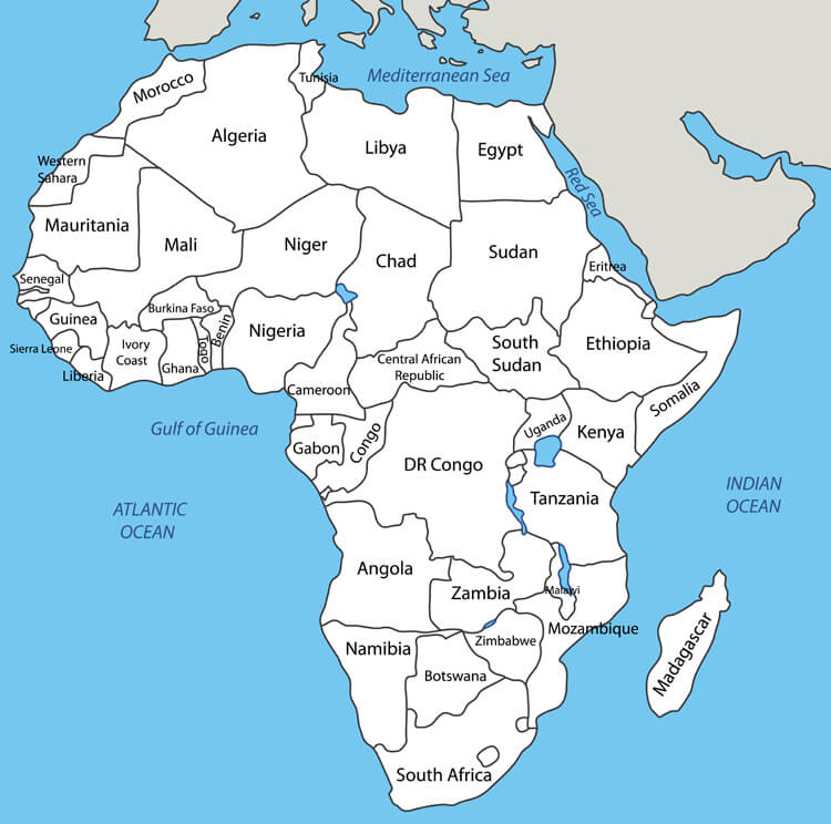
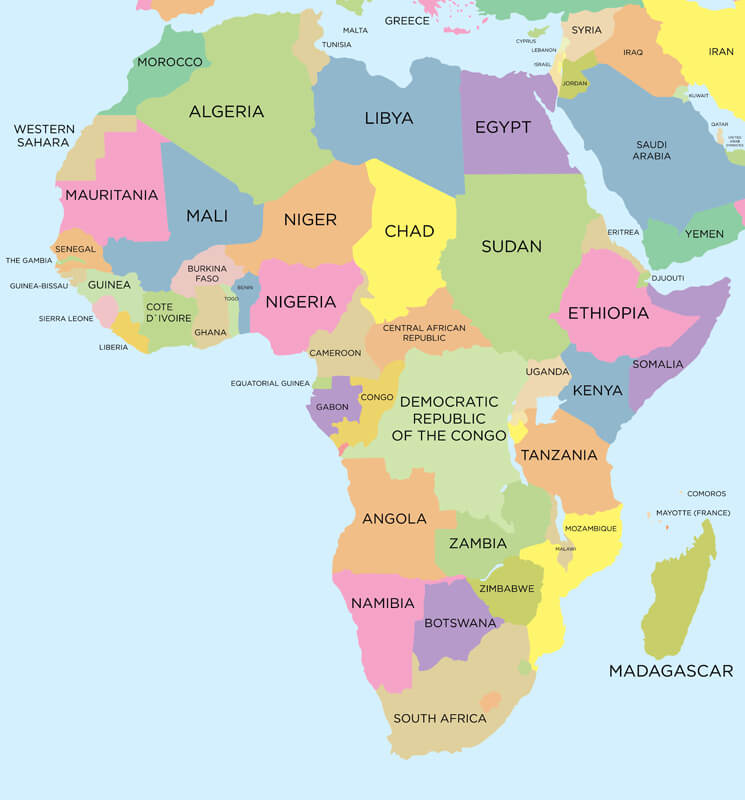
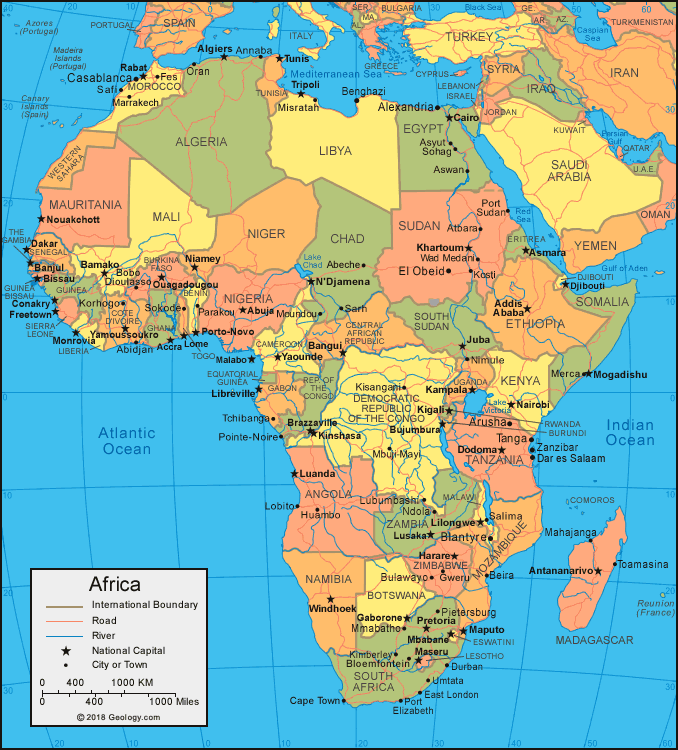
Looking at the map, it’s easy to identify the geographical location of Africa:
- North: bordered by the Mediterranean Sea
- Northeast: bordered by the Red Sea and Asia
- Southeast: bordered by the Indian Ocean
- West: bordered by the Atlantic Ocean
Looking at the map, we can see that the African territory has a block-like shape. The coastline is less divided, with very few bays, peninsulas, and islands. The two largest peninsulas are Madagascar and Somalia. The equator runs almost through the middle of Africa, with the southern and northern hemispheres nearly balanced.
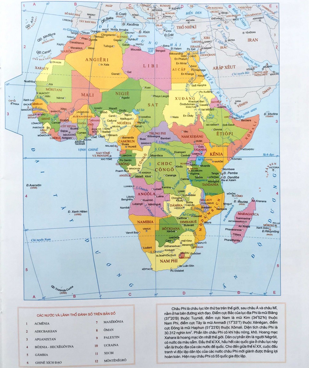
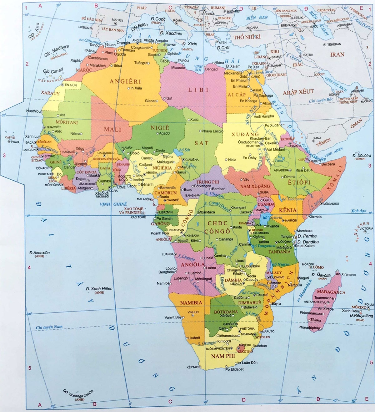
Map of Africa in Vietnamese
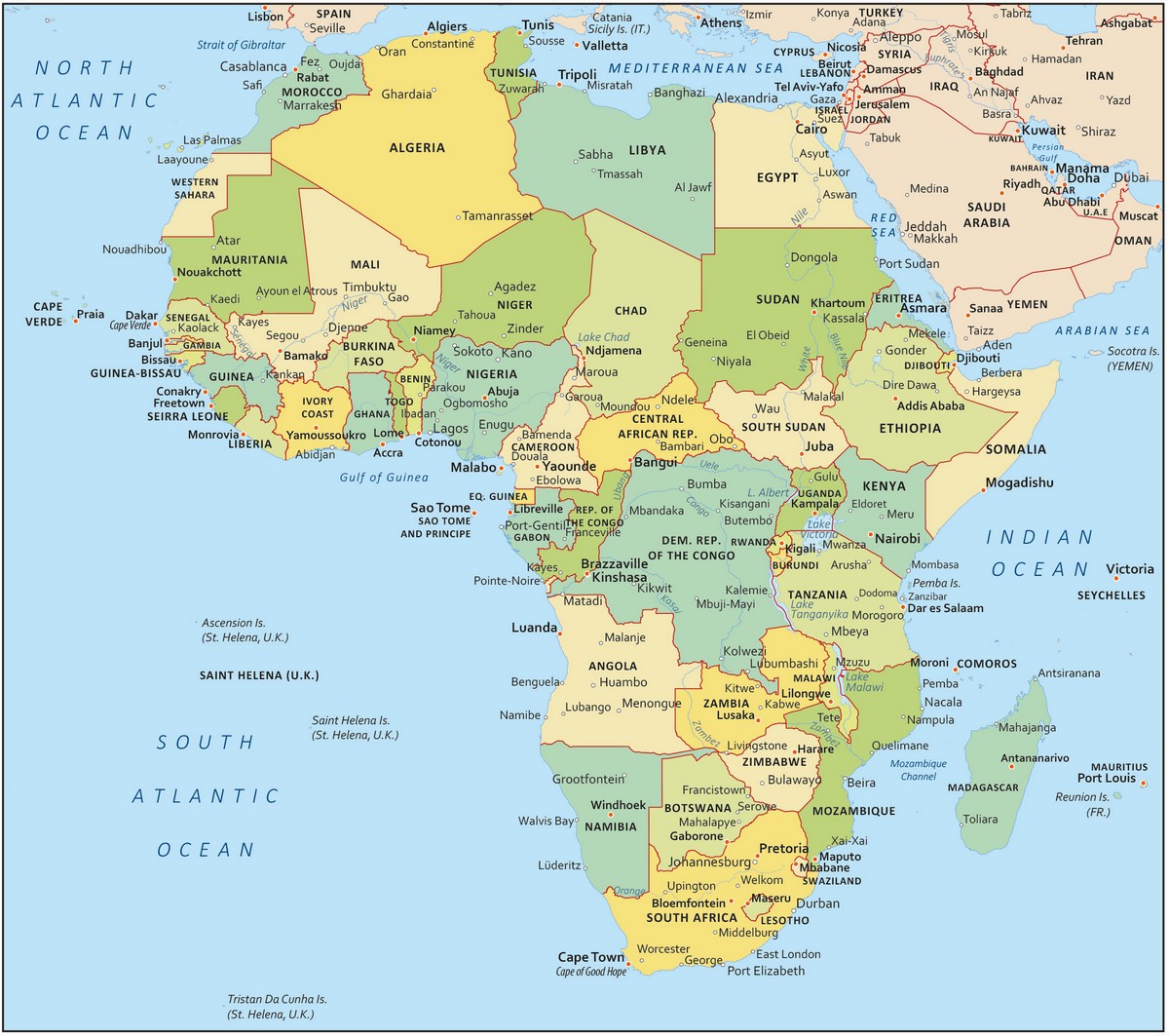
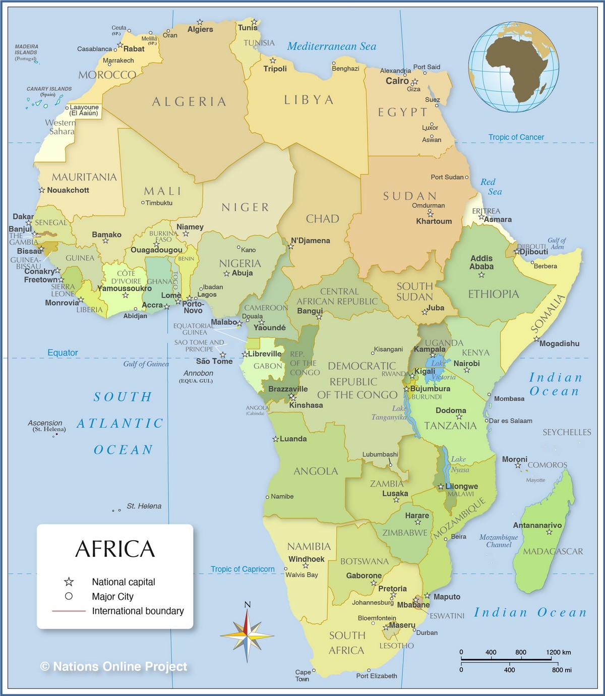
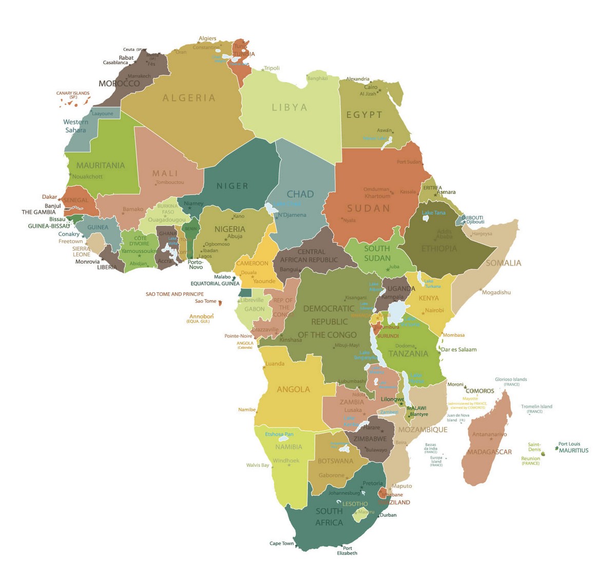
Map of Africa (in English)
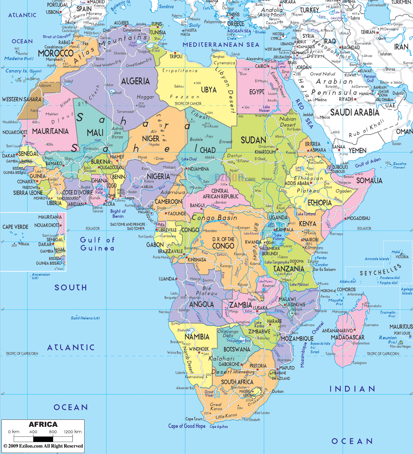
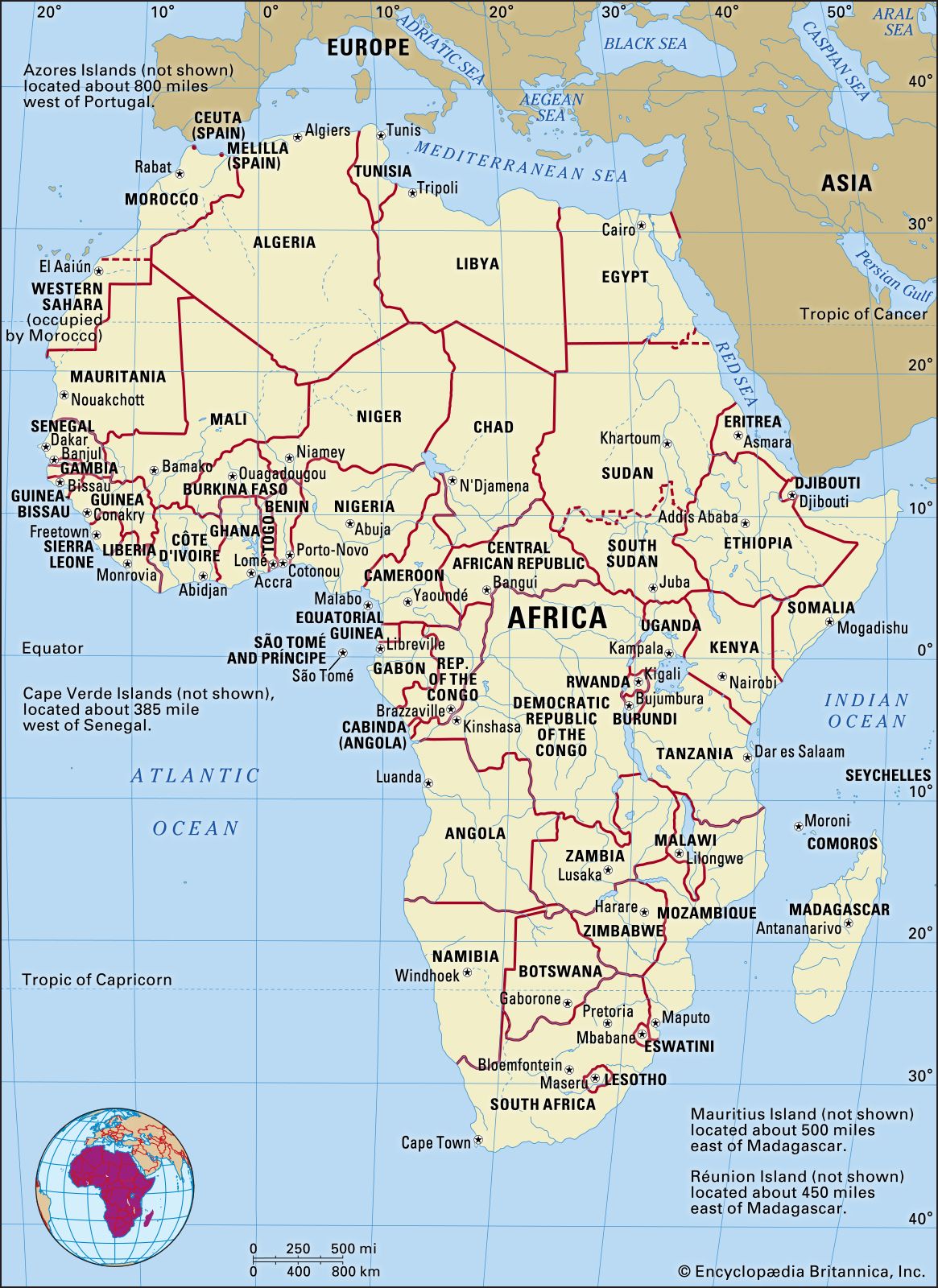
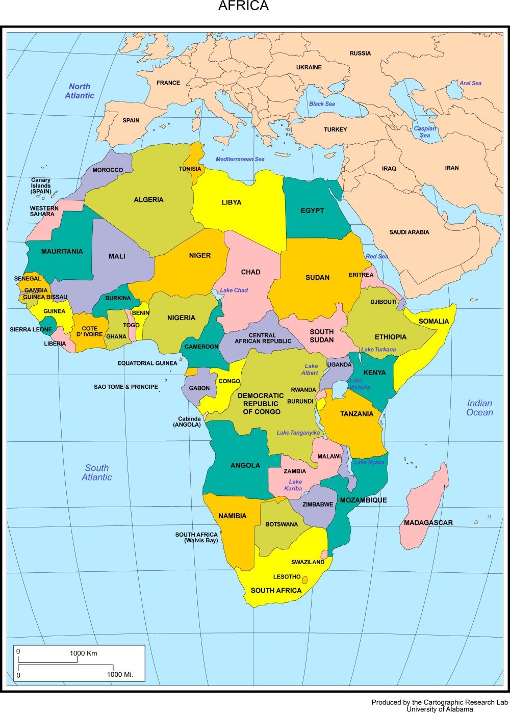
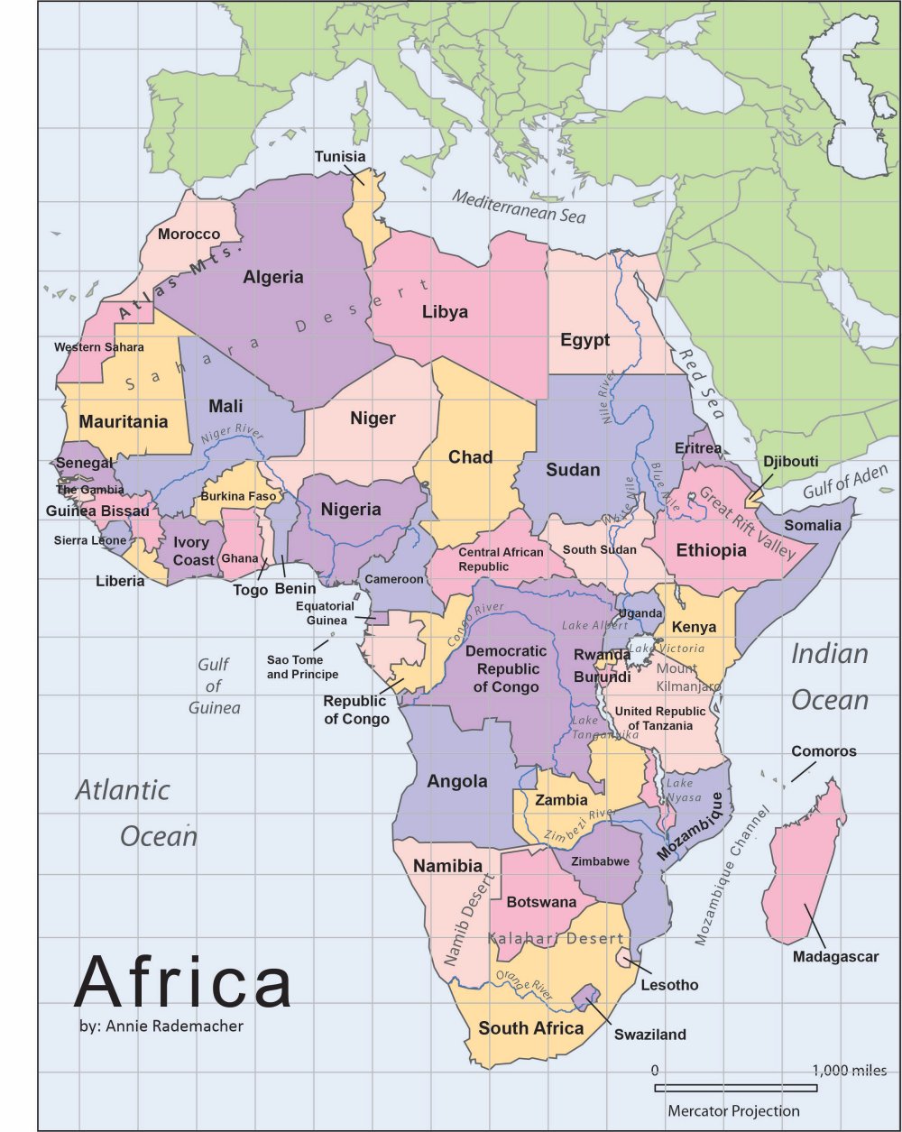

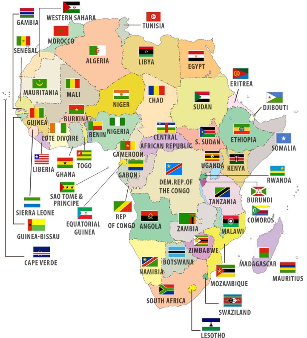
Flags of African countries
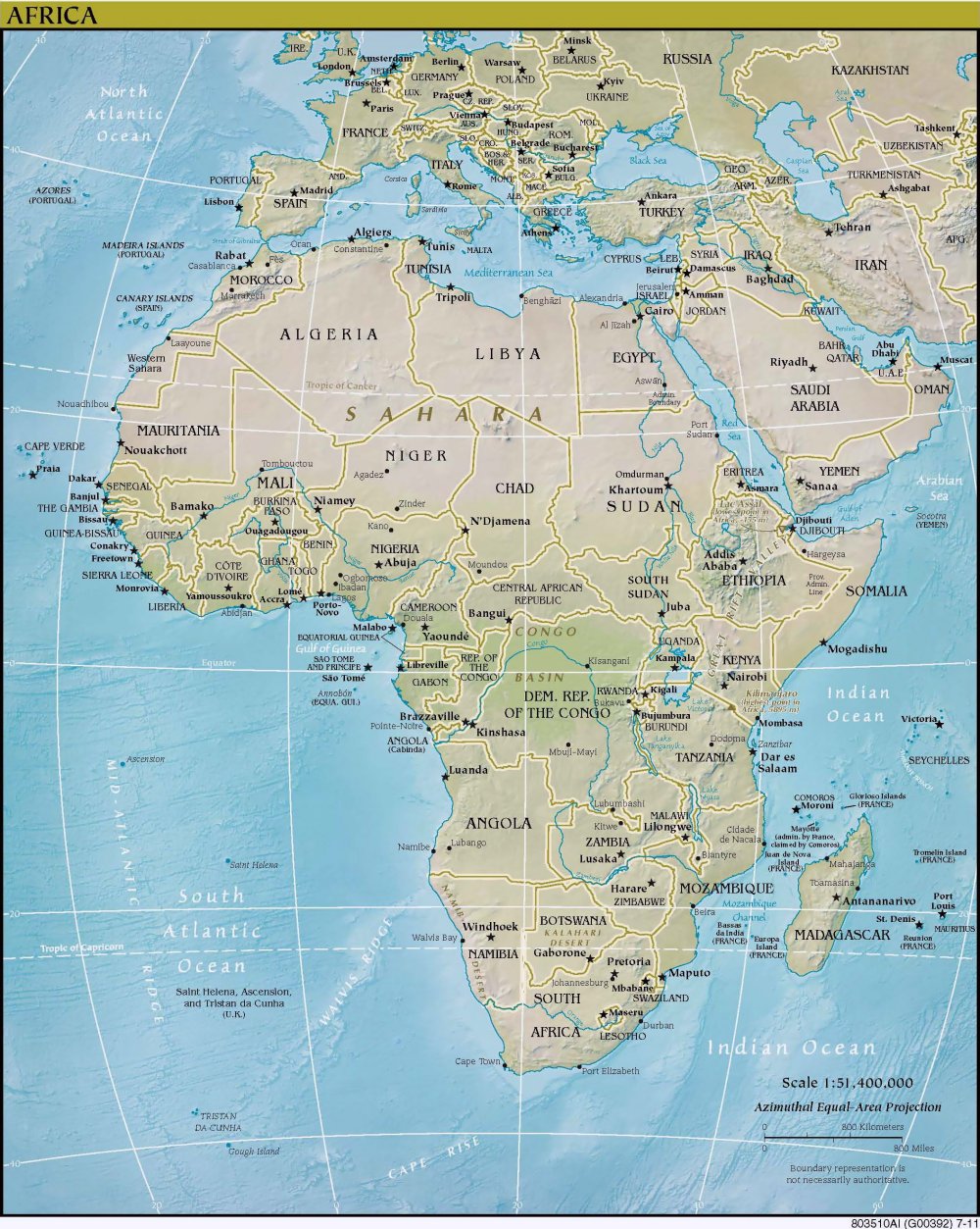
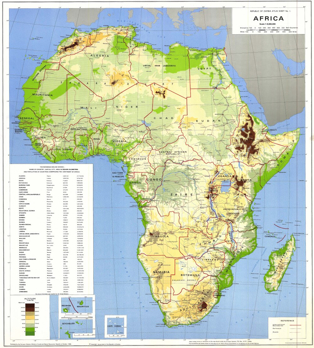
Physical Map of Africa
With a physical map, we can easily observe the terrain of the African continent. The terrain of Africa is quite simple; the entire continent is a giant plateau with an average elevation of 750m, mainly consisting of peneplains interspersed with low basins.
The eastern part has been strongly uplifted, with the bedrock fractured to form many deep valleys and long, narrow lakes. Africa has very few high mountains and plains; if any, they are very small, mainly distributed along the coast. The main slope of Africa’s terrain is from Southeast to Northwest.
References
- United Nations Environment Programme (UNEP). Africa Atlas (PDF). Available at: https://na.unep.net/atlas/africa/downloads/chapters/Africa_Atlas_English_Chapter_1.pdf
- National Geographic Society. (19/10/2023). Africa: Physical Geography. Authors: Diane Boudreau, Melissa McDaniel, Erin Sprout, Andrew Turgeon. Available at: https://education.nationalgeographic.org/resource/africa-physical-geography/
See more
- Saint Kitts & Nevis
- Saint Lucia
- Samoa
- San Marino
- São Tomé & Príncipe
- Saudi Arabia
- Senegal
- Serbia
- Seychelles
- Sierra Leone
- Singapore
- Slovakia
- Slovenia
- Solomon Islands
- Somalia
- South Africa
- South Korea
- South Sudan
- Spain
- Sri Lanka
- Saint Vincent & the Grenadines
- Sudan
- Suriname
- Sweden
- Switzerland
- Syria
- Saint Helena
- Saint Barthélemy
- Saint Martin
- Saint Pierre and Miquelon
- Somaliland


