Antarctica is the most recently discovered continent by humanity among all continents. Scientists discovered Antarctica at the end of the 19th century, and it wasn’t until the 20th century that people set foot to explore it. It is also the only continent that currently has no permanent residents, with only scientists coming to research and live at research stations. It can be said that Antarctica is the most mysterious continent for humans.
From 1957 onwards, the allure of Antarctica has drawn scientists from around the world to focus their attention on exploring this region. They have intensified their research and exploration activities more comprehensively, with support from countries such as Japan, Russia, the United States, the United Kingdom, France, and many other nations in establishing scientific research stations on Antarctic soil. On December 1, 1959, the world witnessed the signing of the “Antarctic Treaty” by 12 countries, with the main goal of exploring and researching this land in a spirit of peace. This agreement also stipulates that there is no dispute over the division of territory or resources in this area between the signatory countries.
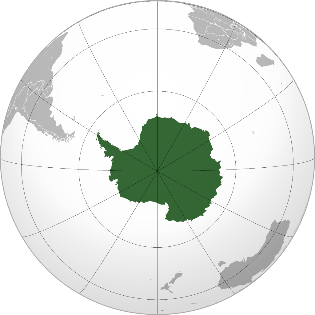
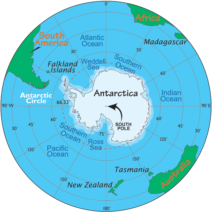
Location of Antarctica
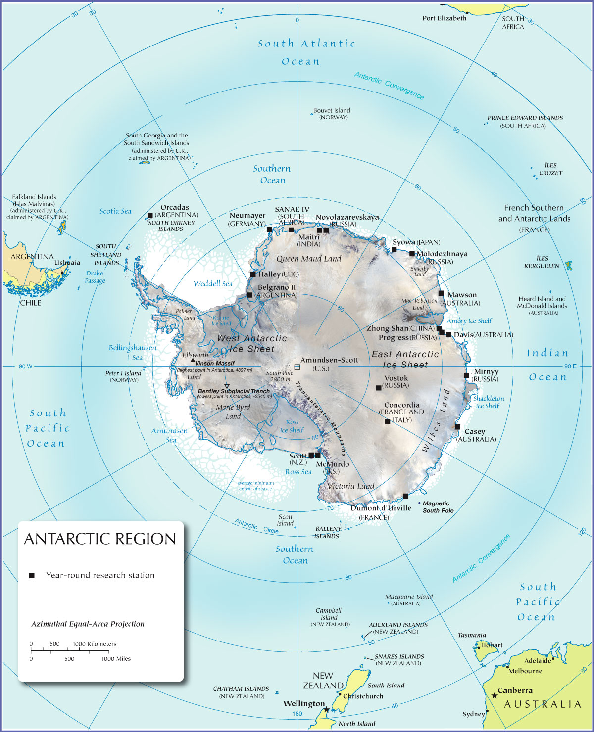
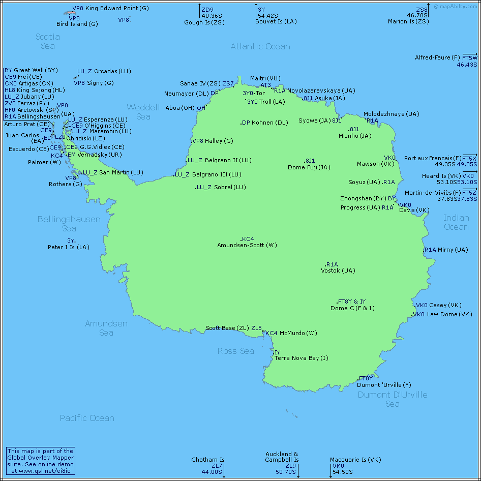
Antarctica is located at the South Pole of the Earth, surrounded by the Pacific Ocean, Indian Ocean, and Atlantic Ocean. The coastline of Antarctica is about 17,968 km long and is mainly in the form of ice. The longest river on this continent is the Onyx River, and Lake Vostok in this continent is identified as the largest ice lake in the world.
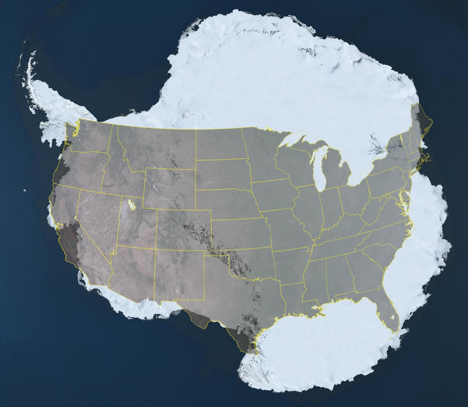
Map of Antarctica’s Size
Antarctica has an area of 14.1 million km² including the Antarctic continent and coastal islands. Although not as large as Asia, Africa, North America, or South America, Antarctica is still a very large continent, approximately the size of the United States and Mexico combined. You may not know, but Antarctica is larger than Europe, and nearly twice the size of Australia.
Most of Antarctica’s area is covered by an ice sheet with an average thickness of 1.6 km. Meanwhile, in the Arctic, this cold ice layer is only 2m to 4m thick. Antarctica’s ice accounts for 90% of the world’s ice, according to scientists’ calculations, if all this ice melts, sea levels would rise by about 60m.
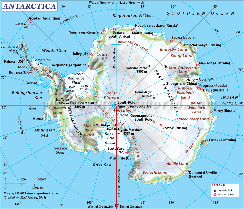
Map of Antarctica
Some interesting facts about Antarctica
- The highest temperature in Antarctica is -28.9°C in mid-summer and cannot exceed this level.
- The lowest temperature in Antarctica can reach -80°C.
- The ice sheets in Antarctica are a massive freshwater reserve, accounting for 70% of the world’s freshwater.
- Antarctica is also the driest continent on Earth. Although it has the largest amount of freshwater in the world, it is also the driest land, with year-round low temperatures freezing water, reducing humidity to unimaginable levels.
- Antarctica is the only continent without reptiles.
- Antarctica is the continent with the highest average elevation among all continents (over 2000m).
- There is no night and day in Antarctica. During the Antarctic winter, the sun does not rise above the horizon, so people have to live in complete darkness for 4 months.
- Every 60 years, a strange phenomenon occurs in Antarctica and the Arctic: 6 months of daylight – 6 months of night. This is a climate and physical phenomenon that only occurs in the highest latitude regions of the Earth due to the Earth’s rotation around its axis while orbiting the sun.
See more
- Saint Kitts & Nevis
- Saint Lucia
- Samoa
- San Marino
- São Tomé & Príncipe
- Saudi Arabia
- Senegal
- Serbia
- Seychelles
- Sierra Leone
- Singapore
- Slovakia
- Slovenia
- Solomon Islands
- Somalia
- South Africa
- South Korea
- South Sudan
- Spain
- Sri Lanka
- Saint Vincent & the Grenadines
- Sudan
- Suriname
- Sweden
- Switzerland
- Syria
- Saint Helena
- Saint Barthélemy
- Saint Martin
- Saint Pierre and Miquelon
- Somaliland
