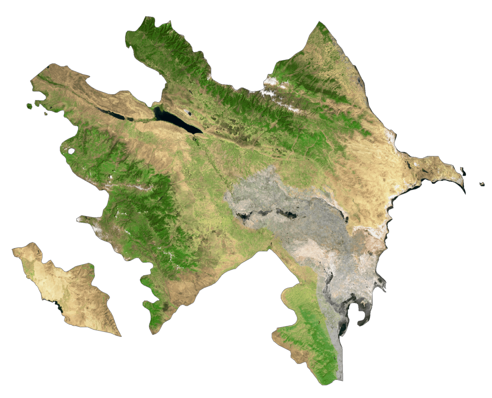
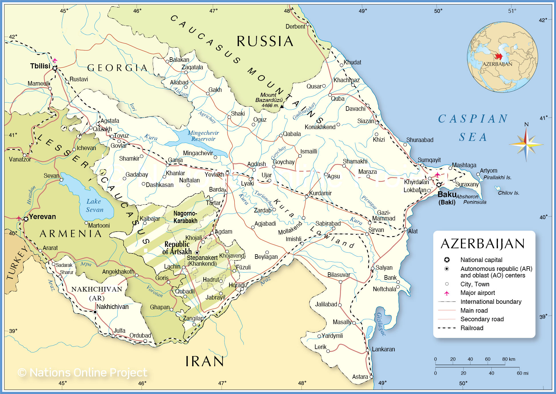
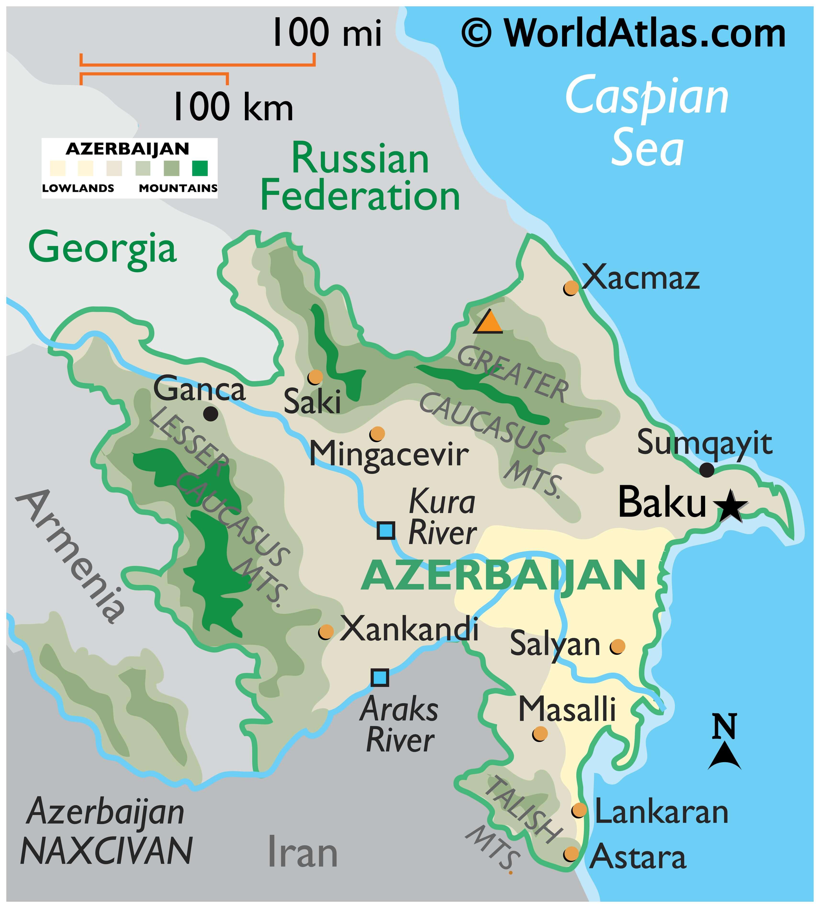
Azerbaijan is a country covering 86,600 km2 (33,400 sq mi) in the Caucasus region of Eurasia.
As observed on the physical map of Azerbaijan, the country his highly mountainous. The Caucasus Mountains cover the north and central regions of the country. Here, many snow-capped peaks exceed 12,000 ft.
The highest point in the country, Baza-Dyuzi at 14,698 ft. (4,480m) is also located here and has been marked on the map above by a yellow triangle.
Moving southwest, the Lesser Caucasus cross the land, stretching on into Armenia, and in the far-south, the Talish Mountains help form its border with Iran.
A low flood plain covers the south-central and east, ending at the Caspian Sea; much of it below sea level. Baku, the capital city, sits on the Abseron Yasaqligi (or Apsheron Peninsula), which juts hook-line into the Caspian Sea
Significant rivers include the Alazani, Aras and Kura, and the Mangachevir Reservoir is the largest inland body of water.
| Flag: |  |
|---|---|
| Legal Name: | Republic of Azerbaijan |
| Capital Value: | Baku (Baki, Baky) |
| Official languages: | Azerbaijani |
| Demonym(s): |
|
| Government: | Unitary semi-presidential republic |
| Legislature: | National Assembly |
| Total Area: | 86,600 km² |
| Land Area: | 82,629 km² |
| Water Area: | 3,971 km² |
| Population: | 10,023,318 |
| Density: | 117/km (303.0/sq mi) (99th) |
| GDP: | $48.05 Billion |
| GDP Per Capita: | $4,793.59 |
| Currency Value: | Azerbaijani manats (AZN) |
| Driving side: | right |
| Calling code: | +994 |
| Internet TLD: | .az |
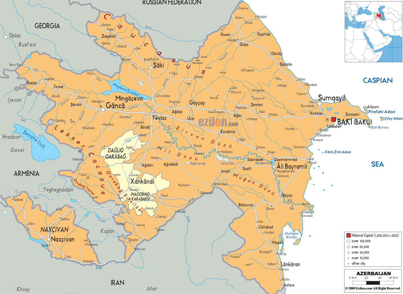
Azerbaijan is a country located in Western Asia, with a stunning landscape marked by the Great Caucasus Mountains and Absheron Peninsula. A map of the country displays its cities, towns, rivers, lakes, roads, and highways. Satellite imagery and elevation maps further showcase its unique topography.
Online Interactive Political Map
Click on ![]() to view map in "full screen" mode.
to view map in "full screen" mode.
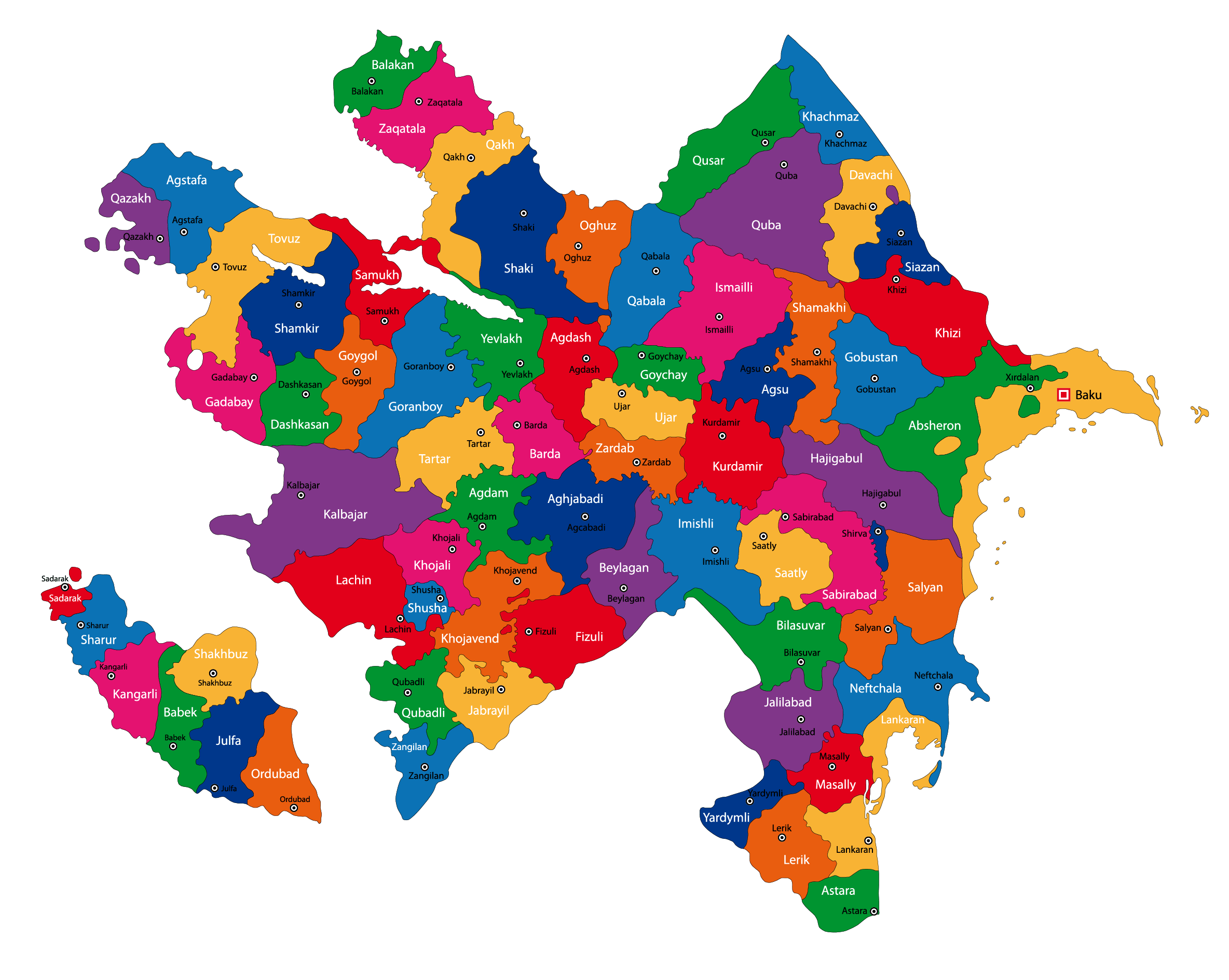
Azerbaijan (officially, Republic of Azerbaijan) is divided into 66 rayons (rayonlar, sing. rayon) and 11 cities (saharlar, sing. sahar). In alphabetical order, the rayons are: Abseron, Agcabadi, Agdam, Agdas, Agstafa, Agsu, Astara, Babak, Balakan, Barda, Beylaqan, Bilasuvar, Cabrayil, Calilabad, Culfa, Daskasan, Fuzuli, Gadabay, Goranboy, Goycay, Goygol, Haciqabul, Imisli, Ismayilli, Kalbacar, Kangarli, Kurdamir, Lacin, Lankaran, Lerik, Masalli, Neftcala, Oguz, Ordubad, Qabala, Qax, Qazax, Qobustan, Quba, Qubadli, Qusar, Saatli, Sabirabad, Sabran, Sadarak, Sahbuz, Saki, Salyan, Samaxi, Samkir, Samux, Sarur, Siyazan, Susa, Tartar, Tovuz, Ucar, Xacmaz, Xizi, Xocali, Xocavand, Yardimli, Yevlax, Zangilan, Zaqatala and Zardab. The cities are: Baku, Ganca, Lankaran, Mingacevir, Naftalan, Naxcivan (Nakhichevan), Saki, Sirvan, Sumqayit, Xankandi and Yevlax.
Located on western coast of the Caspian Sea, Baku is the capital and the largest city of Azerbaijan. For its location of 28m below the sea level, Baku is largest city in the world located below the sea level and also the lowest lying national capital in the world. Baku is the administrative, cultural and economic center of Azerbaijan.
Location Maps
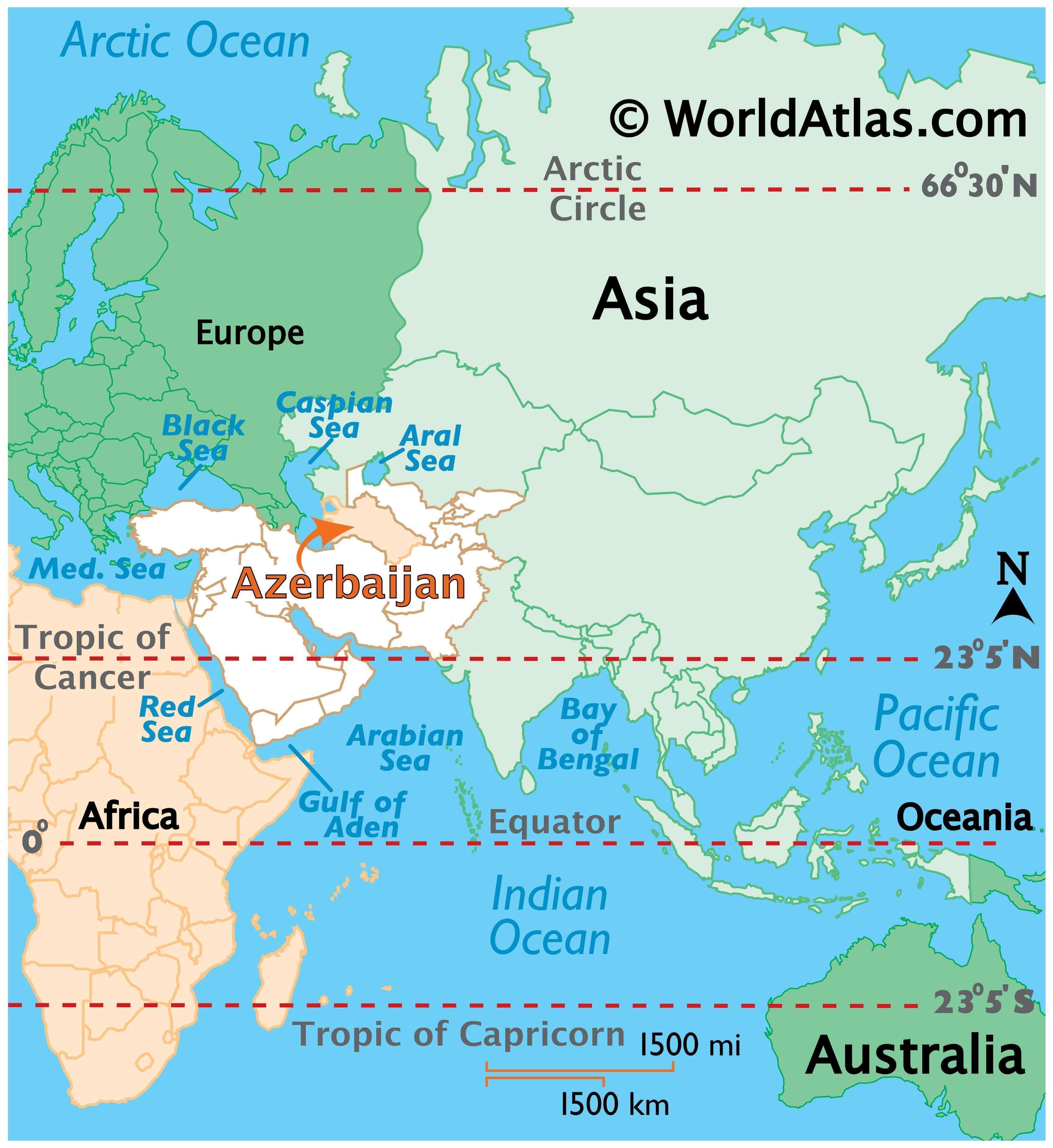
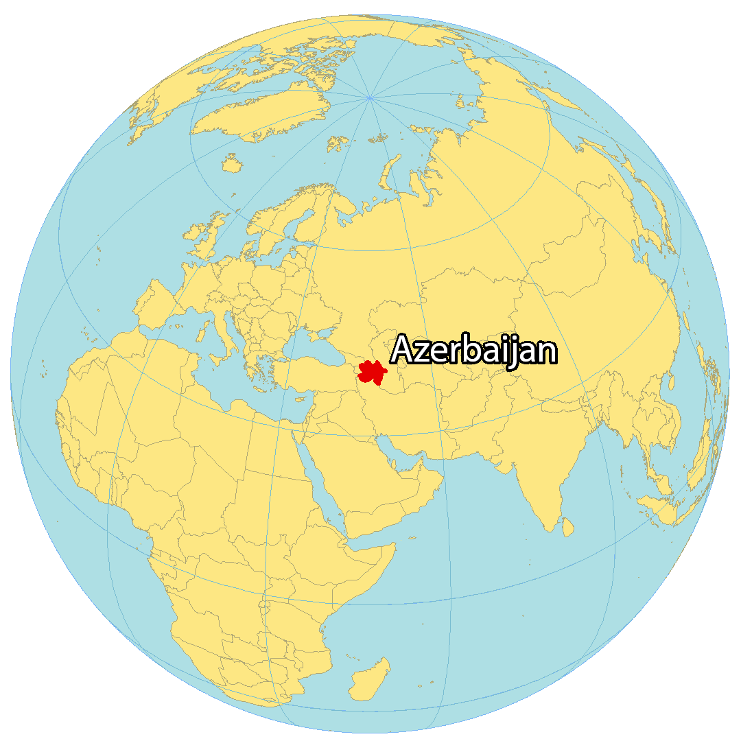
Where is Azerbaijan?
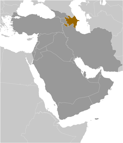
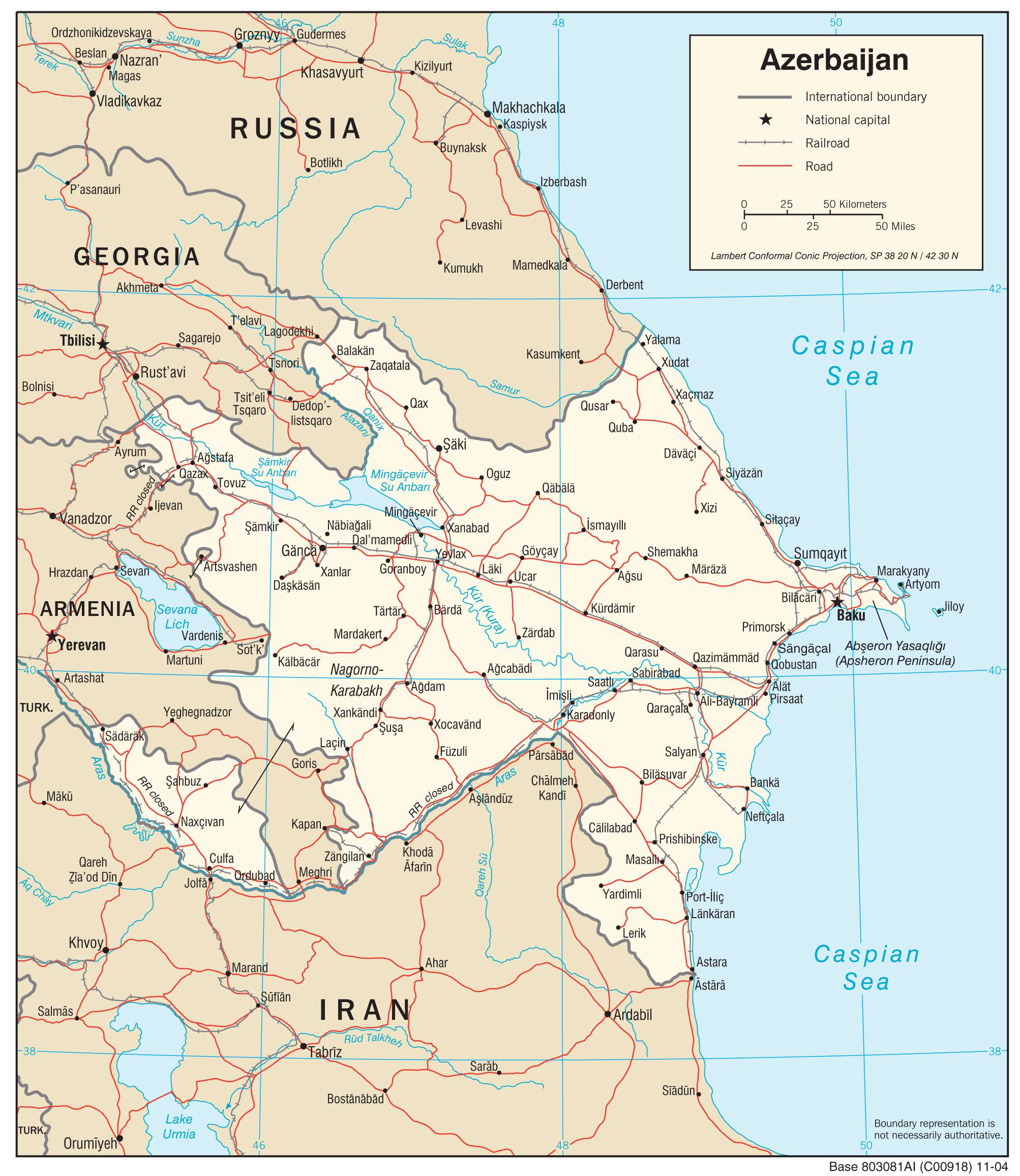
Azerbaijan is a landlocked country situated along the coastline of the Caspian Sea to the east. It borders four other countries – Georgia and Russia to the north, Iran to the south, and Armenia to the west, forming a complex country boundary. The Nakhchivan Autonomous Republic is an exclave of Azerbaijan that borders Armenia to the southwest. Artsvashen and the Nagorno Karabakh Republic are enclaves that Armenia claims within Azerbaijan. Similarly, Azerbaijan claims 4 enclaves within Armenia – Yukhari Askipara, Yaradullu, Barxudarli, and Karki.
High Definition Political Map of Azerbaijan
Physical Map of Azerbaijan


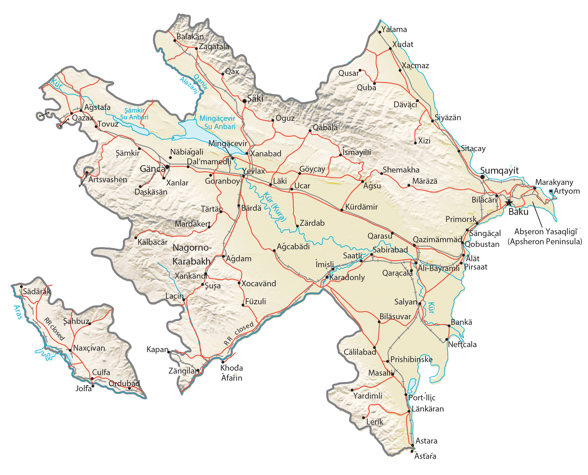
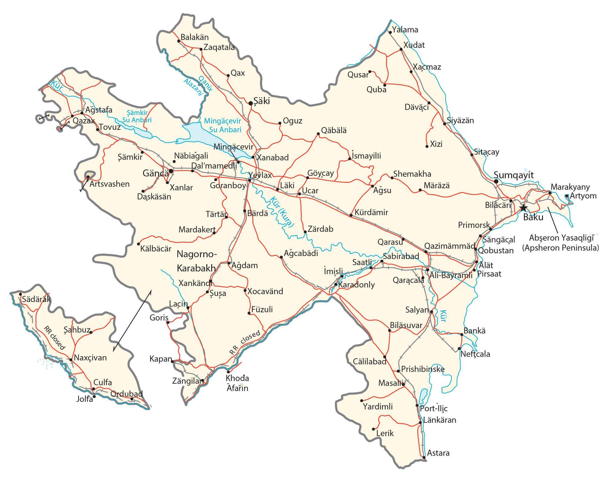
Transportation Map of Azerbaijan
Azerbaijan Satellite Map