The Caribbean Netherlands (Dutch: Caribisch Nederland, pronounced [kaˈribisˌnedərˌlɑnt] (listen)) are the three public bodies of the Netherlands that are located in the Caribbean Sea. They consist of the islands of Bonaire, Sint Eustatius and Saba, although the term “Caribbean Netherlands” is sometimes used to refer to all of the islands in the Dutch Caribbean. In legislation, the three islands are also known as Bonaire, Sint Eustatius and Saba or the BES islands (an acronym of their names). The islands are currently classified as public bodies in the Netherlands and as overseas countries and territories of the European Union; thus, European Union law does not automatically apply.
Bonaire (including the islet of Klein Bonaire) is one of the Leeward Antilles and is located close to the coast of Venezuela. Sint Eustatius and Saba are in the main Lesser Antilles group and are located south of Sint Maarten and northwest of Saint Kitts and Nevis. The Caribbean Netherlands has a population of 25,157 as of January 2019.
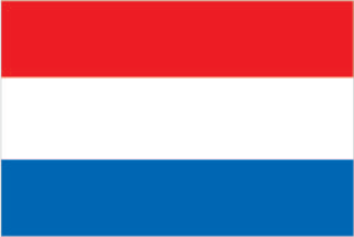
| Flag: |  |
|---|---|
| Official languages: | Dutch |
| Density: | 77/km (199.4/sq mi) |
| Currency Value: | United States dollar ($) (USD) |
| Internet TLD: |
|
Location Maps
Where is Caribbean Netherlands?
History
The Caribbean Netherlands are a group of islands in the Caribbean Sea that are part of the Kingdom of the Netherlands. The islands have a complex history, with various colonial powers claiming control over the region over the centuries.
The islands were initially inhabited by various indigenous peoples, including the Ciboney, Arawak, and Carib peoples. In the late 15th century, the islands were discovered by Christopher Columbus, who claimed them for Spain.
Over the centuries, the islands were controlled by various European powers, including the Dutch, French, and British. The Dutch West India Company established a presence on some of the islands in the 17th century, and the Dutch later gained control of the entire region in the 19th century.
During the 20th century, the islands became part of the Netherlands Antilles, a group of islands that were granted self-governance in the 1950s. However, in 2010, the Netherlands Antilles was dissolved, and the islands of Bonaire, Sint Eustatius, and Saba became special municipalities of the Netherlands, known collectively as the Caribbean Netherlands.
Today, the Caribbean Netherlands are part of the Kingdom of the Netherlands, and the islands are known for their beautiful natural landscapes, including their beaches, coral reefs, and wildlife. The islands also have a unique culture and heritage, with a mix of African, European, and indigenous influences.
The economy of the Caribbean Netherlands is primarily based on tourism, with many visitors coming to the islands to enjoy their natural beauty and unique culture. The islands also have a growing population, with a mix of local residents and people from around the world.
Geography
The Caribbean Netherlands form part of the Lesser Antilles. Within this island group:
- Bonaire is part of the ABC islands within the Leeward Antilles island chain off the Venezuelan coast. The Leeward Antilles have a mixed volcanic and coral origin.
- Saba and Sint Eustatius are part of the SSS islands. They are located east of Puerto Rico and the Virgin Islands. Although in the English language they are usually described as being part of the Leeward Islands, in French, Spanish, Dutch and the English spoken locally, they are considered to be part of the Windward Islands. The Windward Islands are all of volcanic origin and hilly, leaving little ground suitable for agriculture. The highest point is Mount Scenery, 887 metres (2,910 ft), on Saba (also the highest point in all the Kingdom of the Netherlands).
Map showing Bonaire, Sint Eustatius, and Saba
Relative distance between mainland Netherlands in Europe and the Caribbean Netherlands
The Caribbean BES islands are subdivisions of the country of the Netherlands and are therefore referred to as the “Caribbean Netherlands.”
Climate
The islands of the Caribbean Netherlands enjoy a tropical climate with warm weather all year round. The Leeward Antilles are warmer and drier than the Windward islands. In summer, the Windward Islands can be subject to hurricanes.