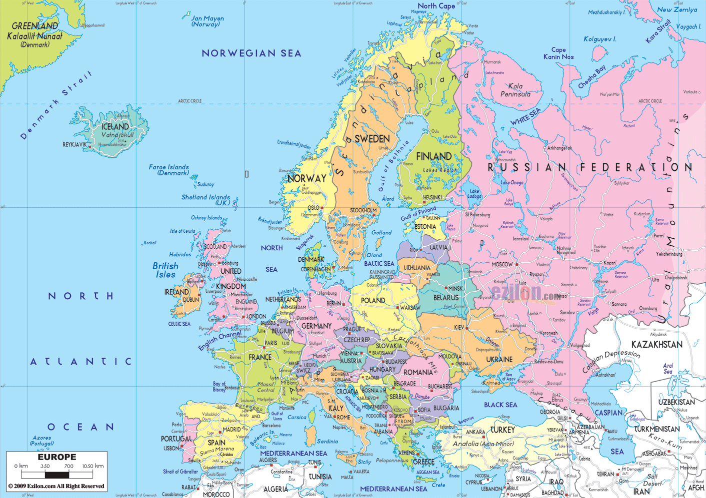
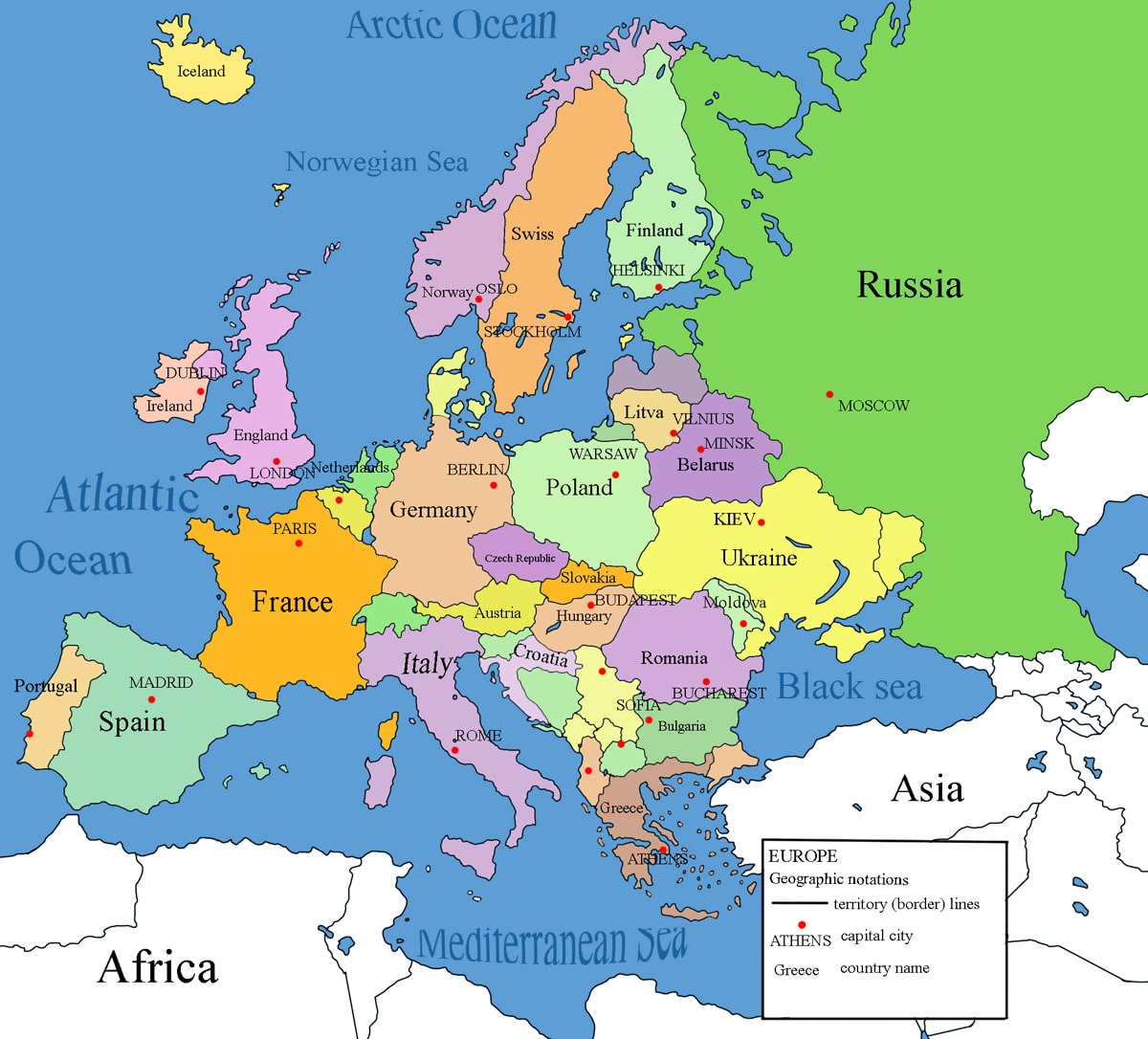
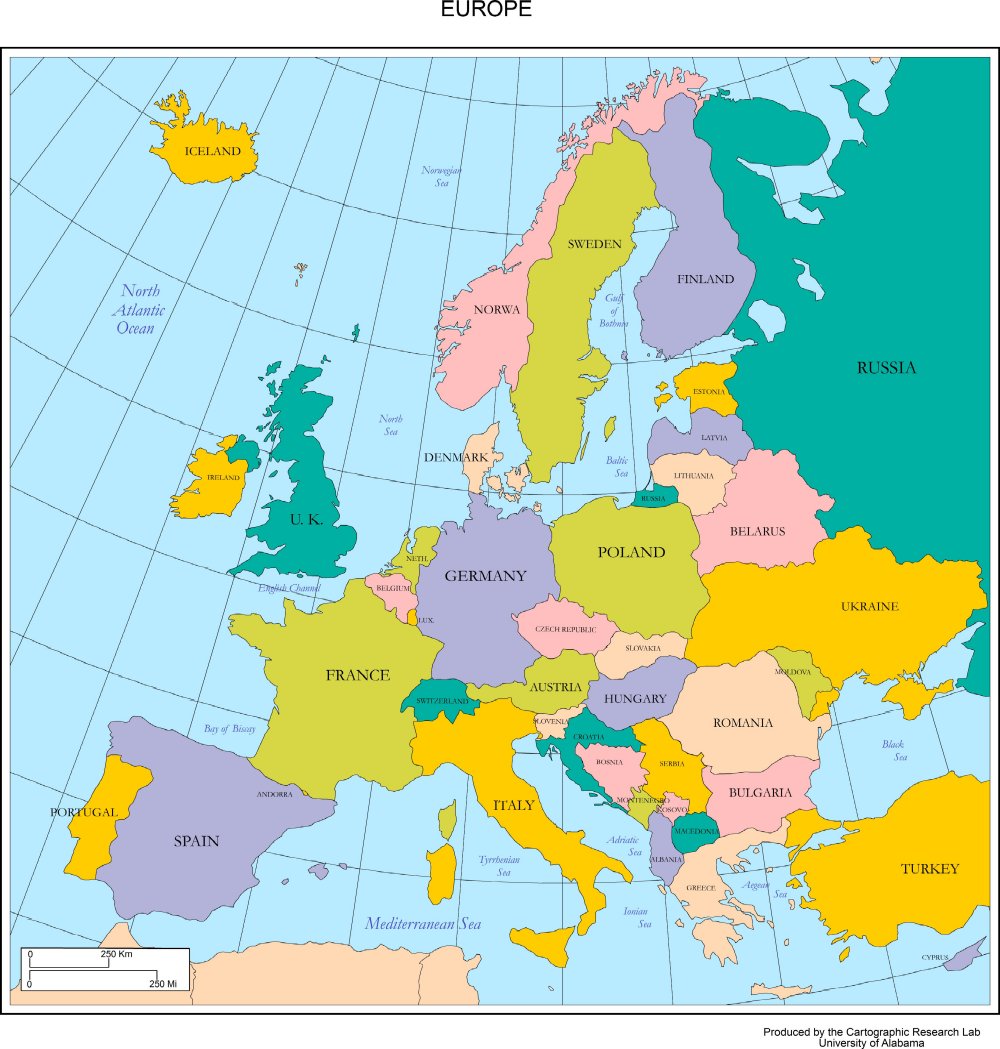
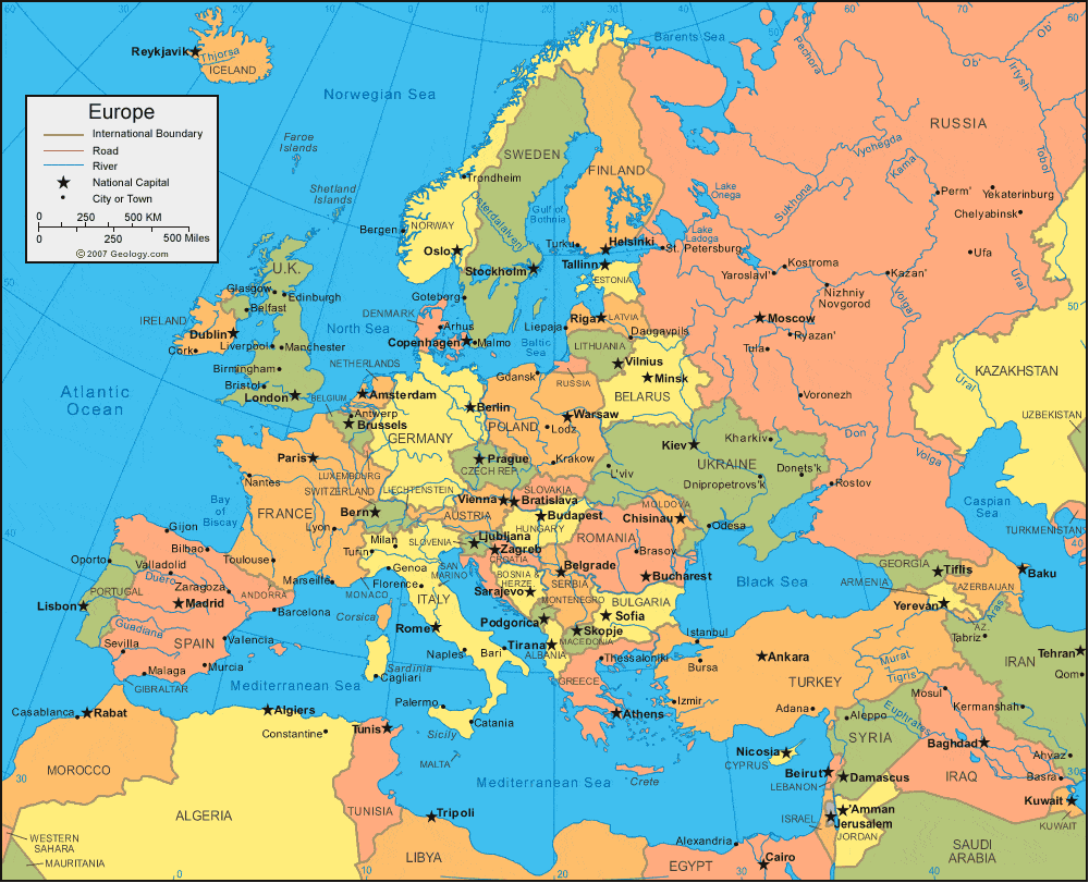
In this article, we will compile various maps of Europe. With carefully selected high-quality maps, readers can conveniently look up information about geographical locations, national borders, and terrain. Using these maps, you can support learning, research, and easily plan travel journeys to explore the beautiful, rich countries of Europe.
Europe is known as the “old continent” not just because of its rich resources, but mainly due to its long and extensive cultural and historical development. With a diverse and rich historical tapestry, Europe has created profound influences in art, knowledge, and cultural norms, forming a unique cultural landscape and the prosperous lifestyle we often see today.
The total area of European countries is approximately 10,180,000 km² (equivalent to 3,930,000 square miles), ranking second in the world by area, only after Australia and significantly larger than Oceania. In terms of population, Europe holds the third position globally. According to United Nations data as of September 8, 2023, the total population of Europe is approximately 747,708,709 people, representing 9.48% of the world’s total population.
Europe’s Position on the World Map
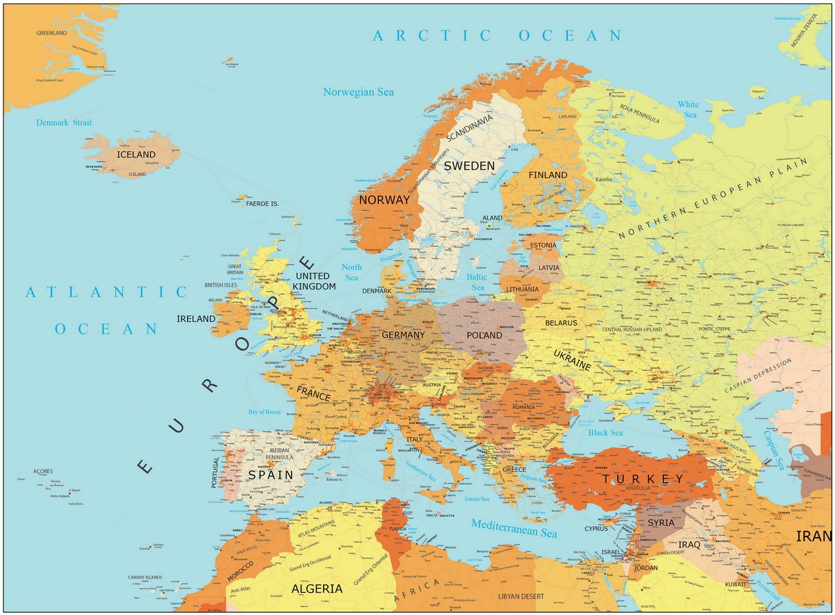
Europe is located on the same continental block as Asia (Eurasian Continent). It is separated from Asia by the Ural Mountains. Looking at the map, one can see that in addition to Asia, Europe is also very close to Africa.
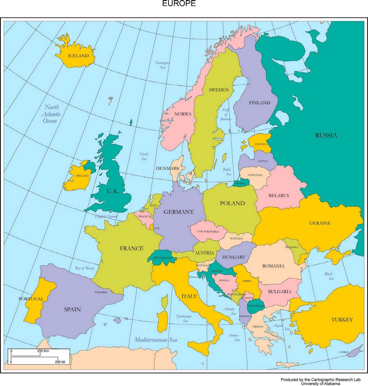
Europe is divided into 4 regions: Northern Europe, Southern Europe, Western Europe, and Eastern Europe.
European Union (EU) Map
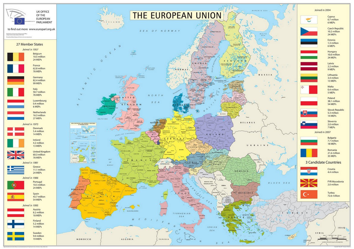
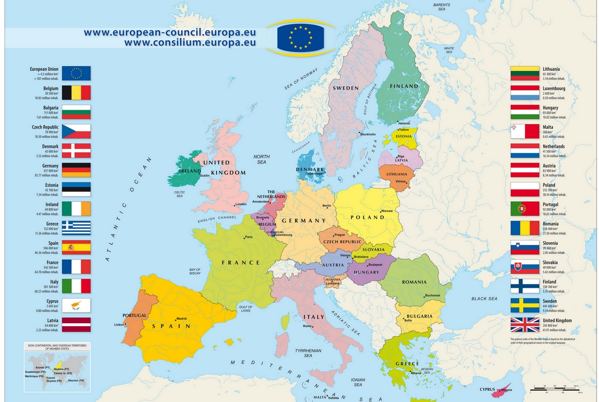
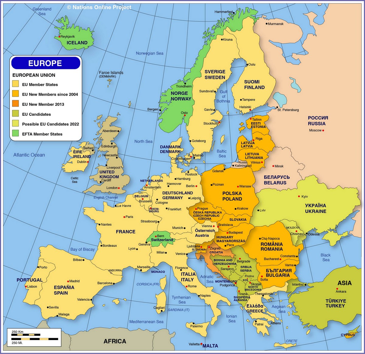
European countries, also known as the European Union (EU), currently include 51 member countries: France, Ukraine, Spain, Sweden, Germany, Finland, Norway, Poland, Italy, United Kingdom and Northern Ireland, Romania, Belarus, Russia (Russia is part of Europe), Greece, Bulgaria, Iceland, Hungary, Portugal, Serbia, Austria, Czech Republic, Ireland, Lithuania, Latvia, Svalbard and Jan Mayen, Croatia, Bosnia and Herzegovina, Slovakia, Estonia, Denmark, Switzerland, Netherlands, Moldova, Belgium, Albania, North Macedonia, Slovenia, Montenegro, Kosovo, Transnistria, Luxembourg, Faroe Islands, Andorra, Malta, Liechtenstein, Jersey, Guernsey, San Marino, Gibraltar, Monaco, Vatican City.
Europe Maps
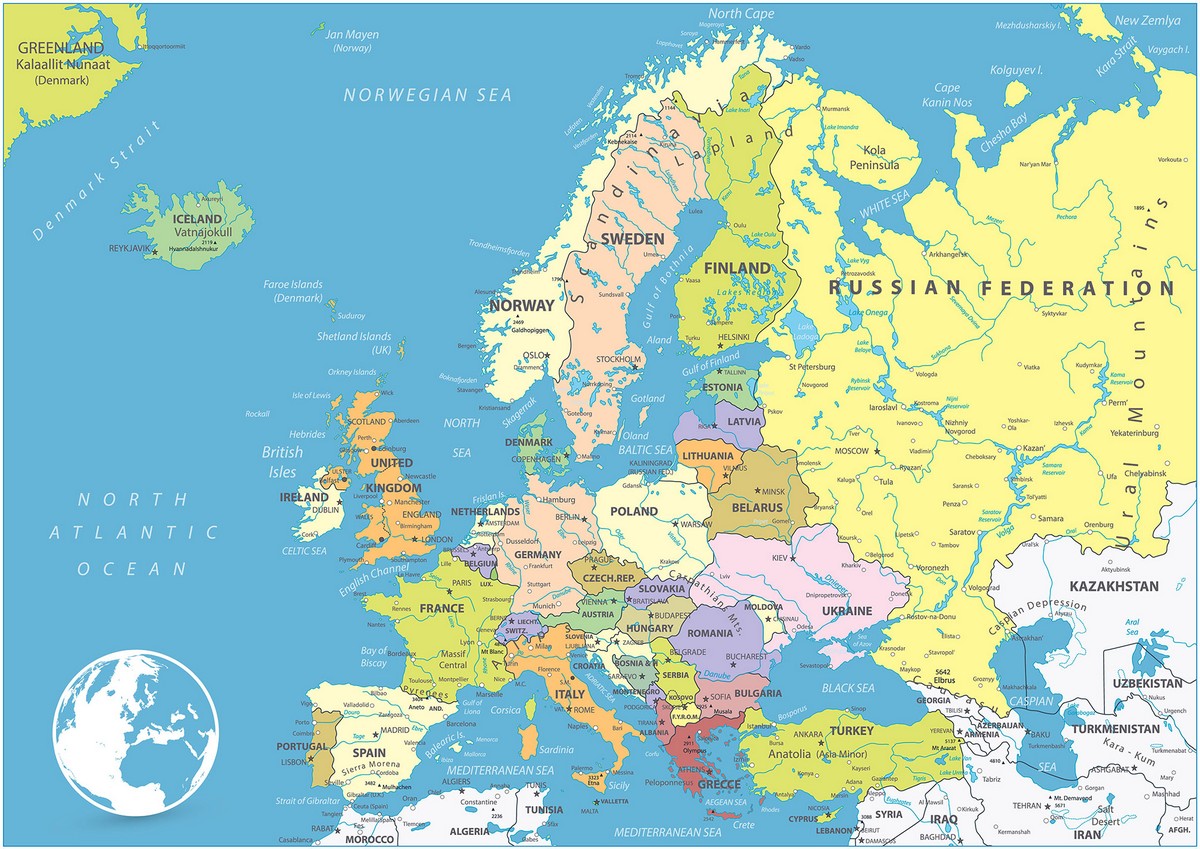
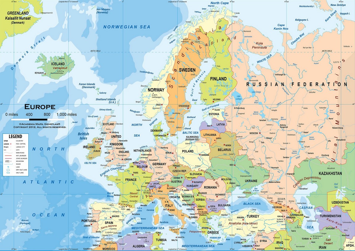
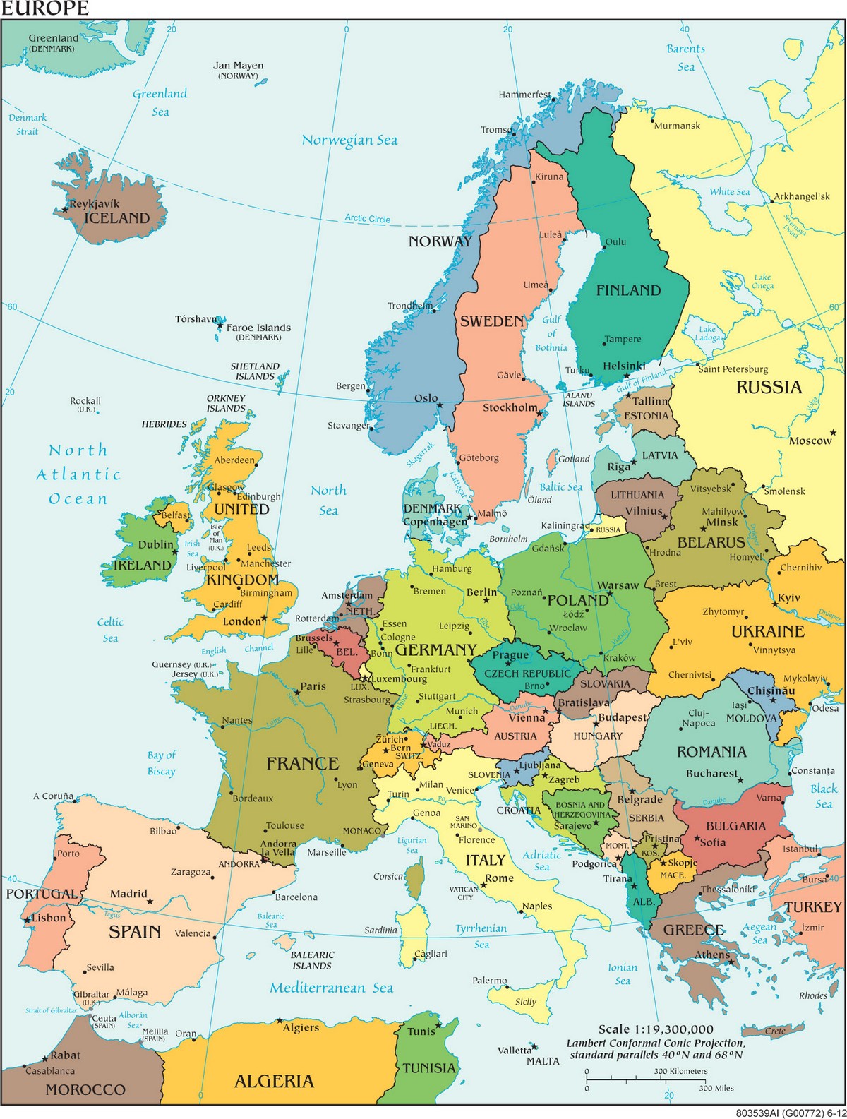
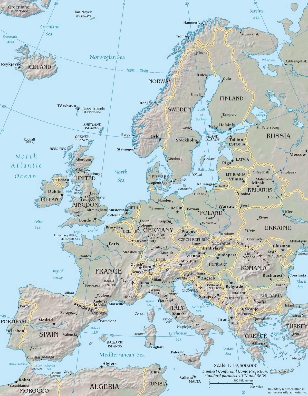
Below are several high-quality Europe maps (in English) compiled and carefully selected by Real Estate Smart. These are high-resolution map files, arranged from highest to lowest resolution. Maps with extremely large file sizes will be displayed with reduced size, and readers can download the full-size original file by clicking the button below the image.
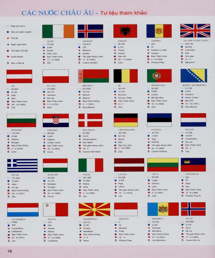
Flags of European Countries
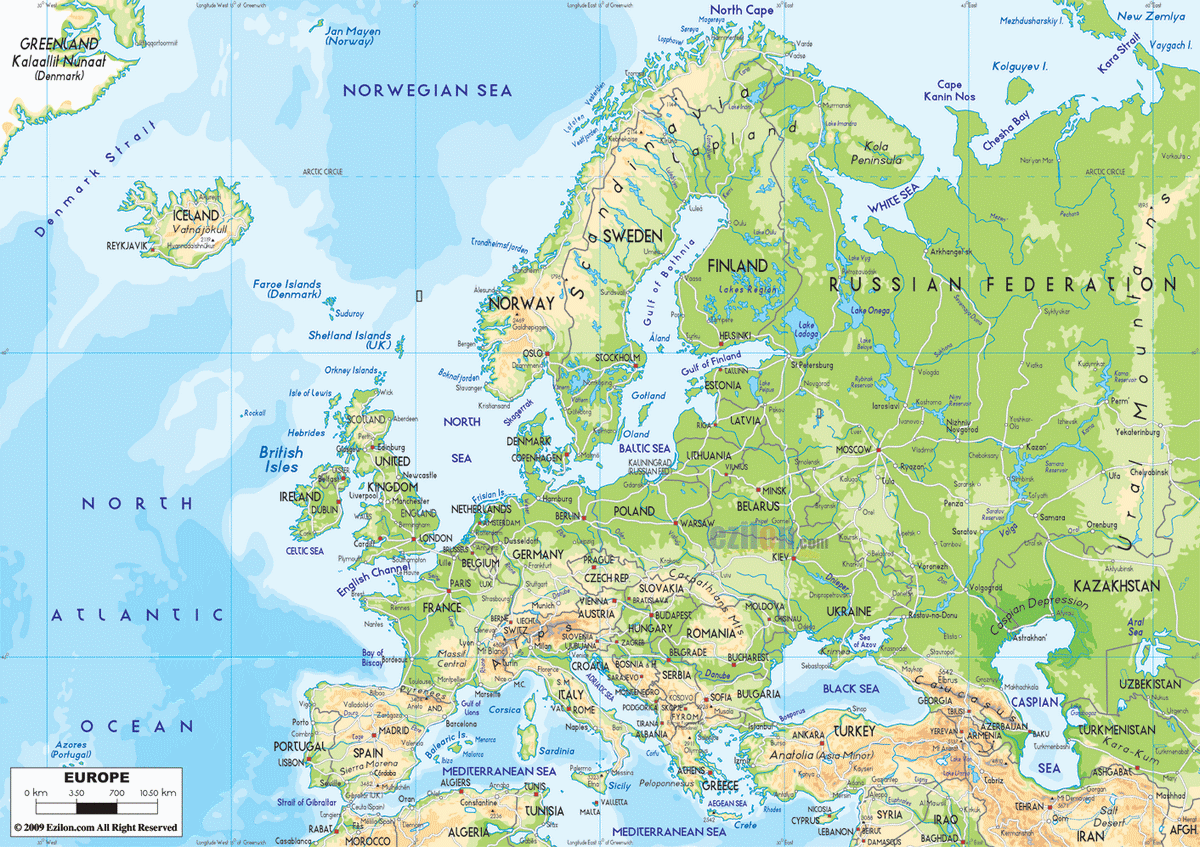
Physical Map of Europe
See More
- Saint Kitts & Nevis
- Saint Lucia
- Samoa
- San Marino
- São Tomé & Príncipe
- Saudi Arabia
- Senegal
- Serbia
- Seychelles
- Sierra Leone
- Singapore
- Slovakia
- Slovenia
- Solomon Islands
- Somalia
- South Africa
- South Korea
- South Sudan
- Spain
- Sri Lanka
- Saint Vincent & the Grenadines
- Sudan
- Suriname
- Sweden
- Switzerland
- Syria
- Saint Helena
- Saint Barthélemy
- Saint Martin
- Saint Pierre and Miquelon
- Somaliland

