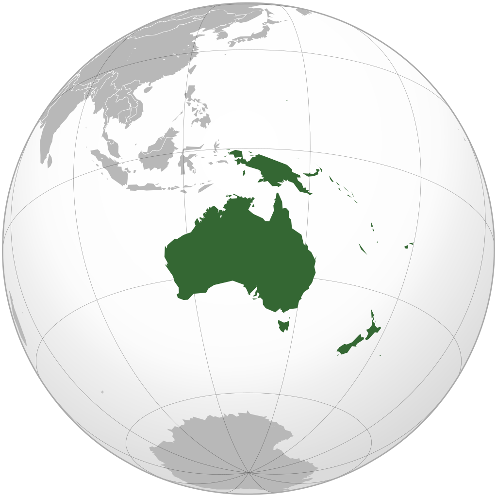
Oceania (or Australia) is the smallest continent in terms of land area and the second least populous after Antarctica. Oceania has an area of 8,525,989 km² and a population of about 40 million people.
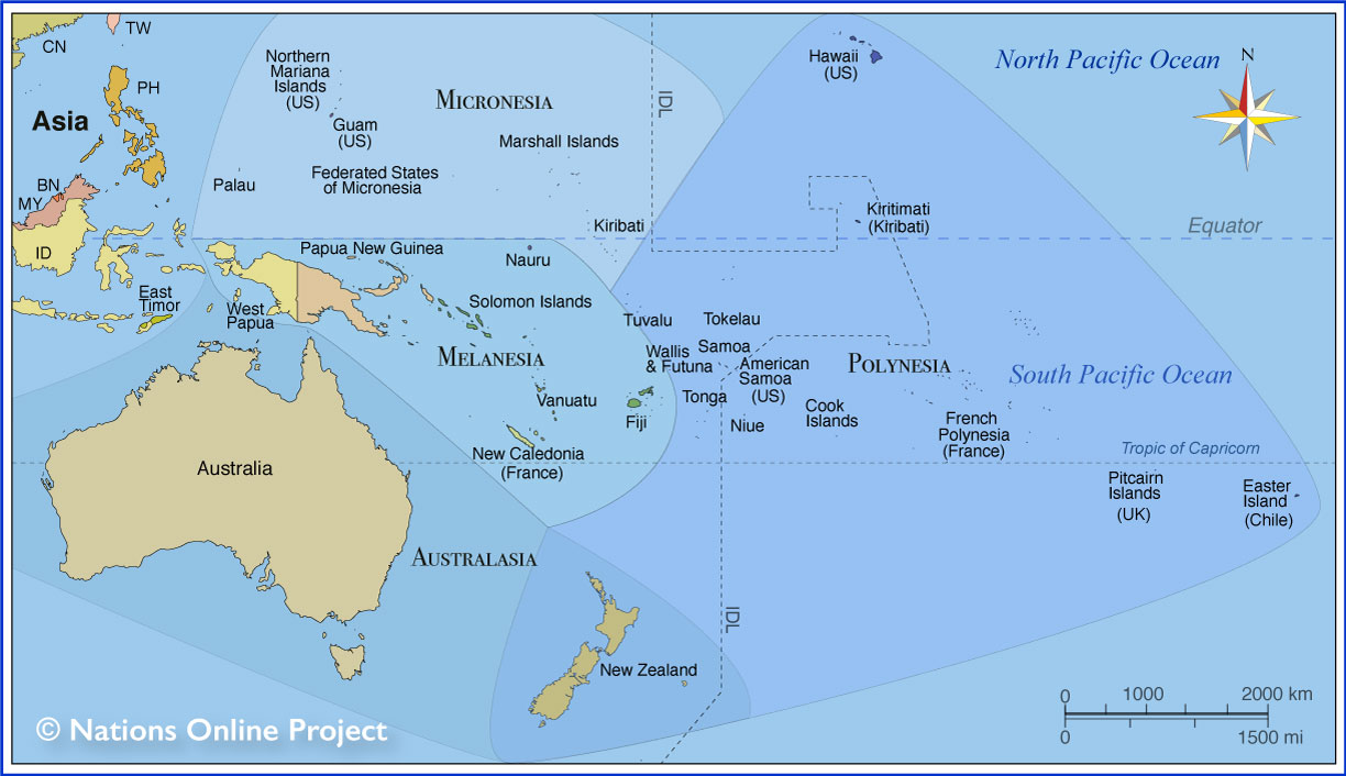
It’s important to note that the islands of Oceania are a significant part of the continent. A few decades ago, Oceania was understood globally as the entire island region in the central and western Pacific Ocean. The vast majority of the islands here are very small coral and volcanic islands, scattered over a vast space. The total area of all these islands is about 1 million km², equal to 1/50 of the ocean surface area within the aforementioned island region. Hence, this island region was called Oceania. At that time, Oceania was distinguished from Australia (now called Australia), which included the Australian continent and some small surrounding islands. Later, these two continents were combined and called Oceania.
Location of Oceania
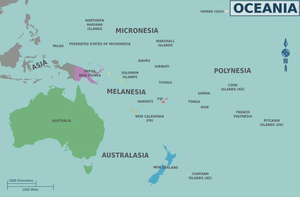
Oceania is located in the Southern Hemisphere, spanning both the Eastern and Western Hemispheres. Oceania lies to the east of Asia, surrounded by the Indian Ocean and the Pacific Ocean, with the Tropic of Capricorn (latitude 23° 27′ South) running across its territory.
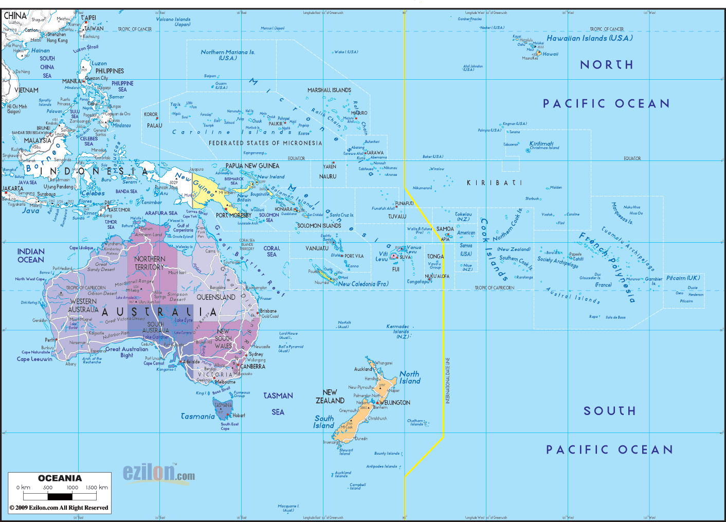
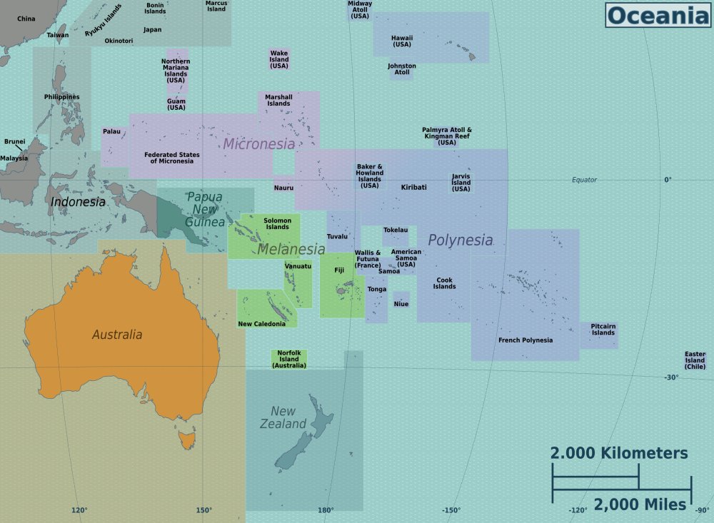
Map of Oceania
Oceania has the lowest population density in the world, averaging 3.6 people/km². But the urban population rate is high – reaching 69% in 2001. The population in Oceania is mostly immigrants (up to 80%).
Among the 14 countries mentioned above, Australia and New Zealand have the most developed economies in the region, while the remaining countries have developing economies, mainly relying on tourism and natural resource exploitation for export.
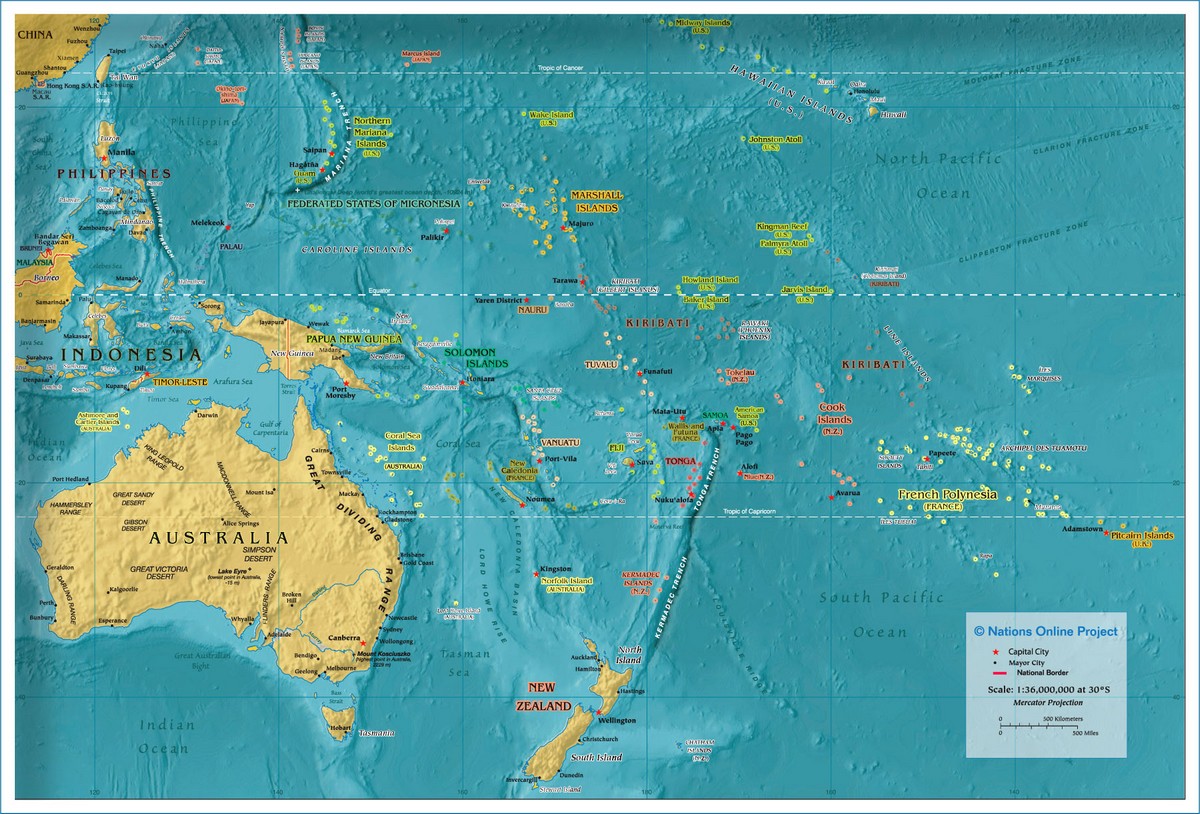
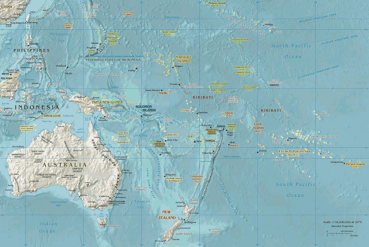
Physical Map of Oceania
A physical map in English, when translated to Vietnamese, can be understood as a topographical map or a map showing geographical features such as rivers, terrain elevation, etc.
Oceania includes many archipelagos, comprising 4 basic types: continental islands, volcanic islands, coral reefs, and raised coral platforms. Many volcanic islands still have active volcanoes, including Bougainville, Hawaii, and the Solomon Islands.
Australia itself has quite diverse terrain ranging from arid deserts and vast grasslands to mountain ranges and tropical forests. Much of the land is flat and low-lying, with prairies and grasslands stretching across many areas. The mountainous regions are mainly concentrated in the East, but there are also many mountain ranges in Central and Western Australia.
See more
- Saint Kitts & Nevis
- Saint Lucia
- Samoa
- San Marino
- São Tomé & Príncipe
- Saudi Arabia
- Senegal
- Serbia
- Seychelles
- Sierra Leone
- Singapore
- Slovakia
- Slovenia
- Solomon Islands
- Somalia
- South Africa
- South Korea
- South Sudan
- Spain
- Sri Lanka
- Saint Vincent & the Grenadines
- Sudan
- Suriname
- Sweden
- Switzerland
- Syria
- Saint Helena
- Saint Barthélemy
- Saint Martin
- Saint Pierre and Miquelon
- Somaliland
