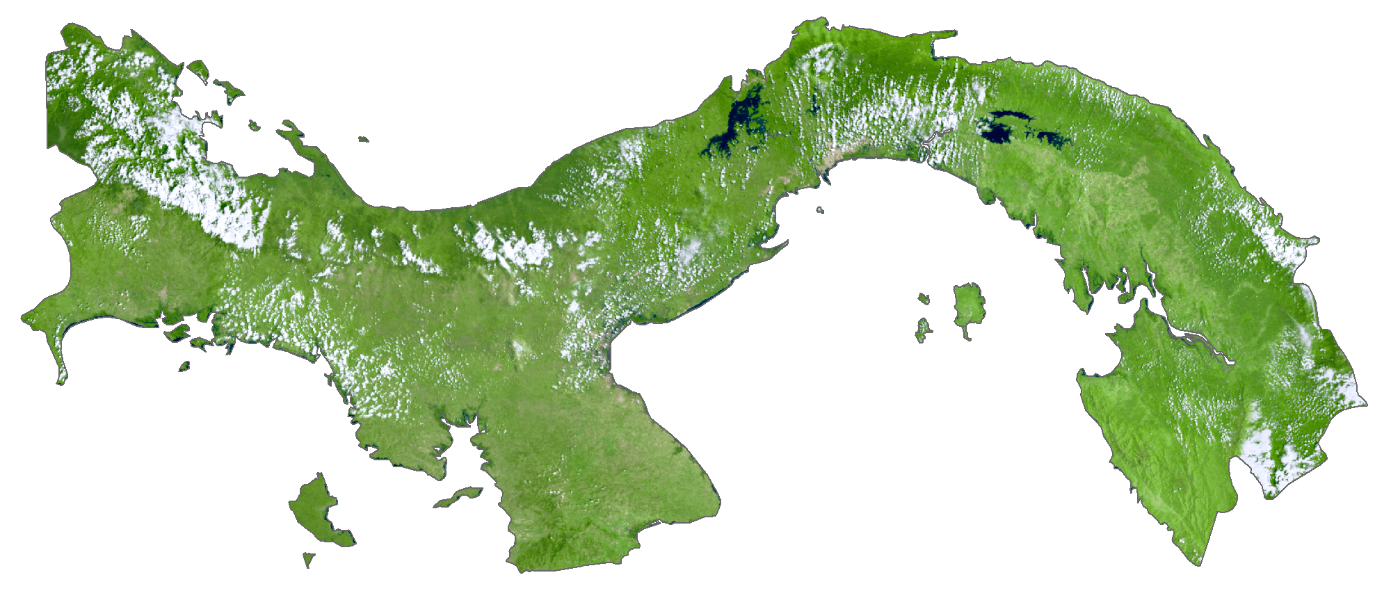
Panama is a transcontinental country covering an area of 75,417 sq. km (29,119 sq mi) from Central to South America.
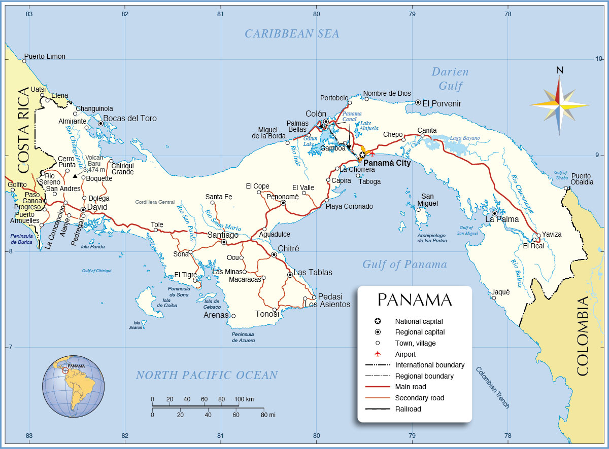
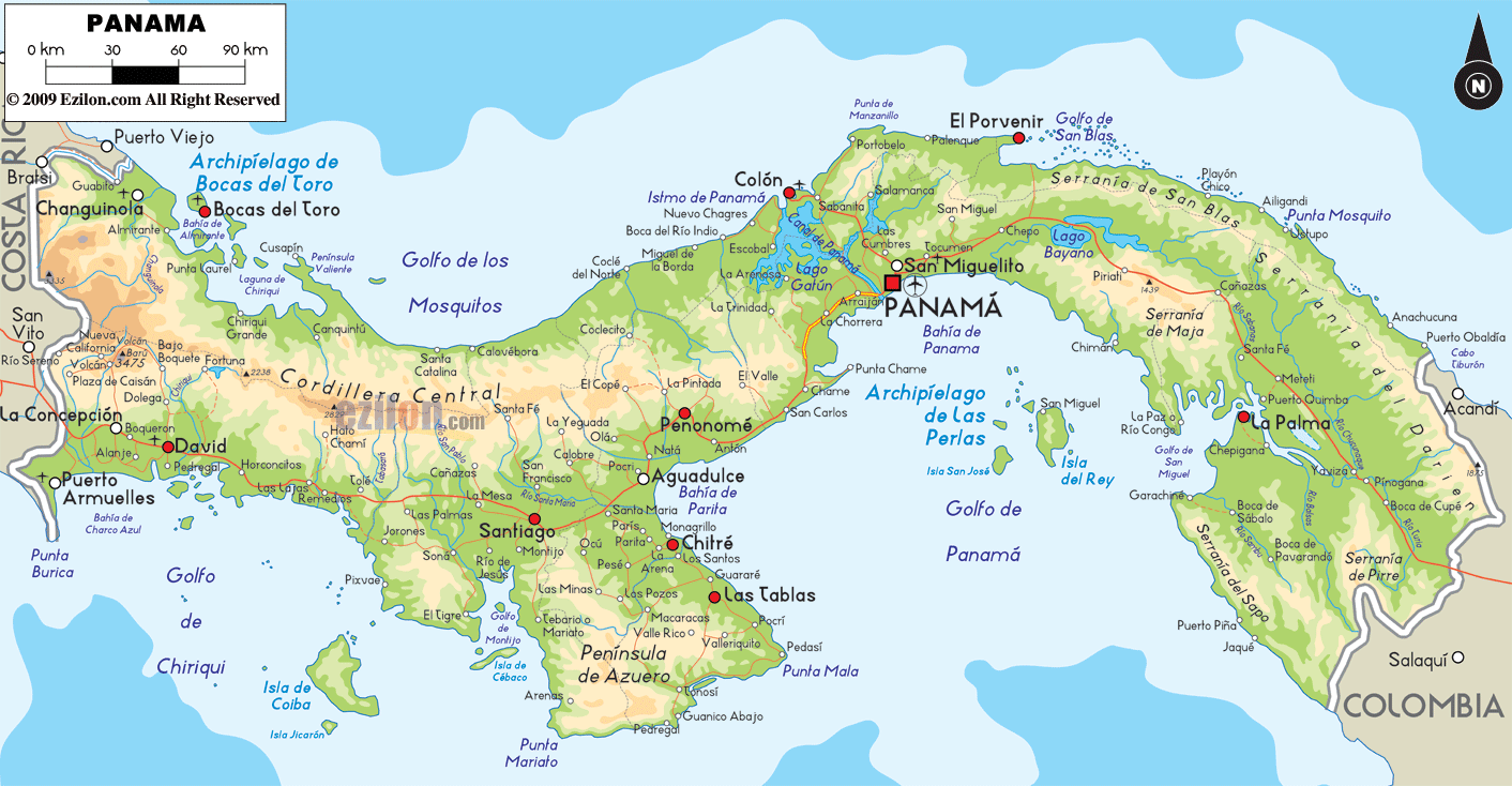
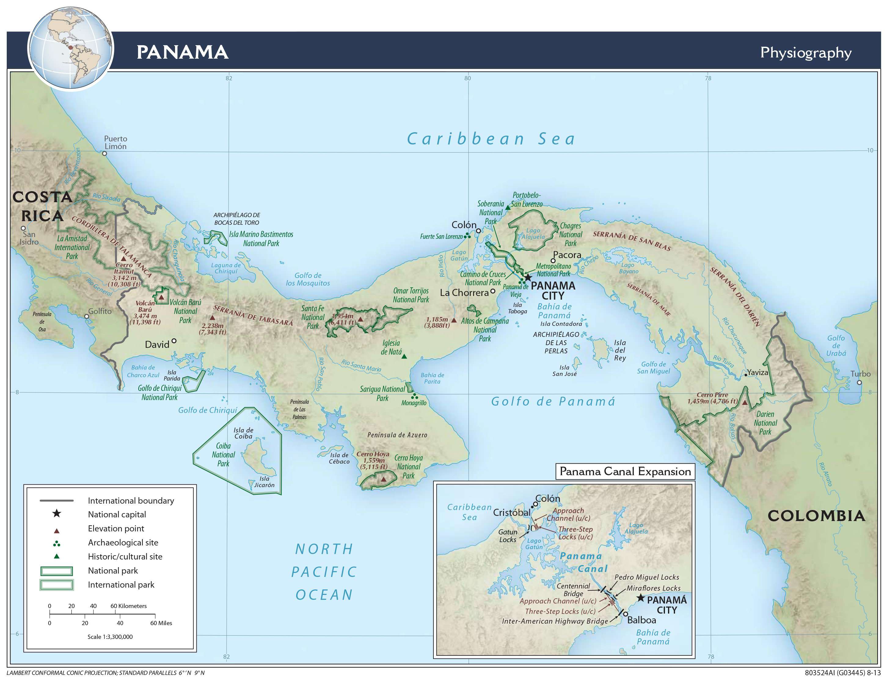
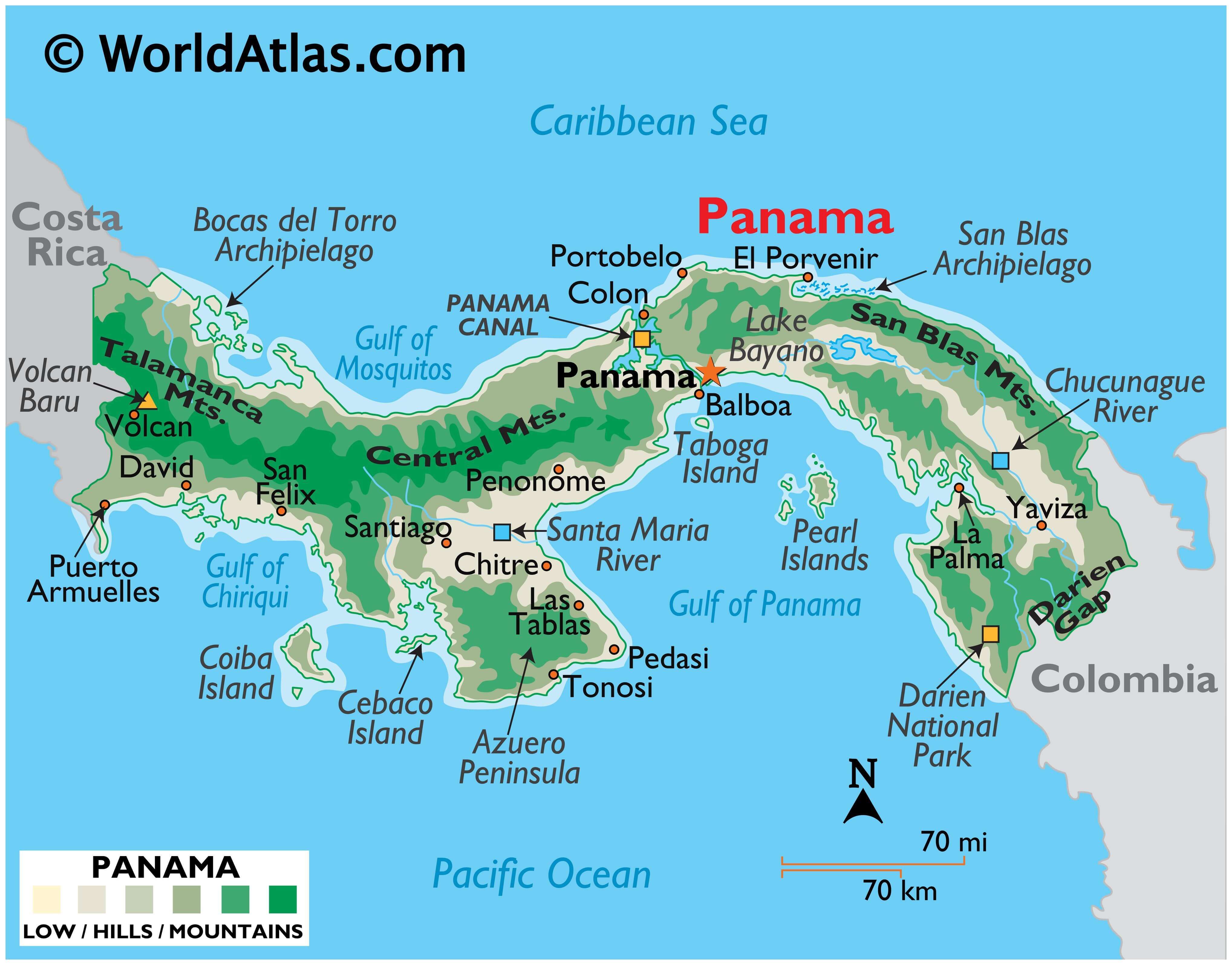
As observed on the physical map of Panama, the country’s landscape is dominated by forested, volcanic-in-origin, mountains that extend from its Costa Rican border to Colombia, South America. Significant ranges include the lengthy Central Mountains, as well as the San Blas, Talamanca, and Tabasara.
The highest point in Panama is the 3,475 m (11,401 ft) tall Volcán Barú. A yellow upright triangle mars the position of the point on the map.
The sandy beach coastlines of Panama merge into forested lowlands that rise into the foothills of the inland mountain ranges. The eastern third of Panama (the Darien province) is a sparsely populated land of rain forests, rivers and swampy lowlands bordered by high mountain peaks. The Darian Gap, fronting the border with Colombia, is an inhospitable, almost impassable thick jungle.
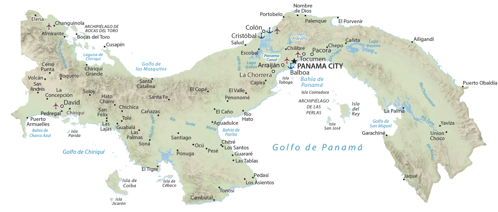
The northern coastline is ringed by the hundreds of small islands that form the Bocas del Torro and San Blas Archipelagos. Significant islands along the southern coastlines include the Pearl Islands (of Survivor fame), Taboga, Cebaco and Coiba. Hundreds of rivers drain the land, mostly small; significant ones include the Charges, Chepo, Chucunague, San Pablo, Santa Maria and Tuira.
| Flag: | 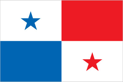 |
|---|---|
| Legal Name: | Republic of Panama |
| Capital Value: | Panama City |
| Largest City: |
Ciudad de Panamá (Panama City) (1,860,291) |
| Official languages: | Spanish |
| Demonym(s): | Panamanian |
| Government: | Unitary presidential constitutional republic |
| Legislature: | National Assembly |
| Total Area: | 75,420 km² |
| Land Area: | 74,340 km² |
| Water Area: | 1,080 km² |
| Population: | 4,246,439 |
| Density: | 56/km (145.0/sq mi) (122nd) |
| GDP: | $66.80 Billion |
| GDP Per Capita: | $15,731.02 |
| Currency Value: | Balboas (PAB) |
| Driving side: | right |
| Calling code: | +507 |
| Internet TLD: | .pa |
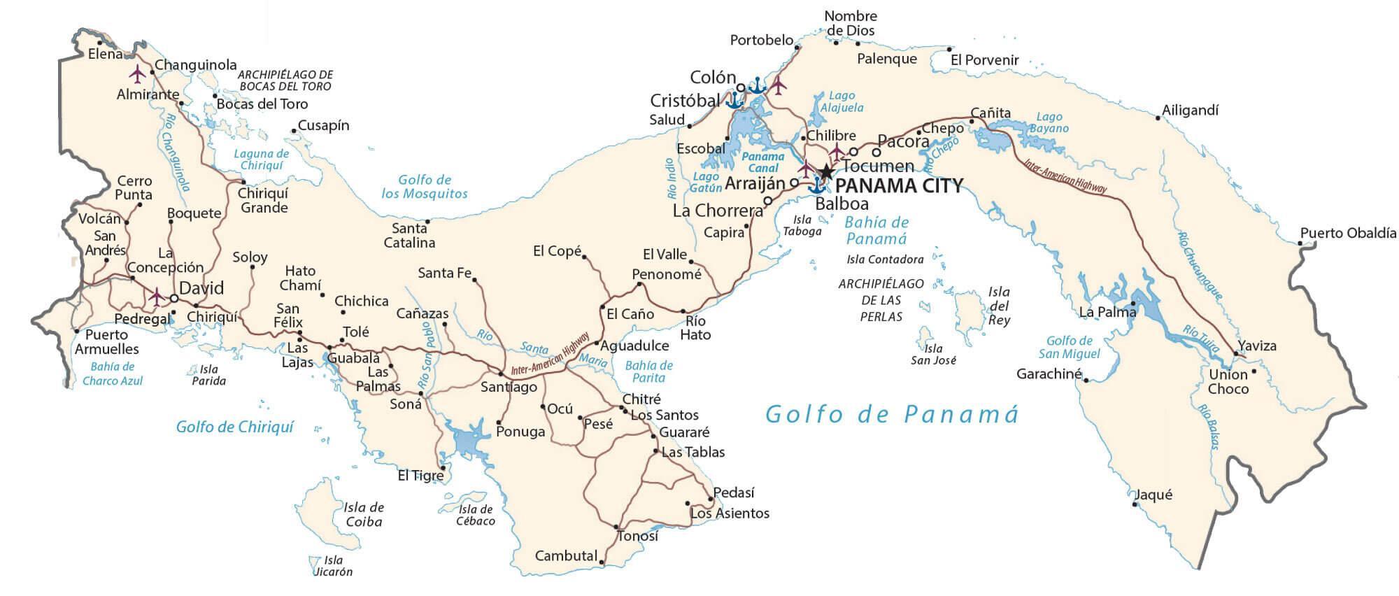
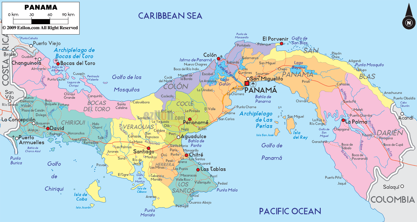
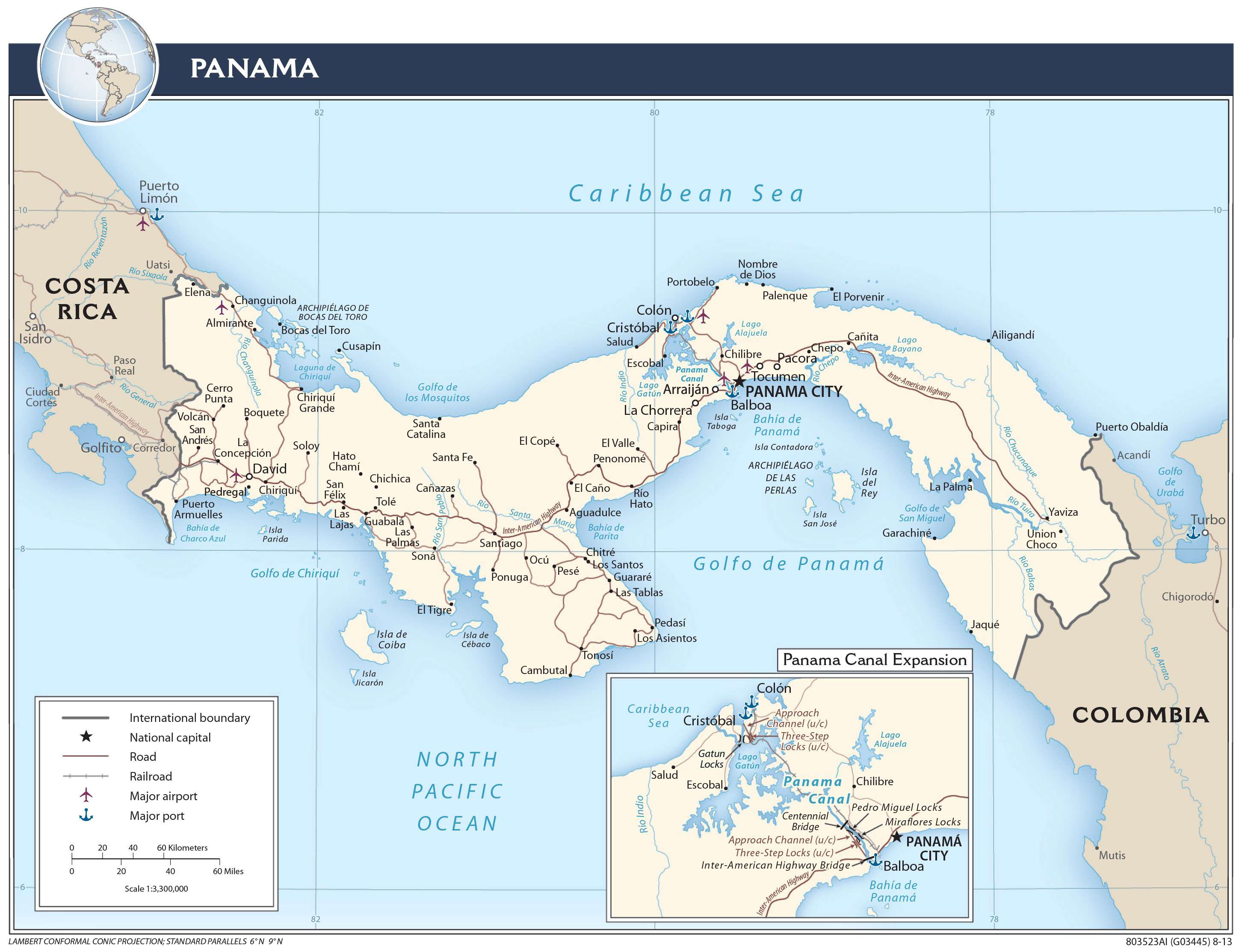
Explore the beauty of Panama with this detailed map. From the bustling cities of Panama City and Colon, to the stunning Caribbean Sea, this map is sure to show you the best of this Central American nation. It includes major cities, towns, roads, rivers, the Central Cordillera, the Panama Canal, and its numerous islands and gulfs. With this map, you can discover the natural beauty, cultural heritage, and economic opportunities of Panama.
Online Interactive Political Map
Click on ![]() to view map in "full screen" mode.
to view map in "full screen" mode.
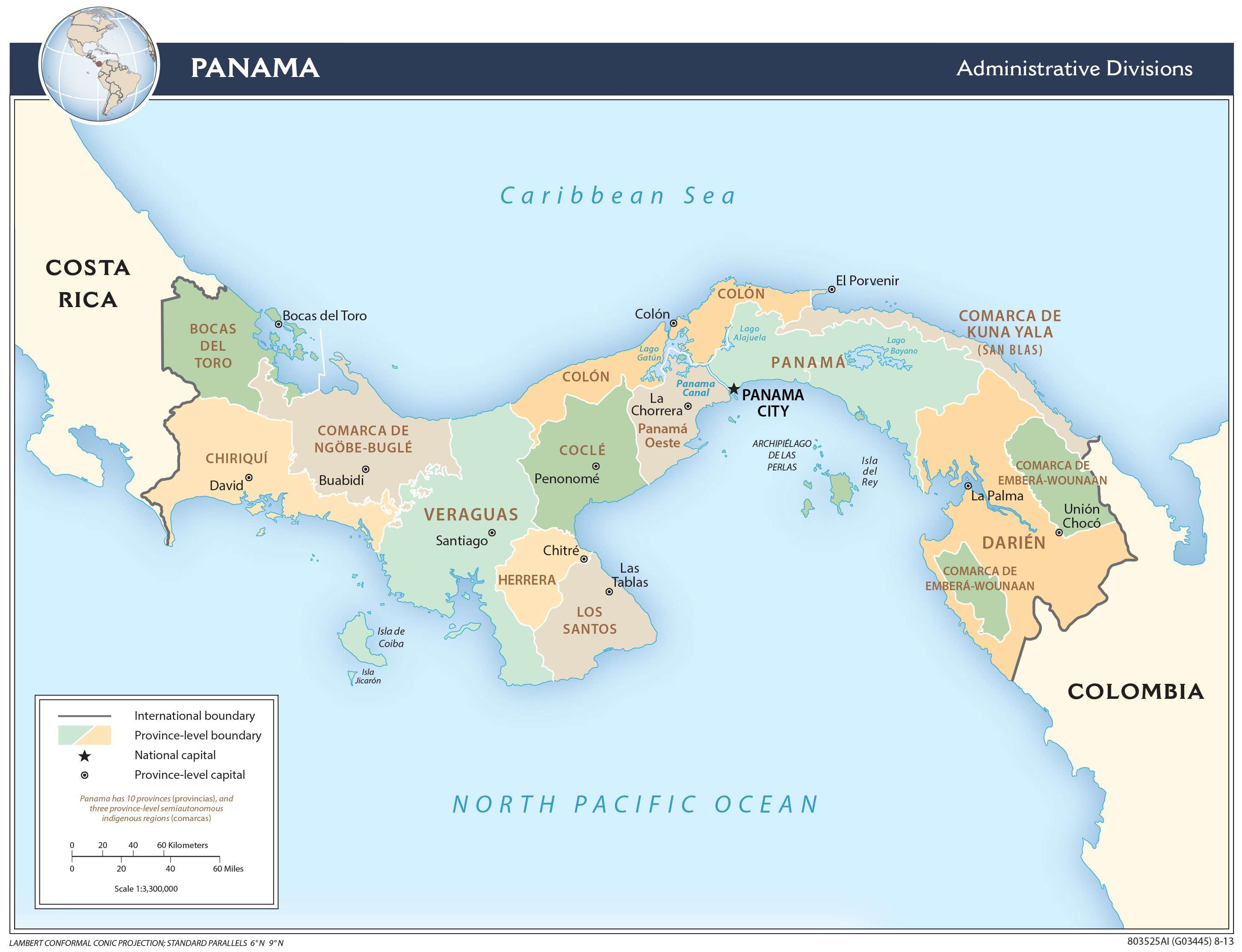
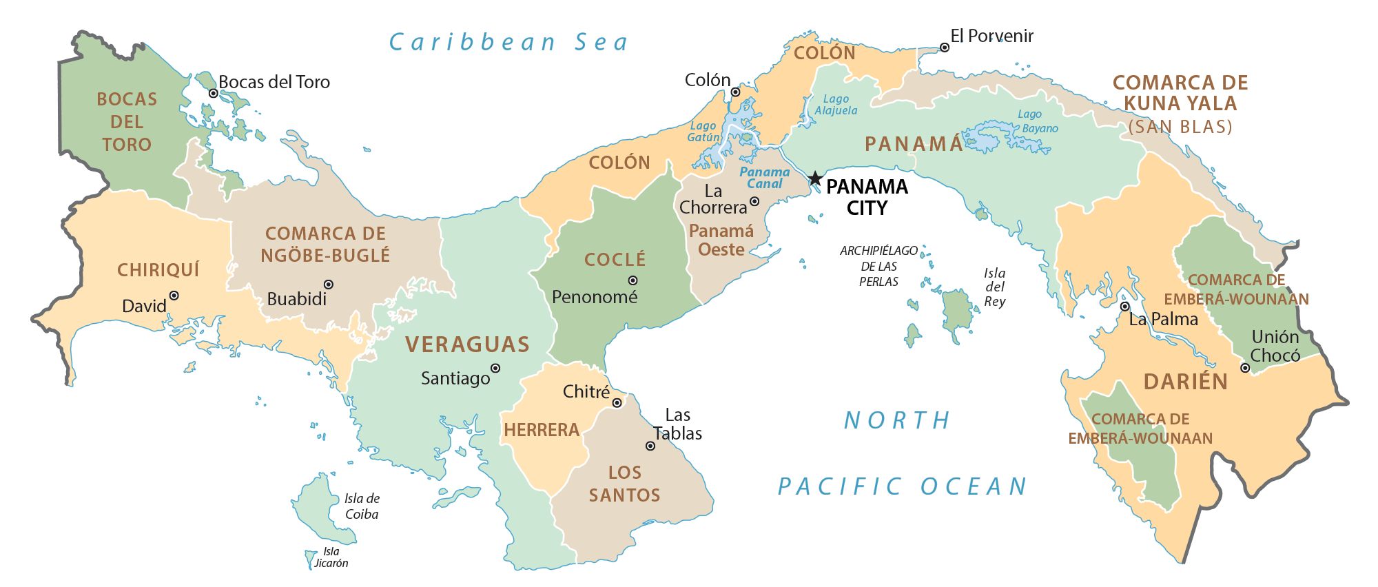
Panama (officially, the Republic of Panama) is divided into 10 administrative provinces (provincias, sing. provincia) and 3 indigenous regions (comarcas). In alphabetical order, the provinces are: Bocas del Toro, Chiriqui, Cocle, Colon, Darien, Herrera, Los Santos, Panama, Panama Oeste and Veraguas. Embera-Wounaan, Guna Yala and Ngobe-Bugle are the 3 indigenous regions of Panama. The provinces are further subdivided into districts and townships. Kuna de Madungandi and Kuna de Wargandi are the two indigenous comarcas within the administrative provinces which have the same status as that of a municipality (corregimiento).
Situated in the province of Panama, with a strategic position at the Pacific entrance of the Panama Canal is Panama City – the capital, the largest and the most populous city of Panama. It is also the administrative, commercial and banking hub of the country.
Location Maps
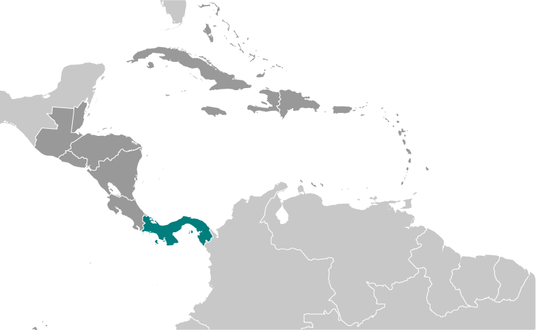
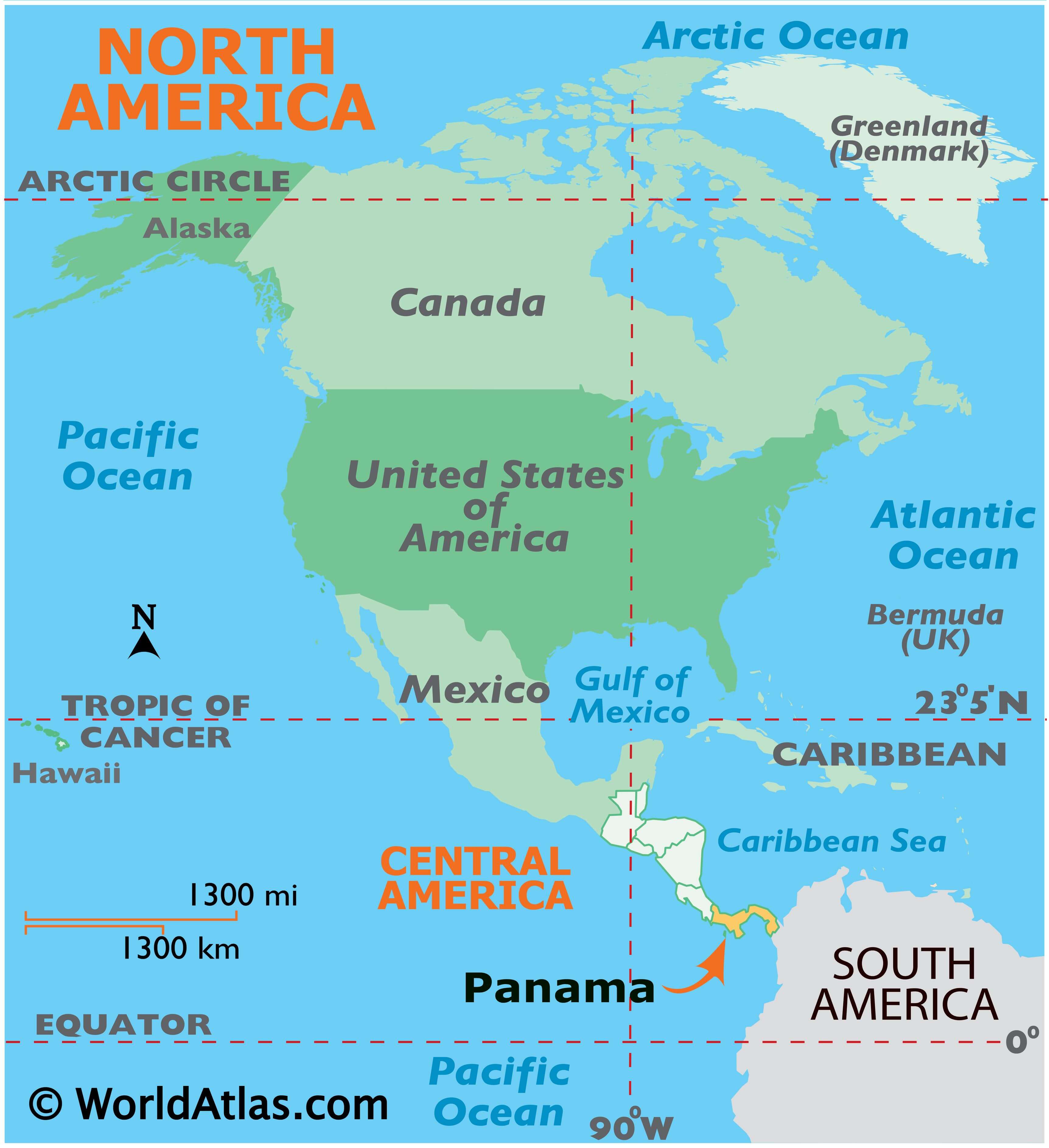
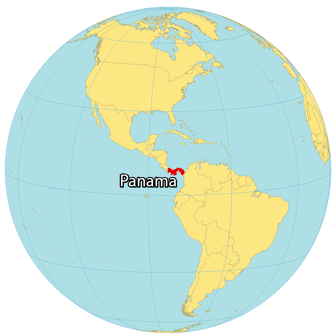
Where is Panama?
Panama is located along the North Pacific Ocean in Central America. It borders Colombia to the south and Costa Rica to the north. The country is home to the Panama Canal – a strategic shortcut for shipping to the Caribbean Sea – and is a transcontinental country, located at the boundary between both North America and South America. Panama City is the capital and largest city, but its other major cities include San Miguelito, Juan Diaz, and David.
High Definition Political Map of Panama
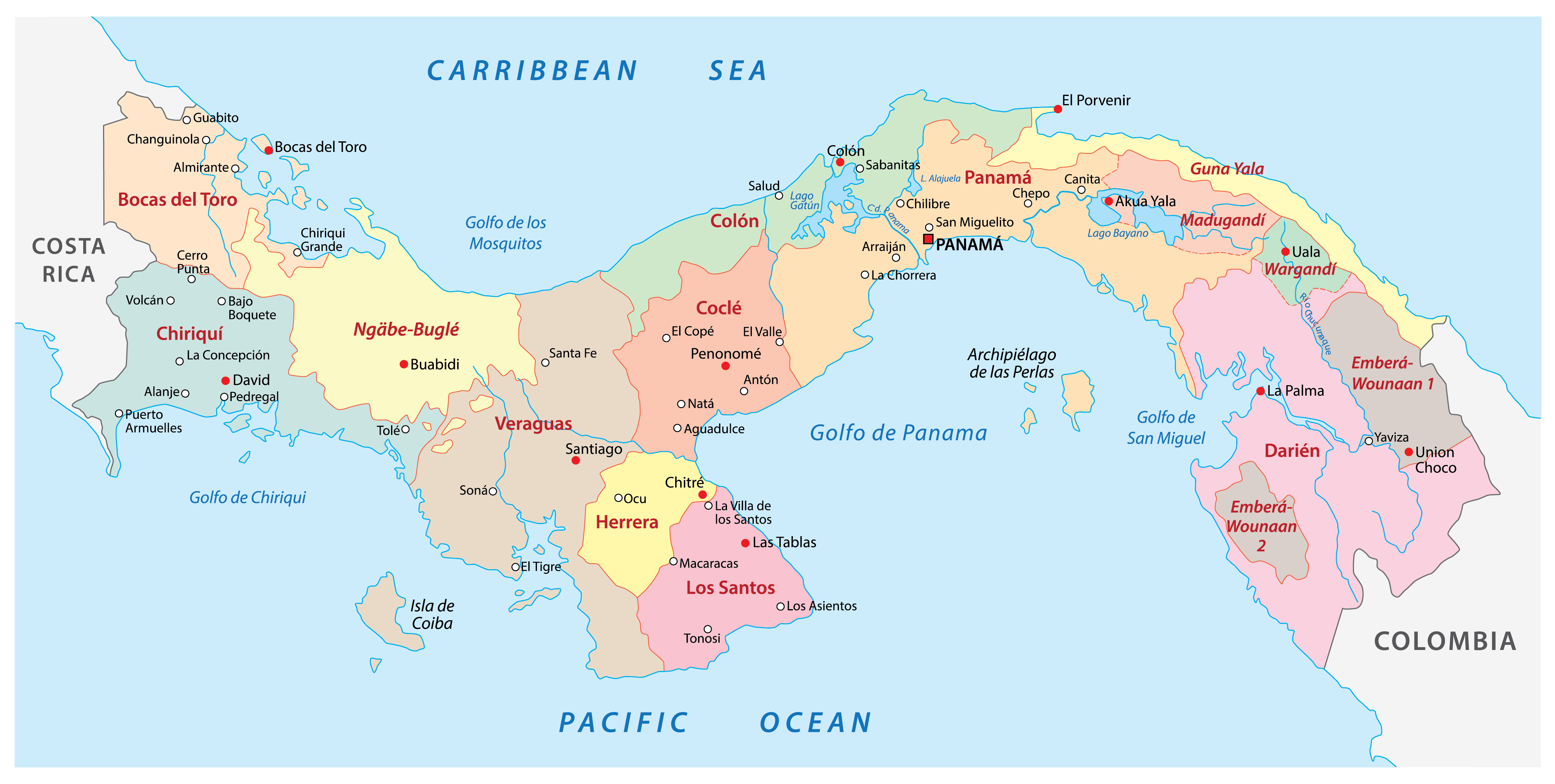
Panama Administrative Map
Physical Map of Panama
Transportation Map of Panama
Panama Satellite Map