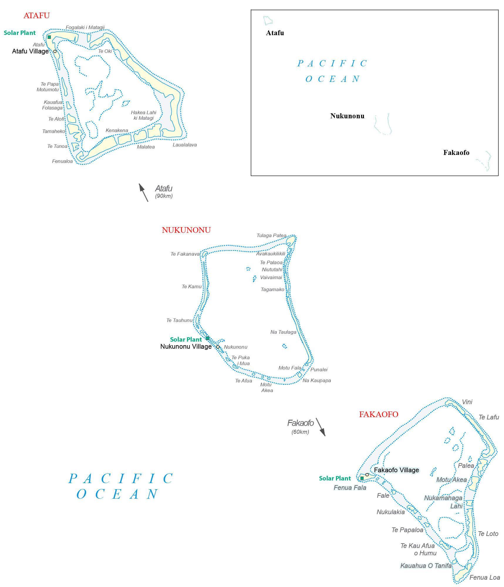
Covering a combined land area of only 10.8 sq.km (3.9 sq mi), Tokelau is a dependent territory of New Zealand and comprises of 3 small coral atolls (Atafu, Nukunonu and Fakaofo) located in the South Pacific Ocean. Each of the low-lying coral atolls encloses a large central lagoon and are surrounded by a number of reef-bound islets of varying length and rising to over 3m above sea level. The highest point of Tokelau is only 5m (16ft) above sea level. There are no ports or harbors in Tokelau.
| Flag: | 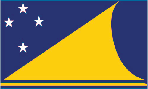 |
|---|---|
| Legal Name: | Tokelau |
| Official languages: |
|
| Demonym(s): | Tokelauan |
| Government: | Devolved parliamentary dependency under a constitutional monarchy |
| Legislature: | General Fono |
| Total Area: | 12 km² |
| Land Area: | 12 km² |
| Population: | 1,285 |
| Density: | 115/km (297.8/sq mi) (86th) |
| Currency Value: | New Zealand dollars (NZD) |
| Driving side: | left |
| Calling code: | +690 |
| Internet TLD: | .tk |
Tokelau is an isolated group of atolls located in the South Pacific Ocean, and is a self-governing territory of New Zealand. This map of Tokelau shows the many points, bays, islands, settlements, and solar plants that power the islands. The remote location of Tokelau makes it a truly unique and fascinating place to explore.
Online Interactive Political Map
Click on ![]() to view map in "full screen" mode.
to view map in "full screen" mode.
Tokelau has no known administrative divisions. Covering a combined land area of only 10.8 sq.km, Tokelau is a dependent territory of New Zealand and comprises of 3 small coral atolls (Atafu, Nukunonu and Fakaofo) located in the South Pacific Ocean.
Tokelau has no official capital. Its capital and leadership rotate yearly between its 3 atolls which have their own administrative centers.
Location Maps
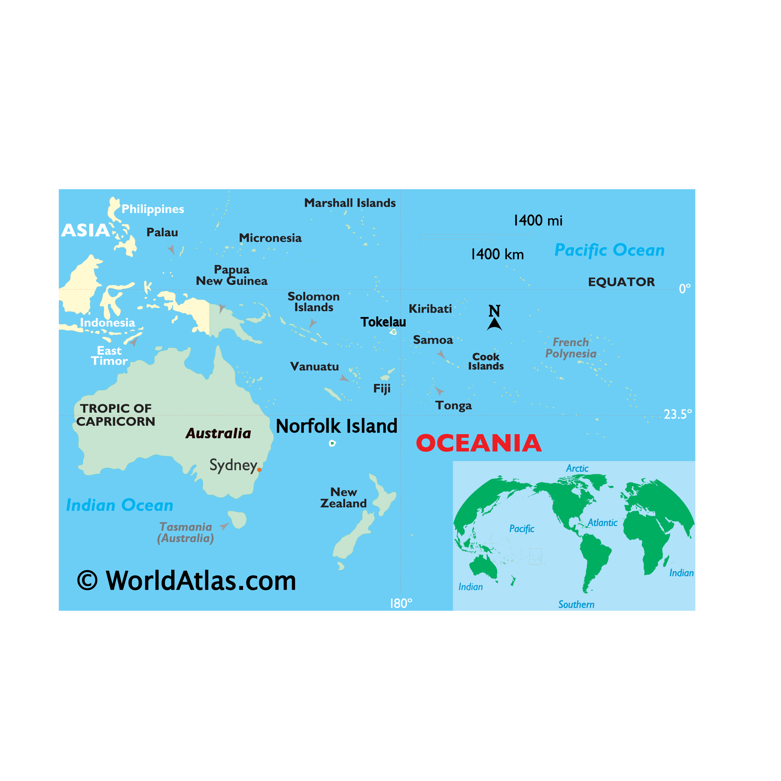
Where is Tokelau?
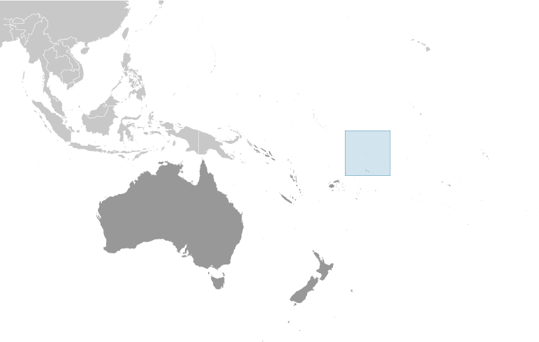
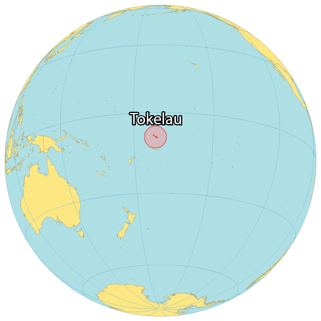
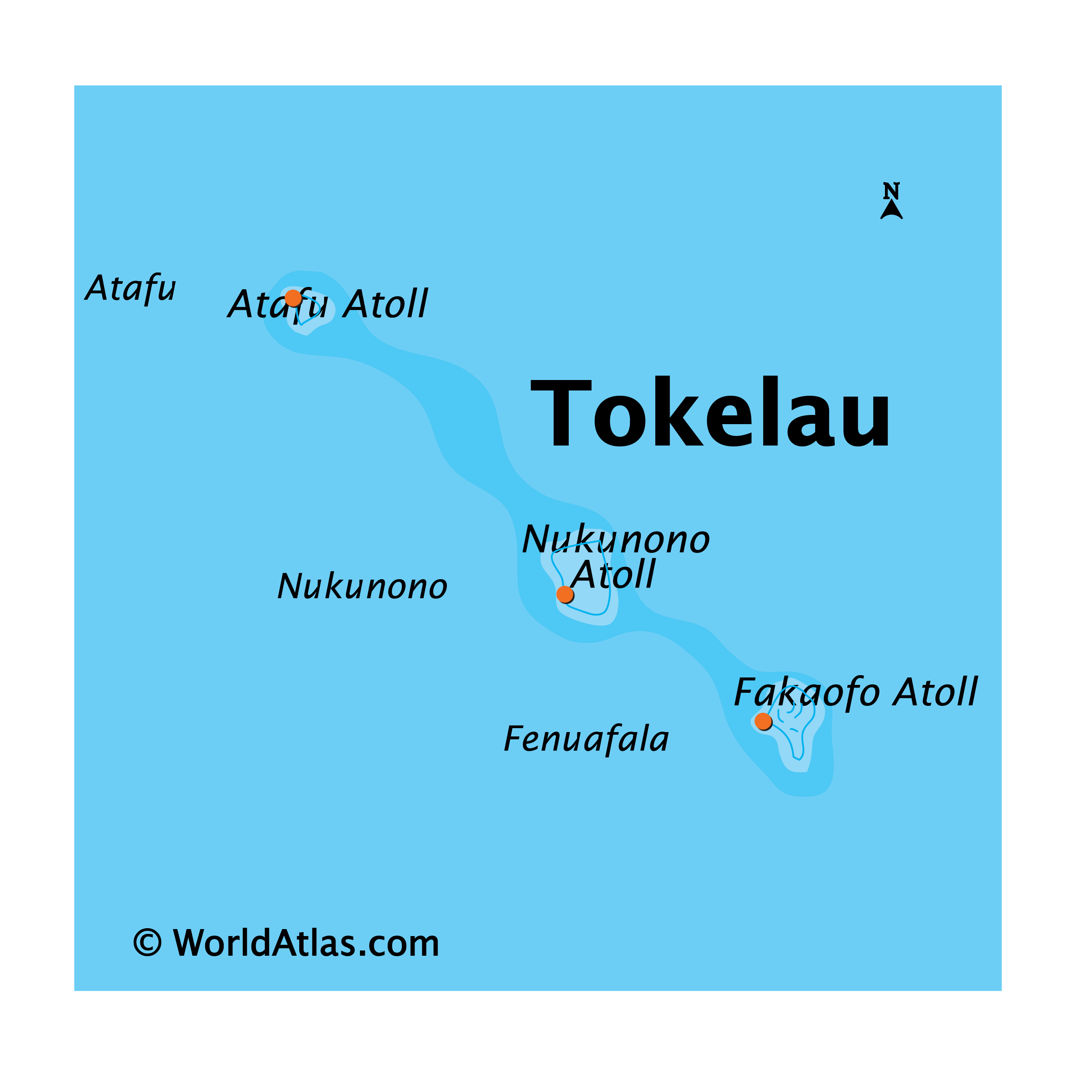
Tokelau is a remote collection of atolls in the Pacific Ocean, spread out over a distance of about 170 kilometers (105 mi). It is comprised of three main atolls – Nukunonu in the center, Atafu to the north (90 kilometers away) and Fakaofo to the south (60 kilometers away). The Northern Cook Islands are 615 kilometers (382 mi) away to the southeast, and Kiribati (Phoenix Islands) is situated 460 kilometers (285 mi) away to the north. The combined area of the atolls is 10 square kilometers (4 sq mi), which makes it about half the size of Nauru. Each atoll contains a village by the same name with Atafu being the largest settlement.
Tokelau is a dependent territory of New Zealand with an estimated population of just 1,500 people, making it one of the least populous in the world. The territory relies on renewable solar power, making it the first nation to use it for 100% of its energy source. Samoa is situated 185 kilometers (115 mi) to the south.
High Definition Political Map of Tokelau
History
Pre-history
Archaeological evidence indicates that the atolls of Tokelau – Atafu, Nukunonu, and Fakaofo – were settled about 1,000 years ago from Samoa and may have been a gateway into Eastern Polynesia. The inhabitants embrace Polynesian mythology and the local god, Tui Tokelau. Over time, they developed distinctive musical and art forms. The three atolls have historically functioned separately politically, while maintaining social and linguistic cohesion. Tokelauan society has been governed by chiefly clans, and there have been occasional skirmishes and wars between the atolls, as well as inter-marriage. Fakaofo, the “chiefly island”, held some dominion over Atafu and Nukunonu after the dispersal of Atafu. Life on the atolls was historically subsistence-based, with a diet that relied mainly on fish and coconut.
Contact with other cultures
The first European to sight Atafu was Commodore John Byron, on 24 June 1765. He called the island “Duke of York’s Island”. Parties from his expedition who ventured ashore reported that there were no signs of current or previous inhabitants. Captain Edward Edwards, having learned of Byron’s discovery, visited Atafu on 6 June 1791 in search of the Bounty mutineers. They found no inhabitants, but saw that there were houses containing canoes and fishing gear, which suggested to them that the island was being used as a temporary residence by fishing parties from other, nearby islands. On 12 June 1791, Edwards sailed farther south, and sighted Nukunonu, naming it “Duke of Clarence’s Island”. A landing party that went ashore was unable to make contact with the inhabitants, but saw “morais”, burying places, and canoes with “stages in their middle” sailing across the island’s lagoons.
On 29 October 1825, August R. Strong of the USS Dolphin and his crew arrived at the atoll Nukunonu. He wrote:
On 14 February 1835, Captain Smith, of the United States whaling ship the General Jackson, wrote of having sighted Fakaofo, which he chose to call “D’Wolf’s Island”. On 25 January 1841, the United States Exploring Expedition visited Atafu, and discovered a small population living on the island. The residents appeared to be there only temporarily, because there was no chief among them, and they had the kind of double canoes that were typically used for inter-island travel. They appeared to have interacted with foreigners in the past, because they expressed a desire to engage in barter with the expedition crew, and they possessed items that were apparently of foreign origin: blue beads and a plane-iron. A few days later, French explorer Captain Morvan sighted Fakaofo. The American expedition reached Nukunonu on 28 January 1841, but did not record any information about inhabitants. On 29 January 1841, the expedition sighted Fakaofo and named it “Bowditch”. The Fakaofo islanders were found to be similar in appearance and behavior to the Atafu islanders.
Missionaries preached Christianity in Tokelau from 1845 to the 1870s. French Catholic missionaries on Wallis Island (also known as ‘Uvea) and missionaries of the Protestant London Missionary Society in Samoa used native teachers to convert the Tokelauans. Atafu was converted to Protestantism by the London Missionary Society, Nukunonu was converted to Catholicism and Fakaofo was converted to both denominations. The Rev. Samuel James Whitmee, of the London Missionary Society, visited Tokelau in 1870.
Helped by Swains Island-based Eli Jennings senior, Peruvian “blackbird” slave traders arrived in 1863 and kidnapped nearly all (253) of the able-bodied men to work as labourers, depopulating the atolls. The Tokelauan men died of dysentery and smallpox, and very few returned. With that loss, the system of governance became based on the “Taupulega”, or “Councils of Elders”, on which individual families on each atoll were represented. During that time, Polynesian immigrants settled, followed by American, Scottish, French, Portuguese and German beachcombers, marrying local women and repopulating the atolls.
Between 1856 and 1979, the United States claimed that it held sovereignty over the island and the other Tokelauan atolls. In 1979, the U.S. conceded that Tokelau was under New Zealand sovereignty, and a maritime boundary between Tokelau and American Samoa was established by the Treaty of Tokehega.
Tropical cyclones
Cyclone Percy struck and severely damaged Tokelau in late February and early March 2005. Forecasters underestimated the cyclone’s strength and the length of time it would be in vicinity to Tokelau. It coincided with a spring tide which put most of the area of the two villages on Fakaofo and Nukunonu under a metre of seawater. The cyclone also caused major erosion on several islets of all three atolls, damaging roads and bridges and disrupting electric power and telecommunications systems. The cyclone did significant and widespread damage to food crops including bananas, coconuts and pandanus. It did not seriously injure anyone but villagers lost significant amounts of property.
No significant land is more than two metres (6.6 feet) above high water of ordinary tides. This means Tokelau is particularly vulnerable to any possible sea level rises.
Time zone
Until December 2011, Tokelau was 11 hours behind Coordinated Universal Time (UTC). At midnight 29 December 2011 Tokelau shifted to UTC+13:00 in response to Samoa’s decision to switch sides of the International Dateline. This brought Tokelau closer to New Zealand time (and in the process omitted 30 December).
Many sources claim that Tokelau is 14 hours ahead of UTC (UTC−10 before the 2011 date switch), but the correct time zone offset is UTC+13:00.
Physical Map of Tokelau
Geography
Tokelau includes three atolls in the South Pacific Ocean between longitudes 171° W and 173° W and between latitudes 8° S and 10° S, about midway between Hawaii and New Zealand. From Atafu in the north to Fakaofo in the south, Tokelau extends for less than 200 km. The atolls lie about 500 kilometres (311 miles) north of Samoa. The atolls are Atafu and Nukunonu, both in an island group once called the Duke of Clarence Group, and Fakaofo, once Bowditch Island. Their combined land area is 10.8 km (4.2 sq mi). The atolls each have a number of coral islands, where the villages are situated. The highest point of Tokelau is just 5 metres (16 feet) above sea level. There are no ports or harbours for large vessels, however, all three atolls have a jetty to and from which supplies and passengers are shipped. Tokelau lies in the Pacific tropical cyclone belt. A fourth island that is culturally, historically, and geographically, but not politically, a part of the Tokelau Islands is Swains Island (Olohega), under United States control since about 1900 and administered as a part of American Samoa since 1925.
Swains Island was claimed by the United States pursuant to the Guano Islands Act, as were the other three islands of Tokelau; the latter three claims were ceded to Tokelau by treaty in 1979. In the draft constitution of Tokelau subject to the Tokelauan self-determination referendum in 2006, Olohega (Swains Island) was also claimed as a part of Tokelau, though the claim was surrendered in the same 1979 treaty. This established a clearly defined boundary between American Samoa and Tokelau.
Tokelau’s claim to Swains is generally comparable to the Marshall Islands‘ claim to U.S.-administered Wake Island, but the re-emergence of this somewhat dormant issue has been an unintended result of the United Nations’ recent efforts to promote decolonisation in Tokelau. Tokelauans have proven somewhat reluctant to push their national identity in the political realm: recent decolonisation moves have mainly been driven from outside for ideological reasons. But at the same time, Tokelauans are reluctant to disown their common cultural identity with Swains Islanders who speak their language.